Long Haven

Sea, Estuary, Creek in Aberdeenshire

Scotland

Long Haven

Guillemot Nap Time Guillemots taking a nap on the sheer cliffs of the Bullers of Buchan in Aberdeenshire.
Guillemot Nap Time Credit: Iain Smith

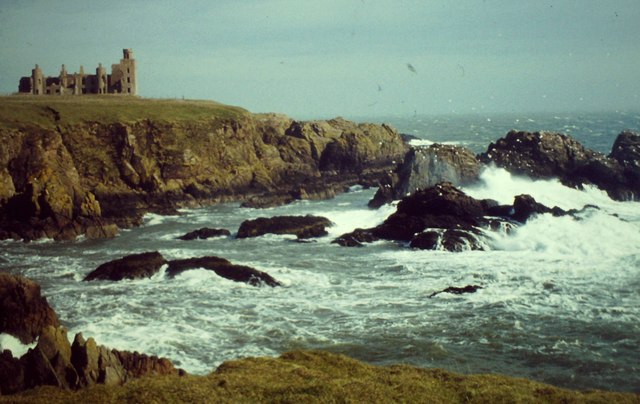
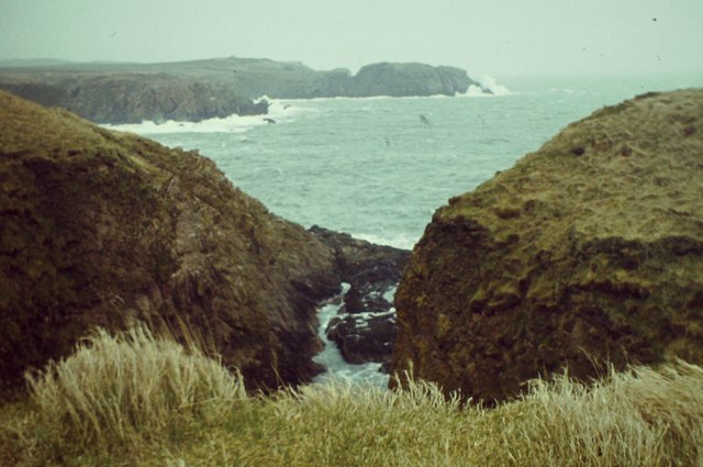
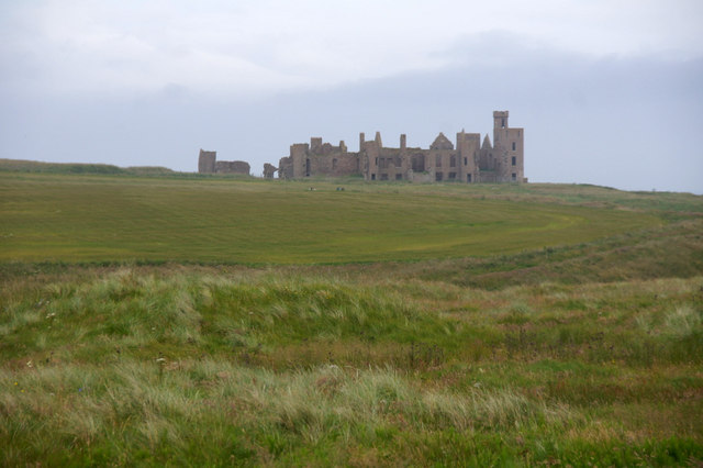
Long Haven is a picturesque coastal area located in Aberdeenshire, Scotland. It is known for its stunning natural beauty, with its sea, estuary, and creek creating a unique and diverse landscape.

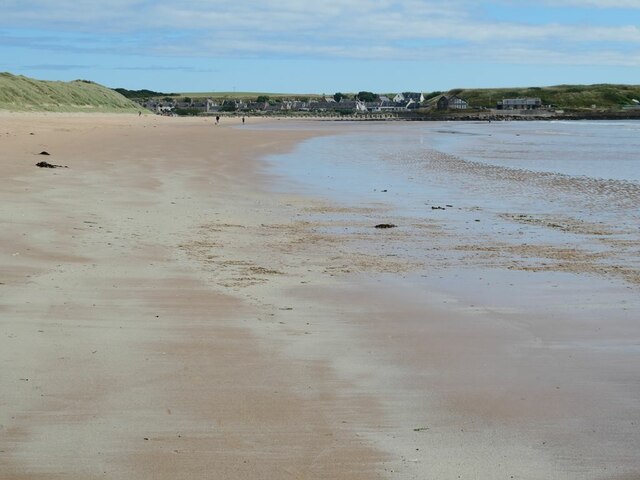
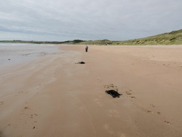
The area is characterized by its pristine sandy beaches and crystal-clear waters. The Long Haven beach stretches for several miles, providing ample opportunities for leisurely walks, sunbathing, or simply enjoying the tranquility of the surroundings. The beach is popular among locals and tourists alike, especially during the summer months.

The estuary of Long Haven is a significant feature of the area. It is formed by the confluence of a river and the North Sea, resulting in a dynamic ecosystem that supports a wide range of marine life. The estuary is a haven for birdwatching enthusiasts, as it attracts various species of migratory birds throughout the year. Visitors can witness flocks of wading birds, ducks, and geese, making it a perfect spot for bird enthusiasts.

A creek also meanders through Long Haven, adding to the charm of the area. The creek is a small, narrow waterway that provides a sheltered environment for smaller boats and kayakers. It is a popular spot for water-based activities like fishing, boating, and canoeing.

Overall, Long Haven offers a delightful coastal experience, combining breathtaking natural beauty, a diverse ecosystem, and a range of recreational opportunities. Whether it's exploring the pristine beaches, observing the vibrant birdlife, or indulging in water activities, Long Haven is a must-visit destination for nature lovers and outdoor enthusiasts.

If you have any feedback on the listing, please let us know in the comments section below.

Long Haven Images

Images are sourced within 2km of 57.416994/-1.8310943 or Grid Reference NK1036. Thanks to Geograph Open Source API. All images are credited.

Guillemot Nap Time Guillemots taking a nap on the sheer cliffs of the Bullers of Buchan in Aberdeenshire.
Guillemot Nap Time
Guillemots taking a nap on the sheer cliffs of the Bullers of Buchan in Aberdeenshire.
Stormy Coast A rough day at New Slains Castle with big waves battering the rocky Buchan coast.
Stormy Coast
A rough day at New Slains Castle with big waves battering the rocky Buchan coast.
Long Haven Deep and extensive geo to the north of New Slains Castle.
Long Haven
Deep and extensive geo to the north of New Slains Castle.
The Pot Looking into The Pot, a collapsed sea cave at the Bullers of Buchan. The North Sea is visible through the arch.
<span class="nowrap"><a title="http://bullersofbuchan.me.uk/" rel="nofollow ugc noopener" href="http://bullersofbuchan.me.uk/">Link</a><img style="margin-left:2px;" alt="External link" title="External link - shift click to open in new window" src="https://s1.geograph.org.uk/img/external.png" width="10" height="10"/></span>
The Pot
Looking into The Pot, a collapsed sea cave at the Bullers of Buchan. The North Sea is visible through the arch. LinkExternal link
Bullers o' Buchan Famous collapsed sea cave on the Buchan coast south of Peterhead.
<span class="nowrap"><a title="http://bullersofbuchan.me.uk/" rel="nofollow ugc noopener" href="http://bullersofbuchan.me.uk/">Link</a><img style="margin-left:2px;" alt="External link" title="External link - shift click to open in new window" src="https://s1.geograph.org.uk/img/external.png" width="10" height="10"/></span>
Bullers o' Buchan
Famous collapsed sea cave on the Buchan coast south of Peterhead. LinkExternal link
Track to Slains Castle, Cruden Bay
Slains Castle from above Port Erroll harbour
Puffin at the Bullers of Buchan Sadly, there seems to be less puffins this year than usual on the cliffs at the Bullers of Buchan. Possibly due to the very extreme weather whilst they were at sea this season.
Puffin at the Bullers of Buchan
Sadly, there seems to be less puffins this year than usual on the cliffs at the Bullers of Buchan. Possibly due to the very extreme weather whilst they were at sea this season.
The cliffs just south of Bullers of Buchan
At Bullers of Buchan
Bullers of Buchan
Bullers of Buchan
Natural arch at Bullers of Buchan
Bullers of Buchan
Bullers of Buchan
Cairn-na-hilt
Cairn-na-hilt
Bullers of Buchan Erosion of the cliff into a sea arch.
Bullers of Buchan
Erosion of the cliff into a sea arch.
Old Railway Embankment An embankment and single bridge stanchion, remaining from the former Great North of Scotland Railway as the line headed north.
Old Railway Embankment
An embankment and single bridge stanchion, remaining from the former Great North of Scotland Railway as the line headed north.
The beach at Cruden Bay Looking north-east towards the village.
The beach at Cruden Bay
Looking north-east towards the village.
The beach at Cruden Bay Looking south-west.
The beach at Cruden Bay
Looking south-west.
Show me another place!

Long Haven is located at Grid Ref: NK1036 (Lat: 57.416994, Lng: -1.8310943)

Unitary Authority: Aberdeenshire

Police Authority: North East

What 3 Words

///tidy.packing.ironclad. Near Port Erroll, Aberdeenshire

Related Wikis

Nearby Amenities

Located within 500m of 57.416994,-1.8310943
Source: OS7
Lat/Long: 57.4203418/-1.8279177
Source: OS7
Lat/Long: 57.4198849/-1.8284321
Source: OS7
Lat/Long: 57.4194528/-1.8294072
Source: OS7
Lat/Long: 57.4187568/-1.8295692
Source: OS7
Lat/Long: 57.4172284/-1.8290528
Source: OS7
Lat/Long: 57.4168905/-1.8279654
Source: OS7
Lat/Long: 57.4161062/-1.8303687
Source: OS7
Lat/Long: 57.4150484/-1.831787
Source: OS7
Lat/Long: 57.414636/-1.8317857
Source: OS7
Lat/Long: 57.4138714/-1.8330549
Source: OS7
Lat/Long: 57.413392/-1.8356957
Source: OS7
Lat/Long: 57.4140114/-1.8357161
Source: OS7
Lat/Long: 57.4179228/-1.8296584
Clubbs Chair
Natural: cape
Lat/Long: 57.4209274/-1.827509
Coral
Natural: cape
Lat/Long: 57.420379/-1.8278416
Bowness
Natural: cape
Lat/Long: 57.4169029/-1.8273999
Long Haven
Natural: bay
Lat/Long: 57.4175042/-1.8297234
The data included in this document is from www.openstreetmap.org. The data is made available under ODbL.

Have you been to Long Haven?

Leave your review of Long Haven below (or comments, questions and feedback).