Bloodhound Cove

Sea, Estuary, Creek in Cornwall

England

Bloodhound Cove

St Merryn School
St Merryn School Credit: Roy Hughes

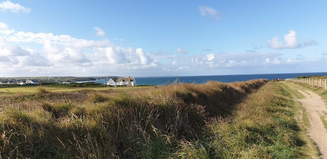
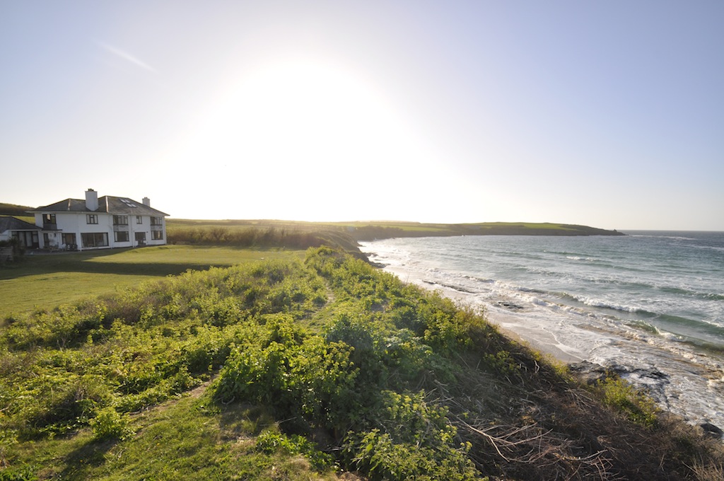
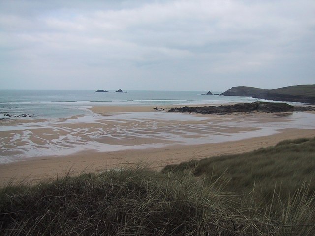
Bloodhound Cove is a picturesque coastal area located in Cornwall, England. Situated along the south-western coast, this charming cove offers visitors a captivating blend of sea, estuary, and creek landscapes.

The cove's main attraction is its pristine sandy beach, which stretches for approximately half a mile and boasts crystal-clear turquoise waters. The beach is a popular spot for sunbathing, picnicking, and swimming, particularly during the summer months when the weather is warm and inviting.

Bloodhound Cove is also renowned for its estuary, which is formed where a river meets the sea. This estuary provides a unique habitat for a variety of marine life, making it a popular destination for nature enthusiasts and birdwatchers. Visitors can wander along the estuary's banks, observing the diverse array of flora and fauna that call this area home.

Additionally, Bloodhound Cove is home to a tranquil creek, offering visitors the opportunity to explore its peaceful waters by kayak or canoe. The creek's calm and sheltered waters make it an ideal location for water sports enthusiasts and those seeking a relaxing day out on the water.

Surrounded by breathtaking cliffs and rolling hills, Bloodhound Cove offers visitors a truly captivating coastal experience. Whether it's lazing on the sandy beach, exploring the estuary's rich wildlife, or kayaking along the creek, this picturesque cove has something for everyone to enjoy.

If you have any feedback on the listing, please let us know in the comments section below.

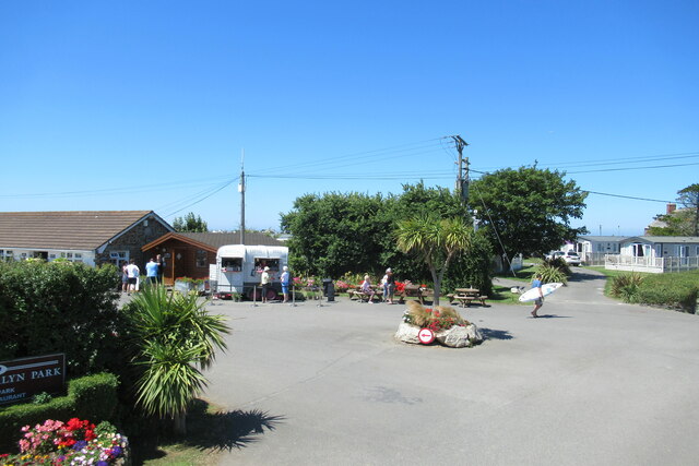
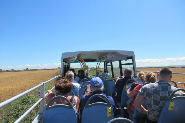
Bloodhound Cove Images

Images are sourced within 2km of 50.540875/-5.0017101 or Grid Reference SW8775. Thanks to Geograph Open Source API. All images are credited.

St Merryn School
St Merryn School
The Farmers Arms and St Merryn village
Approaching Higher Harlyn Park campsite
Entrance to Higher Harlyn Park campsite
The road to Trevose Head
Harlyn Bay beach
Harlyn Bay beach
View from the Atlantic Coaster bus shortly after Harlyn Bay
St Constantine's Well
St Constantine well
St Constantine well
Wesleyan chapel
Wesleyan chapel
Former Wesleyan chapel Now St Merryn Parish Hall and Institute
Former Wesleyan chapel
Now St Merryn Parish Hall and Institute
Former Wesleyan Methodist Chapel
Walk Towards Booby's Bay A view from the path from the car park down to Booby's Bay.
Walk Towards Booby's Bay
A view from the path from the car park down to Booby's Bay.
Fields at Booby's Bay The fields to the north of the path down to Booby's Bay from the car park. You can just see a glimpse of the sea on the horizon.
Fields at Booby's Bay
The fields to the north of the path down to Booby's Bay from the car park. You can just see a glimpse of the sea on the horizon.
The Sea at Booby's Bay Looking down from the cliff at the sea breaking on rocks at Booby's Bay.
The Sea at Booby's Bay
Looking down from the cliff at the sea breaking on rocks at Booby's Bay.
High Tide at Booby's Bay Looking across Booby's Bay towards Constantine Bay and Treyarnon.
High Tide at Booby's Bay
Looking across Booby's Bay towards Constantine Bay and Treyarnon.
Cliff Path at Booby's Bay A cliff top path at Booby's Bay, looking out over the breaking waves.
Cliff Path at Booby's Bay
A cliff top path at Booby's Bay, looking out over the breaking waves.
Rocks at Booby's Bay The sea breaking on rocks at Booby's Bay.
Rocks at Booby's Bay
The sea breaking on rocks at Booby's Bay.
Show me another place!

Bloodhound Cove is located at Grid Ref: SW8775 (Lat: 50.540875, Lng: -5.0017101)

Unitary Authority: Cornwall

Police Authority: Devon and Cornwall

What 3 Words

///lands.lofts.quietest. Near Padstow, Cornwall

Related Wikis

Harlyn

Harlyn (Cornish: ar-Lyn, meaning facing a pool) is a small village on the north coast of Cornwall, England, United Kingdom. It is situated inland from...

Trevose Golf & Country Club

Trevose Golf & Country Club is a 27-hole golf club in Cornwall, England which has hosted many of the leading amateur golf tournaments in Britain, including...

Mother Ivy's Bay

Polventon Bay (Cornish: Poll Fenton, meaning pool of a spring), Mother Ivey's Bay is a bay and bathing beach on the north coast of Cornwall, United Kingdom...

Constantine Bay

Constantine Bay (Cornish: Eglos Costentin, meaning church of St Constantine) is a village and beach on the Atlantic coast of north Cornwall, England, United...

Nearby Amenities

Located within 500m of 50.540875,-5.0017101
Source: PGS
Lat/Long: 50.5417725/-4.9951178
Source: PGS
Lat/Long: 50.541643/-4.9950534
Source: PGS
Lat/Long: 50.5414248/-4.9952144
Source: PGS
Lat/Long: 50.541343/-4.9952466
Source: PGS
Lat/Long: 50.5409628/-4.9952573
Source: PGS
Lat/Long: 50.5408009/-4.9950537
Source: PGS
Lat/Long: 50.540756/-4.9950164
Source: PGS
Lat/Long: 50.5406429/-4.9952232
Source: PGS
Lat/Long: 50.5404551/-4.9958318
Source: PGS
Lat/Long: 50.5402499/-4.9974695
Source: PGS
Lat/Long: 50.5402771/-4.9982634
Source: PGS
Lat/Long: 50.5403149/-4.9985398
Source: PGS
Lat/Long: 50.5405911/-5.0004264
Source: PGS
Lat/Long: 50.5407324/-5.0013498
Source: PGS
Lat/Long: 50.5408697/-5.0021191
Source: PGS
Lat/Long: 50.5412243/-5.0026234
Source: PGS
Lat/Long: 50.5413265/-5.0031169
Source: PGS
Lat/Long: 50.5420493/-5.003589
Source: PGS
Lat/Long: 50.5428675/-5.0039859
Source: PGS
Lat/Long: 50.5432772/-5.0047915
Source: PGS
Lat/Long: 50.5433707/-5.0046685
Source: PGS
Lat/Long: 50.5434525/-5.0043467
Source: PGS
Lat/Long: 50.5438219/-5.0044473
Post Box
Brand: Royal Mail
Brand Wikidata: Q638098
Collection Times: Mo-Fr 09:00; Sa 07:00
Operator: Royal Mail
Operator Wikidata: Q638098
Post Box Mounting: stone_wall
Post Box Type: wall
Ref: PL28 4D
Royal Cypher: EVIIR
Royal Cypher Wikidata: Q33102324
Survey Date: 2022-12-03
Lat/Long: 50.5373265/-5.005015
Post Box
Brand: Royal Mail
Brand Wikidata: Q638098
Collection Times: Mo-Fr 09:00; Sa 07:00
Mapillary: 720929246402316
Operator: Royal Mail
Operator Wikidata: Q638098
Post Box Mounting: pier
Post Box Type: lamp
Ref: PL28 82
Royal Cypher: EIIR
Royal Cypher Wikidata: Q33102113
Survey Date: 2023-02-12
Lat/Long: 50.5381004/-4.9977043
Bus Stop
Mother Iveys Corner
Bus: yes
Naptan AtcoCode: 0800FWX38566
Naptan Bearing: SW
Naptan CommonName: Mother Iveys Corner
Naptan NaptanCode: cordampj
Naptan Street: Unclassified
Naptan Verified: no
Public Transport: platform
Source: naptan_import
Lat/Long: 50.5366412/-4.9998276
Harlyn
Name Kw: Arlynn
Place: village
Source: OS_OpenData_StreetView
Wikidata: Q5659002
Lat/Long: 50.5384844/-4.9976439
Barrier: stile
Material: wood
Stile: stepover
Lat/Long: 50.5377287/-5.001864
Barrier: stile
Material: wood
Stile: stepover
Lat/Long: 50.5381715/-4.9999194
Barrier: stile
Material: wood
Stile: stepover
Lat/Long: 50.5445155/-5.0048049
Bench
Backrest: yes
Lat/Long: 50.5414519/-4.9947427
Barrier: kissing_gate
Lat/Long: 50.543522/-5.0048384
Polmark Beach Cottages
Tourism: chalet
Lat/Long: 50.5380065/-4.9972598
Barrier: stile
Material: wood
Stile: stepover
Lat/Long: 50.536646/-5.0019418
Waste Basket
Survey Date: 2022-12-03
Waste: trash
Lat/Long: 50.5393736/-4.9953569
Life Ring
Emergency: life_ring
Survey Date: 2022-12-03
Lat/Long: 50.5395574/-4.9949525
Bench
Backrest: yes
Survey Date: 2022-12-03
Lat/Long: 50.5409283/-4.9950007
Life Ring
Emergency: life_ring
Survey Date: 2022-12-03
Lat/Long: 50.5400155/-4.9995524
Fire Hydrant
Emergency: fire_hydrant
Fire Hydrant Diameter Signed: no
Fire Hydrant Position: lane
Fire Hydrant Type: underground
Survey Date: 2022-12-03
Lat/Long: 50.5376892/-5.0037239
Life Ring
Emergency: life_ring
Survey Date: 2022-12-03
Lat/Long: 50.5433394/-5.0048894
Bench
Backrest: yes
Survey Date: 2022-12-03
Lat/Long: 50.5411991/-4.9949896
Waste Basket
Survey Date: 2022-12-03
Waste: dog_excrement
Lat/Long: 50.5418223/-5.0084764
Bench
Backrest: yes
Survey Date: 2022-12-03
Lat/Long: 50.541006/-4.9950236
Fire Hydrant
Emergency: fire_hydrant
Fire Hydrant Type: underground
Survey Date: 2023-02-12
Lat/Long: 50.5387474/-4.9968136
Fire Hydrant
Emergency: fire_hydrant
Fire Hydrant Type: underground
Survey Date: 2023-02-12
Lat/Long: 50.539313/-4.9954793
Traffic Calming: bump
Lat/Long: 50.5386418/-5.0076598
Passing Place
Lat/Long: 50.5380938/-5.0063451
The data included in this document is from www.openstreetmap.org. The data is made available under ODbL.

Have you been to Bloodhound Cove?

Leave your review of Bloodhound Cove below (or comments, questions and feedback).