Port Leabaidh

Sea, Estuary, Creek in Ross-shire

Scotland

Port Leabaidh

Gisla Power Station Small HEP station on the western shore of Loch Rog Beag at Giosla.
Gisla Power Station Credit: Colin Smith

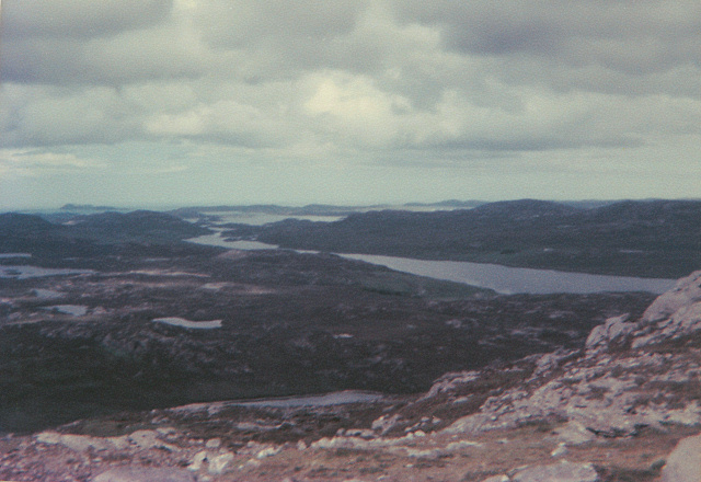
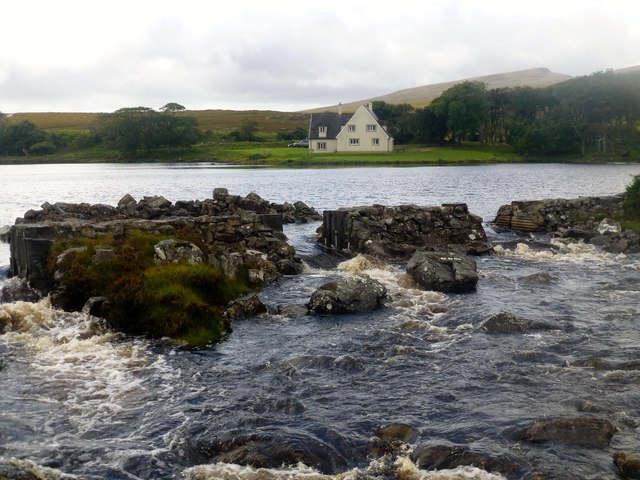
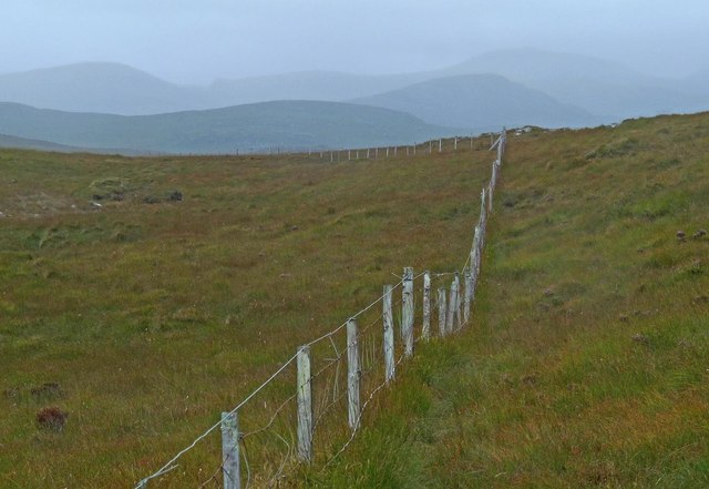
Port Leabaidh, also known as Leabaidh Harbour, is a picturesque coastal settlement located in Ross-shire, Scotland. Nestled on the eastern shore of the North Atlantic Ocean, this small port is renowned for its stunning sea views, tranquil estuary, and charming creek.

Situated at the mouth of a river, Port Leabaidh offers a unique blend of natural beauty and maritime activity. The sea surrounding the port is a haven for marine enthusiasts, with its crystal-clear waters and diverse ecosystem. It provides an ideal setting for fishing, sailing, and other water sports. The estuary, characterized by its calm and shallow waters, is a popular spot for birdwatching and wildlife observation.

The creek at Port Leabaidh is a focal point of the village, featuring a picturesque waterfront lined with colorful fishing boats and small yachts. This bustling area serves as a hub for local fishermen, who rely on the creek for their livelihoods. The bustling activity of unloading fresh catches and repairing nets creates a vibrant atmosphere, attracting visitors seeking an authentic glimpse into the fishing industry.

In addition to its natural attractions, Port Leabaidh boasts a small but thriving community. With its charming cottages and friendly locals, the village offers a warm and welcoming atmosphere to residents and tourists alike. Visitors can explore the local shops, enjoy traditional Scottish cuisine at the village pub, or take a leisurely stroll along the sandy beaches.

Overall, Port Leabaidh is a hidden gem on the Scottish coast, offering a unique blend of natural beauty, maritime heritage, and village charm. Whether one seeks relaxation by the sea or an adventure on the water, this coastal settlement has something for everyone to enjoy.

If you have any feedback on the listing, please let us know in the comments section below.

Port Leabaidh Images

Images are sourced within 2km of 58.113458/-6.8601915 or Grid Reference NB1324. Thanks to Geograph Open Source API. All images are credited.

Gisla Power Station Small HEP station on the western shore of Loch Rog Beag at Giosla.
Gisla Power Station
Small HEP station on the western shore of Loch Rog Beag at Giosla.
B8011 cut through the hillside By the bottom of Loch Ròg Beag
B8011 cut through the hillside
By the bottom of Loch Ròg Beag
Gisla Power Station A small hydroelectric power station, using water piped from Loch Coirceabhat.
Gisla Power Station
A small hydroelectric power station, using water piped from Loch Coirceabhat.
On the northern slopes of Coduinn The rocky hillside offers a view over Loch Ròg Beag, a long sea loch, and, to its west, moorland lochs and lochans.
On the northern slopes of Coduinn
The rocky hillside offers a view over Loch Ròg Beag, a long sea loch, and, to its west, moorland lochs and lochans.
Caultrashal Beag [Coltraiseal Beag] First HuMP of four today with Michael Earnshaw, Jim Bloomer and Martin Richardson in mixed weather.

Name: Caultrashal Beag [Coltraiseal Beag]
Hill number: 4941
Height: 226m / 741ft
Area: 24A: Lewis and Nearby Islands
Class: Hu,2
Grid ref: NB149241 (est)
Drop: 108m
Col: 118m  NB161233
Caultrashal Beag [Coltraiseal Beag]
First HuMP of four today with Michael Earnshaw, Jim Bloomer and Martin Richardson in mixed weather. Name: Caultrashal Beag [Coltraiseal Beag] Hill number: 4941 Height: 226m / 741ft Area: 24A: Lewis and Nearby Islands Class: Hu,2 Grid ref: NB149241 (est) Drop: 108m Col: 118m NB161233
View From Bridge View from the road bridge towards Loch Rog Beag.
View From Bridge
View from the road bridge towards Loch Rog Beag.
Weir View A view across Loch Morsgail towards Loidse Mhorsgail.
Weir View
A view across Loch Morsgail towards Loidse Mhorsgail.
River Morsgail The River Morsgail divides again to form another island.
River Morsgail
The River Morsgail divides again to form another island.
River Morsgail View A tributary joins the River Morsgail at a strange angle.
River Morsgail View
A tributary joins the River Morsgail at a strange angle.
Old road bridge at Giosla
Cairn Near Summit Of Codiunn Coduinn, Beinn a' Tuath, Beinn Mheadhanach and Sgeun with Jim Fothergill on a damp grey misty morning.
Name: Coduinn
Hill number: 4940
Height: 241m / 791ft
Parent (Ma/M): 1570 Beinn Mheadhanach [Beinn Mheadhonach]
Section: 24A: Lewis and Nearby Islands
County/UA: Na h-Eileanan Siar [Western Isles] (UA)
Island: Lewis and Harris
Class: HuMP, Tump (200-299m)
Grid ref: NB120232 (est)
Drop: 103m
Col: 138m NB116233
Cairn Near Summit Of Codiunn
Coduinn, Beinn a' Tuath, Beinn Mheadhanach and Sgeun with Jim Fothergill on a damp grey misty morning. Name: Coduinn Hill number: 4940 Height: 241m / 791ft Parent (Ma/M): 1570 Beinn Mheadhanach [Beinn Mheadhonach] Section: 24A: Lewis and Nearby Islands County/UA: Na h-Eileanan Siar [Western Isles] (UA) Island: Lewis and Harris Class: HuMP, Tump (200-299m) Grid ref: NB120232 (est) Drop: 103m Col: 138m NB116233
Gate below Sgeun, Isle of Lewis Looking towards Loch Mòr Ruadh.
Gate below Sgeun, Isle of Lewis
Looking towards Loch Mòr Ruadh.
Fence to the south of Loch Gainmhich, Isle of Lewis The highest hill in the background is Stulabhal.

Although not particularly new looking, the fence is not currently shown on the OS map (as viewed on OS Maps 23/09/16).
Fence to the south of Loch Gainmhich, Isle of Lewis
The highest hill in the background is Stulabhal. Although not particularly new looking, the fence is not currently shown on the OS map (as viewed on OS Maps 23/09/16).
Rock on moorland near Loch Fuarail, Isle of Lewis Looking towards Loch Fuarail and Coduinn.
Rock on moorland near Loch Fuarail, Isle of Lewis
Looking towards Loch Fuarail and Coduinn.
Loch Sùrstabhat at sunset Although looking almost due north, the sun was setting just off the left of this view, taken after 10 pm (summer time). The sunset hadn't yet developed the spectacular underlit cloudscape that followed 20 minutes or so later, but the little loch caught our eye as we became increasingly distracted from the road looking for a suitable foreground. Fortunately, there are sections of the old road to safely get off the highway and wander about with a camera !
Loch Sùrstabhat at sunset
Although looking almost due north, the sun was setting just off the left of this view, taken after 10 pm (summer time). The sunset hadn't yet developed the spectacular underlit cloudscape that followed 20 minutes or so later, but the little loch caught our eye as we became increasingly distracted from the road looking for a suitable foreground. Fortunately, there are sections of the old road to safely get off the highway and wander about with a camera !
Sunset over Loch Sùrstabhat As the sky cleared from the west, the sun started to underlight the cloud cover as we passed by the upper end of Loch Sùrstabhat. The perspective and the direction of clearance has produced one of those views where the horizon looks tilted one way when seen "broad-brush" but then seems tilted the other way when the water is looked at more closely. I find the effect somewhat disturbing, but have tried to get the real horizon as level as possible. It's not helped by those electric poles all leaning towards the long span of cable across the loch...
Sunset over Loch Sùrstabhat
As the sky cleared from the west, the sun started to underlight the cloud cover as we passed by the upper end of Loch Sùrstabhat. The perspective and the direction of clearance has produced one of those views where the horizon looks tilted one way when seen "broad-brush" but then seems tilted the other way when the water is looked at more closely. I find the effect somewhat disturbing, but have tried to get the real horizon as level as possible. It's not helped by those electric poles all leaning towards the long span of cable across the loch...
Looking towards Giosla from the B8011
Road leading to Mhorsgail Lodge
Show me another place!

Port Leabaidh is located at Grid Ref: NB1324 (Lat: 58.113458, Lng: -6.8601915)

Unitary Authority: Na h-Eileanan an Iar

Police Authority: Highlands and Islands

What 3 Words

///commander.providing.boldest. Near Carloway, Na h-Eileanan Siar

Related Wikis

Gisla Hydro-Electric Scheme

Gisla Hydro-Electric Scheme was a small scheme promoted by the North of Scotland Hydro-Electric Board on the Isle of Lewis, Outer Hebrides, Scotland. It...

Eilean Mòr, Loch Langavat

Eilean Mòr is an island in Loch Langavat on the Isle of Lewis in the Outer Hebrides of Scotland. == Footnotes ==

Fuaigh Beag

Fuaigh Beag or Vuia Be(a)g is an island in the Outer Hebrides. It is off the west coast of Lewis near Great Bernera in Loch Roag. Its name means "little...

Flodaigh, Lewis

Flodaigh is a small island in Loch Roag on the west coast of Lewis in the Outer Hebrides of Scotland. It is about 33 hectares (82 acres) in extent and...

Nearby Amenities

Located within 500m of 58.113458,-6.8601915
Passing Place
Lat/Long: 58.1123897/-6.8631483
Power: pole
Lat/Long: 58.117508/-6.8578659
Power: pole
Lat/Long: 58.1171635/-6.8590734
Power: pole
Lat/Long: 58.1168166/-6.8602313
Power: pole
Lat/Long: 58.1165328/-6.8628856
Power: pole
Lat/Long: 58.1166103/-6.8650253
Power: pole
Lat/Long: 58.1167698/-6.8563948
Power: pole
Lat/Long: 58.1160387/-6.8564002
Power: pole
Lat/Long: 58.1152935/-6.8569661
Power: pole
Lat/Long: 58.1149124/-6.8576662
Power: pole
Lat/Long: 58.1144808/-6.8591354
Power: pole
Lat/Long: 58.1144647/-6.8598576
Power: pole
Lat/Long: 58.1144173/-6.8611882
Power: pole
Lat/Long: 58.1143769/-6.8623225
Power: pole
Lat/Long: 58.1143684/-6.863205
Power: pole
Lat/Long: 58.1146206/-6.8638138
Power: pole
Lat/Long: 58.1150739/-6.8648733
Power: pole
Lat/Long: 58.1155641/-6.8656189
Power: pole
Lat/Long: 58.1161818/-6.8665014
Power: pole
Lat/Long: 58.1097763/-6.857475
Power: pole
Lat/Long: 58.1106324/-6.8579034
Power: pole
Lat/Long: 58.1114576/-6.8582999
Power: pole
Lat/Long: 58.1122912/-6.8586991
Power: pole
Lat/Long: 58.1133162/-6.8591837
Power: pole
Lat/Long: 58.1137874/-6.8591677
Power: pole
Lat/Long: 58.1136343/-6.8609607
Power: pole
Lat/Long: 58.1137507/-6.8596202
Barrier: cattle_grid
Lat/Long: 58.1139195/-6.8616512
Power: pole
Lat/Long: 58.1143204/-6.8591463
Power: pole
Lat/Long: 58.1145073/-6.8583708
Passing Place
Lat/Long: 58.1116788/-6.8621671
Passing Place
Lat/Long: 58.1109056/-6.8611429
Barrier: cattle_grid
Lat/Long: 58.1149163/-6.8677963
Passing Place
Lat/Long: 58.113461/-6.8662
Passing Place
Lat/Long: 58.1131635/-6.8655521
Generator Method: wind_turbine
Generator Output Electricity: small_installation
Generator Source: wind
Generator Type: horizontal_axis
Power: generator
Lat/Long: 58.1119521/-6.8641418
Generator Method: wind_turbine
Generator Output Electricity: small_installation
Generator Source: wind
Generator Type: horizontal_axis
Power: generator
Lat/Long: 58.1116191/-6.8643148
Generator Method: wind_turbine
Generator Output Electricity: small_installation
Generator Source: wind
Generator Type: horizontal_axis
Power: generator
Lat/Long: 58.1118564/-6.8648713
Generator Method: wind_turbine
Generator Output Electricity: small_installation
Generator Source: wind
Generator Type: horizontal_axis
Power: generator
Lat/Long: 58.1121752/-6.8650993
Man Made: mast
Tower Construction: mast
Lat/Long: 58.1153383/-6.859116
The data included in this document is from www.openstreetmap.org. The data is made available under ODbL.

Have you been to Port Leabaidh?

Leave your review of Port Leabaidh below (or comments, questions and feedback).