An Ollag

Beach in Argyllshire

Scotland

An Ollag

Wrack, Port Fada High water, this area dries at low tide.
Wrack, Port Fada Credit: Richard Webb

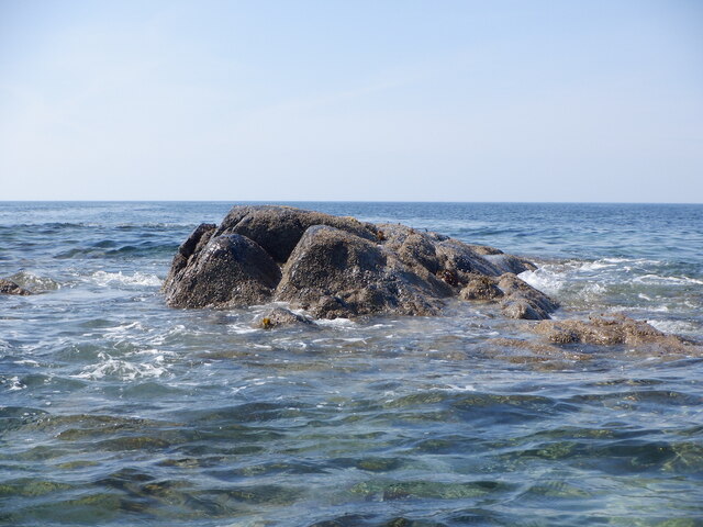
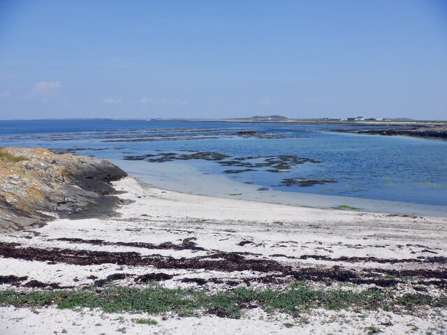
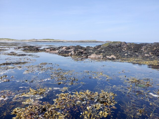
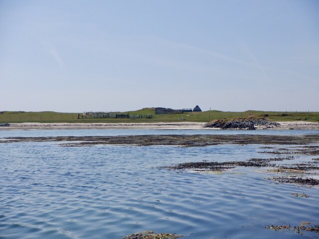
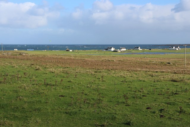
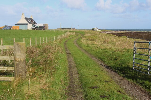
An Ollag, located in Argyllshire, is a stunning beach renowned for its natural beauty and tranquil atmosphere. Situated on the west coast of Scotland, it offers visitors a picturesque setting that is ideal for relaxation and outdoor activities.

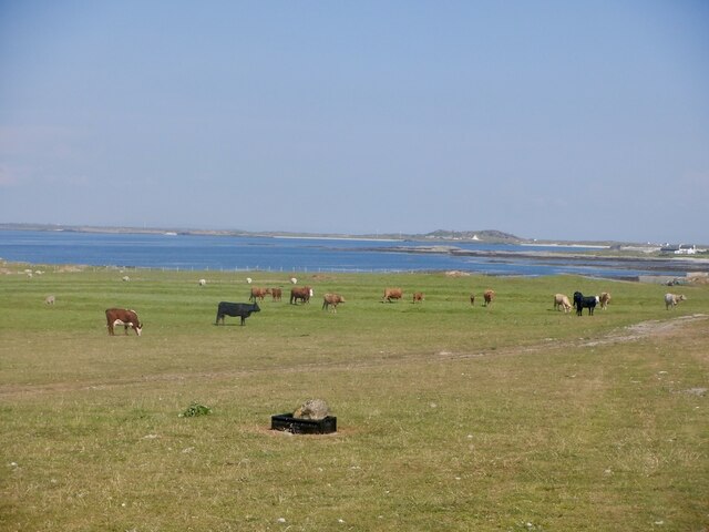
The beach is characterized by its golden sands and crystal-clear waters, which provide a perfect backdrop for sunbathing, swimming, and picnicking. The surrounding landscape is dominated by rugged cliffs and rolling hills, creating a dramatic and awe-inspiring scenery.

An Ollag is also home to a diverse range of wildlife, making it a popular destination for nature enthusiasts. Seals, dolphins, and various seabirds can often be spotted in the area, providing a unique opportunity for wildlife observation and photography.

The beach is easily accessible by road and is well-maintained, with parking facilities available for visitors. There are also basic amenities such as public toilets and nearby cafes or restaurants for those looking to grab a bite to eat or a hot beverage.

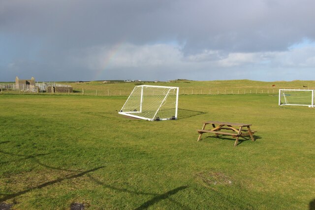
For those seeking adventure, An Ollag offers opportunities for various water sports activities like kayaking, paddleboarding, and even surfing during suitable weather conditions. Additionally, the beach is surrounded by hiking trails and coastal walks, allowing visitors to explore the stunning natural surroundings while enjoying breathtaking views of the sea and the nearby islands.

Overall, An Ollag in Argyllshire is a hidden gem, combining natural beauty, tranquility, and outdoor activities, making it an ideal destination for a day trip or a relaxing beach holiday.

If you have any feedback on the listing, please let us know in the comments section below.

An Ollag Images

Images are sourced within 2km of 56.527143/-6.9008501 or Grid Reference NL9847. Thanks to Geograph Open Source API. All images are credited.

Wrack, Port Fada High water, this area dries at low tide.
Wrack, Port Fada
High water, this area dries at low tide.
Sgeir Fada Very little of the skerry emerges from a neap high water. Another rock nearby was also dry.
Sgeir Fada
Very little of the skerry emerges from a neap high water. Another rock nearby was also dry.
Beach at Port Fada Near high water.
Beach at Port Fada
Near high water.
Port Fada Rocks and seaweed near high water. Most of the square dries.
Port Fada
Rocks and seaweed near high water. Most of the square dries.
Beach, Port Fada
Beach, Port Fada
Cattle near Ainshval North coast of Tiree.
Cattle near Ainshval
North coast of Tiree.
A playing field at Tiree High School
A burn draining moorland bogs at Cornaigbeg
House at Cornaigbeg
House at Cornaigbeg
Houses at Balephetrish Bay
Road to Kenovay Farm and Ard Mor The west side of Balephetrish Bay on Tiree.
Road to Kenovay Farm and Ard Mor
The west side of Balephetrish Bay on Tiree.
Windsurfing on Loch Bhasapoli, Tiree
Natural Arch, Balephetrish Bay, Tiree one of a number of arches at the west end of the bay
Natural Arch, Balephetrish Bay, Tiree
one of a number of arches at the west end of the bay
Two people windsurfing Windsurfing on Loch Bhasapoli, Tiree
Two people windsurfing
Windsurfing on Loch Bhasapoli, Tiree
Loch Bhasapoll
Loch Bhasapoll
Rocky outcrops This area has many outcrops of Lewesian Gneiss.
Rocky outcrops
This area has many outcrops of Lewesian Gneiss.
Torosa farm track The track leading to the farm in the background.  The coastal areas of Tiree 
are fertile machair.
Torosa farm track
The track leading to the farm in the background. The coastal areas of Tiree are fertile machair.
West coast of Balephetrish Bay A lot of seaweed on this corner of the beach, and very rocky further along.
West coast of Balephetrish Bay
A lot of seaweed on this corner of the beach, and very rocky further along.
Show me another place!

An Ollag is located at Grid Ref: NL9847 (Lat: 56.527143, Lng: -6.9008501)

Unitary Authority: Argyll and Bute

Police Authority: Argyll and West Dunbartonshire

What 3 Words

///excuse.curly.dirt. Near Scarinish, Argyll & Bute

Related Wikis

Tiree Airport

Tiree Airport (Scottish Gaelic: Port-adhair Thiriodh) (IATA: TRE, ICAO: EGPU) is located 2.5 nautical miles (4.6 km; 2.9 mi) north northeast of Balemartine...

Tiree Music Festival

Tiree Music Festival is a Scottish folk music festival held annually on the Island of Tiree in the Inner Hebrides. The festival was founded in 2010 by...

Tiree

Tiree (; Scottish Gaelic: Tiriodh, pronounced [ˈtʲʰiɾʲəɣ]) is the most westerly island in the Inner Hebrides of Scotland. The low-lying island, southwest...

Dun Mor Vaul

Dun Mor Vaul (or simply Dun Mor; Scottish Gaelic: Dùn Mòr) is an iron-age broch located on the north coast of the island of Tiree, in Scotland. ��2�...

Nearby Amenities

Located within 500m of 56.527143,-6.9008501
Created By: dmgroom_coastlines
Source: PGS
Lat/Long: 56.52904/-6.90812
Created By: dmgroom_coastlines
Source: PGS
Lat/Long: 56.52876/-6.9072
Created By: dmgroom_coastlines
Source: PGS
Lat/Long: 56.52874/-6.90581
Created By: dmgroom_coastlines
Source: PGS
Lat/Long: 56.52872/-6.90443
Created By: dmgroom_coastlines
Source: PGS
Lat/Long: 56.52845/-6.90351
Created By: dmgroom_coastlines
Source: PGS
Lat/Long: 56.5283/-6.90259
Created By: dmgroom_coastlines
Source: PGS
Lat/Long: 56.52779/-6.90262
Created By: dmgroom_coastlines
Source: PGS
Lat/Long: 56.5278/-6.90401
Created By: dmgroom_coastlines
Source: PGS
Lat/Long: 56.52678/-6.9043
Created By: dmgroom_coastlines
Source: PGS
Lat/Long: 56.52629/-6.90456
Created By: dmgroom_coastlines
Source: PGS
Lat/Long: 56.5264/-6.90363
Created By: dmgroom_coastlines
Source: PGS
Lat/Long: 56.52651/-6.90269
Created By: dmgroom_coastlines
Source: PGS
Lat/Long: 56.52625/-6.90248
Created By: dmgroom_coastlines
Source: PGS
Lat/Long: 56.52574/-6.90251
Created By: dmgroom_coastlines
Source: PGS
Lat/Long: 56.52563/-6.90274
Created By: dmgroom_coastlines
Source: PGS
Lat/Long: 56.52549/-6.90298
Created By: dmgroom_coastlines
Source: PGS
Lat/Long: 56.52498/-6.90324
Created By: dmgroom_coastlines
Source: PGS
Lat/Long: 56.5251/-6.90277
Created By: dmgroom_coastlines
Source: PGS
Lat/Long: 56.52535/-6.90229
Created By: dmgroom_coastlines
Source: PGS
Lat/Long: 56.52547/-6.90182
Created By: dmgroom_coastlines
Source: PGS
Lat/Long: 56.52521/-6.90161
Created By: dmgroom_coastlines
Source: PGS
Lat/Long: 56.52495/-6.90116
Created By: dmgroom_coastlines
Source: PGS
Lat/Long: 56.52443/-6.90095
Created By: dmgroom_coastlines
Source: PGS
Lat/Long: 56.52454/-6.90003
Created By: dmgroom_coastlines
Source: PGS
Lat/Long: 56.52453/-6.8991
Created By: dmgroom_coastlines
Source: PGS
Lat/Long: 56.52424/-6.89725
Created By: dmgroom_coastlines
Source: PGS
Lat/Long: 56.52423/-6.8968
Created By: dmgroom_coastlines
Source: PGS
Lat/Long: 56.52433/-6.89494
Created By: dmgroom_coastlines
Source: PGS
Lat/Long: 56.52484/-6.89468
Created By: dmgroom_coastlines
Source: PGS
Lat/Long: 56.52535/-6.89442
Created By: dmgroom_coastlines
Source: PGS
Lat/Long: 56.52534/-6.89349
Created By: dmgroom_coastlines
Source: PGS
Lat/Long: 56.52584/-6.89346
Created By: dmgroom_coastlines
Source: PGS
Lat/Long: 56.5266/-6.89296
Power: pole
Lat/Long: 56.5245679/-6.9046113
Power: pole
Lat/Long: 56.5239738/-6.9035112
Power: pole
Lat/Long: 56.5237968/-6.9019422
Power: pole
Lat/Long: 56.5236966/-6.9010849
Power: pole
Lat/Long: 56.52348/-6.8992351
Power: pole
Lat/Long: 56.5233845/-6.898327
Power: pole
Lat/Long: 56.5230199/-6.9021365
Clachan Mòr
Place: locality
Lat/Long: 56.5243774/-6.9050418
The data included in this document is from www.openstreetmap.org. The data is made available under ODbL.

Have you been to An Ollag?

Leave your review of An Ollag below (or comments, questions and feedback).