Porth Cerrig Lago

Bay in Anglesey

Wales

Porth Cerrig Lago

Porth Melin Ifan Owen
Porth Melin Ifan Owen Credit: Alistair Hare

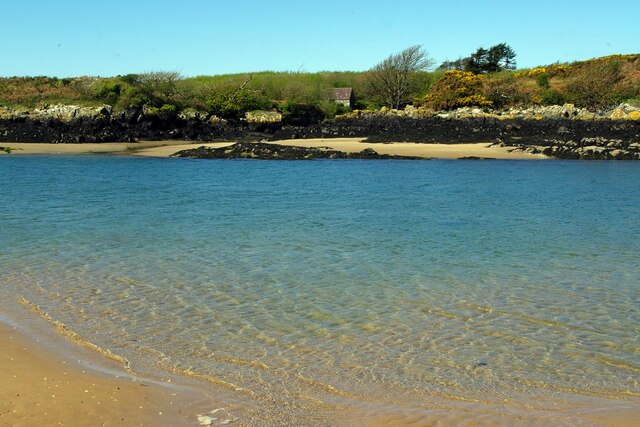
Porth Cerrig Lago, also known as Porth Cerrig-y-llyn, is a picturesque bay located on the north coast of Anglesey, an island off the coast of Wales. Situated between the villages of Cemaes and Llanbadrig, this bay offers stunning views and a serene atmosphere.

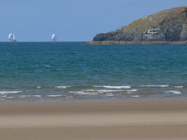
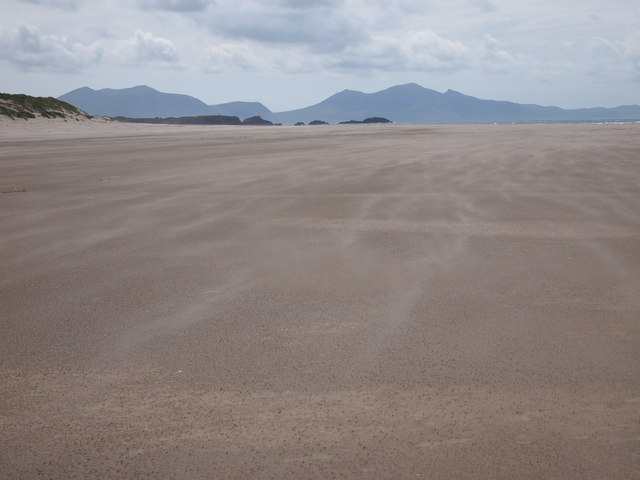
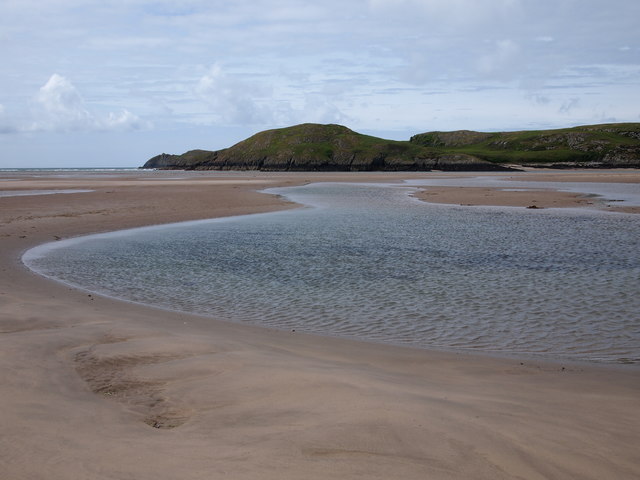
The bay is characterized by its golden sandy beach, which stretches for approximately 300 meters. It is a popular destination for locals and tourists alike, especially during the summer months. The beach provides ample space for sunbathing, picnicking, and enjoying a variety of water-based activities such as swimming, kayaking, and paddleboarding.

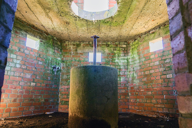
Porth Cerrig Lago is surrounded by rugged cliffs, adding to its natural beauty. These cliffs provide a sheltered environment, making the bay an ideal spot for wildlife enthusiasts. Visitors may catch a glimpse of various seabirds, including cormorants and guillemots, as well as seals and dolphins that occasionally visit the area.

The bay is easily accessible, with a car park located nearby. There are also public toilets and a café within walking distance, ensuring visitors have all the necessary amenities. Additionally, the bay is wheelchair-friendly, with a concrete ramp allowing access to the beach.

Porth Cerrig Lago is a hidden gem on the Isle of Anglesey, offering tranquility, natural beauty, and a range of activities for all to enjoy. Whether you are looking to relax on the sandy beach or explore the surrounding cliffs and wildlife, this bay has something for everyone.

If you have any feedback on the listing, please let us know in the comments section below.

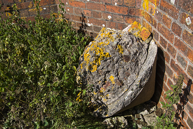
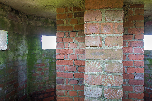
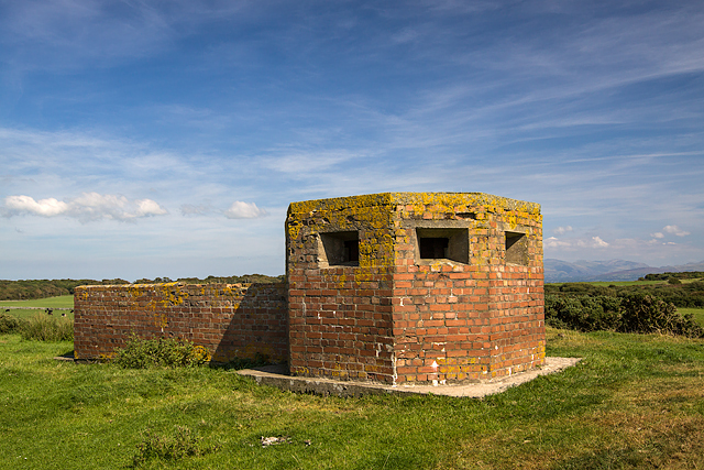
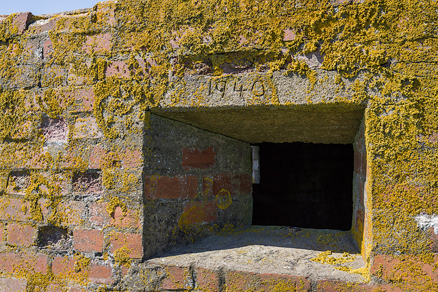
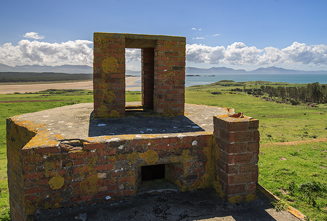
Porth Cerrig Lago Images

Images are sourced within 2km of 53.161019/-4.4495423 or Grid Reference SH3665. Thanks to Geograph Open Source API. All images are credited.

Porth Melin Ifan Owen
Pen-y-parc headland from Traeth Penrhos
View to Llanddwyn Island (Ynys Llanddwyn) A low tide has allowed access to this remote square with distant views to the dark line of Llanddwyn Island (Ynys Llanddwyn), and beyond, The Rivals (Yr Eifl) on the Llŷn Peninsula (Pen Llŷn). Position checked with GPS.
View to Llanddwyn Island (Ynys Llanddwyn)
A low tide has allowed access to this remote square with distant views to the dark line of Llanddwyn Island (Ynys Llanddwyn), and beyond, The Rivals (Yr Eifl) on the Llŷn Peninsula (Pen Llŷn). Position checked with GPS.
North Wales WWII defences: RAF Bodorgan, Anglesey - Trefri pillbox (1) -
Pillbox (unclassified): DoB ID: S0003171

On a hilltop in open countryside is a single storey, brick-faced, octagonal plan pillbox with a reinforced concrete roof, and an attached octagonal LAAMG post. Part of the former airfield defences of RAF Bodorgan.

<a href="https://www.geograph.org.uk/photo/5085758">SH3767 : North Wales WWII defences: RAF Bodorgan, Anglesey - Trefri pillbox (2)</a>
North Wales WWII defences: RAF Bodorgan, Anglesey - Trefri pillbox (1)
- Pillbox (unclassified): DoB ID: S0003171 On a hilltop in open countryside is a single storey, brick-faced, octagonal plan pillbox with a reinforced concrete roof, and an attached octagonal LAAMG post. Part of the former airfield defences of RAF Bodorgan. SH3767 : North Wales WWII defences: RAF Bodorgan, Anglesey - Trefri pillbox (2)
North Wales WWII defences: RAF Bodorgan, Anglesey - Trefri pillbox (2) -
Pillbox (unclassified): DoB ID: S0003171

View from the LAAMG post showing the attached walled enclosure to the pillbox that provided a protected corridor between the two positions.

<a href="https://www.geograph.org.uk/photo/5085763">SH3767 : North Wales WWII defences: RAF Bodorgan, Anglesey - Trefri pillbox (3)</a>
North Wales WWII defences: RAF Bodorgan, Anglesey - Trefri pillbox (2)
- Pillbox (unclassified): DoB ID: S0003171 View from the LAAMG post showing the attached walled enclosure to the pillbox that provided a protected corridor between the two positions. SH3767 : North Wales WWII defences: RAF Bodorgan, Anglesey - Trefri pillbox (3)
North Wales WWII defences: RAF Bodorgan, Anglesey - Trefri pillbox (3) -
Pillbox (unclassified): DoB ID: S0003171

Unfortunately this is all that remains of the central concrete pillar of the LAAMG position upon which the AA gun was mounted, having apparently been toppled (note the conical top to allow upward traversing of the weapon).

<a href="https://www.geograph.org.uk/photo/5085767">SH3767 : North Wales WWII defences: RAF Bodorgan, Anglesey - Trefri pillbox (4)</a>
North Wales WWII defences: RAF Bodorgan, Anglesey - Trefri pillbox (3)
- Pillbox (unclassified): DoB ID: S0003171 Unfortunately this is all that remains of the central concrete pillar of the LAAMG position upon which the AA gun was mounted, having apparently been toppled (note the conical top to allow upward traversing of the weapon). SH3767 : North Wales WWII defences: RAF Bodorgan, Anglesey - Trefri pillbox (4)
North Wales WWII defences: RAF Bodorgan, Anglesey - Trefri pillbox (4) -
Pillbox (unclassified): DoB ID: S0003171

Interior view through an embrasure showing the 'T' plan anti-ricochet wall.

<a href="https://www.geograph.org.uk/photo/5085771">SH3767 : North Wales WWII defences: RAF Bodorgan, Anglesey - Trefri pillbox (5)</a>
North Wales WWII defences: RAF Bodorgan, Anglesey - Trefri pillbox (4)
- Pillbox (unclassified): DoB ID: S0003171 Interior view through an embrasure showing the 'T' plan anti-ricochet wall. SH3767 : North Wales WWII defences: RAF Bodorgan, Anglesey - Trefri pillbox (5)
North Wales WWII defences: RAF Bodorgan, Anglesey - Trefri pillbox (5) -
Pillbox (unclassified): DoB ID: S0003171

View from the west.

<a href="https://www.geograph.org.uk/photo/5085777">SH3968 : North Wales WWII defences: RAF Bodorgan, Anglesey - Hermon pillbox (1)</a>
North Wales WWII defences: RAF Bodorgan, Anglesey - Trefri pillbox (5)
- Pillbox (unclassified): DoB ID: S0003171 View from the west. SH3968 : North Wales WWII defences: RAF Bodorgan, Anglesey - Hermon pillbox (1)
Traeth Penrhos Sand blowing across the surface.
Traeth Penrhos
Sand blowing across the surface.
Dinas-lwyd
Dinas-lwyd
North Wales WWII defences: RAF Bodorgan, Anglesey - Bodowen pillbox (1) -
Pillbox (unclassified): DoB ID: S0003170 

Almost identical to the one at Hermon, it comprises an enclosed circular gun pit, with a crew shelter in the middle, and a hexagonal pillbox with a brick built structure on the roof that was probably an observation post. It differs from the one at Hermon in that the attached gun pit is much deeper externally to allow the structure to be accommodated on the rock outcrop on which it sits, and also the entrance is on the right instead of the left-hand side of the crew room. The vista in front of it is little short of breathtaking with views over the mouth of the Malltraeth Estuary, and Llanddwyn Island beyond.

This is the most inaccessible of all the defensive structures at RAF Bodorgan and special permission is required from the Bodorgan Estate in order to visit it. With thanks therefore to Tim Bowie, Estate Manager for arranging access, and to Jonathan Thickett, Estate Warden, for his help in finding other sites, and for the "guided tour".

<a href="https://www.geograph.org.uk/photo/5408277">SH3766 : North Wales WWII defences: RAF Bodorgan, Anglesey - Bodowen pillbox (2)</a>
North Wales WWII defences: RAF Bodorgan, Anglesey - Bodowen pillbox (1)
- Pillbox (unclassified): DoB ID: S0003170 Almost identical to the one at Hermon, it comprises an enclosed circular gun pit, with a crew shelter in the middle, and a hexagonal pillbox with a brick built structure on the roof that was probably an observation post. It differs from the one at Hermon in that the attached gun pit is much deeper externally to allow the structure to be accommodated on the rock outcrop on which it sits, and also the entrance is on the right instead of the left-hand side of the crew room. The vista in front of it is little short of breathtaking with views over the mouth of the Malltraeth Estuary, and Llanddwyn Island beyond. This is the most inaccessible of all the defensive structures at RAF Bodorgan and special permission is required from the Bodorgan Estate in order to visit it. With thanks therefore to Tim Bowie, Estate Manager for arranging access, and to Jonathan Thickett, Estate Warden, for his help in finding other sites, and for the "guided tour". SH3766 : North Wales WWII defences: RAF Bodorgan, Anglesey - Bodowen pillbox (2)
North Wales WWII defences: RAF Bodorgan, Anglesey - Bodowen pillbox (2) -
Pillbox (unclassified): DoB ID: S0003170 

The view of the pillbox from below the bluff.

<a href="https://www.geograph.org.uk/photo/5408297">SH3766 : North Wales WWII defences: RAF Bodorgan, Anglesey - Bodowen pillbox (3)</a>
North Wales WWII defences: RAF Bodorgan, Anglesey - Bodowen pillbox (2)
- Pillbox (unclassified): DoB ID: S0003170 The view of the pillbox from below the bluff. SH3766 : North Wales WWII defences: RAF Bodorgan, Anglesey - Bodowen pillbox (3)
North Wales WWII defences: RAF Bodorgan, Anglesey - Bodowen pillbox (3) -
Pillbox (unclassified): DoB ID: S0003170

<a href="https://www.geograph.org.uk/photo/5408305">SH3766 : North Wales WWII defences: RAF Bodorgan, Anglesey - Bodowen pillbox (4)</a>
North Wales WWII defences: RAF Bodorgan, Anglesey - Bodowen pillbox (3)
North Wales WWII defences: RAF Bodorgan, Anglesey - Bodowen pillbox (4) -
Pillbox (unclassified): DoB ID: S0003170

The date '1940' is inscribed on the lintel of an embrasure.

<a href="https://www.geograph.org.uk/photo/5408335">SH3766 : North Wales WWII defences: RAF Bodorgan, Anglesey - Bodowen pillbox (5)</a>
North Wales WWII defences: RAF Bodorgan, Anglesey - Bodowen pillbox (4)
- Pillbox (unclassified): DoB ID: S0003170 The date '1940' is inscribed on the lintel of an embrasure. SH3766 : North Wales WWII defences: RAF Bodorgan, Anglesey - Bodowen pillbox (5)
North Wales WWII defences: RAF Bodorgan, Anglesey - Bodowen pillbox (6) -
Pillbox (unclassified): DoB ID: S0003170

The view from the crew room roof over Malltraeth Bay, with in the foreground, the crew room chimney, the northwest facing embrasure of the attached pillbox, and beyond on its roof is the curious brick-built observation post.

<a href="https://www.geograph.org.uk/photo/5408332">SH3766 : North Wales WWII defences: RAF Bodorgan, Anglesey - Bodowen pillbox (7)</a>
North Wales WWII defences: RAF Bodorgan, Anglesey - Bodowen pillbox (6)
- Pillbox (unclassified): DoB ID: S0003170 The view from the crew room roof over Malltraeth Bay, with in the foreground, the crew room chimney, the northwest facing embrasure of the attached pillbox, and beyond on its roof is the curious brick-built observation post. SH3766 : North Wales WWII defences: RAF Bodorgan, Anglesey - Bodowen pillbox (7)
North Wales WWII defences: RAF Bodorgan, Anglesey - Bodowen pillbox (7) -
Pillbox (unclassified): DoB ID: S0003170

The circular aperture cut into the pillbox roof gave access to the observation post. Below this can be seen a concrete pedestal in the centre of which is a metal pole. The exact purpose of this is not known, but it has been conjectured that the metal pole may have supported a secondary piece of equipment that protruded into the observation post. It would have allowed its operator to stand on the pedestal below with his head above the roof line inside the observation post. 

<a href="https://www.geograph.org.uk/photo/5408342">SH3766 : North Wales WWII defences: RAF Bodorgan, Anglesey - Bodowen pillbox (8)</a>
North Wales WWII defences: RAF Bodorgan, Anglesey - Bodowen pillbox (7)
- Pillbox (unclassified): DoB ID: S0003170 The circular aperture cut into the pillbox roof gave access to the observation post. Below this can be seen a concrete pedestal in the centre of which is a metal pole. The exact purpose of this is not known, but it has been conjectured that the metal pole may have supported a secondary piece of equipment that protruded into the observation post. It would have allowed its operator to stand on the pedestal below with his head above the roof line inside the observation post. SH3766 : North Wales WWII defences: RAF Bodorgan, Anglesey - Bodowen pillbox (8)
North Wales WWII defences: RAF Bodorgan, Anglesey - Bodowen pillbox (5) -
Pillbox (unclassified): DoB ID: S0003170

<a href="https://www.geograph.org.uk/photo/5408321">SH3766 : North Wales WWII defences: RAF Bodorgan, Anglesey - Bodowen pillbox (6)</a>
North Wales WWII defences: RAF Bodorgan, Anglesey - Bodowen pillbox (5)
North Wales WWII defences: RAF Bodorgan, Anglesey - Bodowen pillbox (8) -
Pillbox (unclassified): DoB ID: S0003170

The view inside the pillbox of the pedestal with its now truncated metal pole. Its equipment mounting bracket on the end would originally have protruded into the observation post above the pillbox roofline. Above this is the circular opening in the ceiling that allowed access into the observation post from inside the pillbox.

<a href="https://www.geograph.org.uk/photo/5408346">SH3766 : North Wales WWII defences: RAF Bodorgan, Anglesey - Bodowen pillbox (9)</a>
North Wales WWII defences: RAF Bodorgan, Anglesey - Bodowen pillbox (8)
- Pillbox (unclassified): DoB ID: S0003170 The view inside the pillbox of the pedestal with its now truncated metal pole. Its equipment mounting bracket on the end would originally have protruded into the observation post above the pillbox roofline. Above this is the circular opening in the ceiling that allowed access into the observation post from inside the pillbox. SH3766 : North Wales WWII defences: RAF Bodorgan, Anglesey - Bodowen pillbox (9)
Show me another place!

Porth Cerrig Lago is located at Grid Ref: SH3665 (Lat: 53.161019, Lng: -4.4495423)

Unitary Authority: Isle of Anglesey

Police Authority: North Wales

What 3 Words

///pastels.thrashed.gosh. Near Rhosneigr, Isle of Anglesey

Related Wikis

Afon Ffraw

The Afon Ffraw is a short river on the Isle of Anglesey, Wales. It arises at Llyn Coron and flows southwest for two miles along the northwestern margin...

Aberffraw

Aberffraw is a village and community on the south west coast of the Isle of Anglesey (Welsh: Ynys Môn), in Wales. The village is 9 miles from the island...

RAF Bodorgan

Royal Air Force Bodorgan, or more simply RAF Bodorgan, is a former Royal Air Force satellite airfield located near to Bodorgan Hall on the Isle of Anglesey...

Bodorgan

Bodorgan is a village and community on the Isle of Anglesey, Wales, United Kingdom. According to the 2001 Census, there were 1,503 residents in the now...

St Beuno's Church, Aberffraw

St Beuno's Church, Aberffraw is a 12th-century parish church in Anglesey, north Wales. A church was established in Aberffraw in the 7th century by St Beuno...
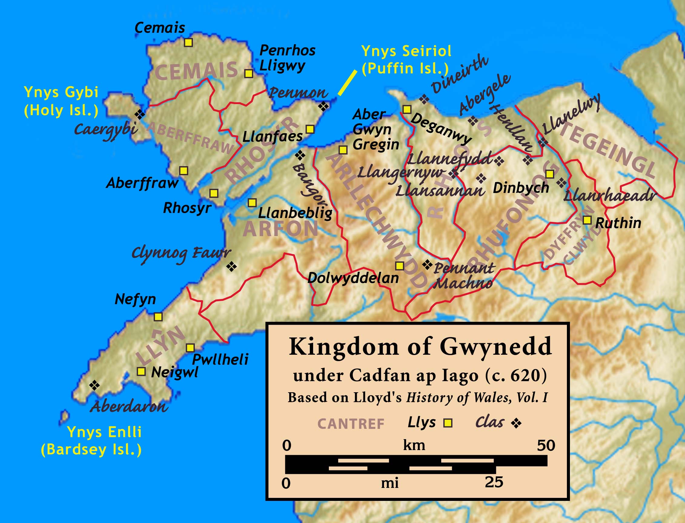
Aberffraw (cantref)

Aberffraw was one of the three medieval cantrefs on the island of Anglesey, north Wales, in the Kingdom of Gwynedd as a cadet branch, named the House of...
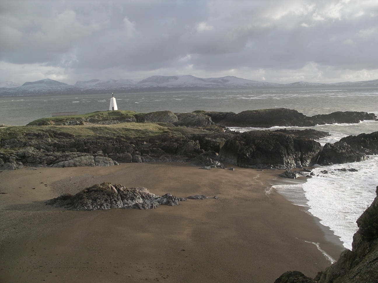
Ynys Llanddwyn

Ynys Llanddwyn (also known as Llanddwyn Island) is a small tidal island off the west coast of Anglesey (Welsh: Ynys Môn), northwest Wales. The nearest...

St Cwyfan's Church, Llangwyfan

Eglwys Cwyfan (St Cwyfan's Church) is a Grade II*-listed medieval church in Llangadwaladr, Anglesey, Wales. Located on the small tidal island of Cribinau...

Nearby Amenities

Located within 500m of 53.161019,-4.4495423
Created By: dmgroom_coastlines
Source: PGS
Lat/Long: 53.1647858/-4.4527337
Created By: dmgroom_coastlines
Source: PGS
Lat/Long: 53.1644663/-4.4530386
Created By: dmgroom_coastlines
Source: PGS
Lat/Long: 53.164295/-4.453857
Created By: dmgroom_coastlines
Source: PGS
Lat/Long: 53.16378/-4.454054
Created By: dmgroom_coastlines
Source: PGS
Lat/Long: 53.1635069/-4.4537782
Created By: dmgroom_coastlines
Source: PGS
Lat/Long: 53.1635381/-4.4533634
Created By: dmgroom_coastlines
Source: PGS
Lat/Long: 53.1638485/-4.4529432
Created By: dmgroom_coastlines
Source: PGS
Lat/Long: 53.164302/-4.4524947
Created By: dmgroom_coastlines
Source: PGS
Lat/Long: 53.1645953/-4.4518289
Source: PGS
Lat/Long: 53.1648752/-4.4511521
Source: PGS
Lat/Long: 53.1645065/-4.4497666
Source: PGS
Lat/Long: 53.1641985/-4.4495706
Source: PGS
Lat/Long: 53.163765/-4.4492124
Source: PGS
Lat/Long: 53.1635624/-4.4490028
Source: PGS
Lat/Long: 53.1631085/-4.448719
Created By: dmgroom_coastlines
Source: PGS
Lat/Long: 53.163087/-4.447848
Created By: dmgroom_coastlines
Source: PGS
Lat/Long: 53.162829/-4.448053
Created By: dmgroom_coastlines
Source: PGS
Lat/Long: 53.162055/-4.448453
Created By: dmgroom_coastlines
Source: PGS
Lat/Long: 53.161799/-4.448445
Created By: dmgroom_coastlines
Source: PGS
Lat/Long: 53.161673/-4.448227
Created By: dmgroom_coastlines
Source: PGS
Lat/Long: 53.161678/-4.447801
Source: PGS
Lat/Long: 53.1612486/-4.4475565
Source: PGS
Lat/Long: 53.1622697/-4.4462656
Source: PGS
Lat/Long: 53.1624318/-4.4460696
Source: PGS
Lat/Long: 53.1624035/-4.4455221
Source: PGS
Lat/Long: 53.1623629/-4.4449949
Source: PGS
Lat/Long: 53.1621603/-4.4445083
Created By: dmgroom_coastlines
Source: PGS
Lat/Long: 53.1619921/-4.4441157
Source: PGS
Lat/Long: 53.1617348/-4.4441703
Source: PGS
Lat/Long: 53.1614147/-4.444657
Source: PGS
Lat/Long: 53.1611351/-4.4450625
Source: PGS
Lat/Long: 53.160819/-4.4456843
Source: PGS
Lat/Long: 53.1603611/-4.444515
Source: PGS
Lat/Long: 53.1606326/-4.4441839
Source: PGS
Lat/Long: 53.1605597/-4.443677
Source: PGS
Lat/Long: 53.1608109/-4.4430687
Source: PGS
Lat/Long: 53.1608676/-4.4427916
Source: PGS
Lat/Long: 53.1604057/-4.4425009
Source: PGS
Lat/Long: 53.1596519/-4.4426564
The data included in this document is from www.openstreetmap.org. The data is made available under ODbL.

Have you been to Porth Cerrig Lago?

Leave your review of Porth Cerrig Lago below (or comments, questions and feedback).