Abereiddi Bay

Bay in Pembrokeshire

Wales

Abereiddi Bay

A grey day at the Blue Lagoon The Blue Lagoon to the north of Abereiddi Bay doesn't look too inviting on an overcast day. A former slate quarry with its seaward wall breached to form a small deep bay.
A grey day at the Blue Lagoon Credit: E Gammie

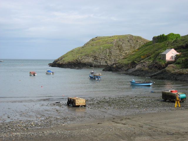
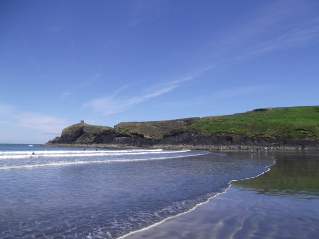
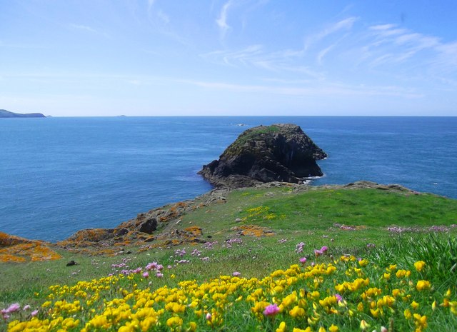
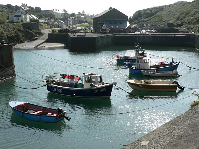
Abereiddi Bay is a picturesque coastal area located in Pembrokeshire, Wales. Situated on the western coast of the country, it is known for its stunning natural beauty and rich history. The bay is nestled between high cliffs and is characterized by its pebble beach and crystal-clear waters.

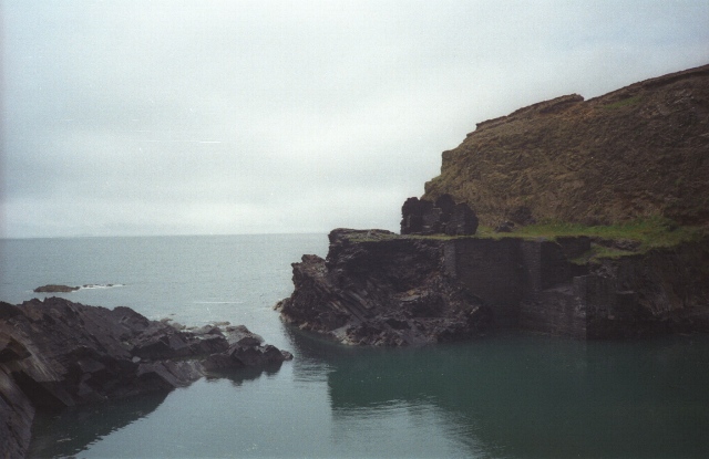
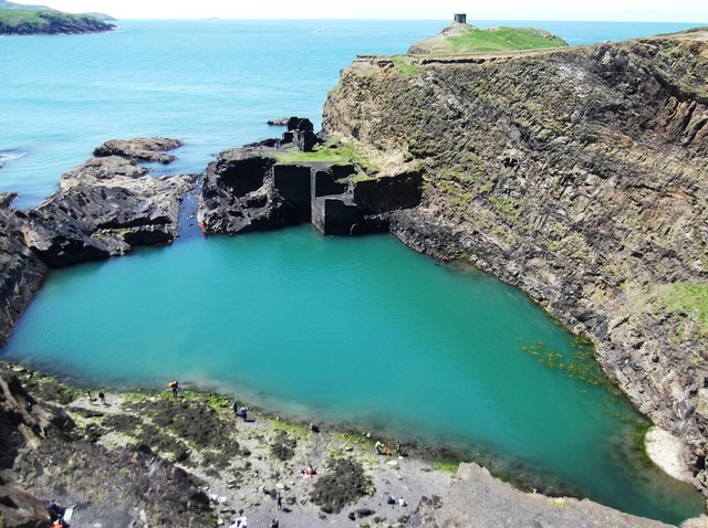
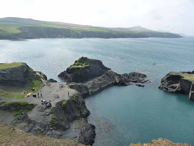
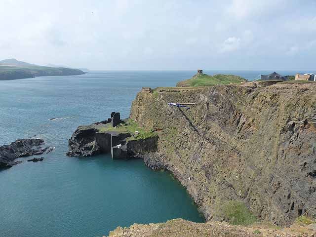
One of the key features of Abereiddi Bay is the Blue Lagoon, a former slate quarry that has now been filled with seawater, creating a stunning turquoise pool. The Blue Lagoon is a popular spot for swimming and cliff jumping, attracting thrill-seekers and nature enthusiasts alike.

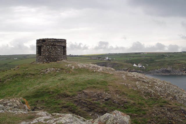
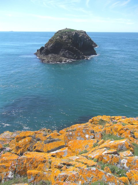
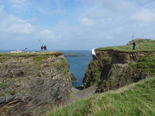
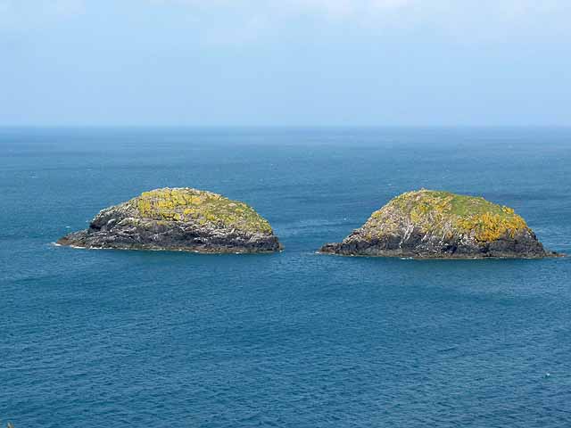
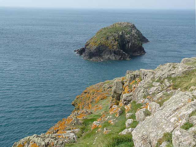
The bay is also renowned for its geology, with a variety of rock formations and caves to explore. The towering cliffs provide a dramatic backdrop and offer breathtaking views of the bay and the surrounding landscape.

Abereiddi Bay is not only a haven for natural beauty but also boasts a rich cultural heritage. The area has a long history of slate quarrying, and remnants of this industry can still be seen today. The ruins of the old quarry buildings add an element of historical interest to the bay, providing a glimpse into its industrial past.

With its stunning scenery, diverse wildlife, and opportunities for outdoor activities, Abereiddi Bay is a popular destination for tourists and locals alike. Whether it's exploring the Blue Lagoon, taking a coastal walk, or simply relaxing on the beach, visitors to Abereiddi Bay are sure to be captivated by its natural charm and beauty.

If you have any feedback on the listing, please let us know in the comments section below.

Abereiddi Bay Images

Images are sourced within 2km of 51.935227/-5.2094147 or Grid Reference SM7931. Thanks to Geograph Open Source API. All images are credited.

A grey day at the Blue Lagoon The Blue Lagoon to the north of Abereiddi Bay doesn't look too inviting on an overcast day. A former slate quarry with its seaward wall breached to form a small deep bay.
A grey day at the Blue Lagoon
The Blue Lagoon to the north of Abereiddi Bay doesn't look too inviting on an overcast day. A former slate quarry with its seaward wall breached to form a small deep bay.
Make Hay. Pwll-caerog, looking across the fields from the Pembrokeshire Coast Path.
Make Hay.
Pwll-caerog, looking across the fields from the Pembrokeshire Coast Path.
Aber Pwll
Aber Pwll
Abereiddy Tower Situated on the Trwyncastell headland to the north of Abereiddi Bay. This tower, of uncertain usage (local information board suggests possibility of it being a meeting place for directors of the now defunct Abereiddy Slate Mine, or their ladies), lies just off the Pembrokeshire Coastal Path and gets comparatively few visitors. This is possibly because a "scramble" is required to access the headland, as coastal erosion is steadily severing the headland's link with the main peninsula.
Abereiddy Tower
Situated on the Trwyncastell headland to the north of Abereiddi Bay. This tower, of uncertain usage (local information board suggests possibility of it being a meeting place for directors of the now defunct Abereiddy Slate Mine, or their ladies), lies just off the Pembrokeshire Coastal Path and gets comparatively few visitors. This is possibly because a "scramble" is required to access the headland, as coastal erosion is steadily severing the headland's link with the main peninsula.
Abereiddi Bay
Abereiddi Bay
Cerrig Gwylan From a Lichen-encrusted Mainland These two rocky islets are popular with seabirds (Kittiwake, Cormorant and Black-backed Gulls). The brightly coloured lichen in the foreground covers the mainland rocks.
Cerrig Gwylan From a Lichen-encrusted Mainland
These two rocky islets are popular with seabirds (Kittiwake, Cormorant and Black-backed Gulls). The brightly coloured lichen in the foreground covers the mainland rocks.
Abereiddy Beach Abereiddy (usual Welsh spelling: Abereiddi) is a hamlet in the county of Pembrokeshire, in south-west Wales.

It has a small beach. A large car park adjoins the beach, where in the summer an ice cream van can usually be found.
Abereiddy Beach
Abereiddy (usual Welsh spelling: Abereiddi) is a hamlet in the county of Pembrokeshire, in south-west Wales. It has a small beach. A large car park adjoins the beach, where in the summer an ice cream van can usually be found.
The Blue Lagoon The Blue Lagoon is a large disused slate quarry, now filled with seawater through a breach in the outer wall. This is 25m deep, according to a nearby Pembrokeshire National Park information board. Despite the name, the water is always a distinct greenish hue, owing to the mineral content within the quarry.

The lagoon is a favourite for adventure groups practising Coasteering.
The Blue Lagoon
The Blue Lagoon is a large disused slate quarry, now filled with seawater through a breach in the outer wall. This is 25m deep, according to a nearby Pembrokeshire National Park information board. Despite the name, the water is always a distinct greenish hue, owing to the mineral content within the quarry. The lagoon is a favourite for adventure groups practising Coasteering.
Bluebell Covered Clifftops
Aber-pwll
Aber-pwll
Caer Aber Pwll (Caerau) Iron Age Fort The complex defences at Caer Aber Pwll (Caerau) define a simple promontory fort to the east and a more heavily defended promontory fort on the west, both utilising the defensive potentials of the steep coastal cliffs. The western fort contains at least one building platform and is enclosed by a complex of up to four banks and ditches thought to represent at least two periods of construction, of uncertain relation, extending over a roughly 172m front. The main, inturned, gateway can be made out on the far side of the earthworks.

A second enclosure on the east, about 48m by 34m, may be a fragment of an early enclosure, isolated by redevelopment, an annex, or a separate and later enclosure butting onto the primary work.
Caer Aber Pwll (Caerau) Iron Age Fort
The complex defences at Caer Aber Pwll (Caerau) define a simple promontory fort to the east and a more heavily defended promontory fort on the west, both utilising the defensive potentials of the steep coastal cliffs. The western fort contains at least one building platform and is enclosed by a complex of up to four banks and ditches thought to represent at least two periods of construction, of uncertain relation, extending over a roughly 172m front. The main, inturned, gateway can be made out on the far side of the earthworks. A second enclosure on the east, about 48m by 34m, may be a fragment of an early enclosure, isolated by redevelopment, an annex, or a separate and later enclosure butting onto the primary work.
Pembrokeshire Coastal Path
Cerrig Gwylan These two rocky islets are popular with seabirds (Kittiwake, Cormorant and Black-backed Gulls).
Cerrig Gwylan
These two rocky islets are popular with seabirds (Kittiwake, Cormorant and Black-backed Gulls).
The mouth of the Blue Lagoon The Blue Lagoon is an abandoned slate quarry, now flooded by the sea.
The mouth of the Blue Lagoon
The Blue Lagoon is an abandoned slate quarry, now flooded by the sea.
Cliff diving board, Blue Lagoon The Blue Lagoon is an abandoned slate quarry, now flooded by the sea. The diving board, soon to be dismantled, was installed for the Red Bull Cliff Diving Event held on the preceding two days.
Cliff diving board, Blue Lagoon
The Blue Lagoon is an abandoned slate quarry, now flooded by the sea. The diving board, soon to be dismantled, was installed for the Red Bull Cliff Diving Event held on the preceding two days.
Aerial ropeway, Blue Lagoon The Blue Lagoon is an abandoned slate quarry, now flooded by the sea. A large amount of equipment was installed on the overlooking clifftop for the Red Bull Cliff Diving Event held on the preceding two days. Here the gear is being laboriously dismantled and returned to the mainland via this aerial ropeway.
Aerial ropeway, Blue Lagoon
The Blue Lagoon is an abandoned slate quarry, now flooded by the sea. A large amount of equipment was installed on the overlooking clifftop for the Red Bull Cliff Diving Event held on the preceding two days. Here the gear is being laboriously dismantled and returned to the mainland via this aerial ropeway.
Cerrig Wylan Two rocky islets off the Pembrokeshire Coast.
Cerrig Wylan
Two rocky islets off the Pembrokeshire Coast.
Cerrig Wylan Seen from the nearby headland, it is not entirely clear that there are two islands lying offshore.
Cerrig Wylan
Seen from the nearby headland, it is not entirely clear that there are two islands lying offshore.
Show me another place!

Abereiddi Bay is located at Grid Ref: SM7931 (Lat: 51.935227, Lng: -5.2094147)

Unitary Authority: Pembrokeshire

Police Authority: Dyfed Powys

What 3 Words

///factoring.drumbeat.prayers. Near Llanrhian, Pembrokeshire

Related Wikis

Arfordir Abereiddi

Arfordir Abereiddi is a Site of Special Scientific Interest (SSSI) in Pembrokeshire, South Wales. It has been designated as a Site of Special Scientific...

Abereiddy

Abereiddy (Welsh: Abereddi) is a hamlet in the county of Pembrokeshire, in west Wales.It has a small beach which was awarded the Blue flag rural beach...

Portheiddy Moor

Portheiddy Moor is a Site of Special Scientific Interest (or SSSI) a little to the east of Abereiddy in Pembrokeshire, South Wales. It has been designated...

Porthgain

Porthgain (Welsh for fair/beautiful port or more likely 'chisel port' from the Welsh 'porth' meaning port and 'gaing' meaning chisel as used by the many...

Nearby Amenities

Located within 500m of 51.935227,-5.2094147
Abereiddy
Created By: Potlatch 0.8b
Is In: Pembrokeshire
Place: hamlet
Wikidata: Q4667060
Lat/Long: 51.9352634/-5.2052018
Toilets
Created By: Potlatch 0.10b
Lat/Long: 51.9373964/-5.2045749
Bus Stop
Bench: no
Bin: yes
Bus: yes
Public Transport: platform
Shelter: no
Lat/Long: 51.9361811/-5.2054566
Material: wood
Power: pole
Lat/Long: 51.9332172/-5.2032173
Power: pole
Lat/Long: 51.9331395/-5.2044752
Power: pole
Lat/Long: 51.933672/-5.2065915
Power: pole
Lat/Long: 51.9350744/-5.2030134
Power: pole
Lat/Long: 51.9354928/-5.2035981
Power: pole
Lat/Long: 51.9359443/-5.2042285
Bench
Backrest: no
Lat/Long: 51.9374392/-5.2064761
Ford: yes
Lat/Long: 51.9369478/-5.2060251
The data included in this document is from www.openstreetmap.org. The data is made available under ODbL.

Have you been to Abereiddi Bay?

Leave your review of Abereiddi Bay below (or comments, questions and feedback).