Hamhaugh Island

Island in Middlesex Spelthorne

England

Hamhaugh Island

Shepperton Lock
Shepperton Lock Credit: Alex McGregor

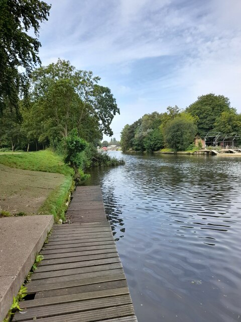
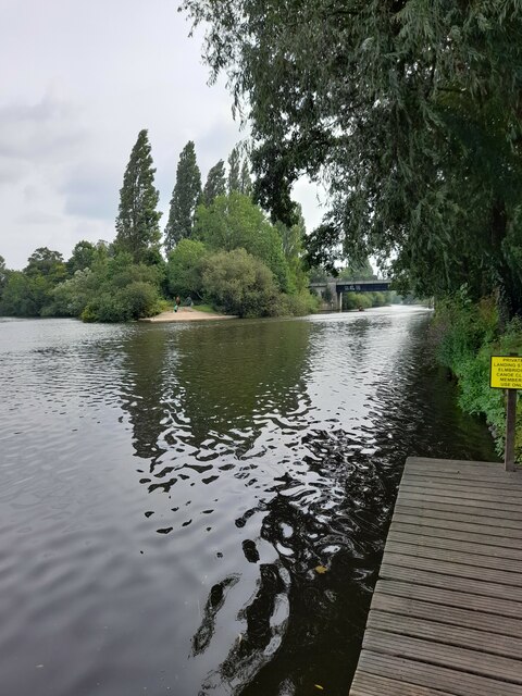
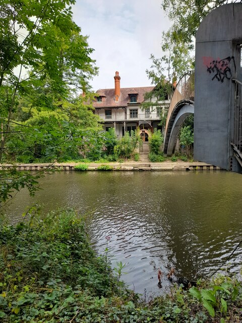
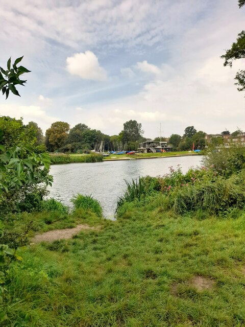
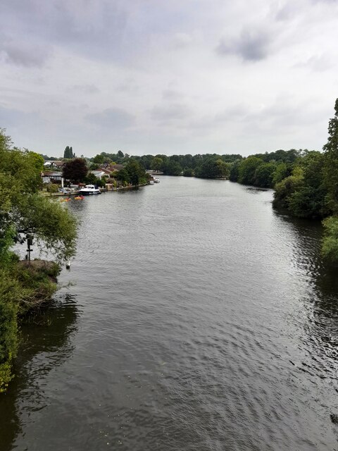
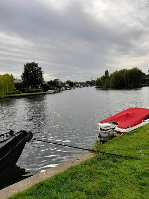
Hamhaugh Island is a small, triangular-shaped island located in the county of Middlesex, England. Situated on the River Thames, it is part of the larger Shepperton area and is commonly referred to as an island, although it is connected to the mainland by a bridge.

Covering an area of approximately 15 acres, Hamhaugh Island is predominantly residential and is home to a small community of houses. The island offers a tranquil and picturesque setting, surrounded by the flowing waters of the Thames. The properties on the island enjoy stunning river views and are often sought after for their unique location and peaceful atmosphere.

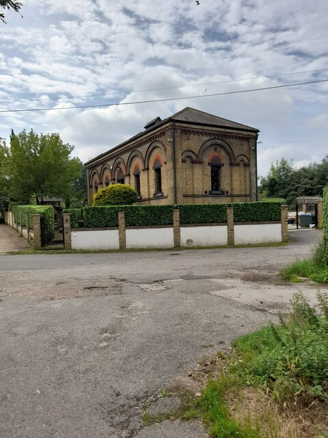
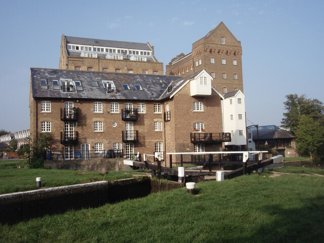
Despite its small size, Hamhaugh Island has a rich history. It is believed to have been inhabited since medieval times, with evidence of ancient settlements and archaeological finds in the area. The island also played a role in the industrial revolution, when it was used as a base for river trade and transportation.

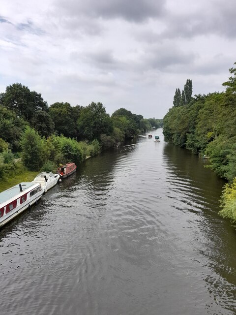
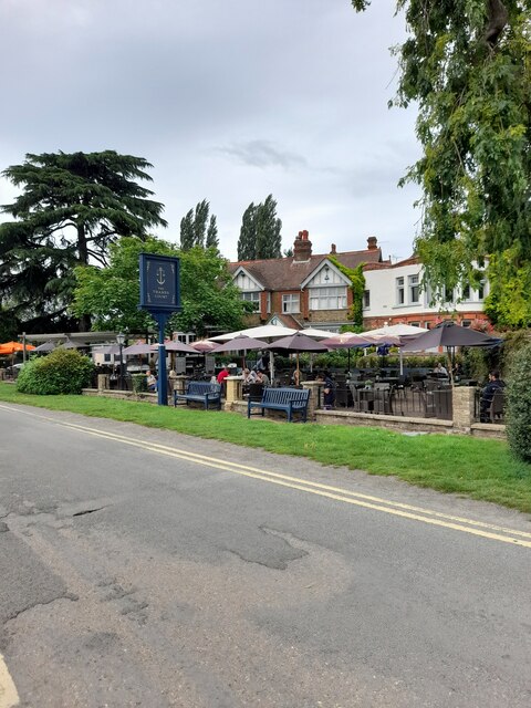
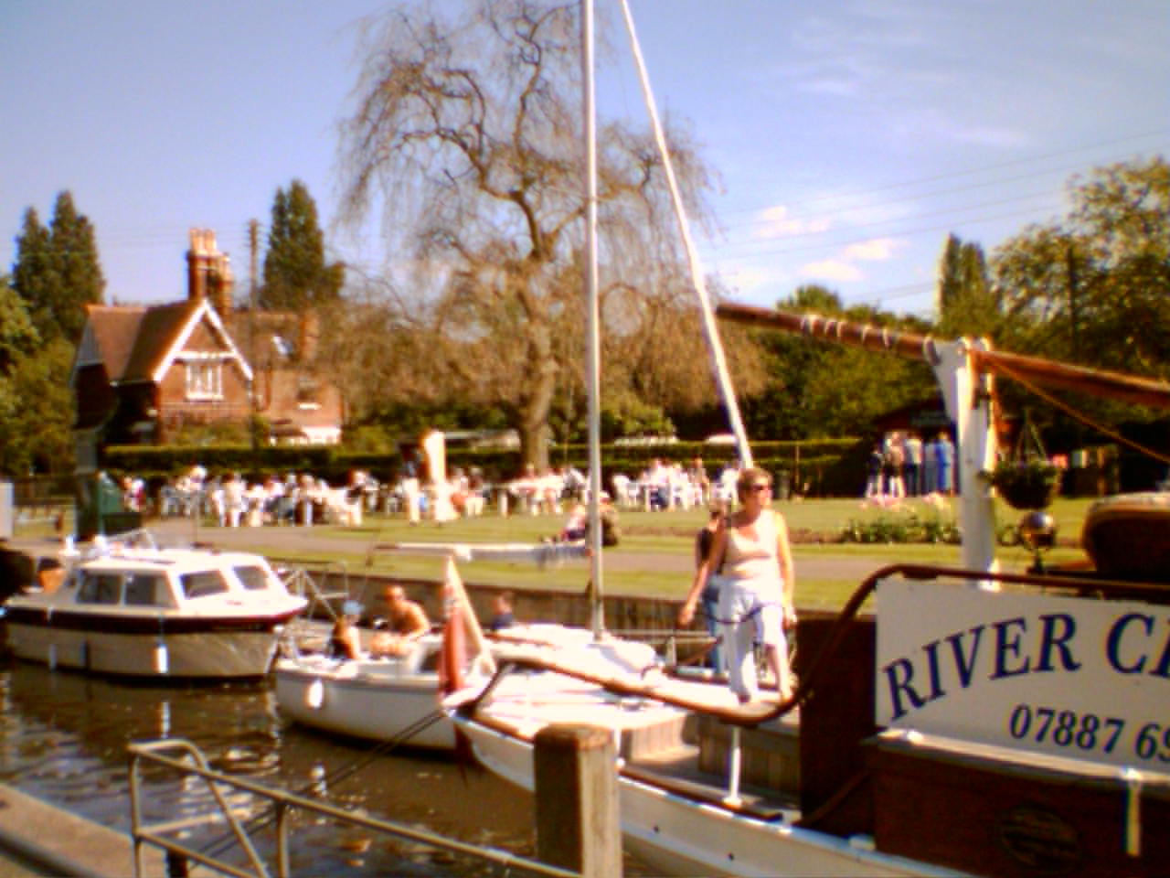
Today, Hamhaugh Island retains its charm and is a popular destination for boaters and river enthusiasts. It offers a range of recreational activities, including fishing, boating, and riverside walks. The island is well-connected to the surrounding areas, with easy access to amenities, shops, and schools in nearby Shepperton.

Overall, Hamhaugh Island is a hidden gem in Middlesex, offering a unique and idyllic riverside living experience. Its rich history, beautiful surroundings, and close-knit community make it a highly desirable place to reside.

If you have any feedback on the listing, please let us know in the comments section below.

Hamhaugh Island Images

Images are sourced within 2km of 51.380443/-0.46084728 or Grid Reference TQ0765. Thanks to Geograph Open Source API. All images are credited.

Shepperton Lock
Shepperton Lock
Convent Lane
Convent Lane
Convent Lane
Convent Lane
Elmbridge Canoe Club
River Thames
River Thames
River Thames
River Thames
D'Oyly Carte
D'Oyly Carte
Desborough Sailing Club
Desborough Water Works
River Thames
River Thames
River Thames
River Thames
The Thames Court
The Thames Court
River Thames
River Thames
Shepperton Lock
Shepperton Lock
Shepperton Lock
Shepperton Lock
Coxes Lock Mills The converted Mills at Coxes Lock, Weybridge.
Coxes Lock Mills
The converted Mills at Coxes Lock, Weybridge.
Farmland next to Walton Lane Fields between the River Thames and Oatlands Park Hotel.
Farmland next to Walton Lane
Fields between the River Thames and Oatlands Park Hotel.
Bishop Duppas Recreation Ground Midium sized park of Lower Halliford.
Bishop Duppas Recreation Ground
Midium sized park of Lower Halliford.
Show me another place!

Hamhaugh Island is located at Grid Ref: TQ0765 (Lat: 51.380443, Lng: -0.46084728)

Administrative County: Surrey

District: Spelthorne

Police Authority: Surrey

What 3 Words

///loses.puddles.puns. Near Weybridge, Surrey

Related Wikis

Hamhaugh Island

Hamhaugh Island is an island, historically known simply as Stadbury, in the River Thames in England south of Shepperton Lock, in Shepperton, Surrey....

Lock Island

Lock Island is an island in the River Thames in England connected to Shepperton Lock, near Shepperton. Facing the attached by lock-gate bridge mainland...
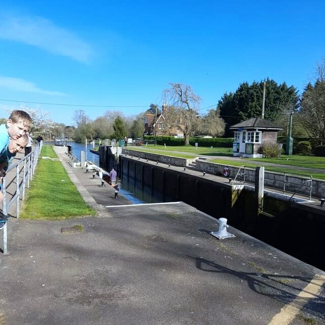
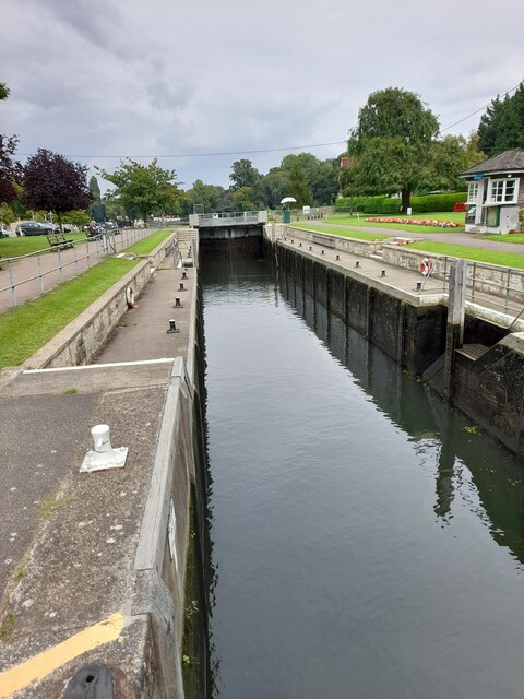
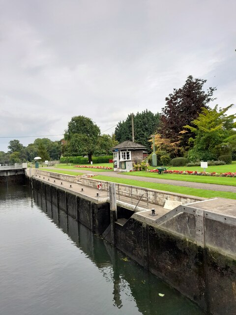
Shepperton Lock

Shepperton Lock is a lock on the River Thames, in England by the left bank at Shepperton, Surrey. It is across the river from Weybridge which is nearby...

Weybridge Ladies Amateur Rowing Club

Weybridge Ladies Amateur Rowing Club (WLARC) is a rowing club at the confluence of a mouth of the Wey and two weirstreams of the Thames, based at Boat...

River Bourne, Addlestone

The River Bourne is the name given to a Thames tributary in northwest Surrey, England which has a longer tributary, the Windle Brook, that rises nears...

Shepperton to Weybridge Ferry

The Shepperton to Weybridge Ferry is a pedestrian and cycle ferry service across the River Thames in Surrey, England. The service has operated almost continuously...

Pharaoh's Island, River Thames

Pharaoh's Island is an island in the River Thames, in Surrey, England, 270 m (300 yd) upstream of Shepperton Lock. == Overview == The island has a length...

D'Oyly Carte Island

D'Oyly Carte Island is a small private island in the River Thames, England, administratively and historically part of Weybridge, near its other inhabited...

Nearby Amenities

Located within 500m of 51.380443,-0.46084728
Post Box
Operator: Royal Mail
Post Box Type: pillar
Ref: TW17 317D
Royal Cypher: EIIR
Royal Cypher Wikidata: Q33102113
Lat/Long: 51.3821639/-0.4591278
Turning Circle
Lat/Long: 51.3798933/-0.4542875
Barrier: cycle_barrier
Lat/Long: 51.3789097/-0.4558644
Pub
The Minnow
Addr City: Weybridge
Addr Housenumber: 104
Addr Postcode: KT13 8NL
Addr Street: Thames Street
Food: yes
Outdoor Seating: yes
Lat/Long: 51.3800469/-0.4556136
Post Box
Operator: Royal Mail
Post Box Type: pillar
Ref: KT13 3
Royal Cypher: GVIR
Royal Cypher Wikidata: Q33102169
Lat/Long: 51.3798334/-0.4558582
Parking
Access: customers
Lat/Long: 51.380011/-0.4551673
Ferry Terminal
Ferry: yes
Public Transport: station
Lat/Long: 51.3826276/-0.4568838
Ferry Terminal
Ferry: yes
Public Transport: station
Lat/Long: 51.3820646/-0.4562896
Upper side weir
Material: concrete
Operator: National Trust
Waterway: weir
Lat/Long: 51.376637/-0.4629817
Turning Circle
Lat/Long: 51.3761946/-0.4601665
Restaurant
Lat/Long: 51.3827982/-0.4616602
Post Box
Operator: Royal Mail
Post Box Type: lamp
Ref: KT13 95D
Royal Cypher: EIIR
Royal Cypher Wikidata: Q33102113
Lat/Long: 51.377645/-0.4659481
Hamm Court
Place: hamlet
Lat/Long: 51.3798835/-0.4651175
Drinking Water
Note: Water point is somewhere on this bank, but exact position unknown.
Lat/Long: 51.3790719/-0.4599751
Bench
Lat/Long: 51.3820223/-0.4562024
Bench
Lat/Long: 51.3820298/-0.4561796
Power: substation
Ref: 121786
Lat/Long: 51.3779291/-0.4578172
Barrier: height_restrictor
Maxheight: 2.1
Lat/Long: 51.3806523/-0.4566777
Crossing
Crossing: uncontrolled
Kerb: lowered
Sloped Curb: yes
Source: Surrey-Air_Survey
Traffic Calming: table
Lat/Long: 51.3766303/-0.4586818
Crossing
Crossing: uncontrolled
Kerb: lowered
Sloped Curb: yes
Source: Surrey-Air_Survey
Traffic Calming: cushion
Lat/Long: 51.3771571/-0.4574572
Bench
Lat/Long: 51.3811419/-0.4568867
Bench
Lat/Long: 51.3810654/-0.456902
Barrier: cycle_barrier
Lat/Long: 51.3785166/-0.4565645
Power: pole
Lat/Long: 51.3802914/-0.4678188
Bench
Backrest: yes
Material: wood
Lat/Long: 51.3823966/-0.4553385
Bench
Backrest: yes
Material: wood
Lat/Long: 51.3823489/-0.455482
Information: board
Tourism: information
Lat/Long: 51.3811787/-0.4568902
Hiking: yes
Information: guidepost
Source: GPS survey
Tourism: information
Lat/Long: 51.3819647/-0.4561619
Toilets
Lat/Long: 51.3821896/-0.4586972
Bench
Backrest: yes
Lat/Long: 51.3824635/-0.4617074
Bench
Backrest: yes
Lat/Long: 51.3826058/-0.4621084
Bench
Backrest: yes
Lat/Long: 51.3825405/-0.4619126
Bench
Backrest: yes
Lat/Long: 51.3831817/-0.4649314
Bench
Backrest: yes
Lat/Long: 51.3824108/-0.4579959
Bench
Backrest: yes
Lat/Long: 51.38223/-0.4581756
Bench
Backrest: yes
Lat/Long: 51.3822442/-0.4583097
Bench
Backrest: yes
Lat/Long: 51.3821999/-0.4584224
Bench
Backrest: yes
Lat/Long: 51.3821802/-0.4585404
Bench
Backrest: yes
Lat/Long: 51.382163/-0.458637
Bench
Backrest: yes
Lat/Long: 51.3821383/-0.4587905
Bench
Backrest: yes
Lat/Long: 51.3821748/-0.459044
Bench
Backrest: yes
Lat/Long: 51.3821522/-0.4592063
Bench
Backrest: yes
Lat/Long: 51.3821471/-0.4592465
Bench
Backrest: yes
Lat/Long: 51.3821388/-0.4592867
Turning Circle
Lat/Long: 51.3797419/-0.4571774
Bench
Backrest: yes
Lat/Long: 51.378877/-0.4604768
Bench
Backrest: yes
Lat/Long: 51.3788139/-0.460521
Bench
Backrest: yes
Lat/Long: 51.3787441/-0.4605667
Entrance: main
Lat/Long: 51.3829806/-0.45739
Entrance: main
Lat/Long: 51.3827705/-0.4572905
Waterway: sanitary_dump_station
Lat/Long: 51.3821639/-0.458894
Defibrillator
Defibrillator Location: On shed wall
Emergency: defibrillator
Indoor: no
Not Ref GB The Circuit: 656AAC14-10CE-4765-AA36-ADD3013273C0
Lat/Long: 51.3800208/-0.4609987
The data included in this document is from www.openstreetmap.org. The data is made available under ODbL.

Have you been to Hamhaugh Island?

Leave your review of Hamhaugh Island below (or comments, questions and feedback).