Round Skerry

Island in Shetland

Scotland

Round Skerry

Ruined crofthouse on the Ness of Ramnageo
Ruined crofthouse on the Ness of Ramnageo Credit: Mike Pennington

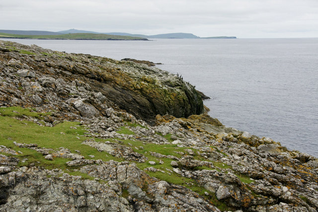
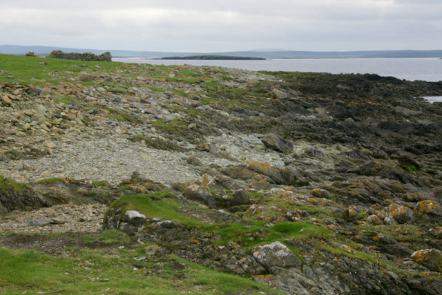
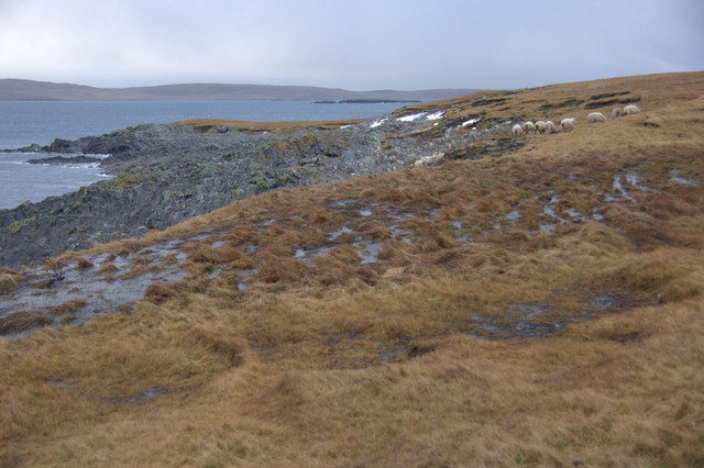
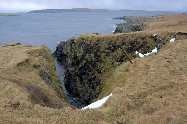
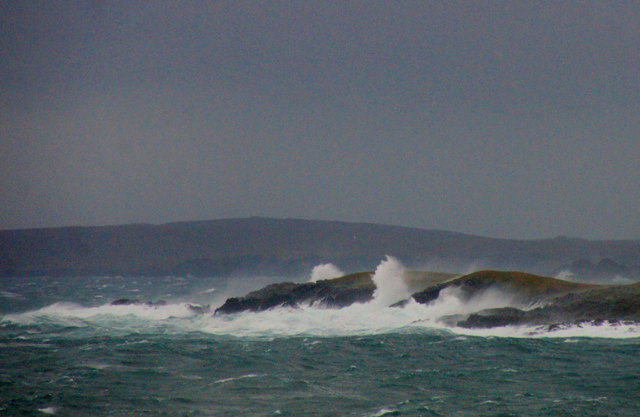
Round Skerry is a small uninhabited island located in the Shetland Islands, an archipelago in Scotland. Situated approximately 10 kilometers northeast of the main island of Shetland, Round Skerry is known for its rugged and dramatic coastline.

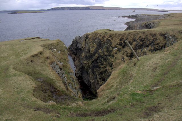
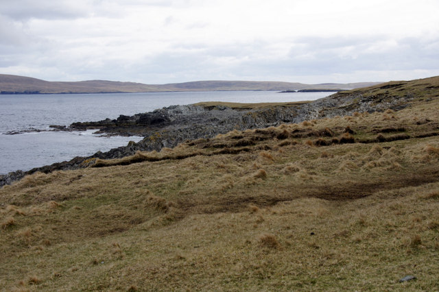
The island is of volcanic origin and has a circular shape, measuring roughly 500 meters in diameter. Its cliffs rise steeply from the surrounding sea, reaching heights of up to 30 meters. The terrain is largely rocky, with sparse vegetation covering the island.

Round Skerry is a popular site for birdwatching and wildlife enthusiasts. The island is home to a variety of seabirds, including guillemots, razorbills, puffins, and fulmars, which nest on the cliffs and use the surrounding waters for feeding. It is also a designated Special Protection Area due to its importance as a breeding ground for several species.

The island is inaccessible to the general public as it is a nature reserve managed by Scottish Natural Heritage. However, boat trips and guided tours are sometimes available, allowing visitors to observe the wildlife from a distance.

Round Skerry is also known for its historical significance. In the 19th century, a lighthouse was constructed on the island to guide ships navigating the treacherous waters of the North Sea. Although the lighthouse is now automated, it stands as a reminder of the island's maritime past.

Overall, Round Skerry is a remote and picturesque island, offering a unique opportunity to experience the natural beauty and wildlife of the Shetland Islands.

If you have any feedback on the listing, please let us know in the comments section below.

Round Skerry Images

Images are sourced within 2km of 60.681923/-0.84444932 or Grid Reference HP6300. Thanks to Geograph Open Source API. All images are credited.

Ruined crofthouse on the Ness of Ramnageo
Ness of Ramnageo A ruined planticrub (shelter for growing crops) on the Ness; Fetlar is in the distance.
Ness of Ramnageo
A ruined planticrub (shelter for growing crops) on the Ness; Fetlar is in the distance.
Beaches on the west of the Ness of Ramnageo The ruined croft at Littlegarth can just be seen in the distance.
Beaches on the west of the Ness of Ramnageo
The ruined croft at Littlegarth can just be seen in the distance.
Coastline below Littlegarth Uyea isle is in the distance.
Coastline below Littlegarth
Uyea isle is in the distance.
Cliffs at Littlegarth Fulmars are beginning to return to ledges left empty for most of the winter.
Cliffs at Littlegarth
Fulmars are beginning to return to ledges left empty for most of the winter.
Wick of Fauld Looking across the wick from Littlegarth towards Ramnageo.
Wick of Fauld
Looking across the wick from Littlegarth towards Ramnageo.
Beach on Ness of Ramnageo Looking towards Fetlar.
Beach on Ness of Ramnageo
Looking towards Fetlar.
Wick of Fauld from Ramnageo Looking towards Littlegarth.
Wick of Fauld from Ramnageo
Looking towards Littlegarth.
Landward Taing, Haaf Gruney Closest to Unst.
Landward Taing, Haaf Gruney
Closest to Unst.
North coast of Haaf Gruney This beach is used as a nursery beach by Grey Seals in autumn. The ruined house at the far end of the beach was a shelter used by chromate miners working at the quarry, but there were no permanent homes on the island.
North coast of Haaf Gruney
This beach is used as a nursery beach by Grey Seals in autumn. The ruined house at the far end of the beach was a shelter used by chromate miners working at the quarry, but there were no permanent homes on the island.
Ness of Ramnageo Looking out towards Wedder Holm, with Fetlar in the distance.
Ness of Ramnageo
Looking out towards Wedder Holm, with Fetlar in the distance.
Scranklings, Ness of Ramnageo This unusual piece of coastline along the east side of the Ness of Ramnageo has the strangely appropriate-sounding name of Scranklings, according to the 1:10,000 map.
Scranklings, Ness of Ramnageo
This unusual piece of coastline along the east side of the Ness of Ramnageo has the strangely appropriate-sounding name of Scranklings, according to the 1:10,000 map.
Stubbi Geos, Ramnageo I had always assumed that at least one of these geos was the eponymous Ramnageo ('Raven's geo') but according to the map they are named Stubbi Geos.
Stubbi Geos, Ramnageo
I had always assumed that at least one of these geos was the eponymous Ramnageo ('Raven's geo') but according to the map they are named Stubbi Geos.
Wester Stubbi Geo, Ness of Ramnageo Looking south towards Fetlar, with Haaf Gruney on the left and Wedder Hom on the right.
Wester Stubbi Geo, Ness of Ramnageo
Looking south towards Fetlar, with Haaf Gruney on the left and Wedder Hom on the right.
Easter Stubbi Geo, Ness of Ramnageo The top of the cliff is in one gridsquare, but the bottom of the cliff is in the next.
Easter Stubbi Geo, Ness of Ramnageo
The top of the cliff is in one gridsquare, but the bottom of the cliff is in the next.
High seas hitting Haaf Gruney Strong easterlies hitting the island, photographed from Muness.
High seas hitting Haaf Gruney
Strong easterlies hitting the island, photographed from Muness.
Stubbi Geos, Ramnageo, Muness
Scranklings, Ness of Ramnageo, Muness
Show me another place!

Round Skerry is located at Grid Ref: HP6300 (Lat: 60.681923, Lng: -0.84444932)

Unitary Authority: Shetland Islands

Police Authority: Highlands and Islands

What 3 Words

///universes.submits.rationed. Near Uyeasound, Shetland Islands

Related Wikis

Muness Castle

Muness Castle is located on Unst, which is one of the Shetland Islands of Scotland. The castle is 3 kilometres (1.9 mi) east of the village of Uyeasound...

Haaf Gruney

Haaf Gruney is a small island in the north east of the Shetland Islands. == Geography and geology == The island is between Unst and Fetlar which are to...

Mailand, Shetland

Mailand is a hamlet in the Shetland Islands. It is on the island of Unst, the northernmost of the inhabited British Isles, near its southern coast. �...

Clivocast

Clivocast is a settlement on the island of Unst in the Shetland Islands, Scotland at 60.67°N 00.90°W / 60.67; -00.90 or grid reference HP6000 and is situated...

Uyea, Unst

Uyea (Scots: Uyea) is an uninhabited island, lying south of Unst in Shetland, Scotland. == History == The island was inhabited as early as the Bronze Age...

Uyeasound

Uyeasound is a village on the Isle of Unst, the northernmost island of the Shetland Islands, Scotland. It takes its name from the neighbouring strait of...

Huney

Huney is an uninhabited island due east of the island of Unst in the Shetland Islands, Scotland. The island is located approximately 1 kilometre south...

Sound Gruney

For other islands with similar names, see Gruney (disambiguation) Sound Gruney is one of the Shetland islands. It lies about 1.5 kilometres (0.93 mi)...

Nearby Amenities

Located within 500m of 60.681923,-0.84444932
Passing Place
Lat/Long: 60.6844676/-0.8497426
Power: pole
Lat/Long: 60.6853841/-0.8475362
Power: pole
Lat/Long: 60.6859954/-0.8482238
Power: pole
Lat/Long: 60.6847503/-0.8491857
Power: pole
Lat/Long: 60.6849107/-0.8487774
Power: pole
Lat/Long: 60.685107/-0.8482759
Power: pole
Lat/Long: 60.6855761/-0.8470298
Power: pole
Lat/Long: 60.685835/-0.8463919
The data included in this document is from www.openstreetmap.org. The data is made available under ODbL.

Have you been to Round Skerry?

Leave your review of Round Skerry below (or comments, questions and feedback).