Black Skerry

Island in Shetland

Scotland

Black Skerry

Mavis Grind This is the narrowest land in the British Isles. The inlet on the right is an arm of the Atlantic Ocean; and on the left is Sullom Voe, which is an inlet of the North Sea.
Mavis Grind Credit: Anne Burgess

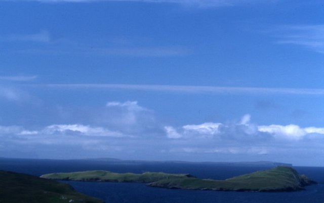
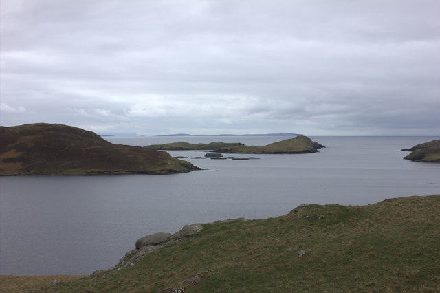
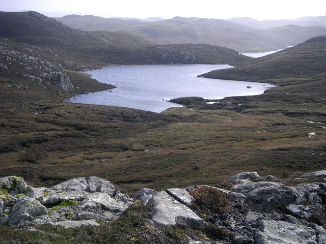
Black Skerry is a small, uninhabited island located off the coast of Shetland, an archipelago in Scotland. Situated in the North Sea, this remote island is known for its rugged beauty and rich wildlife.

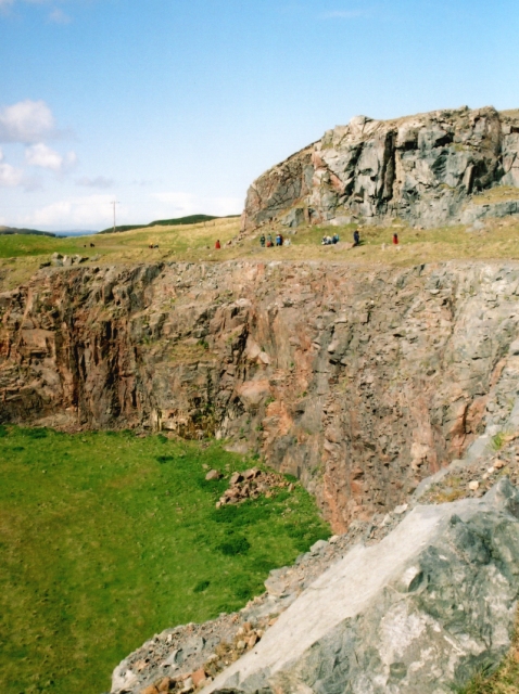
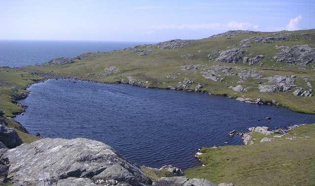
Covered in peat and heather, Black Skerry is approximately 50 acres in size and rises to a height of around 40 meters above sea level. The island is mainly composed of sandstone and has a distinctive black appearance, hence its name.

Black Skerry is renowned for its diverse bird population, attracting ornithologists and nature enthusiasts from around the world. The island serves as an important breeding ground for various seabirds, including puffins, razorbills, and guillemots. These birds nest among the cliffs and grassy slopes, creating a vibrant and noisy spectacle during the breeding season.

In addition to its avian residents, Black Skerry is also home to a variety of other wildlife. Seals can often be spotted lounging on the rocky shores, while otters can be seen frolicking in the surrounding waters. The waters around the island are teeming with marine life, making it a popular spot for divers and snorkelers.

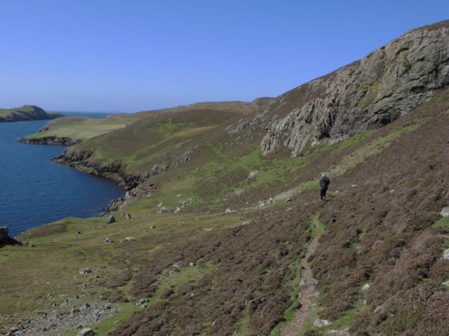
Due to its remote location and lack of facilities, Black Skerry is not accessible to the general public. However, boat trips and guided tours are available to those who wish to visit and explore its natural wonders. The island offers a unique opportunity to experience the untamed beauty of Shetland's coastline and observe the fascinating wildlife that call this rugged island home.

If you have any feedback on the listing, please let us know in the comments section below.

Black Skerry Images

Images are sourced within 2km of 60.405964/-1.4228661 or Grid Reference HU3169. Thanks to Geograph Open Source API. All images are credited.

Mavis Grind This is the narrowest land in the British Isles. The inlet on the right is an arm of the Atlantic Ocean; and on the left is Sullom Voe, which is an inlet of the North Sea.
Mavis Grind
This is the narrowest land in the British Isles. The inlet on the right is an arm of the Atlantic Ocean; and on the left is Sullom Voe, which is an inlet of the North Sea.
Virdins Quarry A large roadmetal quarry, with many veins of red granite cutting the surrounding grey diorite.
Virdins Quarry
A large roadmetal quarry, with many veins of red granite cutting the surrounding grey diorite.
Holm of Culsetter The holm is the tiny island in this voe. In the foreground is a 'roche moutonnée', on which can be seen grooves carved by pebbles under the ice sheet during the last ice age. These grooves, called striae, show the direction of movement of the ice.
Holm of Culsetter
The holm is the tiny island in this voe. In the foreground is a 'roche moutonnée', on which can be seen grooves carved by pebbles under the ice sheet during the last ice age. These grooves, called striae, show the direction of movement of the ice.
Egilsay From the head of Mangaster Voe.
Egilsay
From the head of Mangaster Voe.
Lochs and a lumpy landscape, near Islesburgh This area is fascinating for the series of small lochs (lochans) some forming a circle.  Many are connected one to the next by small burns. The landscape itself is largely devoid of human settlement, and even of sheep.  Yet in its barren-ness, it is very beautiful.
Lochs and a lumpy landscape, near Islesburgh
This area is fascinating for the series of small lochs (lochans) some forming a circle. Many are connected one to the next by small burns. The landscape itself is largely devoid of human settlement, and even of sheep. Yet in its barren-ness, it is very beautiful.
Head of Mangaster Voe from Isleburgh
Pier at the head of Mangaster Voe
Virdins Summit Cairn Bagged with Tricky Speirs for our 21st TuMP of the day.
Name: Virdins
Hill number: 104001
Height: 68m / 223ft
Area:22: Shetland Islands
Class: 0
Grid ref: HU338687 (est)
Drop: 44m
Col: 24m
Virdins Summit Cairn
Bagged with Tricky Speirs for our 21st TuMP of the day. Name: Virdins Hill number: 104001 Height: 68m / 223ft Area:22: Shetland Islands Class: 0 Grid ref: HU338687 (est) Drop: 44m Col: 24m
Ness of Culsetter Third TuMP of a short circuit with Tricky Speirs.
Name: Ness of Culsetter
Hill number: 103921
Height: 96m / 315ft
Area:22:  Shetland Islands
Class: 0
Grid ref: HU329677 (est)
Drop: 68m
Col: 28m
Ness of Culsetter
Third TuMP of a short circuit with Tricky Speirs. Name: Ness of Culsetter Hill number: 103921 Height: 96m / 315ft Area:22: Shetland Islands Class: 0 Grid ref: HU329677 (est) Drop: 68m Col: 28m
Mangaster Voe
Mangaster Voe
Mangaster Voe
Mangaster Voe
Pastures and ruins  South east of Mangaster.
Mangaster Voe in the foreground.
Pastures and ruins
South east of Mangaster. Mangaster Voe in the foreground.
Homestead on promontory  Overlooking Mangaster Voe.
Too Brekk is hill beyond on the left.
Homestead on promontory
Overlooking Mangaster Voe. Too Brekk is hill beyond on the left.
Outer Scarvie
Outer Scarvie
Brei Water Brei Water, view from Fellsa Moors.
Brei Water
Brei Water, view from Fellsa Moors.
Heo Dale Valley between Heodale hills and Stane Timna.
Heo Dale
Valley between Heodale hills and Stane Timna.
Gill Water Small weedy loch with wild brown trout.
Gill Water
Small weedy loch with wild brown trout.
Coast near Mangaster
Show me another place!

Black Skerry is located at Grid Ref: HU3169 (Lat: 60.405964, Lng: -1.4228661)

Unitary Authority: Shetland Islands

Police Authority: Highlands and Islands

What 3 Words

///twit.rescuer.fetching. Near Brae, Shetland Islands

Related Wikis

Mavis Grind

Mavis Grind (Old Norse: Mæfeiðs grind or Mæveiðs grind, meaning "gate of the narrow isthmus") is a narrow isthmus joining the Northmavine peninsula to...

Brae

"Brae" is also the Lowland Scots language word for the slope or brow of a hill.Brae (Old Norse: Breiðeið, meaning "the wide isthmus") is a village on the...

Busta Voe

Busta Voe, (HU665350), in the north central Mainland, Shetland, is a sea inlet lying between the village of Brae and the island of Muckle Roe. At the head...

Muckle Roe

Muckle Roe is an island in Shetland, Scotland, in St. Magnus Bay, to the west of Mainland. It has a population of around 130 people, who mainly croft and...

Gunnister

Gunnister is a small 'abandoned' village at the North-West Mainland in Shetland, Scotland. It is most commonly known for the Gunnister Man - the remains...

Sullom

Sullom is a village on the Shetland peninsula of Northmavine, between Haggrister and Bardister. It lies on the northwest side of Sullom Voe, to which it...

Linga, Busta Voe

Linga is a small, uninhabited island, 1 km (0.62 mi) east of Muckle Roe in the Shetland Islands. The island is roughly circular in shape and its highest...

Punds Water

Punds Water is a freshwater loch near Mangaster in Northmavine, Shetland. It also gives its name to a nearby Neolithic heel-shaped cairn. == Heel-shaped... ==

Have you been to Black Skerry?

Leave your review of Black Skerry below (or comments, questions and feedback).