Bass Rock

Island in Cornwall

England

Bass Rock

Rock strata - Porthbean Beach
Rock strata - Porthbean Beach Credit: Ian Cunliffe

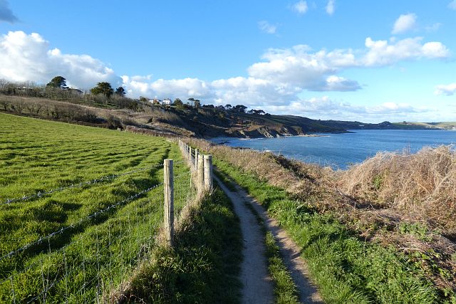
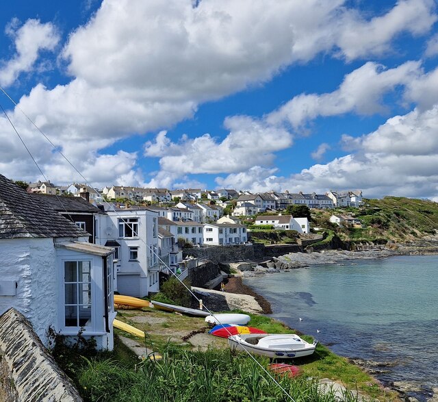
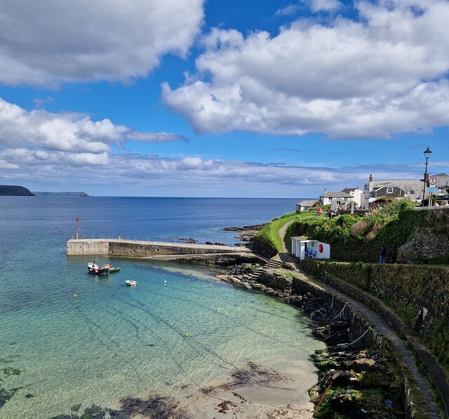
Bass Rock, located off the coast of Cornwall, is a small and uninhabited island famous for its natural beauty and rich wildlife. Situated in the Celtic Sea, approximately 2 kilometers offshore, the island covers an area of around 5 hectares and stands at an impressive height of 107 meters.

The island is primarily known for its striking appearance, with steep cliffs rising dramatically from the sea and dominating the landscape. These cliffs are home to a large colony of seabirds, making Bass Rock an important breeding ground and a designated Special Protection Area for bird conservation. The gannet population on the island is particularly noteworthy, with over 150,000 pairs nesting there during the breeding season, making it the largest colony of Northern gannets in the world.

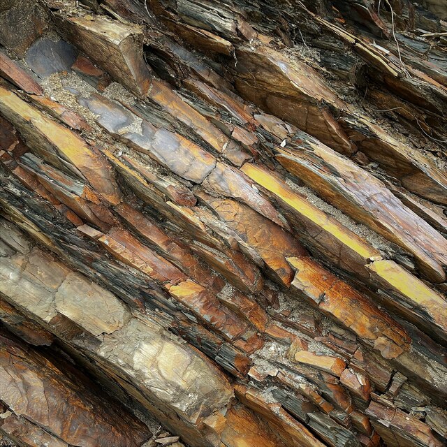
Bass Rock's distinct appearance is due to its volcanic origins, with layers of volcanic rock forming the base of the island. Over time, erosion has shaped the cliffs and created caves and crevices that serve as nesting sites for the birds.

Although Bass Rock is not accessible to the public, boat trips are available for visitors to admire the island from a distance and witness the bustling bird activity. The sight of thousands of gannets and other seabirds soaring above the island is truly awe-inspiring.

In addition to its natural beauty, Bass Rock also holds historical significance. It was once used as a fortress and prison during the 16th century, and remnants of a medieval chapel and a lighthouse can still be seen on the island.

Overall, Bass Rock is a remarkable natural wonder, offering a mesmerizing display of wildlife and a glimpse into Cornwall's historical past.

If you have any feedback on the listing, please let us know in the comments section below.

Bass Rock Images

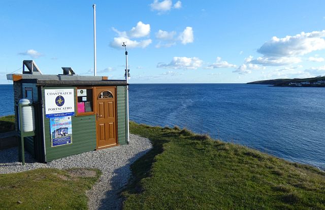
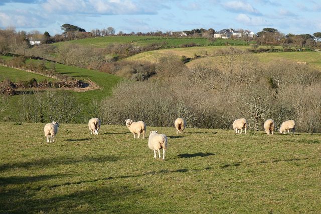
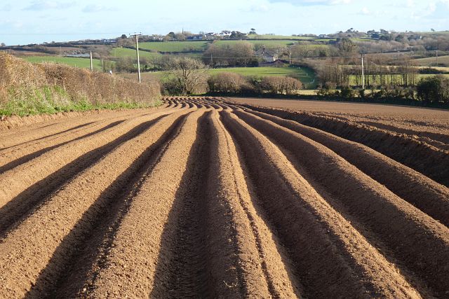
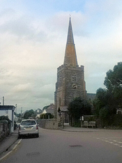
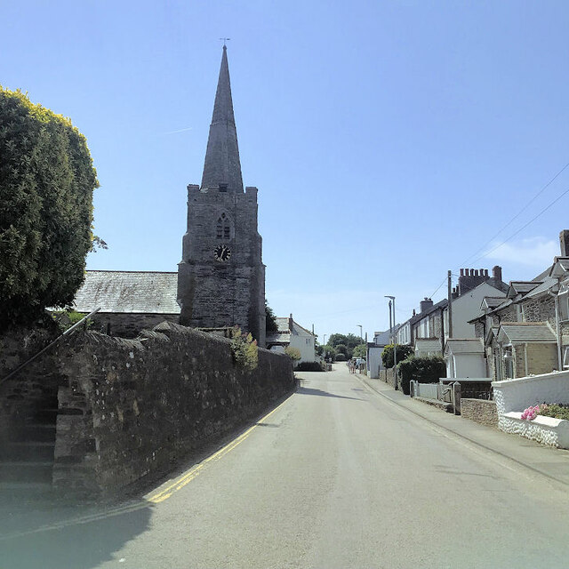
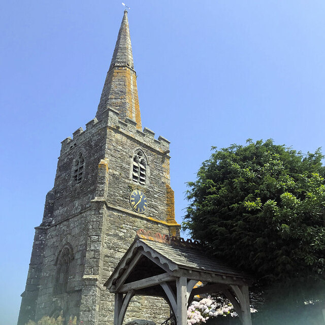
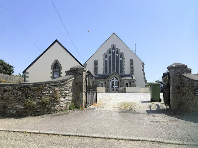
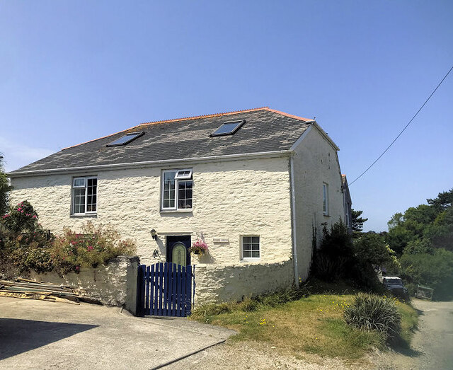
Images are sourced within 2km of 50.181332/-4.973816 or Grid Reference SW8735. Thanks to Geograph Open Source API. All images are credited.

Rock strata - Porthbean Beach
Old Wayside Cross in St Gerran's churchyard Gerrans Cross, the head, shaft and base of an old wayside cross moved to St Gerran's churchyard, south of the church porch, in Gerrans parish. Grade II Listed <span class="nowrap"><a title="https://historicengland.org.uk/listing/the-list/list-entry/1136345" rel="nofollow ugc noopener" href="https://historicengland.org.uk/listing/the-list/list-entry/1136345">Link</a><img style="margin-left:2px;" alt="External link" title="External link - shift click to open in new window" src="https://s1.geograph.org.uk/img/external.png" width="10" height="10"/></span> and a Scheduled Monument <span class="nowrap"><a title="https://historicengland.org.uk/listing/the-list/list-entry/1015072" rel="nofollow ugc noopener" href="https://historicengland.org.uk/listing/the-list/list-entry/1015072">Link</a><img style="margin-left:2px;" alt="External link" title="External link - shift click to open in new window" src="https://s1.geograph.org.uk/img/external.png" width="10" height="10"/></span>. See also <span class="nowrap"><a title="https://www.flickr.com/photos/ocifant/2951998330" rel="nofollow ugc noopener" href="https://www.flickr.com/photos/ocifant/2951998330">Link</a><img style="margin-left:2px;" alt="External link" title="External link - shift click to open in new window" src="https://s1.geograph.org.uk/img/external.png" width="10" height="10"/></span>.

Milestone Society National ID: CWCA_GER
Old Wayside Cross in St Gerran's churchyard
Gerrans Cross, the head, shaft and base of an old wayside cross moved to St Gerran's churchyard, south of the church porch, in Gerrans parish. Grade II Listed LinkExternal link and a Scheduled Monument LinkExternal link. See also LinkExternal link. Milestone Society National ID: CWCA_GER
Farmland, Gerrans A crop of maize in a field crossed by the footpath to the west of Treloan. The cumulus is indicative of a showery day in the middle of Cornwall.
Farmland, Gerrans
A crop of maize in a field crossed by the footpath to the west of Treloan. The cumulus is indicative of a showery day in the middle of Cornwall.
Coastal path, Gerrans On the approach to Greeb Point with Gull Rock seen out at sea.
Coastal path, Gerrans
On the approach to Greeb Point with Gull Rock seen out at sea.
Farmland, Gerrans Fields of barley beside the road above Percuil.
Farmland, Gerrans
Fields of barley beside the road above Percuil.
Coastline, Gerrans The coast-path to the north of Pednvadan approaching Porthbean Beach.
Coastline, Gerrans
The coast-path to the north of Pednvadan approaching Porthbean Beach.
Lookout station, Gerrans The vantage point on Pednvadan.
Lookout station, Gerrans
The vantage point on Pednvadan.
Pasture, Gerrans Sheep grazing beside the main road into the village from Trewithian.
Pasture, Gerrans
Sheep grazing beside the main road into the village from Trewithian.
Farmland, Gerrans A furrowed potato field beside the footpath between Trewithian and Tregaire Barton.
Farmland, Gerrans
A furrowed potato field beside the footpath between Trewithian and Tregaire Barton.
St Gerrans Church
St Gerrans Church
St Gerrans church
St Gerrans church
St Gerrans church
St Gerrans church
The Sunday House Private dwellings formerly Gerrans Wesleyan Methodist Chapel.
The Sunday House
Private dwellings formerly Gerrans Wesleyan Methodist Chapel.
Chapel Cottage Formerly a Wesleyan Methodist Chapel <span class="nowrap"><a title="http://cornishstory.com/2021/01/31/mapping-methodism-gerrans-wesleyan-chapels/" rel="nofollow ugc noopener" href="http://cornishstory.com/2021/01/31/mapping-methodism-gerrans-wesleyan-chapels/">Link</a><img style="margin-left:2px;" alt="External link" title="External link - shift click to open in new window" src="https://s1.geograph.org.uk/img/external.png" width="10" height="10"/></span>
Chapel Cottage
Formerly a Wesleyan Methodist Chapel LinkExternal link
Portscatho - seafront Looking along the curving seafront of the village of Portscatho from the coastal street called "The Lugger". Lugger usually refers to a type of boat, but in this part of Cornwall it seems to be a common name for a coastal road or lane.
Portscatho is situated on the eastern coast of the Roseland peninsula about 7 miles (11km) south of Truro. Its name comes from the Cornish words for harbour or cove  (porth <span class="nowrap"><a title="https://www.cornishdictionary.org.uk/?locale=en#harbour" rel="nofollow ugc noopener" href="https://www.cornishdictionary.org.uk/?locale=en#harbour">Link</a><img style="margin-left:2px;" alt="External link" title="External link - shift click to open in new window" src="https://s1.geograph.org.uk/img/external.png" width="10" height="10"/></span> ) and boats (skathow <span class="nowrap"><a title="https://www.cornishdictionary.org.uk/?locale=en#boat" rel="nofollow ugc noopener" href="https://www.cornishdictionary.org.uk/?locale=en#boat">Link</a><img style="margin-left:2px;" alt="External link" title="External link - shift click to open in new window" src="https://s1.geograph.org.uk/img/external.png" width="10" height="10"/></span> ).
Portscatho - seafront
Looking along the curving seafront of the village of Portscatho from the coastal street called "The Lugger". Lugger usually refers to a type of boat, but in this part of Cornwall it seems to be a common name for a coastal road or lane. Portscatho is situated on the eastern coast of the Roseland peninsula about 7 miles (11km) south of Truro. Its name comes from the Cornish words for harbour or cove (porth LinkExternal link ) and boats (skathow LinkExternal link ).
Portscatho - breakwater and slipway Looking from the coastal street called "The Lugger" down to the harbour of Portscatho with its breakwater and attached sloping slipway.
See also <a href="https://www.geograph.org.uk/photo/7480194">SW8735 : Portscatho - seafront</a>
Portscatho - breakwater and slipway
Looking from the coastal street called "The Lugger" down to the harbour of Portscatho with its breakwater and attached sloping slipway. See also SW8735 : Portscatho - seafront
Portscatho - Nonconformist Chapel - Window (1) The left-hand of a pair of modern stained glass windows in the Nonconformist Chapel at the eastern end of The Lugger in Portscatho.
In memory of a former minister who died in 1957. The inscription at the base of the two windows reads in toto:
"To the glory of God and in memory of a beloved minister and friend
The Reverend E Sidney Bardgett died Sept. 18 1957. Aged 69 years"
See also <a href="https://www.geograph.org.uk/photo/7480293">SW8735 : Portscatho - Nonconformist Chapel - Window (2)</a>
Portscatho - Nonconformist Chapel - Window (1)
The left-hand of a pair of modern stained glass windows in the Nonconformist Chapel at the eastern end of The Lugger in Portscatho. In memory of a former minister who died in 1957. The inscription at the base of the two windows reads in toto: "To the glory of God and in memory of a beloved minister and friend The Reverend E Sidney Bardgett died Sept. 18 1957. Aged 69 years" See also SW8735 : Portscatho - Nonconformist Chapel - Window (2)
Portscatho - Nonconformist Chapel - Window (2) The right-hand of a pair of modern stained glass windows in the Nonconformist Chapel at the eastern end of The Lugger in Portscatho.
In memory of a former minister who died in 1957. The inscription at the base of the two windows reads in toto:
"To the glory of God and in memory of a beloved minister and friend
The Reverend E Sidney Bardgett died Sept. 18 1957. Aged 69 years"
See also <a href="https://www.geograph.org.uk/photo/7480292">SW8735 : Portscatho - Nonconformist Chapel - Window (1)</a>
Portscatho - Nonconformist Chapel - Window (2)
The right-hand of a pair of modern stained glass windows in the Nonconformist Chapel at the eastern end of The Lugger in Portscatho. In memory of a former minister who died in 1957. The inscription at the base of the two windows reads in toto: "To the glory of God and in memory of a beloved minister and friend The Reverend E Sidney Bardgett died Sept. 18 1957. Aged 69 years" See also SW8735 : Portscatho - Nonconformist Chapel - Window (1)
Show me another place!

Bass Rock is located at Grid Ref: SW8735 (Lat: 50.181332, Lng: -4.973816)

Unitary Authority: Cornwall

Police Authority: Devon and Cornwall

What 3 Words

///lasted.hurtles.rider. Near Portscatho, Cornwall

Related Wikis

Portscatho

Portscatho (Cornish: Porthskathow) is a coastal village on the Roseland Peninsula in Cornwall, England, United Kingdom. The village adjoins Gerrans (the...

Gerrans

Gerrans (Cornish: Gerens) is a coastal civil parish and village on the Roseland Peninsula in Cornwall, England, United Kingdom. The village adjoins Portscatho...

Rosevine

Rosevine is a farm in the parish of Gerrans in Cornwall, England. == See also == List of farms in Cornwall == References ==

Trewithian

Trewithian (Cornish: Trewydhyan) is a hamlet near Portscatho in Cornwall, England. Trewithian lies within the Cornwall Area of Outstanding Natural Beauty...

Nearby Amenities

Located within 500m of 50.181332,-4.973816
Source: PGS
Lat/Long: 50.1770867/-4.9721303
Source: PGS
Lat/Long: 50.178946/-4.9717522
Source: PGS
Lat/Long: 50.1790175/-4.9719131
Source: PGS
Lat/Long: 50.1793345/-4.9728525
Source: PGS
Lat/Long: 50.1791529/-4.973065
Source: PGS
Lat/Long: 50.1793566/-4.9732002
Source: PGS
Lat/Long: 50.1808101/-4.9738954
Source: PGS
Lat/Long: 50.1812249/-4.9739708
Source: PGS
Lat/Long: 50.1817845/-4.9740234
Source: PGS
Lat/Long: 50.1822843/-4.9738581
Source: PGS
Lat/Long: 50.182985/-4.9732557
Source: PGS
Lat/Long: 50.1835484/-4.9727268
Source: PGS
Lat/Long: 50.1842402/-4.9728105
Source: PGS
Lat/Long: 50.1849301/-4.9725933
Source: PGS
Lat/Long: 50.1851457/-4.9723645
Source: PGS
Lat/Long: 50.1854154/-4.9718103
Source: PGS
Lat/Long: 50.1855442/-4.9714241
Portscatho
Is In: Cornwall, England, UK
Is In Country: England
Is In Country Code: GB
Is In County: Cornwall
Name Kw: Porthskathow
Place: village
Source: npe
Wikidata: Q7232404
Lat/Long: 50.1797427/-4.9756476
Pub
Plume of Feathers
Addr City: Truro
Addr Country: GB
Addr Housenumber: 10
Addr Place: Portscatho
Addr Postcode: TR2 5HW
Addr Street: The Square
Fhrs Id: 930629
Lat/Long: 50.1792639/-4.975379
Parking
Portscatho
Parking: surface
Lat/Long: 50.1816331/-4.9750612
Doctors
Healthcare: doctor
Lat/Long: 50.1783927/-4.9774787
Post Office
Portscatho Post Office
Addr City: Truro
Addr Housenumber: 4
Addr Postcode: TR2 5HW
Addr Street: The Square
Addr Village: Portscatho
Brand: Post Office
Brand Wikidata: Q1783168
Opening Hours: Mo-Su 07:00-19:00
Ref Pol Id: 130979
Source: pol_branch_list_2022‑05‑27
Website: https://www.postoffice.co.uk/branch-finder/4255550/portscatho
Lat/Long: 50.1793406/-4.9757909
Bench
Backrest: yes
Lat/Long: 50.1789953/-4.9739289
Porthscatho Stores
Addr City: Truro
Addr Country: GB
Addr Housenumber: 4
Addr Place: Portscatho
Addr Postcode: TR2 5HW
Addr Street: The Square
Fhrs Id: 1019996
Shop: convenience
Lat/Long: 50.1793337/-4.9758118
Restaurant
The Boathouse
Addr City: Truro
Addr Housenumber: 11
Addr Place: Portscatho
Addr Postcode: TR2 5HW
Addr Street: The Square
Fhrs Id: 1014635
Lat/Long: 50.1790846/-4.9756133
AR Day Butchers
Addr City: Truro
Addr Country: GB
Addr Hamlet: Portscatho
Addr Housenumber: 7
Addr Postcode: TR2 5HW
Addr Street: The Square
Fhrs Id: 438830
Shop: butcher
Lat/Long: 50.1794025/-4.9755436
New Gallery
Shop: art
Lat/Long: 50.1791736/-4.9759297
Spindrift Gallery
Addr City: Portscatho
Addr Housenumber: 8
Addr Postcode: TR2 5HF
Addr Street: The Quay
Shop: art
Website: http://www.spindrift-gallery.co.uk/
Lat/Long: 50.1793304/-4.9748835
The Harbour Gallery
Addr City: Portscatho
Addr Housenumber: 8a
Addr Postcode: TR2 5HF
Addr Street: The Quay
Shop: art
Website: https://www.theharbourgallery.co.uk/
Lat/Long: 50.1793871/-4.9749157
Toilets
Source: checked by visit
Lat/Long: 50.1796411/-4.9746765
Bench
Backrest: yes
Lat/Long: 50.1782214/-4.9718453
Bench
Backrest: yes
Lat/Long: 50.1789363/-4.9731063
Bench
Backrest: yes
Lat/Long: 50.1789354/-4.9730674
Bench
Backrest: yes
Lat/Long: 50.1789335/-4.9730306
Bench
Backrest: yes
Lat/Long: 50.1789239/-4.9729865
Bench
Backrest: yes
Lat/Long: 50.1789034/-4.9727652
Bench
Backrest: yes
Lat/Long: 50.1788972/-4.9727301
Shelter
Bench: yes
Lat/Long: 50.1789801/-4.9731647
Leisure: slipway
Lat/Long: 50.1791102/-4.9737013
Bench
Backrest: yes
Lat/Long: 50.1789258/-4.9729501
Bench
Backrest: yes
Lat/Long: 50.1789399/-4.9729175
Monument to General Slim
Historic: memorial
Memorial: war_memorial
Lat/Long: 50.1789187/-4.9731144
WW2 Dragons Teeth (site of)
Lat/Long: 50.1791352/-4.9738828
Leisure: slipway
Lat/Long: 50.179324/-4.9742074
Description: WW2 Dragons Teeth (site of)
Removed Military: obstacle
Lat/Long: 50.1792836/-4.9742309
Barrier: kissing_gate
Lat/Long: 50.1775282/-4.974266
Barrier: stile
Lat/Long: 50.181486/-4.9789358
Post Box
Brand: Royal Mail
Brand Wikidata: Q638098
Collection Times: Mo-Fr 16:15; Sa 10:30; Su off
Drive Through: no
Operator: Royal Mail
Operator Wikidata: Q638098
Post Box Design: 2010_pattern
Post Box Mounting: building
Post Box Type: lamp
Ref: TR2 208
Royal Cypher: EIIR
Royal Cypher Wikidata: Q33102113
Source: survey;streetlevel imagery;aerial imagery
Lat/Long: 50.1793174/-4.9757396
Addr Housenumber: 27
Addr Street: The Lugger
Lat/Long: 50.1786802/-4.9717809
Addr Housename: Beaumont Cottage
Addr Street: The Lugger
Lat/Long: 50.1785843/-4.9719095
Addr Housenumber: 26A
Addr Street: The Lugger
Lat/Long: 50.178672/-4.9720147
Addr Housename: Anchorage Cottage
Addr Street: The Lugger
Lat/Long: 50.1787656/-4.9719302
Bench
Backrest: no
Survey Date: 2023-05-20
Lat/Long: 50.1827091/-4.9752791
Bench
Backrest: yes
Survey Date: 2023-05-20
Lat/Long: 50.182302/-4.9750526
Waste Basket
Survey Date: 2023-05-20
Lat/Long: 50.1790949/-4.9742858
Fire Hydrant
Emergency: fire_hydrant
Fire Hydrant Type: underground
Survey Date: 2023-05-20
Lat/Long: 50.178804/-4.97248
Fire Hydrant
Emergency: fire_hydrant
Fire Hydrant Type: underground
Survey Date: 2023-05-20
Lat/Long: 50.1787192/-4.9719283
Fire Hydrant
Emergency: fire_hydrant
Fire Hydrant Type: underground
Survey Date: 2023-05-20
Lat/Long: 50.1809971/-4.9803651
Bench
Backrest: no
Survey Date: 2023-05-20
Lat/Long: 50.1840719/-4.9742901
Fire Hydrant
Emergency: fire_hydrant
Fire Hydrant Type: underground
Survey Date: 2023-05-20
Lat/Long: 50.17937/-4.9754172
Bench
Backrest: yes
Survey Date: 2023-05-20
Lat/Long: 50.1790569/-4.9741206
Waste Basket
Survey Date: 2023-05-20
Lat/Long: 50.1790546/-4.9739602
Waste Basket
Survey Date: 2023-05-20
Lat/Long: 50.1789285/-4.9738337
Life Ring
Emergency: life_ring
Survey Date: 2023-05-20
Lat/Long: 50.1789862/-4.9731969
Bench
Backrest: yes
Survey Date: 2023-05-20
Lat/Long: 50.1780849/-4.9718799
Waste Basket
Survey Date: 2023-05-20
Waste: dog_excrement
Lat/Long: 50.1808107/-4.9803648
Bus Stop
Top Park An Dillon
Bench: no
Bus: yes
Naptan AdministrativeAreaCode: 73
Naptan AtcoCode: 0800COC30856
Naptan Bearing: S
Naptan BusStopType: CUS
Naptan CommonName: Top Park An Dillon
Naptan Indicator: S-bound
Naptan LocalityName: Gerrans
Naptan NaptanCode: cordamjt
Naptan NptgLocalityCode: E0044492
Naptan RegionCode: cordamjt
Naptan Street: Churchtown Road
Naptan Verified: no
Public Transport: platform
Shelter: no
Source: naptan;bing;naptan_compare_tool
Survey Date: 2023-05-20
Lat/Long: 50.1816088/-4.9802394
Post Box
Collection Times: Mo-Fr 09:00; Sa 07:00; Su off
Operator: Royal Mail
Operator Wikidata: Q638098
Post Box Mounting: pier
Post Box Type: lamp
Ref: TR2 15D
Royal Cypher: EIIR
Royal Cypher Wikidata: Q33102113
Source: survey
Survey Date: 2023-05-20
Lat/Long: 50.1816393/-4.9760658
Bench
Backrest: no
Survey Date: 2023-05-20
Lat/Long: 50.1822863/-4.9750536
Bench
Backrest: yes
Survey Date: 2023-05-20
Lat/Long: 50.1790244/-4.9740219
Fire Hydrant
Emergency: fire_hydrant
Fire Hydrant Type: underground
Survey Date: 2023-05-20
Lat/Long: 50.1817165/-4.9802414
Booth: K6
Covered: booth
Disused Amenity: telephone
Man Made: telephone_box
Lat/Long: 50.1791191/-4.9741929
Disused Amenity: post_box
Post Box Mounting: wall
Post Box Type: wall
Ref: TR2 208
Royal Cypher: GR
Lat/Long: 50.1792054/-4.9743617
Bus Stop
Portscatho Springfield
Bus: yes
Naptan AdministrativeAreaCode: 73
Naptan AtcoCode: 0800COC30859
Naptan Bearing: N
Naptan BusStopType: CUS
Naptan CommonName: Springfield
Naptan Indicator: N-bound
Naptan LocalityName: Portscatho
Naptan NptgLocalityCode: E0002930
Naptan RegionCode: cordampw
Naptan Street: Admiralty Terrace
Naptan Verified: no
Public Transport: platform
Lat/Long: 50.1816721/-4.9760249
Bus Stop
Highertown
Bus: yes
Naptan AdministrativeAreaCode: 73
Naptan AtcoCode: 0800COC30858
Naptan Bearing: E
Naptan BusStopType: CUS
Naptan CommonName: Highertown
Naptan Indicator: E-bound
Naptan LocalityName: Portscatho
Naptan NptgLocalityCode: E0002930
Naptan RegionCode: cordampt
Naptan Verified: no
Public Transport: platform
Lat/Long: 50.1791708/-4.9768213
Bus Stop
Tregassa
Bus: yes
Naptan AdministrativeAreaCode: 73
Naptan AtcoCode: 0800COA15862
Naptan Bearing: W
Naptan BusStopType: CUS
Naptan CommonName: Tregassa
Naptan Indicator: W-bound
Naptan LocalityName: Portscatho
Naptan NptgLocalityCode: E0002930
Naptan RegionCode: corgmajw
Naptan Street: New Road
Naptan Verified: no
Public Transport: platform
Lat/Long: 50.1849/-4.97807
The data included in this document is from www.openstreetmap.org. The data is made available under ODbL.

Have you been to Bass Rock?

Leave your review of Bass Rock below (or comments, questions and feedback).