Shark's Fin

Island in Cornwall

England

Shark's Fin

Footpath to Lowland Point The path was re-routed a few years ago to accommodate expansion of the Dean Gabbro Quarry to the north.
Virtually all the land within this square and indeed the hectad SW81 can be seen in this shot.
Footpath to Lowland Point Credit: Jonathan Billinger

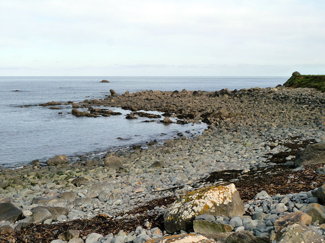
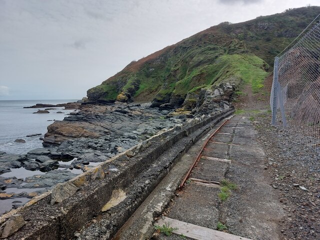
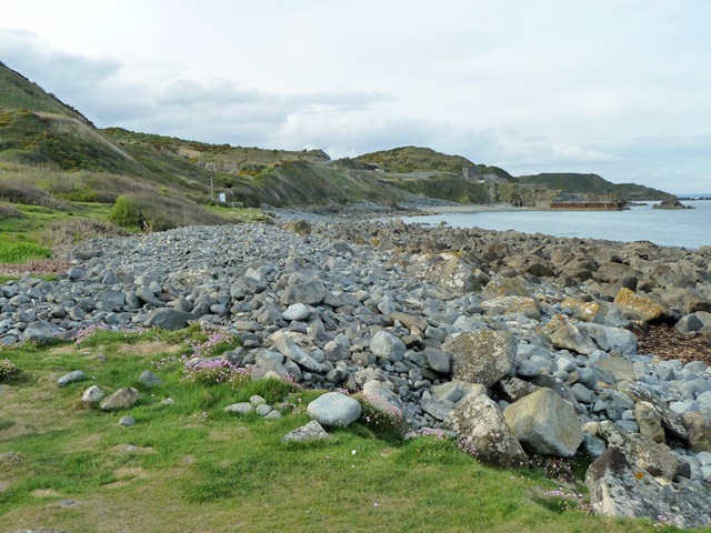
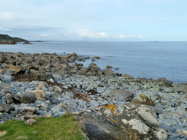
Shark's Fin is a small island located off the coast of Cornwall, England. Situated in the Atlantic Ocean, this rocky outcrop is known for its distinctive shape, which resembles the dorsal fin of a shark. The island is approximately 500 meters in length and 200 meters in width, with rugged cliffs that rise up to 50 meters above sea level.

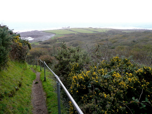
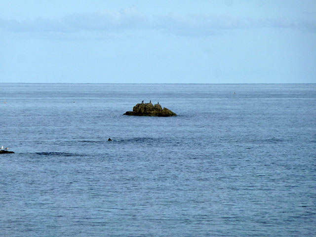
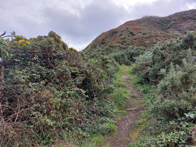
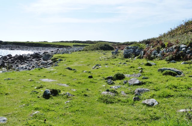
Access to Shark's Fin is only possible by boat, as there are no bridges or other means of reaching the island. This isolation has allowed the natural environment to thrive, making it a popular destination for nature enthusiasts and birdwatchers. The surrounding waters are teeming with marine life, including seals, dolphins, and a variety of fish species.

The island itself is uninhabited and devoid of any infrastructure or facilities. It is primarily composed of granite and features several caves and crevices that have been formed by years of erosion. These caves are home to a diverse range of seabirds, such as puffins, razorbills, and guillemots, which nest on the cliffs during the breeding season.

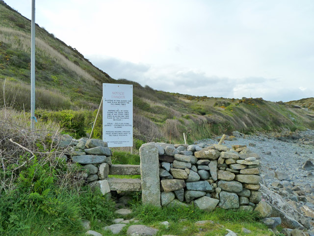
Shark's Fin is also a popular spot for rock climbing and abseiling due to its challenging terrain. The cliffs provide an adrenaline-fueled experience for climbers of various skill levels. However, it is essential to exercise caution and adhere to safety guidelines due to the unpredictable weather conditions and potential dangers associated with the sport.

Overall, Shark's Fin offers a unique and breathtaking natural landscape, making it a must-visit destination for those seeking adventure and a glimpse into Cornwall's rugged beauty.

If you have any feedback on the listing, please let us know in the comments section below.

Shark's Fin Images

Images are sourced within 2km of 50.052598/-5.0563252 or Grid Reference SW8121. Thanks to Geograph Open Source API. All images are credited.

Footpath to Lowland Point The path was re-routed a few years ago to accommodate expansion of the Dean Gabbro Quarry to the north.
Virtually all the land within this square and indeed the hectad SW81 can be seen in this shot.
Footpath to Lowland Point
The path was re-routed a few years ago to accommodate expansion of the Dean Gabbro Quarry to the north. Virtually all the land within this square and indeed the hectad SW81 can be seen in this shot.
Little Wrea Current population three (cormorants).
Little Wrea
Current population three (cormorants).
Lowland Point The isolated rock some way out is Little Wrea. Great Wrea is hidden round the corner of the point and is much closer in, no longer an island at low tide.
Lowland Point
The isolated rock some way out is Little Wrea. Great Wrea is hidden round the corner of the point and is much closer in, no longer an island at low tide.
On the new SW coast path from Porthkerris to Porthoustock The path is much wider now.
On the new SW coast path from Porthkerris to Porthoustock
The path is much wider now.
On the new SW coast path from Porthkerris to Porthoustock Many fences are being built along the path.
On the new SW coast path from Porthkerris to Porthoustock
Many fences are being built along the path.
Entering National Trust land at Lowland Point, Cornwall Part of the SW coast path.
Entering National Trust land at Lowland Point, Cornwall
Part of the SW coast path.
Junction on the coastal path The diverted route via Treglohan reaches the bottom of the hill and the coastal path. The sign on the right warns users of the coastal path of the hazards of blasting in the quarries off to the left.
Junction on the coastal path
The diverted route via Treglohan reaches the bottom of the hill and the coastal path. The sign on the right warns users of the coastal path of the hazards of blasting in the quarries off to the left.
Stone stile and warning sign, coastal path The sign warns of the possibility of blasting in Dean Quarry ahead. The pole to the left is one of the warning flagpoles. At the time the quarry seemed disused. The large upright stone of the stile is presumably the 'Stone' marked on larger scale maps. It has a large 'W' crudely carved on it. There are no administrative boundaries around here, so a property boundary marker?
Stone stile and warning sign, coastal path
The sign warns of the possibility of blasting in Dean Quarry ahead. The pole to the left is one of the warning flagpoles. At the time the quarry seemed disused. The large upright stone of the stile is presumably the 'Stone' marked on larger scale maps. It has a large 'W' crudely carved on it. There are no administrative boundaries around here, so a property boundary marker?
Shore near Lowland Point The area is mapped as 'Polcries', there in no significant near feature other than the beach of large stones, so perhaps that is what it is called.
Shore near Lowland Point
The area is mapped as 'Polcries', there in no significant near feature other than the beach of large stones, so perhaps that is what it is called.
Spring Squill, Lowland Point An impressive spread of Scilla verna on the coastal grassland here.
Spring Squill, Lowland Point
An impressive spread of Scilla verna on the coastal grassland here.
Path leading inland from the SW Coast Path
SW Coast Path The disused Jetty on the right was associated with quarrying at the nearby Dean Quarries,
SW Coast Path
The disused Jetty on the right was associated with quarrying at the nearby Dean Quarries,
South West Coastal Path at Polcries Looking north after rounding Lowland Point.
The jetty infrastructure for the Dean Gabbro quarries can be seen in the next square north.
The path to the left strikes uphill towards St Keverne.
South West Coastal Path at Polcries
Looking north after rounding Lowland Point. The jetty infrastructure for the Dean Gabbro quarries can be seen in the next square north. The path to the left strikes uphill towards St Keverne.
Lowland Point Looking south from the SW Coastal Path.
National Trust-owned land.
Lowland Point
Looking south from the SW Coastal Path. National Trust-owned land.
Blasting warning Alerting walkers on the SW Coastal Path north of Lowland Point of the dangers associated with the stone quarry ahead. Dean Quarry has been producing Gabbro primarily for road-building for over a century.
Blasting warning
Alerting walkers on the SW Coastal Path north of Lowland Point of the dangers associated with the stone quarry ahead. Dean Quarry has been producing Gabbro primarily for road-building for over a century.
View north from Lowland Point
Porthoustock
Porthoustock
Show me another place!

Shark's Fin is located at Grid Ref: SW8121 (Lat: 50.052598, Lng: -5.0563252)

Unitary Authority: Cornwall

Police Authority: Devon and Cornwall

What 3 Words

///magical.sympathy.blogs. Near Falmouth, Cornwall

Related Wikis

Porthoustock

Porthoustock (Cornish: Porthewstek) is a hamlet near St Keverne in Cornwall, England, United Kingdom, on the east coast of Lizard Peninsula. Aggregates...

SS Mohegan

The SS Mohegan was a steamer which sank off the coast of the Lizard Peninsula, Cornwall, on her second voyage. She hit The Manacles on 14 October 1898...

The Manacles

The Manacles (Cornish: Meyn Eglos, meaning church stones) (grid reference SW820205) are a set of treacherous rocks off The Lizard peninsula in Cornwall...

Rosenithon

Rosenithon (Cornish: Ros an Eythin) is a hamlet east of St Keverne in west Cornwall, England.The name Rosenithon comes from the Cornish language Ros an...

Nearby Amenities

Located within 500m of 50.052598,-5.0563252
Manacle Point
Is In Country Code: GB
Is In County: Cornwall
Place: locality
Source: npe
Lat/Long: 50.0521172/-5.0573571
The data included in this document is from www.openstreetmap.org. The data is made available under ODbL.

Have you been to Shark's Fin?

Leave your review of Shark's Fin below (or comments, questions and feedback).