The Anvil

Island in Pembrokeshire

Wales

The Anvil

Caves at Jack Sound Three large caves and impressive rock folding in a small promontory. Wooltack Point in the background.
Caves at Jack Sound Credit: Trevor Rickard

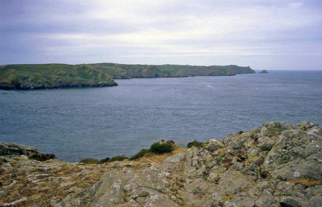
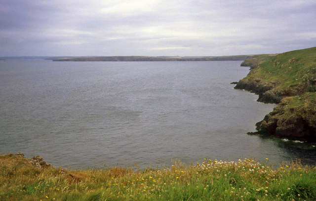
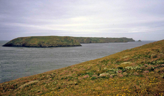
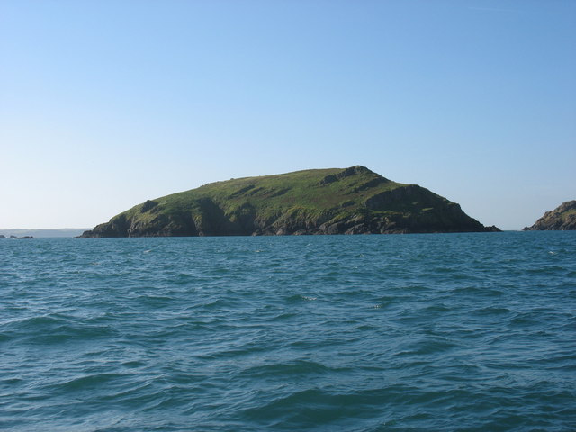
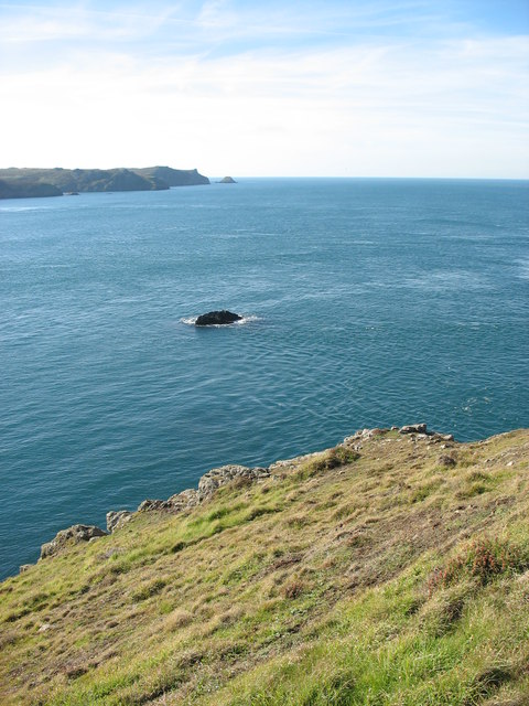
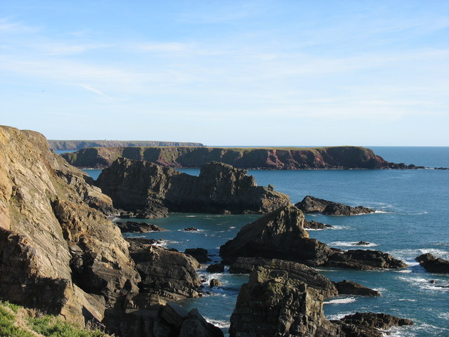
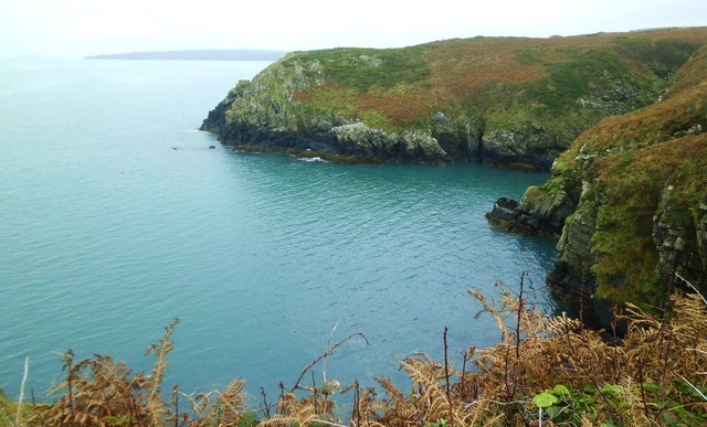
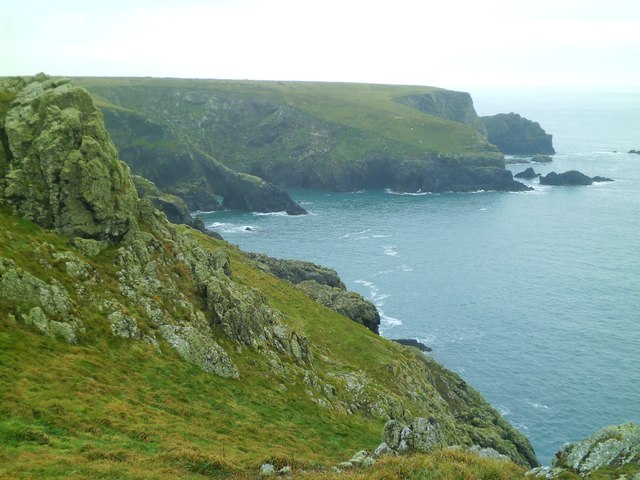
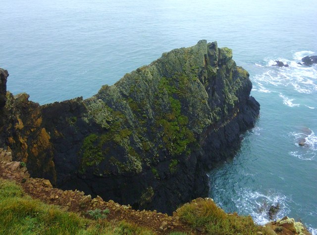
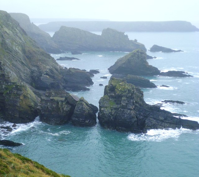
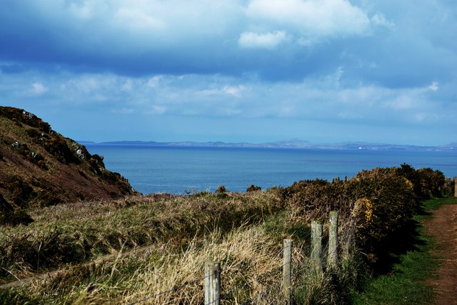
The Anvil is a small island located off the coast of Pembrokeshire, Wales. It is situated approximately 1.5 kilometers southwest of the mainland, near the town of Milford Haven. The island gets its name from its distinctive shape, which resembles an anvil.

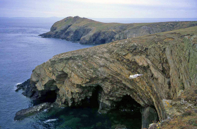
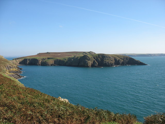
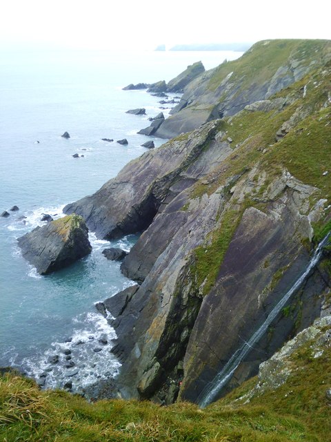
Covering an area of about 2 hectares, The Anvil is known for its rugged and rocky terrain. The island is predominantly composed of sandstone, with steep cliffs rising up to 15 meters above sea level. Vegetation on the island is sparse, consisting mainly of hardy grasses and low-growing shrubs.

The Anvil is a popular destination for birdwatchers and nature enthusiasts due to its rich birdlife. The island is home to a variety of seabirds, including puffins, razorbills, guillemots, and gulls. These birds nest on the cliffs, which provide sheltered nesting sites away from predators.

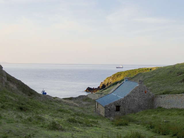
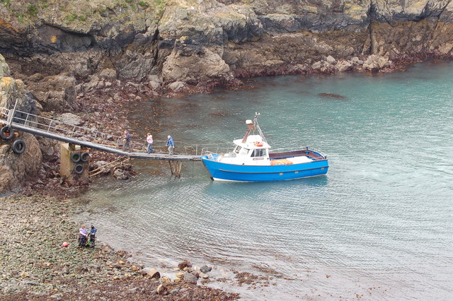
Access to The Anvil is limited and can be challenging. The island is accessible by boat, with several local tour operators offering trips to the island during the summer months. However, landing on the island is not permitted to protect the fragile ecosystem and nesting birds.

The Anvil is part of the Milford Haven Special Area of Conservation, which recognizes its importance as a breeding site for seabirds. The island also forms part of the Pembrokeshire Coast National Park, ensuring its protection and preservation for future generations to enjoy.

If you have any feedback on the listing, please let us know in the comments section below.

The Anvil Images

Images are sourced within 2km of 51.732898/-5.2523233 or Grid Reference SM7508. Thanks to Geograph Open Source API. All images are credited.

Caves at Jack Sound Three large caves and impressive rock folding in a small promontory. Wooltack Point in the background.
Caves at Jack Sound
Three large caves and impressive rock folding in a small promontory. Wooltack Point in the background.
Wooltack Point Looking westwards towards Skomer island with the Garland Stone offshore on the right.
Wooltack Point
Looking westwards towards Skomer island with the Garland Stone offshore on the right.
Coastline east of Haven Point From the grassy top of Haven Point looking east across the bay to the cliffs between Marloes and St Brides.
Coastline east of Haven Point
From the grassy top of Haven Point looking east across the bay to the cliffs between Marloes and St Brides.
Wild Flowers on Wooltack Point Looking west to Skomer. Plenty of spring blooms on the clifftop here, including thrift and sea campion.
Wild Flowers on Wooltack Point
Looking west to Skomer. Plenty of spring blooms on the clifftop here, including thrift and sea campion.
Evening at Martin's Haven
Evening at Wooltack Point, Pembrokeshire In the foreground the rocky headland of Wooltack Point, beyond it ships at anchor in St Bride's Bay, with a distant view of Ramsey Island.
Evening at Wooltack Point, Pembrokeshire
In the foreground the rocky headland of Wooltack Point, beyond it ships at anchor in St Bride's Bay, with a distant view of Ramsey Island.
Midland Isle Between Skomer Island and the mainland at Martin's Haven.
Midland Isle
Between Skomer Island and the mainland at Martin's Haven.
The Neck, Skomer Island The Neck, no doubt named from the narrow strip of land connecting to the main part of Skomer, is closed to visitors.
The Neck, Skomer Island
The Neck, no doubt named from the narrow strip of land connecting to the main part of Skomer, is closed to visitors.
Wooltack Point and Tusker Rock Looking towards Skomer Island, with Garland Stone about 3.5 kilometres away in line with Tusker Rock.
This visit in 2007 had poignant memories for me, as five years earlier I had scattered my aunt's ashes at the tip of Wooltack Point. She had requested this spot as, for her, it was "where earth met heaven". When I first went there, I could see what she meant.
Wooltack Point and Tusker Rock
Looking towards Skomer Island, with Garland Stone about 3.5 kilometres away in line with Tusker Rock. This visit in 2007 had poignant memories for me, as five years earlier I had scattered my aunt's ashes at the tip of Wooltack Point. She had requested this spot as, for her, it was "where earth met heaven". When I first went there, I could see what she meant.
The Pembrokeshire coast south of Martin's Haven The flat-topped land in the middle distance is Gateholm Island (and this photo suggests that a few earlier photos in the square have been wrongly located, though the evidence is not strong enough to suggest a change). The more distant (and rather higher) land is the peninsula leading to St Anne's Head.
The Pembrokeshire coast south of Martin's Haven
The flat-topped land in the middle distance is Gateholm Island (and this photo suggests that a few earlier photos in the square have been wrongly located, though the evidence is not strong enough to suggest a change). The more distant (and rather higher) land is the peninsula leading to St Anne's Head.
Pony near Wooltack Point, on a midsummer's evening This pony had been grazing much lower down, and when it decided to head up the slope I had just a few seconds to catch this silhouette against the evening sky.  Shot taken at 21.08, a few days after midsummer.

I am posting this shot several months after the event - to celebrate the completion of my first thousand images on Geograph.
Pony near Wooltack Point, on a midsummer's evening
This pony had been grazing much lower down, and when it decided to head up the slope I had just a few seconds to catch this silhouette against the evening sky. Shot taken at 21.08, a few days after midsummer. I am posting this shot several months after the event - to celebrate the completion of my first thousand images on Geograph.
Skomer ferry arrives back at Martin's Haven
The coast at High Point The view from the coast path east of Martins Haven.
The coast at High Point
The view from the coast path east of Martins Haven.
Coast at Mouse's Haven Looking south from Wooltack Point past Mouse's Haven towards The Anvil. A dull day with few views, but to compensate there were plenty of choughs, a peregrine, two buzzards, and grey seals hauled out in the coves.
Coast at Mouse's Haven
Looking south from Wooltack Point past Mouse's Haven towards The Anvil. A dull day with few views, but to compensate there were plenty of choughs, a peregrine, two buzzards, and grey seals hauled out in the coves.
The Anvil Dramatic rock ridge at the south western point of the Wooltack peninsula.
The Anvil
Dramatic rock ridge at the south western point of the Wooltack peninsula.
Rocky coast towards Rainy Rock A rocky and inhospitable stretch of coastline on the south side of the Marloes peninsula. Rainy Rock is the big double topped block in the middle distance, whilst Gateholme Island is on the horizon.
Rocky coast towards Rainy Rock
A rocky and inhospitable stretch of coastline on the south side of the Marloes peninsula. Rainy Rock is the big double topped block in the middle distance, whilst Gateholme Island is on the horizon.
Coastline at Victoria Bay Huge slabs of Silurian age rock drop into the ocean at this point and a tiny stream slides down the rock face to the shore.
Coastline at Victoria Bay
Huge slabs of Silurian age rock drop into the ocean at this point and a tiny stream slides down the rock face to the shore.
St Brides Bay to the north On the far horizon across the bay lays the village (or small town) of Solva. We are just outside the Deerpark here, which is situated to the west. Martin's Haven is just out of sight below the cliff edge
St Brides Bay to the north
On the far horizon across the bay lays the village (or small town) of Solva. We are just outside the Deerpark here, which is situated to the west. Martin's Haven is just out of sight below the cliff edge
Show me another place!

The Anvil is located at Grid Ref: SM7508 (Lat: 51.732898, Lng: -5.2523233)

Unitary Authority: Pembrokeshire

Police Authority: Dyfed Powys

What 3 Words

///driven.initiated.crop. Near Dale, Pembrokeshire

Related Wikis

Jack Sound

Jack Sound is a treacherous body of water about 800 metres (2,600 ft) wide between the island of Skomer and the Pembrokeshire mainland that contains numerous...

Martin's Haven

Martin's Haven is a small bay in Pembrokeshire, Wales, UK, on the Dale Peninsula, with views across St Bride's Bay towards St David's. Its shingle beach...

Middleholm

Middleholm, also known as Midland Isle, is a small island lying off southwest Pembrokeshire in Wales, between the island of Skomer and the mainland in...

Skomer Marine Conservation Zone

Skomer Marine Conservation Zone is an underwater marine nature reserve located off the coast of Pembrokeshire in Wales. The nature reserve completely surrounds...

Have you been to The Anvil?

Leave your review of The Anvil below (or comments, questions and feedback).