Uamish

Island in Ross-shire

Scotland

Uamish

Camas Bastadh/Bostadh Spelled differently on the map and gazetteer.
Camas Bastadh/Bostadh Credit: John Lucas

Uamish is a small island located off the coast of Ross-shire in the Scottish Highlands. It is part of the Inner Hebrides archipelago and sits in the Atlantic Ocean. The island measures approximately 2 square kilometers and has a population of around 50 residents.

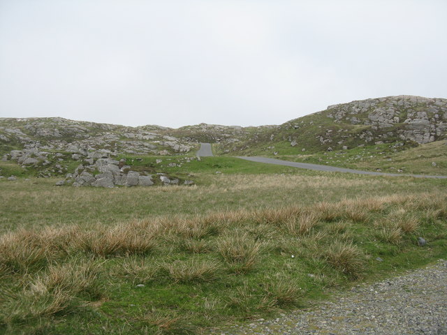
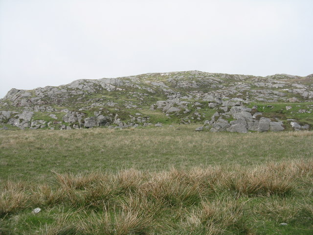
Uamish is known for its stunning natural beauty and rugged landscapes. The island is primarily composed of rocky cliffs and rolling hills, with a few small sandy beaches scattered along its coastline. The terrain is perfect for hiking and exploring, offering breathtaking views of the surrounding sea and neighboring islands.

Despite its small size, Uamish has a rich history. The island is home to ancient ruins, including stone circles and burial sites, which provide a glimpse into its past civilizations. It is believed that Uamish was inhabited as early as the Bronze Age.

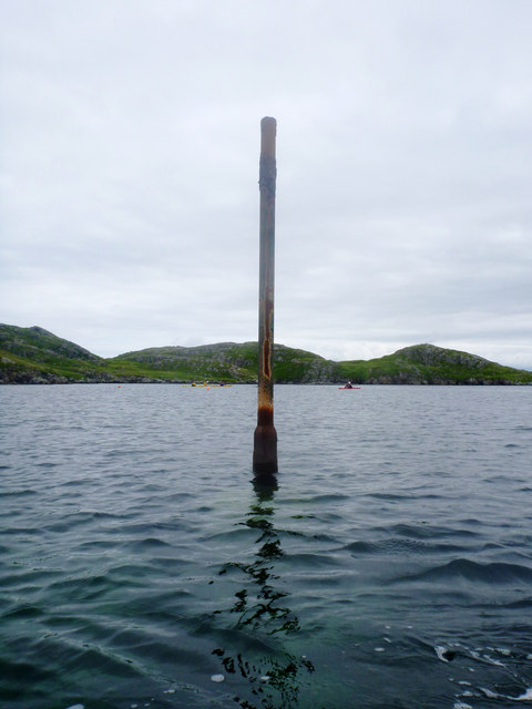
Today, Uamish relies mainly on fishing and tourism as its main economic activities. The island offers a peaceful retreat for visitors seeking a quiet and remote destination away from the bustling cities. Tourists can enjoy activities such as birdwatching, fishing, and wildlife spotting, as the island is home to a variety of seabirds, seals, and sometimes even dolphins.

Uamish is accessible by boat, and there are regular ferry services connecting it to the mainland. The island offers basic amenities, including a small shop and a couple of guesthouses for those wishing to stay overnight. It is a place where visitors can experience unspoiled nature and immerse themselves in the tranquility of island life.

If you have any feedback on the listing, please let us know in the comments section below.

Uamish Images

Images are sourced within 2km of 58.27348/-6.8745087 or Grid Reference NB1441. Thanks to Geograph Open Source API. All images are credited.

Camas Bastadh/Bostadh Spelled differently on the map and gazetteer.
Camas Bastadh/Bostadh
Spelled differently on the map and gazetteer.
The cemetery at Bostadh Perhaps not a surprising number of burials for such a remote location, as it is a very desirable place to be laid to rest.
The cemetery at Bostadh
Perhaps not a surprising number of burials for such a remote location, as it is a very desirable place to be laid to rest.
The road to Bostadh With Siaram Bostadh in mid view on the left side.
The road to Bostadh
With Siaram Bostadh in mid view on the left side.
Beehive Cell - Eilean Fir Chrothair The beautiful little beehive cell on the island of Eilean Fir Chrothair.
Beehive Cell - Eilean Fir Chrothair
The beautiful little beehive cell on the island of Eilean Fir Chrothair.
Public convenience at Bostadh Near the end of the road at the cemetery and Iron Age Village.
Public convenience at Bostadh
Near the end of the road at the cemetery and Iron Age Village.
Camas Bostadh Sand dunes at Bostadh, looking to a cloud-covered Flodaigh.
Camas Bostadh
Sand dunes at Bostadh, looking to a cloud-covered Flodaigh.
Rocky coast at Bostadh Looking across Camas Bostadh from near the cemetery wall.
Rocky coast at Bostadh
Looking across Camas Bostadh from near the cemetery wall.
Beach at Bostadh Looking across Camas Bostadh, with part of Flodaigh on the right.
Beach at Bostadh
Looking across Camas Bostadh, with part of Flodaigh on the right.
Traigh Bostadh Looking across to Cnoc Urraman.
Traigh Bostadh
Looking across to Cnoc Urraman.
View from an Iron Age house Looking over Traigh Bosdtadh to Camus Bostadh and Flodaigh, from the enclosure surrounding the reconstructed house.
View from an Iron Age house
Looking over Traigh Bosdtadh to Camus Bostadh and Flodaigh, from the enclosure surrounding the reconstructed house.
Poll a' Roin A small sandy inlet off Traigh Bostadh; looking north from Cnoc a' Chuispair out to Camas Bostadh and a rocky headland.
Poll a' Roin
A small sandy inlet off Traigh Bostadh; looking north from Cnoc a' Chuispair out to Camas Bostadh and a rocky headland.
The road from Bostadh Near the cul-de-sac by the cemetery and Iron Age Village, at the northern end of Great Bernera/Beàrnaraigh.
The road from Bostadh
Near the cul-de-sac by the cemetery and Iron Age Village, at the northern end of Great Bernera/Beàrnaraigh.
Cnoc Ruinagaidh A rocky out crop near the roadend at Bostadh.
Cnoc Ruinagaidh
A rocky out crop near the roadend at Bostadh.
Visiting the Tide Bell at Bostadh The idea of the tide bell is to toll as the waves cause movement when the tide is high enough. There are a number of these installations around the UK, which will toll at different times as the tide rises and falls in each of the locations. As the tide gets later by a bit under an hour each day, the bell will toll at night as often as during the day, and for longer at spring tides than neaps. Perhaps it is just as well no-one lives here. Visiting the bell is straightforward at low tide and probably needs a small boat (and ear defenders) at high tide. In between, a certain degree of hardiness is required unless, as with these visitors, you happen to be wearing a drysuit...
Visiting the Tide Bell at Bostadh
The idea of the tide bell is to toll as the waves cause movement when the tide is high enough. There are a number of these installations around the UK, which will toll at different times as the tide rises and falls in each of the locations. As the tide gets later by a bit under an hour each day, the bell will toll at night as often as during the day, and for longer at spring tides than neaps. Perhaps it is just as well no-one lives here. Visiting the bell is straightforward at low tide and probably needs a small boat (and ear defenders) at high tide. In between, a certain degree of hardiness is required unless, as with these visitors, you happen to be wearing a drysuit...
Perch in Caolas Bearnaraigh Beag I was intrigued as I paddled along Caolas Bearnaraigh Beag to see this rusting metal pillar, looking for all the world like a misplaced lamppost. The large-scale map shows rocks here, which certainly weren't obvious from the water in these calm conditions, so this perch fulfils the important purpose of marking the rocks for the benefit of those in boats not of a sufficiently shallow draught to pass over them. There is no light, and I imagine it would be pretty hard to see in the dark, but I suspect that, sea kayakers apart, there is not much other than local traffic here, with skippers who know the water.
Perch in Caolas Bearnaraigh Beag
I was intrigued as I paddled along Caolas Bearnaraigh Beag to see this rusting metal pillar, looking for all the world like a misplaced lamppost. The large-scale map shows rocks here, which certainly weren't obvious from the water in these calm conditions, so this perch fulfils the important purpose of marking the rocks for the benefit of those in boats not of a sufficiently shallow draught to pass over them. There is no light, and I imagine it would be pretty hard to see in the dark, but I suspect that, sea kayakers apart, there is not much other than local traffic here, with skippers who know the water.
Lunch stop on Little Bernera Although well under halfway round our trip exploring sea caves in the islands north of Great Bernera, this would be the last sandy beach offering an easy landing, so a stop was inevitable, if only to stretch the legs and relieve any undue pressure. The sea here is deceptively calm - out on the rocky coasts there was an interesting level of swell, which always makes sea cave exploration "interesting".
Lunch stop on Little Bernera
Although well under halfway round our trip exploring sea caves in the islands north of Great Bernera, this would be the last sandy beach offering an easy landing, so a stop was inevitable, if only to stretch the legs and relieve any undue pressure. The sea here is deceptively calm - out on the rocky coasts there was an interesting level of swell, which always makes sea cave exploration "interesting".
Passing through the cave under Campaigh The large scale OS map shows a "natural arch" right through the island of Campaigh, and from either end, one can see daylight on the other side. When explored, however, one finds that there is a third entrance, which must emerge on the north coast of the island. Unfortunately the passage is so narrow and hading that a kayak cannot get through whatever the state of the tide. Daylight, however, is clearly visible, and perhaps a brave enough swimmer/climber could make their way in or out that way (you'd want a day with very little swell as the water surges up and down quite a bit in the middle of the cave).
Passing through the cave under Campaigh
The large scale OS map shows a "natural arch" right through the island of Campaigh, and from either end, one can see daylight on the other side. When explored, however, one finds that there is a third entrance, which must emerge on the north coast of the island. Unfortunately the passage is so narrow and hading that a kayak cannot get through whatever the state of the tide. Daylight, however, is clearly visible, and perhaps a brave enough swimmer/climber could make their way in or out that way (you'd want a day with very little swell as the water surges up and down quite a bit in the middle of the cave).
The eastern entrance of the cave under Campaigh One of the UK's longer through-passage sea caves, much more significant than indicated by the OS map's "natural arch", the route under Campaigh actually has three connections to the outside world. Kayakers can readily pass (in suitable sea conditions) from/to the open east (seen here) and west entrances which connect along a straight passage, so daylight can be seen right the way through. Midway, there is a skylight through a hading rift to the north coast - not passable by a boat of any size at any state of the tide.
The eastern entrance of the cave under Campaigh
One of the UK's longer through-passage sea caves, much more significant than indicated by the OS map's "natural arch", the route under Campaigh actually has three connections to the outside world. Kayakers can readily pass (in suitable sea conditions) from/to the open east (seen here) and west entrances which connect along a straight passage, so daylight can be seen right the way through. Midway, there is a skylight through a hading rift to the north coast - not passable by a boat of any size at any state of the tide.
Show me another place!

Uamish is located at Grid Ref: NB1441 (Lat: 58.27348, Lng: -6.8745087)

Unitary Authority: Na h-Eileanan an Iar

Police Authority: Highlands and Islands

What 3 Words

///unloaded.hush.speech. Near Carloway, Na h-Eileanan Siar

Related Wikis

Cealasaigh

Cealasaigh or Kealasay is an islet in outer Loch Ròg, Lewis, Scotland that lies north of Traigh Mhór on Little Bernera and south of Campaigh. To the west...

Campaigh

Campaigh or Campay is a steep and rocky islet in outer Loch Ròg, Lewis, Scotland that lies north of Cealasaigh and Little Bernera. A huge natural arch...

Little Bernera

Little Bernera (Scottish Gaelic: Beàrnaraigh Beag) is a small island situated off the west coast of the Isle of Lewis in the Outer Hebrides. Little Bernera...

Flodaigh (Outer Loch Ròg)

Flodaigh is an islet in outer Loch Ròg, Lewis, Scotland. It lies north west of Great Bernera and Little Bernera, south of Bearasaigh and Seanna Chnoc and...

Have you been to Uamish?

Leave your review of Uamish below (or comments, questions and feedback).