Jack's Ledge

Island in Cornwall

England

Jack's Ledge

A track on eastern St Martin’s The track runs uphill from the eastern end of Higher Town Bay to the Chapel Down and the Daymark.
A track on eastern St Martin’s Credit: David Lally

Located off the coast of Cornwall, England, Jack's Ledge is a picturesque island that is known for its breathtaking beauty and rich history. This small island is situated in the Celtic Sea, approximately 1.5 miles southwest of Cape Cornwall.

Jack's Ledge covers an area of around 0.3 hectares and is predominantly made up of rugged cliffs and rocky terrain. The island is accessible during low tide, when a narrow strip of land emerges connecting it to the mainland. However, caution is advised as the strip can quickly become submerged during high tide.

The island derives its name from the infamous smuggler "Jack the Ledge," who was said to have used the island as a hideout during the 18th century. Legend has it that he stashed his loot in hidden caves and tunnels within the cliffs, adding an air of mystery to the island.

Today, Jack's Ledge is a popular destination for hikers, nature enthusiasts, and birdwatchers. The island is home to a diverse range of flora and fauna, including various seabird species and rare plants. Visitors can explore the rugged coastline, admire the stunning views of the Atlantic Ocean, and take in the tranquility of this secluded spot.

It is important to note that due to its protected status, visitors are not allowed to camp or stay overnight on Jack's Ledge. Additionally, the island can only be accessed on foot during low tide, making it essential to plan visits accordingly.

If you have any feedback on the listing, please let us know in the comments section below.
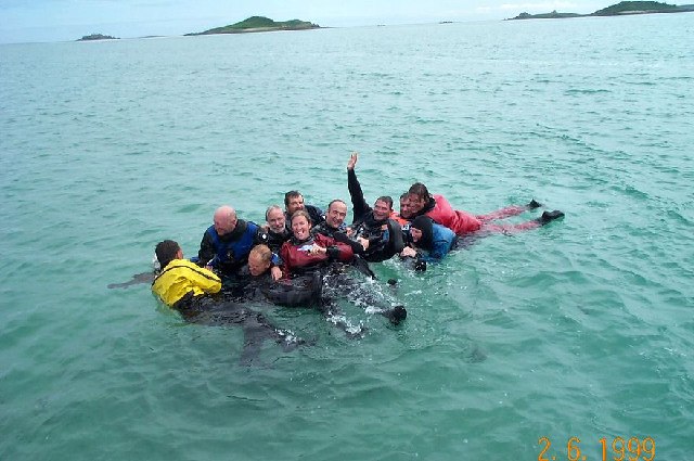
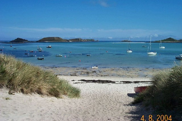
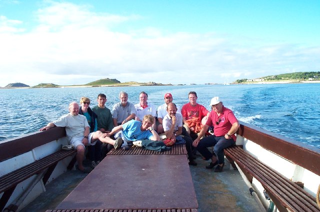
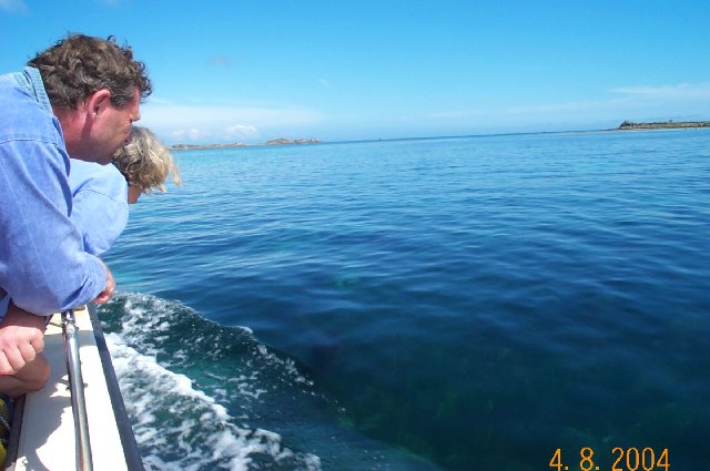
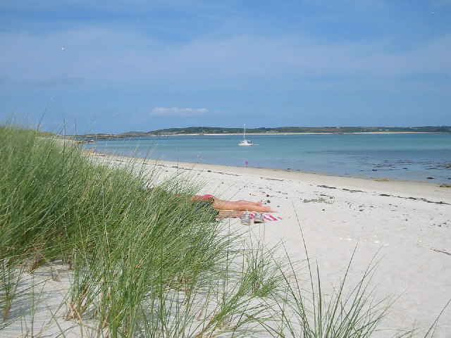
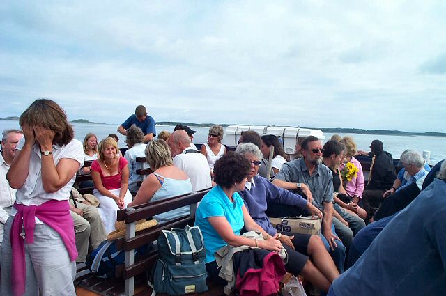
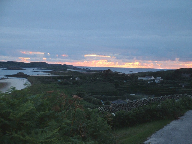
Jack's Ledge Images

Images are sourced within 2km of 49.96163/-6.2968232 or Grid Reference SV9115. Thanks to Geograph Open Source API. All images are credited.

A track on eastern St Martin’s The track runs uphill from the eastern end of Higher Town Bay to the Chapel Down and the Daymark.
A track on eastern St Martin’s
The track runs uphill from the eastern end of Higher Town Bay to the Chapel Down and the Daymark.
Lower Town Quay The smaller of the two quays on St Martin’s. The larger quay at Higher Town is the one used for freight deliveries, but is inaccessible at a low tide.

The island behind is the uninhabited Tean (pronounced tea-an).
Lower Town Quay
The smaller of the two quays on St Martin’s. The larger quay at Higher Town is the one used for freight deliveries, but is inaccessible at a low tide. The island behind is the uninhabited Tean (pronounced tea-an).
Great Bay panorama On of the most beautiful spots on the islands.
Great Bay panorama
On of the most beautiful spots on the islands.
Higher Town Bay
Higher Town Bay
St Martins The beautiful St Martin's Bay
St Martins
The beautiful St Martin's Bay
St Martin's Divers at Higher Town bay
St Martin's
Divers at Higher Town bay
St Martin's Higher Town Bay
St Martin's
Higher Town Bay
Island hopping Crossing from St Martin's to St Mary's on the island ferry.
Island hopping
Crossing from St Martin's to St Mary's on the island ferry.
Near St Martin's - Scilly Well they're looking for something. Is it a seal, a jellyfish or something that just blew out the boat?
Near St Martin's - Scilly
Well they're looking for something. Is it a seal, a jellyfish or something that just blew out the boat?
Pentle Bay, Tresco St. Martin's visible across the water
Pentle Bay, Tresco
St. Martin's visible across the water
Lower Town, St. Martin's Looking SW, Tresco in distance
Lower Town, St. Martin's
Looking SW, Tresco in distance
Middle Town - St Martin's, Scilly The westerly view from Middle Town. Tresco on the horizon.
Middle Town - St Martin's, Scilly
The westerly view from Middle Town. Tresco on the horizon.
St Martin's Ferry - Scillies Passengers on the St Martin - St Mary ferry boat. Many of these will be returning from a week's stay on St Martin's.
St Martin's Ferry - Scillies
Passengers on the St Martin - St Mary ferry boat. Many of these will be returning from a week's stay on St Martin's.
St Martin's - Scillies The high street of Middle Town, St Martin's.
St Martin's - Scillies
The high street of Middle Town, St Martin's.
Sunset on St Martins looking westward
Higher Town on St Martins Looking East
Looking out from gardens of Seven Stones pub View looking south from the pub
Looking out from gardens of Seven Stones pub
View looking south from the pub
St Martin's coastal path, looking towards Great Bay
Show me another place!

Jack's Ledge is located at Grid Ref: SV9115 (Lat: 49.96163, Lng: -6.2968232)

Division: Isles of Scilly

Unitary Authority: Isles of Scilly

Police Authority: Devon and Cornwall

What 3 Words

///hairspray.ideal.essential. Near St Martin's, Isles of Scilly

Related Wikis

Middle Town, St Martin's

Middle Town (Cornish: Tregres) is a small settlement on the island of St Martin's in the Isles of Scilly, England. It is situated slightly inland, approximately...

Lower Town, Isles of Scilly

Lower Town (Cornish: Trewoles) is the westernmost settlement on the island of St Martin's in the Isles of Scilly, England. One of the island's two quays...

St Martin's, Isles of Scilly

St Martin's (Cornish: Brechiek, lit. 'dappled island') is the northernmost populated island of the Isles of Scilly, England, United Kingdom. It has an...

St Martin's Church, St Martin's

St Martin's Church, St Martin's is a Grade II listed parish church in the Church of England located in St Martin's, Isles of Scilly, UK. == History... ==

St Martin's Methodist Church, Isles of Scilly

The Methodist Church, St Martin's, Isles of Scilly is a Grade II listed chapel in St Martin's, Isles of Scilly. == History == Bible Christians arrived...

Higher Town, Isles of Scilly

Higher Town (Cornish: Trewartha) is the easternmost and largest settlement on the island of St Martin's in the Isles of Scilly, England. It is situated...

Teän

Teän ( TEE-ən, sometimes written Tean without the diaeresis; Cornish: Enys Tian) is an uninhabited island to the north of the Isles of Scilly archipelago...

White Island, Isles of Scilly

White Island (Cornish: Ar Nor, "facing the mainland" or Enys Wynn "white island" ) is one of the larger unpopulated islands of the Isles of Scilly, part...

Nearby Amenities

Located within 500m of 49.96163,-6.2968232
Source: PGS
Lat/Long: 49.9623908/-6.2911642
Source: PGS
Lat/Long: 49.9621772/-6.2904406
Source: PGS
Lat/Long: 49.9626869/-6.2933937
Source: PGS
Lat/Long: 49.9643146/-6.3012896
Source: PGS
Lat/Long: 49.9639219/-6.2952267
Source: PGS
Lat/Long: 49.9634868/-6.294156
Source: PGS
Lat/Long: 49.9640719/-6.2961956
Source: PGS
Lat/Long: 49.9641238/-6.2977866
Source: PGS
Lat/Long: 49.9643212/-6.2996593
Source: PGS
Lat/Long: 49.9628497/-6.2939601
Source: PGS
Lat/Long: 49.963083/-6.294032
Telephone
Booth: K6
Covered: booth
Phone: +44 1720 422413
Lat/Long: 49.9659294/-6.2951972
Lawrence's Bay
Natural: bay
Lat/Long: 49.9608292/-6.2916685
Seamark Beacon Special Purpose Colour: yellow
Seamark Beacon Special Purpose Shape: pile
Seamark Type: beacon_special_purpose
Lat/Long: 49.9644449/-6.3012815
The data included in this document is from www.openstreetmap.org. The data is made available under ODbL.

Have you been to Jack's Ledge?

Leave your review of Jack's Ledge below (or comments, questions and feedback).