Cow Hill

Hill, Mountain in Yorkshire Harrogate

England

Cow Hill

Road on Skelding Moor Narrow moorland road crossing Skelding Moor - the gorse already starting to flower despite still in the month of January.
Road on Skelding Moor Credit: Chris Heaton

Cow Hill is a prominent hill located in the Yorkshire Dales National Park, specifically in the county of Yorkshire, England. Rising to an elevation of approximately 1,460 feet (445 meters), it is often described as a hill rather than a mountain due to its relatively modest height. Nonetheless, Cow Hill offers breathtaking panoramic views of the surrounding landscape, making it a popular destination for hikers, nature enthusiasts, and photographers.

Situated near the town of Kettlewell, Cow Hill is part of the Pennine range, which stretches across northern England. The hill is characterized by its distinctive shape, featuring gentle slopes and a rounded summit that provides a relatively easy ascent for visitors. Its grassy slopes are often dotted with grazing sheep, adding to the picturesque scenery.

The summit of Cow Hill offers sweeping vistas of the picturesque Yorkshire Dales, with rolling green hills, scattered farms, and picturesque villages in the distance. On clear days, it is even possible to catch a glimpse of the iconic Three Peaks, another famous natural landmark in the area.

Hiking routes leading to Cow Hill are plentiful, with various options for different skill levels. The hill is accessible from several starting points, including Kettlewell and nearby Wharfedale, allowing visitors to choose the route that best suits their preferences and abilities. The hike to the summit typically takes around 1 to 2 hours, depending on the chosen path and individual pace.

In summary, Cow Hill, Yorkshire, may be considered a hill rather than a mountain, but its stunning views, accessibility, and varied hiking routes make it an attractive destination for outdoor enthusiasts seeking to explore the beauty of the Yorkshire Dales.

If you have any feedback on the listing, please let us know in the comments section below.
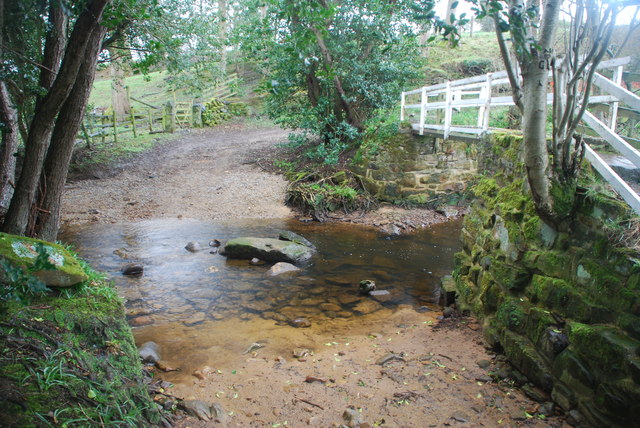
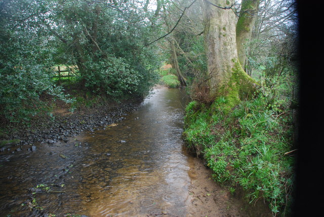
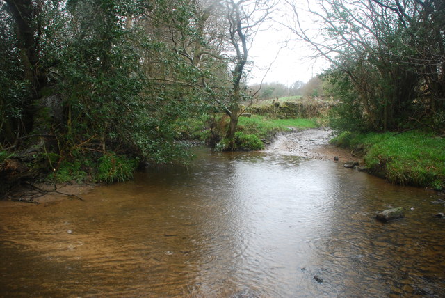
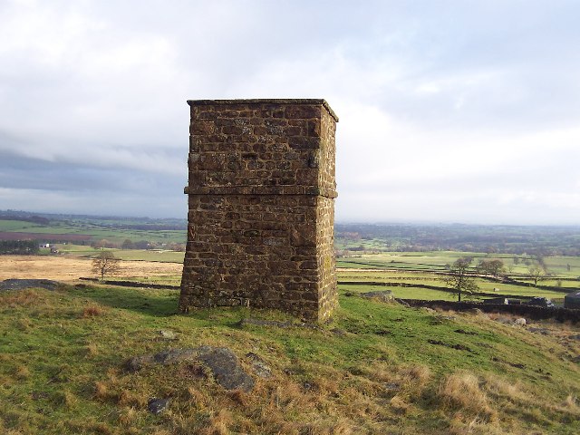
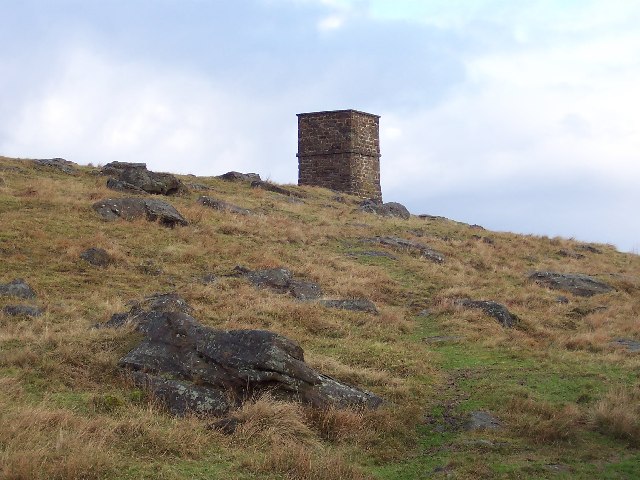
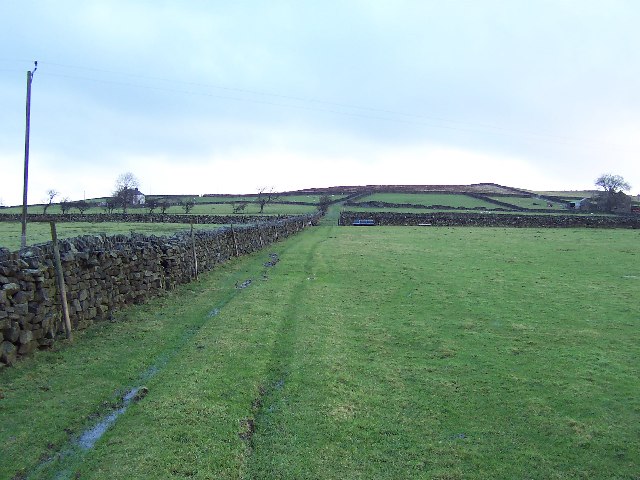
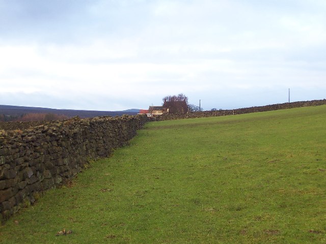
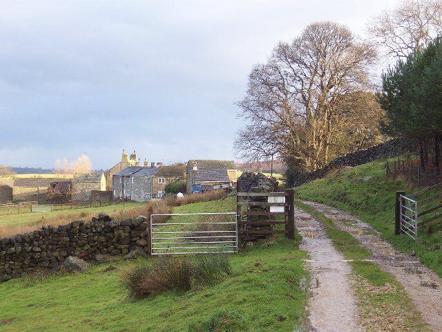
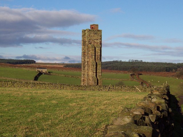
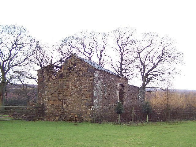
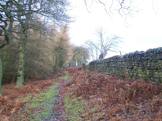
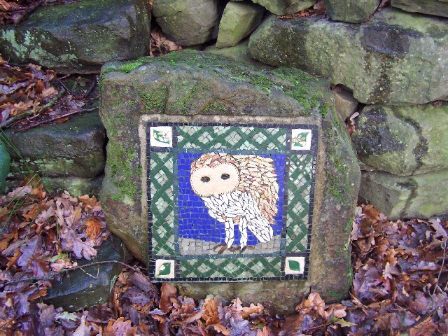
Cow Hill Images

Images are sourced within 2km of 54.140305/-1.7000909 or Grid Reference SE1971. Thanks to Geograph Open Source API. All images are credited.

Road on Skelding Moor Narrow moorland road crossing Skelding Moor - the gorse already starting to flower despite still in the month of January.
Road on Skelding Moor
Narrow moorland road crossing Skelding Moor - the gorse already starting to flower despite still in the month of January.
Road over Skelding Moor to Harper Hill Narrow road from Low Grantley to Harper Hill
Road over Skelding Moor to Harper Hill
Narrow road from Low Grantley to Harper Hill
Skelding Moor Moorland landscape near Grantley
Skelding Moor
Moorland landscape near Grantley
Ordnance Survey Flush Bracket 11573 This re-sited Bracket can be found on the wall of a newly extended building at The Moorhouse - formerly the Drovers Inn.
For more detail see : <span class="nowrap"><a title="http://www.bench-marks.org.uk/bm22378" rel="nofollow ugc noopener" href="http://www.bench-marks.org.uk/bm22378">Link</a><img style="margin-left:2px;" alt="External link" title="External link - shift click to open in new window" src="https://s1.geograph.org.uk/img/external.png" width="10" height="10"/></span>
Ordnance Survey Flush Bracket 11573
This re-sited Bracket can be found on the wall of a newly extended building at The Moorhouse - formerly the Drovers Inn. For more detail see : LinkExternal link
The original location of the now re-sited Ordnance Survey Flush Bracket 11573 The wall of the former Drovers Inn.
For more detail see : <span class="nowrap"><a title="http://www.bench-marks.org.uk/bm22378" rel="nofollow ugc noopener" href="http://www.bench-marks.org.uk/bm22378">Link</a><img style="margin-left:2px;" alt="External link" title="External link - shift click to open in new window" src="https://s1.geograph.org.uk/img/external.png" width="10" height="10"/></span>
The original location of the now re-sited Ordnance Survey Flush Bracket 11573
The wall of the former Drovers Inn. For more detail see : LinkExternal link
New Building at the former Drovers Inn The re-position Ordnance Survey Flush Bracket 11573 is visible on the new wall.
For more detail see : <span class="nowrap"><a title="http://www.bench-marks.org.uk/bm22378" rel="nofollow ugc noopener" href="http://www.bench-marks.org.uk/bm22378">Link</a><img style="margin-left:2px;" alt="External link" title="External link - shift click to open in new window" src="https://s1.geograph.org.uk/img/external.png" width="10" height="10"/></span>
New Building at the former Drovers Inn
The re-position Ordnance Survey Flush Bracket 11573 is visible on the new wall. For more detail see : LinkExternal link
Ford at Belford This ford on the River Laver is found on Belford Lane, a byway leading to Hedge Nook.
Ford at Belford
This ford on the River Laver is found on Belford Lane, a byway leading to Hedge Nook.
Ford at Hedge Nook This ford is found on Aresmor Beck on a byway called Appleby Lane at Hedge Nook.
Ford at Hedge Nook
This ford is found on Aresmor Beck on a byway called Appleby Lane at Hedge Nook.
Ford at Hedge Nook This ford is found on Aresmor Beck along Drift Lane at Hedge Nook.
Ford at Hedge Nook
This ford is found on Aresmor Beck along Drift Lane at Hedge Nook.
Greygarth Monument Erected to celebrate Queen Victoria's Diamond Jubilee in 1897.  This spot affords tremendous views on a clear day, particularly to the east, over the Vale of York to the White Horse of Kilburn and the North York Moors.
Greygarth Monument
Erected to celebrate Queen Victoria's Diamond Jubilee in 1897. This spot affords tremendous views on a clear day, particularly to the east, over the Vale of York to the White Horse of Kilburn and the North York Moors.
Approach to Greygarth Monument There is a right of way over Greygarth Hill to reach the monument from the west.
Approach to Greygarth Monument
There is a right of way over Greygarth Hill to reach the monument from the west.
Green Lane leading away from Dallowgill to Greygarth Pleasant preamble through upland pastures near Greygarth.
Green Lane leading away from Dallowgill to Greygarth
Pleasant preamble through upland pastures near Greygarth.
Approaching Bents House Crossing upland pastures from the east, above the valley of Dallowgill to reach the farm known as Bents House
Approaching Bents House
Crossing upland pastures from the east, above the valley of Dallowgill to reach the farm known as Bents House
Dallow Collection of houses that make up the hamlet of Dallow, from the west.
Dallow
Collection of houses that make up the hamlet of Dallow, from the west.
Sighting Tower, near Carlesmoor Whatever the purpose of this structure it appears abandoned now, and falling into disrepair. See Colsterdale towers on Wikipedia <span class="nowrap"><a title="http://en.wikipedia.org/wiki/Colsterdale_towers" rel="nofollow ugc noopener" href="http://en.wikipedia.org/wiki/Colsterdale_towers">Link</a><img style="margin-left:2px;" alt="External link" title="External link - shift click to open in new window" src="https://s1.geograph.org.uk/img/external.png" width="10" height="10"/></span>
Sighting Tower, near Carlesmoor
Whatever the purpose of this structure it appears abandoned now, and falling into disrepair. See Colsterdale towers on Wikipedia LinkExternal link
Abandoned Farm Buildings, Dallowgill Close to Bents House, and above the wooded cleft of Dallowgill.
Abandoned Farm Buildings, Dallowgill
Close to Bents House, and above the wooded cleft of Dallowgill.
Woods in Dallowgill
Woods in Dallowgill
Art near Stang Brae, Dallowgill Supplemental, I agree.  The area around Dallowgill has several of these mosaics in odd places, almost like a treasure hunt.  Someone with an artistic flair has gone to much trouble.
Art near Stang Brae, Dallowgill
Supplemental, I agree. The area around Dallowgill has several of these mosaics in odd places, almost like a treasure hunt. Someone with an artistic flair has gone to much trouble.
Show me another place!

Cow Hill is located at Grid Ref: SE1971 (Lat: 54.140305, Lng: -1.7000909)

Division: West Riding

Administrative County: North Yorkshire

District: Harrogate

Police Authority: North Yorkshire

What 3 Words

///heightens.zealous.roosts. Near Pateley Bridge, North Yorkshire

Related Wikis

Dallowgill

Dallowgill (historically also Dallaghill) is a village in Harrogate district in North Yorkshire, England. It consists of a number of scattered settlements...

Laverton, North Yorkshire

Laverton is a village and civil parish in the Harrogate district of North Yorkshire, England, about 7 miles (11 km) west of Ripon. The population of this...

Grantley, North Yorkshire

Grantley is a village (also known as High Grantley) and civil parish in North Yorkshire, England. It lies 5 miles (8 km) west of Ripon. The parish also...

Kirkby Malzeard

Kirkby Malzeard () is a village and civil parish in the Harrogate district of North Yorkshire, England. There has been a creamery in the village making...

Eavestone

Eavestone is a hamlet and civil parish in the Harrogate district of North Yorkshire, England. It is situated near Brimham Rocks, 3 miles (4.8 km) east...

High and Low Bishopside

High and Low Bishopside is a civil parish in Nidderdale in the Harrogate district, in the county of North Yorkshire, England. It includes the town of Pateley...

Grantley Hall

Grantley Hall is an English country house located in North Yorkshire, England. It is situated near Grantley, about 5 miles (8 km) to the west of Ripon...

Ripon and Pateley Bridge Rural District

Ripon and Pateley Bridge was a rural district in the West Riding of Yorkshire, England from 1937 to 1974. It was created in 1937 by a County Review Order...

Nearby Amenities

Located within 500m of 54.140305,-1.7000909
Place: farm
Lat/Long: 54.1437732/-1.7029117
Place: farm
Lat/Long: 54.1388585/-1.7002724
Building: yes
Lat/Long: 54.1396881/-1.6942857
Post Box
Royal Cypher: EIIR
Royal Cypher Wikidata: Q33102113
Lat/Long: 54.1430584/-1.7022433
The data included in this document is from www.openstreetmap.org. The data is made available under ODbL.

Have you been to Cow Hill?

Leave your review of Cow Hill below (or comments, questions and feedback).