Anchoring Hill

Hill, Mountain in Devon East Devon

England

Anchoring Hill

West bank of River Otter, near Clamour Bridge The River Otter rises in the Blackdown Hills and flows south to enter the English Channel just east of Budleigh Salterton. It is 20 miles long.
Wikipedia: <span class="nowrap"><a title="http://en.wikipedia.org/wiki/River_Otter" rel="nofollow ugc noopener" href="http://en.wikipedia.org/wiki/River_Otter">Link</a><img style="margin-left:2px;" alt="External link" title="External link - shift click to open in new window" src="https://s1.geograph.org.uk/img/external.png" width="10" height="10"/></span>
West bank of River Otter, near Clamour Bridge Credit: David Smith

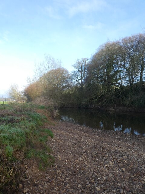
Anchoring Hill, located in Devon, is a prominent hill that offers breathtaking views and is a popular destination for nature enthusiasts and hikers alike. Standing at an elevation of approximately 300 meters, it is considered one of the highest points in the region.

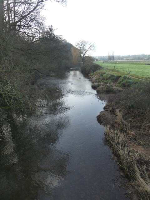
Covered in lush greenery, Anchoring Hill is a part of the renowned Dartmoor National Park, known for its rugged landscapes and rich biodiversity. The hill is characterized by its gently sloping sides, making it accessible to visitors of varying fitness levels. The summit provides panoramic vistas of the surrounding countryside, including rolling hills, picturesque valleys, and meandering rivers.

The hill's diverse flora and fauna add to its appeal, with an abundance of wildflowers, heather, and grasses covering the slopes. It is also home to a variety of wildlife, including birds of prey such as buzzards and kestrels, and occasionally, one might catch a glimpse of a deer or fox.

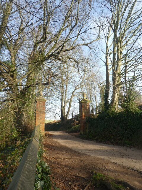
Anchoring Hill offers several well-marked walking trails, ranging from leisurely strolls to more challenging hikes, providing options for all types of outdoor enthusiasts. The paths wind through the hillside, offering stunning views at every turn. Additionally, the hill is a popular spot for paragliding, with its steady winds and open spaces attracting many adrenaline seekers.

The hill's location within Dartmoor National Park means that it is easily accessible, with ample parking and nearby facilities for visitors. Whether it is a leisurely walk, a picnic with a view, or an adventure-filled hike, Anchoring Hill offers a beautiful and invigorating experience for anyone seeking to immerse themselves in the natural beauty of Devon.

If you have any feedback on the listing, please let us know in the comments section below.

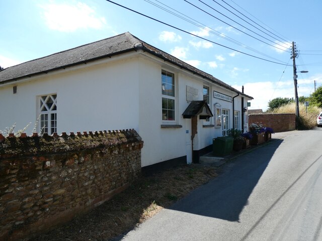
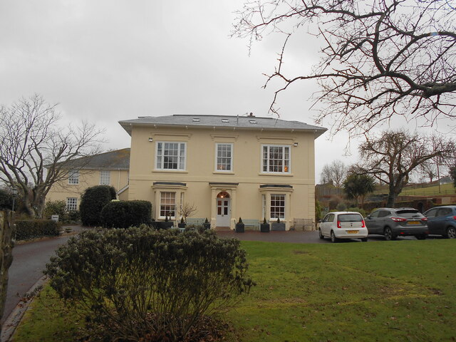
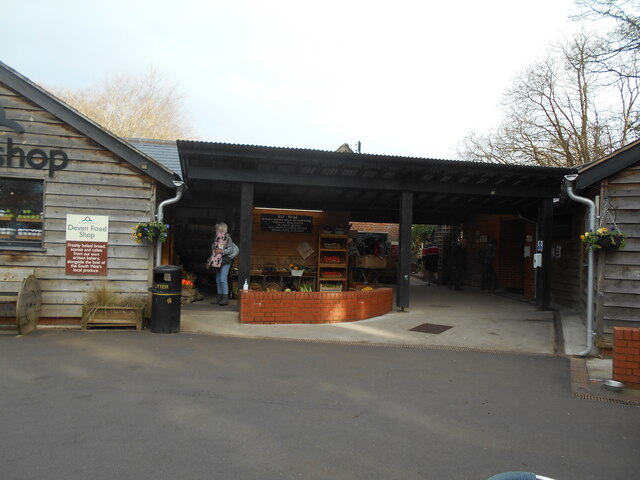
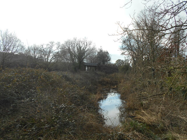
Anchoring Hill Images

Images are sourced within 2km of 50.662792/-3.2986567 or Grid Reference SY0885. Thanks to Geograph Open Source API. All images are credited.

West bank of River Otter, near Clamour Bridge The River Otter rises in the Blackdown Hills and flows south to enter the English Channel just east of Budleigh Salterton. It is 20 miles long.
Wikipedia: <span class="nowrap"><a title="http://en.wikipedia.org/wiki/River_Otter" rel="nofollow ugc noopener" href="http://en.wikipedia.org/wiki/River_Otter">Link</a><img style="margin-left:2px;" alt="External link" title="External link - shift click to open in new window" src="https://s1.geograph.org.uk/img/external.png" width="10" height="10"/></span>
West bank of River Otter, near Clamour Bridge
The River Otter rises in the Blackdown Hills and flows south to enter the English Channel just east of Budleigh Salterton. It is 20 miles long. Wikipedia: LinkExternal link
River Otter. looking south from Clamour Bridge The River Otter rises in the Blackdown Hills and flows south to enter the English Channel just east of Budleigh Salterton. It is 20 miles long.
Wikipedia: <span class="nowrap"><a title="http://en.wikipedia.org/wiki/River_Otter" rel="nofollow ugc noopener" href="http://en.wikipedia.org/wiki/River_Otter">Link</a><img style="margin-left:2px;" alt="External link" title="External link - shift click to open in new window" src="https://s1.geograph.org.uk/img/external.png" width="10" height="10"/></span>
River Otter. looking south from Clamour Bridge
The River Otter rises in the Blackdown Hills and flows south to enter the English Channel just east of Budleigh Salterton. It is 20 miles long. Wikipedia: LinkExternal link
Gateposts on cycle track from Otterton to White Bridge
Tranquil waters A small man made pool next to the Hermitage in Bicton Park.
Tranquil waters
A small man made pool next to the Hermitage in Bicton Park.
Village Shop Front view of Woods Village Shop in Colaton Raleigh, East Devon as seen from the passing B3178.
Village Shop
Front view of Woods Village Shop in Colaton Raleigh, East Devon as seen from the passing B3178.
Football pitch, Colaton Raleigh
Inscription over jubilee tap, Colaton Raleigh This recorded that this site was one of twelve public taps provided for the village of Colaton Raleigh in Queen Victoria's golden jubilee year
Inscription over jubilee tap, Colaton Raleigh
This recorded that this site was one of twelve public taps provided for the village of Colaton Raleigh in Queen Victoria's golden jubilee year
Jubilee tap in Colaton Raleigh Hidden behind parked cars, this tap was installed in 1887 to supply piped water to the village
Jubilee tap in Colaton Raleigh
Hidden behind parked cars, this tap was installed in 1887 to supply piped water to the village
Colaton Raleigh village hall
Plaque on Colaton Raleigh hall The building was opened in 1840 as the National School
Plaque on Colaton Raleigh hall
The building was opened in 1840 as the National School
St John the Baptist church, Colaton Raleigh
The Old Vicarage A throwback to the time when the parish church was large and prosperous and the incumbent had a large family.
The Old Vicarage
A throwback to the time when the parish church was large and prosperous and the incumbent had a large family.
Otterton mill farm shop Selling local groceries and fresh fruit.
Plus bread made from flour ground at the mill.
Otterton mill farm shop
Selling local groceries and fresh fruit. Plus bread made from flour ground at the mill.
No trains anymore The road bridge at Otterton . Now overgrown and waterlogged the track long since overgrown.
No trains anymore
The road bridge at Otterton . Now overgrown and waterlogged the track long since overgrown.
Footpath steps Steps off a public footpath at the rear of Ladram Bay caravan park.
Footpath steps
Steps off a public footpath at the rear of Ladram Bay caravan park.
Stream in Ottery Street It's wintertime. This feeder stream into the River Otter will dry up in the summer months.
Stream in Ottery Street
It's wintertime. This feeder stream into the River Otter will dry up in the summer months.
Big Bank in the lower Otter A new hedge, the Big Bank and two observation hides in the Lower Otter Restoration Project
Big Bank in the lower Otter
A new hedge, the Big Bank and two observation hides in the Lower Otter Restoration Project
The Big Bank observation hide, Lower Otter Restoration Project A path on an earth barrier, part of the Lower Otter Restoration Project
The Big Bank observation hide, Lower Otter Restoration Project
A path on an earth barrier, part of the Lower Otter Restoration Project
Show me another place!

Anchoring Hill is located at Grid Ref: SY0885 (Lat: 50.662792, Lng: -3.2986567)

Administrative County: Devon

District: East Devon

Police Authority: Devon and Cornwall

What 3 Words

///deodorant.defend.woes. Near Budleigh Salterton, Devon

Related Wikis

Otterton Mill

Otterton Water Mill is at the village of Otterton, near Budleigh Salterton in Devon, England. Otterton Water Mill is set beside the River Otter in Devon...

Otterton Priory

Otterton Priory was a priory in Otterton, Devon founded before 1087 and suppressed in 1414. The tower of the parish church is the major remaining structure...

Otterton

Otterton is a village and civil parish in East Devon, England. The parish lies on the English Channel and is surrounded clockwise from the south by the...

East Budleigh railway station

East Budleigh railway station is a closed railway station that served the villages of East Budleigh and Otterton in Devon, England. == History == It was...

River Otter, Devon

The River Otter is a river that rises in the Blackdown Hills just inside the county of Somerset, England near Otterford, then flows south through East...

Ladram Bay

Ladram Bay is a secluded bay with a pebble beach, on the south coast of Devon, England between the coastal towns of Budleigh Salterton and Sidmouth. It...

Salem Chapel, East Budleigh

Salem Chapel is in Vicarage Road, East Budleigh, Devon, England. Initially a Presbyterian, then a Congregational chapel, it was later owned by the Assemblies...

High Peak, Devon

High Peak (also known as Peak Hill) is a hill which is partially eroded, resulting in a cliff face, on the English Channel coast to the southwest of Sidmouth...

Nearby Amenities

Located within 500m of 50.662792,-3.2986567
Otterton
Place: village
Population: 656
Wikidata: Q984760
Wikimedia Commons: Category:Otterton
Wikipedia: en:Otterton
Lat/Long: 50.6594487/-3.2999929
Waterway: weir
Lat/Long: 50.662035/-3.3023769
Bus Stop
Otterton Green (E-bound)
Bench: yes
Bin: yes
Bus: yes
Naptan AtcoCode: 1100DEC10729
Naptan NaptanCode: dvngagjm
Public Transport: platform
Shelter: yes
Lat/Long: 50.659668/-3.3021188
Post Box
Check Date: 2023-06-29
Collection Times: Mo-Fr 09:00; Sa 07:00
Operator: Royal Mail
Operator Wikidata: Q638098
Post Box Mounting: pier
Post Box Type: lamp
Ref: EX9 4D
Royal Cypher: EIIR
Royal Cypher Wikidata: Q33102113
Source: survey
Lat/Long: 50.6597871/-3.3011283
Bus Stop
Otterton Green (W-bound)
Bench: no
Bin: no
Bus: yes
Naptan AtcoCode: 1100DEC10730
Naptan NaptanCode: dvngagjg
Public Transport: platform
Shelter: no
Lat/Long: 50.6595913/-3.3021853
Post Box
Check Date: 2023-06-29
Collection Times: Mo-Fr 09:00; Sa 07:00
Operator: Royal Mail
Operator Wikidata: Q638098
Post Box Mounting: brick_pillar
Post Box Type: wall
Ref: EX9 32D
Royal Cypher: EVIIR
Royal Cypher Wikidata: Q33102324
Lat/Long: 50.6597242/-3.3029322
Bus Stop
Bus: yes
Naptan AtcoCode: 1100DEC10731
Naptan NaptanCode: dvngagmt
Public Transport: platform
Shelter: yes
Lat/Long: 50.6604743/-3.2974114
Public Bookcase
Booth: K6
Covered: booth
Disused Amenity: telephone
Listed Status: Grade II
Man Made: telephone_box
Public Bookcase Type: phone_box
Lat/Long: 50.6603465/-3.2978693
Material: wood
Power: pole
Lat/Long: 50.6647199/-3.3039156
Material: wood
Power: pole
Lat/Long: 50.6656142/-3.303406
Material: wood
Power: pole
Lat/Long: 50.663824/-3.3044226
Barrier: kissing_gate
Bicycle: no
Foot: designated
Horse: no
Material: wood
Vehicle: no
Wheelchair: no
Lat/Long: 50.6606234/-3.3022341
Barrier: kissing_gate
Foot: yes
Horse: no
Material: metal
Vehicle: no
Lat/Long: 50.6662816/-3.2971745
Barrier: kissing_gate
Lat/Long: 50.6607469/-3.2998831
Barrier: kissing_gate
Lat/Long: 50.6618539/-3.2976886
Power: pole
Lat/Long: 50.6609355/-3.3044658
Power: pole
Lat/Long: 50.660694/-3.3020223
Power: pole
Lat/Long: 50.6607908/-3.3009706
Power: pole
Lat/Long: 50.6609643/-3.2989751
Material: wood
Power: pole
Lat/Long: 50.6587796/-3.2957196
Material: wood
Power: pole
Lat/Long: 50.6594256/-3.2962686
Defibrillator
Access: yes
Defibrillator Location: outside Otterton Village Hall, Fore Street, Otterton
Emergency: defibrillator
Indoor: no
Opening Hours: 24/7
Source: survey
Survey Date: 2023-03-18
Wheelchair: yes
Lat/Long: 50.6597187/-3.3005857
Post Box
Collection Times: Mo-Fr 09:00; Sa 07:00
Operator: Royal Mail
Operator Wikidata: Q638098
Post Box Mounting: building
Post Box Type: wall
Ref: EX9 47D
Royal Cypher: GR
Royal Cypher Wikidata: Q33102273
Lat/Long: 50.6602147/-3.2980261
Generator Method: photovoltaic
Generator Output Electricity: yes
Generator Source: solar
Generator Type: solar_photovoltaic_panel
Location: roof
Power: generator
Lat/Long: 50.6594818/-3.3011387
Generator Method: photovoltaic
Generator Output Electricity: yes
Generator Source: solar
Generator Type: solar_photovoltaic_panel
Location: roof
Power: generator
Lat/Long: 50.6595413/-3.30113
Generator Method: photovoltaic
Generator Output Electricity: yes
Generator Source: solar
Generator Type: solar_photovoltaic_panel
Location: roof
Power: generator
Lat/Long: 50.658774/-3.2968887
Generator Method: photovoltaic
Generator Output Electricity: yes
Generator Source: solar
Generator Type: solar_photovoltaic_panel
Location: roof
Power: generator
Lat/Long: 50.658663/-3.2976486
Generator Method: photovoltaic
Generator Output Electricity: yes
Generator Source: solar
Generator Type: solar_photovoltaic_panel
Location: roof
Power: generator
Lat/Long: 50.6602056/-3.296522
Generator Method: photovoltaic
Generator Output Electricity: yes
Generator Source: solar
Generator Type: solar_photovoltaic_panel
Location: roof
Power: generator
Lat/Long: 50.6603404/-3.2952936
Generator Method: photovoltaic
Generator Output Electricity: yes
Generator Source: solar
Generator Type: solar_photovoltaic_panel
Location: roof
Power: generator
Lat/Long: 50.6598039/-3.293408
Generator Method: photovoltaic
Generator Output Electricity: yes
Generator Source: solar
Generator Type: solar_photovoltaic_panel
Location: roof
Power: generator
Lat/Long: 50.6599731/-3.2931264
Bench
Backrest: yes
Material: wood
Lat/Long: 50.6596795/-3.3023501
Bench
Backrest: yes
Lat/Long: 50.6596756/-3.3022065
Fire Hydrant
Emergency: fire_hydrant
Fire Hydrant Type: underground
Survey Date: 2023-03-18
Lat/Long: 50.6643772/-3.2933517
Waste Basket
Survey Date: 2023-03-18
Waste: dog_excrement
Lat/Long: 50.6621934/-3.2960983
Waste Basket
Survey Date: 2023-03-18
Lat/Long: 50.6596747/-3.3022378
Fire Hydrant
Emergency: fire_hydrant
Fire Hydrant Type: underground
Survey Date: 2023-03-18
Lat/Long: 50.6600464/-3.2991598
Fire Hydrant
Emergency: fire_hydrant
Fire Hydrant Type: underground
Survey Date: 2023-03-18
Lat/Long: 50.6610025/-3.2968832
Vending Machine
Vending: milk
Lat/Long: 50.6596119/-3.303592
Bench
Backrest: yes
Material: wood
Lat/Long: 50.6596533/-3.3008257
Addr City: Budleigh Salterton
Addr Housename: Kittiwake
Addr Postcode: EX9 7JF
Addr Street: Ropers Lane
Addr Suburb: Otterton
Lat/Long: 50.6595126/-3.3006004
Entrance: yes
Lat/Long: 50.6597053/-3.3006713
Entrance: yes
Lat/Long: 50.6595916/-3.3007597
Entrance: yes
Lat/Long: 50.6594979/-3.3006174
Otterton Community Shop
Addr City: Budleigh Salterton
Addr Housename: The Village Hall
Addr Postcode: EX9 7HB
Addr Street: Fore Street
Addr Suburb: Otterton
Opening Hours: Mo-Fr 08:00-18:00; Sa 08:00-15:00; Su 08:30-12:00
Shop: convenience
Lat/Long: 50.6595802/-3.3007338
Community Centre
Otterton Village Hall
Addr City: Buddleigh Salterton
Addr Housename: Otterton Village Hall
Addr Street: Fore Street
Addr Suburb: Otterton
Community Centre: village_hall
Lat/Long: 50.6596809/-3.3006734
Bench
Backrest: no
Material: stone
Lat/Long: 50.659669/-3.3025369
Bench
Backrest: yes
Material: wood
Lat/Long: 50.6598425/-3.3027381
Bench
Backrest: yes
Material: wood
Lat/Long: 50.659757/-3.3024571
Parsons Pitch
Addr City: Budleigh Salterton
Addr Housename: Parsons Pitch
Addr Housenumber: 1
Addr Postcode: EX9 7HQ
Addr Street: The Green
Addr Suburb: Otterton
Lat/Long: 50.6595606/-3.3022157
Addr City: Budleigh Salterton
Addr Housenumber: 3
Addr Postcode: EX9 7HQ
Addr Street: The Green
Addr Suburb: Otterton
Lat/Long: 50.6595555/-3.3023103
Addr City: Budleigh Salterton
Addr Housenumber: 5
Addr Postcode: EX9 7HQ
Addr Street: The Green
Addr Suburb: Otterton
Lat/Long: 50.6595513/-3.3023874
Addr City: Budleigh Salterton
Addr Housenumber: 7
Addr Postcode: EX9 7HQ
Addr Street: The Green
Addr Suburb: Otterton
Lat/Long: 50.6595449/-3.3024839
Addr City: Budleigh Salterton
Addr Housenumber: 9
Addr Postcode: EX9 7HQ
Addr Street: The Green
Addr Suburb: Otterton
Lat/Long: 50.6595398/-3.3025838
Addr City: Budleigh Salterton
Addr Housenumber: 11
Addr Postcode: EX9 7HQ
Addr Street: The Green
Addr Suburb: Otterton
Lat/Long: 50.6595356/-3.3026469
Addr City: Budleigh Salterton
Addr Housenumber: 15
Addr Postcode: EX9 7HQ
Addr Street: The Green
Addr Suburb: Otterton
Lat/Long: 50.6595322/-3.3027361
Addr City: Budleigh Salterton
Addr Housenumber: 17
Addr Postcode: EX9 7HQ
Addr Street: The Green
Addr Suburb: Otterton
Lat/Long: 50.6595266/-3.3028796
Entrance: yes
Lat/Long: 50.6596765/-3.3030725
Addr City: Budleigh Salterton
Addr Housename: Mill House
Addr Housenumber: 26
Addr Postcode: EX9 7HQ
Addr Street: The Green
Lat/Long: 50.6596937/-3.3030801
Access: yes
Entrance: yes
Lat/Long: 50.6596165/-3.3035925
Addr City: Budleigh Salterton
Addr Housename: The Lawn
Addr Housenumber: 64
Addr Postcode: EX9 7HB
Addr Street: Fore Street
Addr Suburb: Otterton
Lat/Long: 50.6598905/-3.3016276
Addr City: Budleigh Salterton
Addr Housename: Brook Villas
Addr Housenumber: 66
Addr Postcode: EX9 7HB
Addr Street: Fore Street
Addr Suburb: Otterton
Lat/Long: 50.6597477/-3.3017892
Addr City: Budleigh Salterton
Addr Housename: Brook Villas
Addr Housenumber: 68
Addr Postcode: EX9 7HB
Addr Street: Fore Street
Addr Suburb: Otterton
Lat/Long: 50.6597549/-3.3018858
Addr City: Budleigh Salterton
Addr Housename: Brook Barn
Addr Postcode: EX9 7JD
Addr Street: Maunders Hill
Addr Suburb: Otterton
Lat/Long: 50.6594676/-3.3017296
Addr City: Budleigh Salterton
Addr Housenumber: 57
Addr Postcode: EX9 7HB
Addr Street: Fore Street
Addr Suburb: Otterton
Lat/Long: 50.6595921/-3.3009906
Addr City: Budleigh Salterton
Addr Housenumber: 59
Addr Postcode: EX9 7HB
Addr Street: Fore Street
Addr Suburb: Otterton
Lat/Long: 50.6595649/-3.3011033
Addr City: Budleigh Salterton
Addr Housename: Otter House
Addr Housenumber: 61
Addr Postcode: EX9 7HB
Addr Street: Fore Street
Addr Suburb: Otterton
Lat/Long: 50.6596261/-3.3013628
Addr City: Budleigh Salterton
Addr Housenumber: 63
Addr Postcode: EX9 7HB
Addr Street: Fore Street
Addr Suburb: Otterton
Lat/Long: 50.6596123/-3.3015291
Addr City: Budleigh Salterton
Addr Housenumber: 65
Addr Postcode: EX9 7HB
Addr Street: Fore Street
Addr Suburb: Otterton
Lat/Long: 50.6596038/-3.3015998
Addr City: Budleigh Salterton
Addr Housenumber: 67
Addr Postcode: EX9 7HB
Addr Street: Fore Street
Addr Suburb: Otterton
Lat/Long: 50.6595981/-3.3016655
Addr City: Budleigh Salterton
Addr Housename: Brook House
Addr Housenumber: 69
Addr Postcode: EX9 7HB
Addr Street: Fore Street
Addr Suburb: Otterton
Lat/Long: 50.6595853/-3.3017812
Addr City: Budleigh Salterton
Addr Housename: Willow Cottage
Addr Housenumber: 71
Addr Postcode: EX9 7HB
Addr Street: Fore Street
Addr Suburb: Otterton
Lat/Long: 50.6595679/-3.3019274
Addr City: Budleigh Salterton
Addr Housename: Flintstone Lodge
Addr Postcode: EX9 7HB
Addr Street: Fore Street
Addr Suburb: Otterton
Lat/Long: 50.6597162/-3.2996944
Addr City: Budleigh Salterton
Addr Housename: Basclose
Addr Postcode: EX9 7HB
Addr Street: Fore Street
Addr Suburb: Otterton
Lat/Long: 50.6598697/-3.3007928
Addr City: Budleigh Salterton
Addr Housenumber: 46
Addr Postcode: EX9 7HB
Addr Street: Fore Street
Addr Suburb: Otterton
Lat/Long: 50.6599674/-3.3002215
Addr City: Budleigh Salterton
Addr Housenumber: 48
Addr Postcode: EX9 7HB
Addr Street: Fore Street
Addr Suburb: Otterton
Lat/Long: 50.6599534/-3.3003033
Addr City: Budleigh Salterton
Addr Housenumber: 50
Addr Postcode: EX9 7HB
Addr Street: Fore Street
Addr Suburb: Otterton
Lat/Long: 50.6599402/-3.3003804
Addr City: Budleigh Salterton
Addr Housenumber: 52
Addr Postcode: EX9 7HB
Addr Street: Fore Street
Addr Suburb: Otterton
Lat/Long: 50.6599232/-3.3004683
Addr City: Budleigh Salterton
Addr Housenumber: 54
Addr Postcode: EX9 7HB
Addr Street: Fore Street
Addr Suburb: Otterton
Lat/Long: 50.659913/-3.3005501
Addr City: Budleigh Salterton
Addr Housenumber: 2
Addr Postcode: EX9 7JB
Addr Street: Maunders Hill
Addr Suburb: Otterton
Lat/Long: 50.6591011/-3.30181
Addr City: Budleigh Salterton
Addr Housenumber: 1
Addr Postcode: EX9 7JB
Addr Street: Maunders Hill
Addr Suburb: Otterton
Lat/Long: 50.6591832/-3.3018248
Addr City: Budleigh Salterton
Addr Housenumber: 4
Addr Postcode: EX9 7JB
Addr Street: Ropers Court
Addr Suburb: Otterton
Lat/Long: 50.6589098/-3.3013071
Addr City: Budleigh Salterton
Addr Housenumber: 3
Addr Postcode: EX9 7JB
Addr Street: Ropers Court
Lat/Long: 50.6589651/-3.3013326
Addr City: Budleigh Salterton
Addr Housenumber: 2
Addr Postcode: EX9 7JB
Addr Street: Ropers Court
Addr Suburb: Otterton
Lat/Long: 50.6590433/-3.3014439
Addr City: Budleigh Salterton
Addr Housenumber: 1
Addr Postcode: EX9 7JB
Addr Street: Ropers Court
Addr Suburb: Otterton
Lat/Long: 50.6590412/-3.3015297
Barrier: kissing_gate
Lat/Long: 50.6663086/-3.29718
Barrier: kissing_gate
Foot: yes
Horse: yes
Material: metal
Vehicle: no
Lat/Long: 50.6649682/-3.2982413
Bench
Backrest: yes
Material: wood
Lat/Long: 50.6663347/-3.2976077
Man Made: watermill
Tourism: attraction
Lat/Long: 50.6595385/-3.3033141
Shop: gift
Tourism: artwork
Lat/Long: 50.6595109/-3.3032168
Hiking: yes
Information: guidepost
Tourism: information
Lat/Long: 50.6620635/-3.2932947
The data included in this document is from www.openstreetmap.org. The data is made available under ODbL.

Have you been to Anchoring Hill?

Leave your review of Anchoring Hill below (or comments, questions and feedback).