Aird nan Giullan

Hill, Mountain in Argyllshire

Scotland

Aird nan Giullan

The A849 Near Ardfenaig.
The A849 Credit: Andrew Abbott

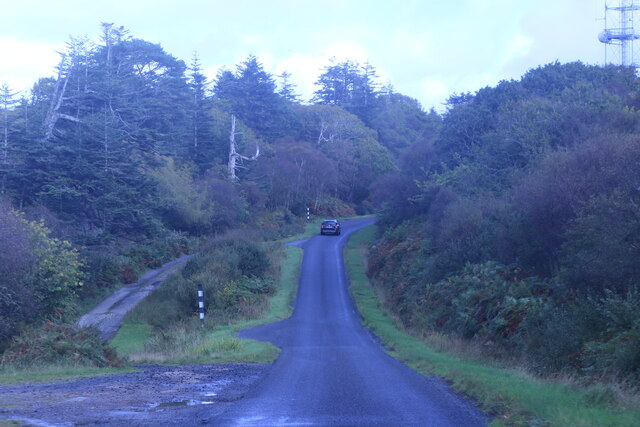
Aird nan Giullan is a prominent hill located in Argyllshire, Scotland. Situated in the picturesque region of Argyll and Bute, it offers breathtaking views of the surrounding landscape. With a height of approximately 1,358 feet (414 meters), it is classified as a mountain.

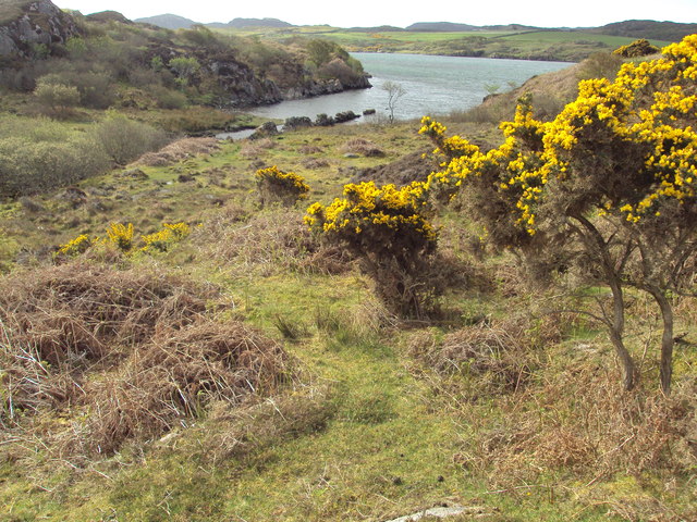
The hill is characterized by its rugged terrain and rocky slopes, making it a challenging yet rewarding destination for hikers and outdoor enthusiasts. Its strategic location provides panoramic vistas of the nearby Loch Long and Loch Goil, as well as the expansive forests and rolling hills of the surrounding area.

Aird nan Giullan is well-known for its diverse wildlife and is home to a variety of bird species, including golden eagles, buzzards, and falcons. The hill's vegetation consists of heather, grasses, and scattered trees, adding to its natural beauty.

Reaching the summit of Aird nan Giullan requires a moderate level of fitness and hiking experience. There are several well-marked trails leading to the top, offering different levels of difficulty and distance. As visitors ascend, they can expect to encounter steep sections, rocky outcrops, and potentially challenging weather conditions, particularly during the winter months.

For those who manage to conquer the hill, the reward is a breathtaking view of the Scottish Highlands. The surrounding landscape, with its pristine lochs and rolling hills, provides a tranquil and awe-inspiring experience for all who venture to Aird nan Giullan.

If you have any feedback on the listing, please let us know in the comments section below.

Aird nan Giullan Images

Images are sourced within 2km of 56.325091/-6.2917905 or Grid Reference NM3423. Thanks to Geograph Open Source API. All images are credited.

The A849 Near Ardfenaig.
The A849
Near Ardfenaig.
Forecourt of Ardfenaig filling station
Ardfenaig Filling Station
A849 near Tiraghoil
A849 near Tiraghoil
Gated field entrance
A849 towards Fionnphort
Aird an Daraich Looking northeast across Loch Scridain to Bearreach. Remains of old oaks occur in the near fields [Daraich is 'oak' in the Gaelic]
Aird an Daraich
Looking northeast across Loch Scridain to Bearreach. Remains of old oaks occur in the near fields [Daraich is 'oak' in the Gaelic]
Tiraghoil and the A849 The road leads to the Iona Ferry at Fionnphort, 6km further on.
Tiraghoil and the A849
The road leads to the Iona Ferry at Fionnphort, 6km further on.
Lazy beds at Aird an Daraich By Ardness House near Bunessan on the A849 road to Fionnphort. The old traditional crofting method of cultivation, particularly of potatoes, by laying them on the surface and covering with seaweed and soil from the side [a precursor to modern raised beds; nothing is new!].
Lazy beds at Aird an Daraich
By Ardness House near Bunessan on the A849 road to Fionnphort. The old traditional crofting method of cultivation, particularly of potatoes, by laying them on the surface and covering with seaweed and soil from the side [a precursor to modern raised beds; nothing is new!].
Ardness House B&B An excellent B&B and base for Geographing, on the A849 west of Bunessan and 6km from the Iona Ferry.
Ardness House B&B
An excellent B&B and base for Geographing, on the A849 west of Bunessan and 6km from the Iona Ferry.
Sheep on Aird an Daraich Looking out to Loch na Lathaich at Bunessan.
Sheep on Aird an Daraich
Looking out to Loch na Lathaich at Bunessan.
Aird an Daraich A view across Loch na Lathaich, and the headland of Eorabus, to Bearraich.
Aird an Daraich
A view across Loch na Lathaich, and the headland of Eorabus, to Bearraich.
Mòine na Cuaiche Traditional and modern building styles near Fionnphort.
Mòine na Cuaiche
Traditional and modern building styles near Fionnphort.
Aird an Daraich Looking towards Loch na Lathaich and the distant mountains of Creach Bheinn and Bein na Sreine.
Aird an Daraich
Looking towards Loch na Lathaich and the distant mountains of Creach Bheinn and Bein na Sreine.
Loch na Lathaich View Looking across Loch na Lathaich to the distant mountains of Creach Bheinn and Bein na Sreine.
Loch na Lathaich View
Looking across Loch na Lathaich to the distant mountains of Creach Bheinn and Bein na Sreine.
An t-Aird summit Rocks, heather & grass
An t-Aird summit
Rocks, heather & grass
Minor inlet on Loch Caol
Rocky beach on Loch na Lathaich, Isle of Mull
Show me another place!

Aird nan Giullan is located at Grid Ref: NM3423 (Lat: 56.325091, Lng: -6.2917905)

Unitary Authority: Argyll and Bute

Police Authority: Argyll and West Dunbartonshire

What 3 Words

///aced.spearing.homework. Near Fionnphort, Argyll & Bute

Related Wikis

Camas Tuath

Camas Tuath (Scottish Gaelic: north bay) is an inlet bay on the Ross of Mull. The bay has two small tidal islands and two Quarrymans' Cottages which the...

Ross of Mull

The Ross of Mull (Scottish Gaelic: An Ros Mhuileach) is the largest peninsula of the Isle of Mull, about 28 kilometres (17 mi) long, and makes up the south...

Suidhe

Suidhe (Scottish Gaelic: Suidhe) is a ruined township located on the southwestern peninsula of the Isle of Mull, Scotland. It lies just over 1 km to the...

Aridhglas

Aridhglas is a village on the Ross of Mull, Isle of Mull in Argyll and Bute, Scotland. == References ==

Bunessan

Bunessan (Scottish Gaelic: Bun Easain) is a small village on the Ross of Mull in the south-west of the Isle of Mull, off the west coast of Scotland. The...

Knocknafenaig

Knocknafenaig (Scottish Gaelic: Cnoc na Fennaig) is a ruined township on the Isle of Mull, Scotland. Located in the south-western portion of the island...

Kintra

Kintra (Scottish Gaelic: Ceann na Tràgha), literally "country" in Scots is a settlement on the North-Western coast of the Ross of Mull, Scotland. The settlement...

Fionnphort

Fionnphort (English: , Scottish Gaelic: [ˈfjun̪ˠafɔrˠt̪]) is the principal port of the Ross of Mull, and the second largest settlement in the area (its...

Nearby Amenities

Located within 500m of 56.325091,-6.2917905
Source: PGS
Lat/Long: 56.3257674/-6.2838713
Source: PGS
Lat/Long: 56.3259917/-6.2839625
Source: PGS
Lat/Long: 56.3259949/-6.2844293
Source: PGS
Lat/Long: 56.326249/-6.2848036
Source: PGS
Lat/Long: 56.3264287/-6.2852818
Source: PGS
Lat/Long: 56.3269913/-6.2856718
Source: PGS
Lat/Long: 56.3271449/-6.2860691
Source: PGS
Lat/Long: 56.3262798/-6.286506
Source: PGS
Lat/Long: 56.3263466/-6.2872015
Source: PGS
Lat/Long: 56.3265034/-6.2878962
Source: PGS
Lat/Long: 56.3265431/-6.2884956
Source: PGS
Lat/Long: 56.3268492/-6.2902914
Source: PGS
Lat/Long: 56.326239/-6.2908452
Source: PGS
Lat/Long: 56.3257069/-6.2907764
Source: PGS
Lat/Long: 56.3253855/-6.2908294
Created By: dmgroom_coastlines
Source: PGS
Lat/Long: 56.32485/-6.2905
Source: PGS
Lat/Long: 56.3248528/-6.29005
Source: PGS
Lat/Long: 56.3245838/-6.2896764
Source: PGS
Lat/Long: 56.324288/-6.2900068
Source: PGS
Lat/Long: 56.3249221/-6.2971283
Source: PGS
Lat/Long: 56.3245399/-6.2975269
Source: PGS
Lat/Long: 56.3238388/-6.2918814
Source: PGS
Lat/Long: 56.3232359/-6.2897968
Created By: dmgroom_coastlines
Source: PGS
Lat/Long: 56.32251/-6.28928
Created By: dmgroom_coastlines
Source: PGS
Lat/Long: 56.32238/-6.28883
Source: PGS
Lat/Long: 56.3219452/-6.287187
Source: PGS
Lat/Long: 56.322143/-6.2869606
Source: PGS
Lat/Long: 56.322685/-6.2872921
Source: PGS
Lat/Long: 56.3230559/-6.287092
Created By: dmgroom_coastlines
Source: PGS
Lat/Long: 56.32322/-6.28693
Source: PGS
Lat/Long: 56.3231591/-6.2867219
Source: PGS
Lat/Long: 56.323069/-6.286208
Source: PGS
Lat/Long: 56.3231314/-6.285841
Source: PGS
Lat/Long: 56.3233081/-6.2854983
Created By: dmgroom_coastlines
Source: PGS
Lat/Long: 56.32358/-6.28552
Passing Place
Source: Bing
Lat/Long: 56.3213701/-6.2882048
Passing Place
Source: Bing
Lat/Long: 56.3241334/-6.2982642
Man Made: mast
Source: Bing
Tower Type: communication
Lat/Long: 56.3232166/-6.2944524
Passing Place
Source: Bing
Lat/Long: 56.3226272/-6.2915819
Generator Method: wind_turbine
Generator Source: wind
Power: generator
Lat/Long: 56.3266077/-6.2988272
Generator Method: wind_turbine
Generator Source: wind
Power: generator
Lat/Long: 56.3269869/-6.2990391
Power: pole
Lat/Long: 56.3219853/-6.288026
Power: pole
Lat/Long: 56.3226836/-6.2895253
Power: pole
Lat/Long: 56.3232302/-6.290625
Power: pole
Lat/Long: 56.3236912/-6.291592
Power: pole
Lat/Long: 56.3242296/-6.2946081
Power: pole
Lat/Long: 56.3244721/-6.2965554
Eilean An T-sionnaich
Historic: Dun
Lat/Long: 56.3234362/-6.2861704
Power: pole
Lat/Long: 56.3272522/-6.2949228
Power: pole
Lat/Long: 56.3265386/-6.2961351
Power: pole
Lat/Long: 56.3260452/-6.2969411
Power: pole
Lat/Long: 56.3255414/-6.2975753
Power: pole
Lat/Long: 56.3248662/-6.2987184
Power: pole
Lat/Long: 56.3247215/-6.2979057
The data included in this document is from www.openstreetmap.org. The data is made available under ODbL.

Have you been to Aird nan Giullan?

Leave your review of Aird nan Giullan below (or comments, questions and feedback).