Sìdhean Cnoc na Buaile
Hill, Mountain in Ross-shire
Scotland
Sìdhean Cnoc na Buaile

Sìdhean Cnoc na Buaile is a prominent hill located in Ross-shire, Scotland. Standing at an elevation of approximately 563 meters (1,847 feet), it is a well-known landmark in the area. The hill is part of the larger Scottish Highlands region, renowned for its stunning natural beauty and rugged landscapes.
Sìdhean Cnoc na Buaile offers breathtaking panoramic views of the surrounding countryside, including the picturesque Strathconon Valley and the nearby mountains. On a clear day, it is possible to see as far as the Moray Firth and the Black Isle. The hill is covered in heather and grass, creating a vibrant and colorful landscape during the summer months.
The hill is a popular destination for outdoor enthusiasts, including hikers and nature lovers. A well-maintained path leads to the summit, providing a relatively easy climb for experienced walkers. The ascent offers a chance to observe local wildlife, such as deer and various bird species that inhabit the area.
At the summit of Sìdhean Cnoc na Buaile, visitors are rewarded with breathtaking views in all directions. The hill is particularly popular during sunrise and sunset, when the changing colors of the sky create a magical atmosphere. The peaceful and serene environment also makes it an ideal spot for picnics and relaxation.
Sìdhean Cnoc na Buaile, with its natural beauty and stunning vistas, is a must-visit for those exploring the Scottish Highlands. It provides a memorable experience for anyone seeking to immerse themselves in the splendor of this picturesque region.
If you have any feedback on the listing, please let us know in the comments section below.
Sìdhean Cnoc na Buaile Images
Images are sourced within 2km of 58.271572/-6.7976528 or Grid Reference NB1841. Thanks to Geograph Open Source API. All images are credited.


Sìdhean Cnoc na Buaile is located at Grid Ref: NB1841 (Lat: 58.271572, Lng: -6.7976528)
Unitary Authority: Na h-Eileanan an Iar
Police Authority: Highlands and Islands
What 3 Words
///beamed.flatten.strutted. Near Carloway, Na h-Eileanan Siar
Nearby Locations
Related Wikis

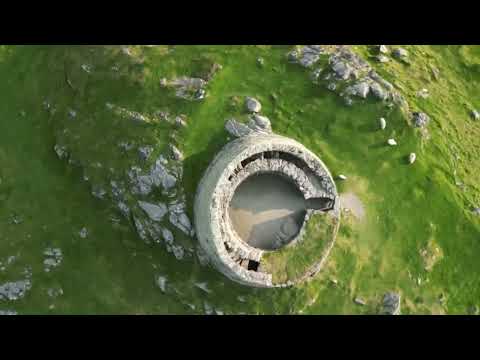
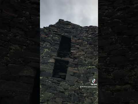
Dun Carloway
Dun Carloway (Scottish Gaelic: Dùn Chàrlabhaigh) is a broch situated in the district of Carloway, on the west coast of the Isle of Lewis, Scotland (grid...

Borrowston, Lewis
Borrowston (Scottish Gaelic: Borghastan), with a population of about 50, is a crofting township situated on the Isle of Lewis, on the Outer Hebrides of...

Carloway
Carloway (Scottish Gaelic: Càrlabhagh [ˈkʰaːɾɫ̪ə.ɤː]) is a crofting township and a district on the west coast of the Isle of Lewis, in the Outer Hebrides...

Garenin
Garenin (Scottish Gaelic: Na Gearrannan) is a crofting township on the west coast of the Isle of Lewis in the Outer Hebrides of Scotland. Garenin is in...
Related Videos

Alpkit Kangri Carloway Trip
Gusting up to 50mph in Carloway, the Kangri never moved an inch.

Nearby Amenities
Located within 500m of 58.271572,-6.7976528Have you been to Sìdhean Cnoc na Buaile?
Leave your review of Sìdhean Cnoc na Buaile below (or comments, questions and feedback).