Cnoc a' Charnain

Hill, Mountain in Ross-shire

Scotland

Cnoc a' Charnain

Dun in Loch an Dùnain Relatively well preserved dun close to the main road <span class="nowrap"><a title="https://canmore.org.uk/site/4092/lewis-loch-an-duin" rel="nofollow ugc noopener" href="https://canmore.org.uk/site/4092/lewis-loch-an-duin">Link</a><img style="margin-left:2px;" alt="External link" title="External link - shift click to open in new window" src="https://s1.geograph.org.uk/img/external.png" width="10" height="10"/></span>
Dun in Loch an Dùnain Credit: Sandy Gerrard

Cnoc a' Charnain, located in Ross-shire, Scotland, is a prominent hill that boasts stunning views and natural beauty. With an elevation of approximately 337 meters (1106 feet), it offers a moderately challenging climb suitable for outdoor enthusiasts of all levels.

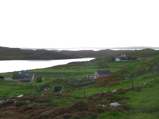
Situated in a picturesque rural area, Cnoc a' Charnain is surrounded by rolling green hills, lush meadows, and scattered woodlands. The hill itself is characterized by its smooth slopes and a distinctive rocky outcrop at its summit, providing hikers with a rewarding panoramic view of the surrounding countryside.

The ascent to the top of Cnoc a' Charnain is mainly along well-defined paths and trails, making it easily accessible for walkers. Along the way, visitors can appreciate the diverse flora and fauna, with wildflowers and heather adorning the landscape during the warmer months. Birdwatchers may also catch a glimpse of various species, including buzzards and golden eagles that inhabit the region.

One of the highlights of Cnoc a' Charnain is its historical significance. The hill is believed to have been used as a lookout point during ancient times, with evidence of Iron Age settlements and structures discovered in the vicinity. This adds an extra layer of intrigue to the hike, allowing visitors to appreciate the hill's cultural heritage.

Overall, Cnoc a' Charnain provides a delightful outdoor experience for nature enthusiasts and history buffs alike. Its captivating views, diverse wildlife, and historical significance make it a must-visit destination for those exploring the natural wonders of Ross-shire.

If you have any feedback on the listing, please let us know in the comments section below.

Cnoc a' Charnain Images

Images are sourced within 2km of 58.251045/-6.8007431 or Grid Reference NB1839. Thanks to Geograph Open Source API. All images are credited.

Dun in Loch an Dùnain Relatively well preserved dun close to the main road <span class="nowrap"><a title="https://canmore.org.uk/site/4092/lewis-loch-an-duin" rel="nofollow ugc noopener" href="https://canmore.org.uk/site/4092/lewis-loch-an-duin">Link</a><img style="margin-left:2px;" alt="External link" title="External link - shift click to open in new window" src="https://s1.geograph.org.uk/img/external.png" width="10" height="10"/></span>
Dun in Loch an Dùnain
Relatively well preserved dun close to the main road LinkExternal link
Doune Carloway, Loch an Dùin and the coast View to the west from <a href="https://www.geograph.org.uk/photo/7630291">NB1941 : Broch at Doune Carloway</a> past  Loch an Dùin and the edge of the village, towards the coast.
Doune Carloway, Loch an Dùin and the coast
View to the west from NB1941 : Broch at Doune Carloway past Loch an Dùin and the edge of the village, towards the coast.
View from Dun Carloway Broch - Loch an Dùin Looking south from <a href="https://www.geograph.org.uk/photo/7630291">NB1941 : Broch at Doune Carloway</a>.
View from Dun Carloway Broch - Loch an Dùin
Looking south from NB1941 : Broch at Doune Carloway.
Doune Braes Hotel
Doune Braes Hotel
Loch an Dùnain
Loch an Dùnain
Isle of Lewis, Loch an Dùnain
View towards Tolsta Chaolais
West Point
West Point
The Road to Tolsta Chaolais
Lazy beds below Cnoc Buaile Fang, Isle of Lewis
Dun Charlabhaigh
Dun Charlabhaigh
Loch a' Bhaile The narrow loch, hemmed in by steep hillsides, flows out into Loch Rog an Ear, a sea loch, via a short river.
Loch a' Bhaile
The narrow loch, hemmed in by steep hillsides, flows out into Loch Rog an Ear, a sea loch, via a short river.
Loch a' Bhaile Loch a' Bhaile & Tolastadh a' Chaolais beyond.
Loch a' Bhaile
Loch a' Bhaile & Tolastadh a' Chaolais beyond.
Tolstachaolais: the post office While many post offices have a buzzer which sounds as the door opens, the postmistress here is alerted to the arrival of customers by the loud bark of the dog tethered to the outside wall.
Tolstachaolais: the post office
While many post offices have a buzzer which sounds as the door opens, the postmistress here is alerted to the arrival of customers by the loud bark of the dog tethered to the outside wall.
Tolstachaolais: along the shore of Loch a' Bhaile Looking across the loch, which runs alongside the road through the village. However, this is the far side that we are looking along.
Tolstachaolais: along the shore of Loch a' Bhaile
Looking across the loch, which runs alongside the road through the village. However, this is the far side that we are looking along.
Tolstachaolais: postbox № HS2 62 This postbox stands more or less in the centre of the village, in front of a house that is set particularly well back from the road. The larger-scale map still marks that house as a post office, although it has actually (as reflected in the 1:50,000 and 1:25,000 map) relocated just over a kilometre to the north - see <a href="https://www.geograph.org.uk/photo/3086624">NB1939 : Tolstachaolais: the post office</a>.
Tolstachaolais: postbox № HS2 62
This postbox stands more or less in the centre of the village, in front of a house that is set particularly well back from the road. The larger-scale map still marks that house as a post office, although it has actually (as reflected in the 1:50,000 and 1:25,000 map) relocated just over a kilometre to the north - see NB1939 : Tolstachaolais: the post office.
Tolstachaolais: Loch a’ Bhaile Looking down this loch from its northern end, with the main part of the village visible far right.
Tolstachaolais: Loch a’ Bhaile
Looking down this loch from its northern end, with the main part of the village visible far right.
Loch a' Bhaile In the crofting community of Tolastadh a' Chaolais.
Loch a' Bhaile
In the crofting community of Tolastadh a' Chaolais.
Show me another place!

Cnoc a' Charnain is located at Grid Ref: NB1839 (Lat: 58.251045, Lng: -6.8007431)

Unitary Authority: Na h-Eileanan an Iar

Police Authority: Highlands and Islands

What 3 Words

///betrayed.townhouse.sweeper. Near Carloway, Na h-Eileanan Siar

Related Wikis

Tolsta Chaolais

Tolsta Chaolais (also Tolastadh Chaolais, Tolstadh a' Chaolais) is a village on the Isle of Lewis, Scotland. It consists of about forty houses, clustered...

Dun Carloway

Dun Carloway (Scottish Gaelic: Dùn Chàrlabhaigh) is a broch situated in the district of Carloway, on the west coast of the Isle of Lewis, Scotland (grid...

Breaclete

Breacleit (or Roulanish; Scottish Gaelic: Breacleit; Old Norse: Breiðiklettr) is the central village on Great Bernera in the Outer Hebrides, Scotland....

Borrowston, Lewis

Borrowston (Scottish Gaelic: Borghastan), with a population of about 50, is a crofting township situated on the Isle of Lewis, on the Outer Hebrides of...

Nearby Amenities

Located within 500m of 58.251045,-6.8007431
Creag Ruadh
Place: locality
Lat/Long: 58.2505442/-6.7942492
Cnocan Òis
Place: locality
Lat/Long: 58.2487488/-6.8010298
Sgeir a' Chàrrain
Place: locality
Lat/Long: 58.2492344/-6.8021027
Creag Àrd
Place: locality
Lat/Long: 58.2499119/-6.7998067
Rubha Geodha na Cloinne
Natural: cape
Lat/Long: 58.2505893/-6.8035189
Cnoc a' Charnain
Place: locality
Lat/Long: 58.2516055/-6.8008367
Druim Teanraigir
Place: locality
Lat/Long: 58.2514249/-6.798369
Loch Shiadair
Natural: bay
Lat/Long: 58.2491102/-6.7948714
Òs Shiadair
Natural: bay
Lat/Long: 58.2474616/-6.80118
The data included in this document is from www.openstreetmap.org. The data is made available under ODbL.

Have you been to Cnoc a' Charnain?

Leave your review of Cnoc a' Charnain below (or comments, questions and feedback).