Cnoc Falasgair

Hill, Mountain in Ross-shire

Scotland

Cnoc Falasgair

Heronry on cliff face, Loch Rog Beag, North Harris These herons are very unusual nesting on the open cliff face rather than in tree tops.  The eggs are very vulnerable to predation by Buzzards and Ravens.  Despite our guided tour RIB remaining well away we observed 2 eggs being taken by groups of Ravens attacking, distracting the parents and "sneaking in".  Nature is hard to observe sometimes.
Heronry on cliff face, Loch Rog Beag, North Harris Credit: Hazel Hambidge

Cnoc Falasgair, located in Ross-shire, Scotland, is a prominent hill/mountain that stands at an impressive height of 586 meters (1,923 feet). Situated in the Northwest Highlands, it is part of the Torridon Range, renowned for its rugged beauty and stunning landscapes.

The name "Cnoc Falasgair" is derived from the Gaelic language and translates to "Hill of the Hunter." This name is fitting, as the hill offers a haven for outdoor enthusiasts and nature lovers alike. The terrain consists of rocky slopes, heather-covered moorland, and scattered patches of woodland, creating a diverse and visually striking environment.

Ascending Cnoc Falasgair rewards climbers with breathtaking panoramic views of the surrounding countryside. To the north, the tranquil waters of Loch Maree stretch out, bordered by rolling hills and verdant forests. The majestic peaks of Beinn Eighe and Liathach dominate the southern horizon, standing tall and proud.

The hill is a popular destination for hikers and mountaineers, offering a variety of routes suitable for different skill levels. The ascent can be challenging, particularly in inclement weather conditions, so proper equipment and navigation skills are essential. However, the effort is rewarded with an invigorating and unforgettable experience in one of Scotland’s most picturesque regions.

Cnoc Falasgair and its surrounding area also provide habitat for a diverse range of flora and fauna. The hillside is home to various species of birds, including golden eagles and peregrine falcons, as well as red deer and mountain hares.

In summary, Cnoc Falasgair is a captivating hill/mountain in Ross-shire, boasting stunning views, a challenging ascent, and rich biodiversity. It is a must-visit destination for those seeking adventure and natural beauty in the Scottish Highlands.

If you have any feedback on the listing, please let us know in the comments section below.

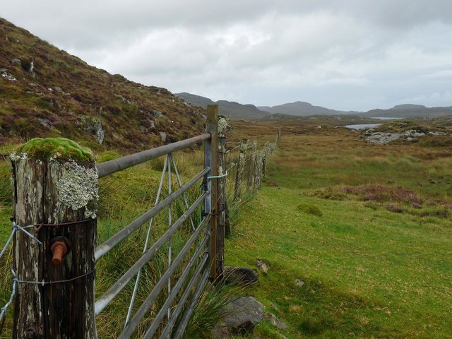
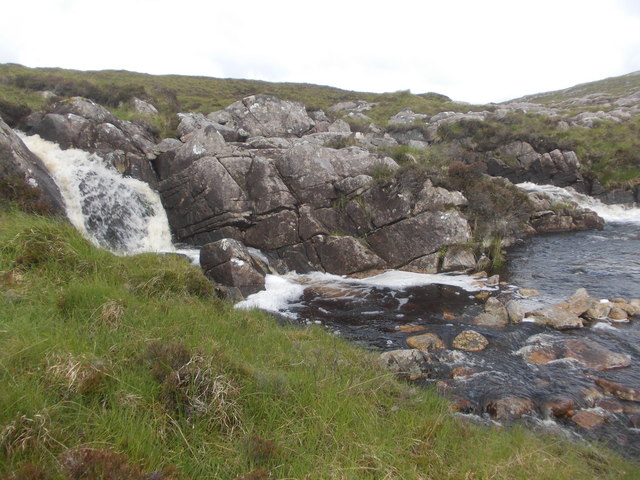
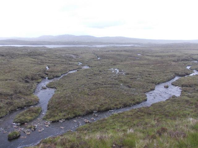
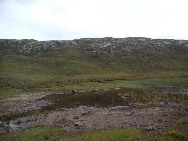
Cnoc Falasgair Images

Images are sourced within 2km of 58.129792/-6.8891378 or Grid Reference NB1226. Thanks to Geograph Open Source API. All images are credited.

Heronry on cliff face, Loch Rog Beag, North Harris These herons are very unusual nesting on the open cliff face rather than in tree tops.  The eggs are very vulnerable to predation by Buzzards and Ravens.  Despite our guided tour RIB remaining well away we observed 2 eggs being taken by groups of Ravens attacking, distracting the parents and "sneaking in".  Nature is hard to observe sometimes.
Heronry on cliff face, Loch Rog Beag, North Harris
These herons are very unusual nesting on the open cliff face rather than in tree tops. The eggs are very vulnerable to predation by Buzzards and Ravens. Despite our guided tour RIB remaining well away we observed 2 eggs being taken by groups of Ravens attacking, distracting the parents and "sneaking in". Nature is hard to observe sometimes.
West Bank, Loch Rog Beag, North Harris View almost south from RIB towards west bank of this narrow sea loch.
West Bank, Loch Rog Beag, North Harris
View almost south from RIB towards west bank of this narrow sea loch.
Gisla Power Station Small HEP station on the western shore of Loch Rog Beag at Giosla.
Gisla Power Station
Small HEP station on the western shore of Loch Rog Beag at Giosla.
B8011 cut through the hillside By the bottom of Loch Ròg Beag
B8011 cut through the hillside
By the bottom of Loch Ròg Beag
Old tractor I'm no expert but I think this is a Ferguson TEA20 of about 1950 vintage with Loch Ròg Beag as a backdrop.
Old tractor
I'm no expert but I think this is a Ferguson TEA20 of about 1950 vintage with Loch Ròg Beag as a backdrop.
Gisla Power Station A small hydroelectric power station, using water piped from Loch Coirceabhat.
Gisla Power Station
A small hydroelectric power station, using water piped from Loch Coirceabhat.
Enaclete: rainbow over Loch Ròg Beag Having visited the Flannan Isles today, in fine weather, it was clear as we approached the Lewis coast on our return that Lewis itself had not fared so fortunately. However, sunshine did break through as we approached Miavaig harbour and, by the time we set foot ashore the sun was shining brightly.

This would be a shortlived break in the showers, though, as this rainbow across the Loch testifies.

The B8011 has very recently been upgraded (not yet included on the 1:50,000 mapping but updated at 1:25,000 scale) and Enaclete village is now bypassed by a two-carriageway road. I am not certain but the track immediately in front of us may derive from the course of the old road.
Enaclete: rainbow over Loch Ròg Beag
Having visited the Flannan Isles today, in fine weather, it was clear as we approached the Lewis coast on our return that Lewis itself had not fared so fortunately. However, sunshine did break through as we approached Miavaig harbour and, by the time we set foot ashore the sun was shining brightly. This would be a shortlived break in the showers, though, as this rainbow across the Loch testifies. The B8011 has very recently been upgraded (not yet included on the 1:50,000 mapping but updated at 1:25,000 scale) and Enaclete village is now bypassed by a two-carriageway road. I am not certain but the track immediately in front of us may derive from the course of the old road.
A typical view on Lewis The recently constructed Enacleit bypass takes the B8011 through the extreme NE corner of this square. I climbed up onto a rocky knoll above the road and walked a little way, to get a good view of the lochans in the distance. The high ground beyond is not in the square.
A typical view on Lewis
The recently constructed Enacleit bypass takes the B8011 through the extreme NE corner of this square. I climbed up onto a rocky knoll above the road and walked a little way, to get a good view of the lochans in the distance. The high ground beyond is not in the square.
Old road bridge at Giosla
The B8011 road from Ardroil An excellent stretch of full width road - the only road which connects Ardroil to the rest of the island.
The B8011 road from Ardroil
An excellent stretch of full width road - the only road which connects Ardroil to the rest of the island.
Loch Ròg Beag Viewed from Einacleite.
Loch Ròg Beag
Viewed from Einacleite.
Gate below Sgeun, Isle of Lewis Looking towards Loch Mòr Ruadh.
Gate below Sgeun, Isle of Lewis
Looking towards Loch Mòr Ruadh.
Rock on moorland near Loch Fuarail, Isle of Lewis Looking towards Loch Fuarail and Coduinn.
Rock on moorland near Loch Fuarail, Isle of Lewis
Looking towards Loch Fuarail and Coduinn.
Looking towards Giosla from the B8011
Falls on the Abhainn Giosla
Looking back down the Abhainn Giosla to hydro Loch Coirceabhat
Giosla Looking towards Giosla across little loch roag
Giosla
Looking towards Giosla across little loch roag
Loch Beag Ruadh with ridge of Sgeun behind
Show me another place!

Cnoc Falasgair is located at Grid Ref: NB1226 (Lat: 58.129792, Lng: -6.8891378)

Unitary Authority: Na h-Eileanan an Iar

Police Authority: Highlands and Islands

What 3 Words

///progress.skidding.mixers. Near Carloway, Na h-Eileanan Siar

Related Wikis

Gisla Hydro-Electric Scheme

Gisla Hydro-Electric Scheme was a small scheme promoted by the North of Scotland Hydro-Electric Board on the Isle of Lewis, Outer Hebrides, Scotland. It...

Fuaigh Beag

Fuaigh Beag or Vuia Be(a)g is an island in the Outer Hebrides. It is off the west coast of Lewis near Great Bernera in Loch Roag. Its name means "little...

Flodaigh, Lewis

Flodaigh is a small island in Loch Roag on the west coast of Lewis in the Outer Hebrides of Scotland. It is about 33 hectares (82 acres) in extent and...

Loch Ròg

Loch Ròg or Loch Roag is a large sea loch on the west coast of Lewis, Outer Hebrides. It is broadly divided into East Loch Roag and West Loch Roag with...

Fuaigh Mòr

Fuaigh Mòr (sometimes anglicised as Vuia Mor) is an island in the Outer Hebrides of Scotland. It is off the west coast of Lewis near Great Bernera in...

Gasker

Gasker is a small uninhabited islet in the Outer Hebrides of Scotland, 8 kilometres (4+1⁄2 nautical miles) southwest of Scarp, off the west coast of Harris...

Callanish VIII

The Callanish VIII stone setting is one of many megalithic structures around the better-known (and larger) Calanais I on the west coast of the Isle of...

Loch na Berie

Loch Na Berie is a broch in the Outer Hebrides of Scotland, located approximately 400 yards from the shore, and is thought to have been located on an island...

Nearby Amenities

Located within 500m of 58.129792,-6.8891378
The data included in this document is from www.openstreetmap.org. The data is made available under ODbL.

Have you been to Cnoc Falasgair?

Leave your review of Cnoc Falasgair below (or comments, questions and feedback).