Gearraidh a' Stigh

Downs, Moorland in Ross-shire

Scotland

Gearraidh a' Stigh

Sròn na Ribha Pier Geocaching is a type of global treasure hunt of people looking for caches, or hidden stashes of objects. Geocaching may also be described as a series of hide-and-seek games, where hiders provide online clues for seekers. Seekers use global positioning system (GPS) devices to find hidden caches
Sròn na Ribha Pier Credit: Ralph Greig

Gearraidh a' Stigh is a small village located in the county of Ross-shire, in the Highlands region of Scotland. Situated on the edge of the downs and moorland, the village offers a stunning natural environment and a peaceful retreat for residents and visitors alike.

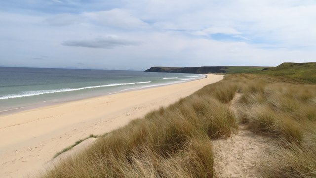
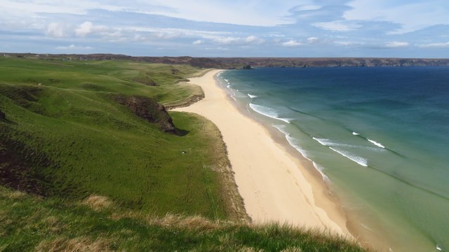
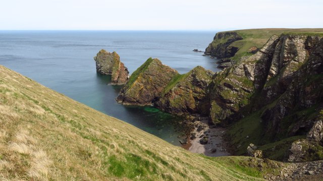
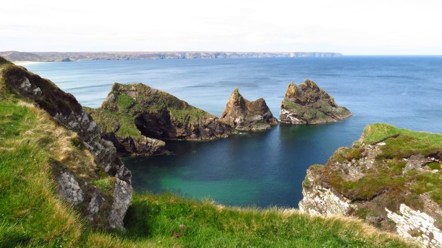
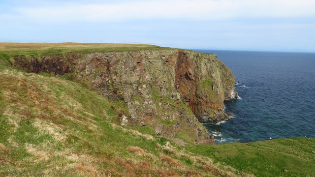
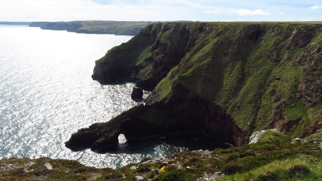
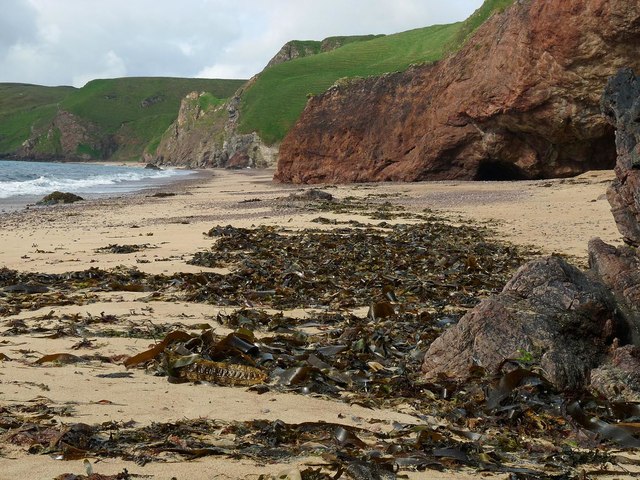
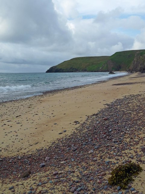
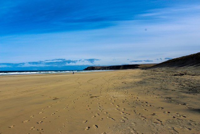
The downs surrounding Gearraidh a' Stigh are characterized by gentle slopes and rolling hills, covered in lush green grass and scattered with wildflowers during the summer months. The moorland, on the other hand, presents a more rugged landscape, with heather-covered hills and rocky outcrops adding to the area's wild beauty.

The village itself is a charming collection of traditional stone houses, many of which date back several centuries, giving it a quaint and timeless feel. A small, picturesque river runs through the village, adding to its idyllic setting.

Nature enthusiasts are drawn to Gearraidh a' Stigh due to its abundant wildlife and birdlife. The downs and moorland provide a habitat for various species, including red deer, mountain hares, and numerous bird species such as curlews and golden eagles.

For outdoor enthusiasts, the village offers ample opportunities for activities such as hiking, cycling, and birdwatching. Nearby nature reserves and trails provide access to stunning viewpoints and breathtaking landscapes.

Despite its remote location, Gearraidh a' Stigh is not completely isolated. The village has a small community center, a primary school, and a few local shops that cater to the needs of its residents. Additionally, the nearby town of Ullapool provides access to additional amenities and services, including healthcare facilities and larger supermarkets.

Overall, Gearraidh a' Stigh in Ross-shire is a picturesque village nestled amidst downs and moorland, offering tranquility, natural beauty, and abundant wildlife for those seeking an escape to the Scottish Highlands.

If you have any feedback on the listing, please let us know in the comments section below.

Gearraidh a' Stigh Images

Images are sourced within 2km of 58.338696/-6.200153 or Grid Reference NB5446. Thanks to Geograph Open Source API. All images are credited.

Sròn na Ribha Pier Geocaching is a type of global treasure hunt of people looking for caches, or hidden stashes of objects. Geocaching may also be described as a series of hide-and-seek games, where hiders provide online clues for seekers. Seekers use global positioning system (GPS) devices to find hidden caches
Sròn na Ribha Pier
Geocaching is a type of global treasure hunt of people looking for caches, or hidden stashes of objects. Geocaching may also be described as a series of hide-and-seek games, where hiders provide online clues for seekers. Seekers use global positioning system (GPS) devices to find hidden caches
Tràigh Ghioradail beach
Traigh Mhor, North Tolsta - view towards southern end of beach
Traigh Mhor, North Tolsta - view from cliffs above Gob an t-Seabhaig
Cliffs at Tolsta Head - view to Eilean a Muigh Heisgeir
Cliffs at south eastern corner of Tolsta Head
Cliffs at Tolsta Head - Rodha & Sron an Fhuaraidh
Trig Point at Tom Sgaire with Loch Gormag Mor beyond, North Tolsta
Boat mooring above Tràigh Ghioradail, Isle of Lewis There are three platforms on which boats can be moored near the foot of the steep block paved access track between the car park and the beach.
Boat mooring above Tràigh Ghioradail, Isle of Lewis
There are three platforms on which boats can be moored near the foot of the steep block paved access track between the car park and the beach.
Tràigh Ghioradail, Isle of Lewis Looking towards Tolsta Head.
Tràigh Ghioradail, Isle of Lewis
Looking towards Tolsta Head.
Tràigh Ghioradail, Isle of Lewis The seaward end of the <a href="https://www.geograph.org.uk/photo/2425150">NB5446 : Old Landslide?</a> is to the left of centre.
Tràigh Ghioradail, Isle of Lewis
The seaward end of the NB5446 : Old Landslide? is to the left of centre.
Tràigh Ghioradail, Isle of Lewis Looking towards Gob Girdabirie.
Tràigh Ghioradail, Isle of Lewis
Looking towards Gob Girdabirie.
Tràigh Ghioradail, Isle of Lewis Looking towards Gob Girdabirie.
Tràigh Ghioradail, Isle of Lewis
Looking towards Gob Girdabirie.
Access to Tràigh Ghioradail, Isle of Lewis The <a href="https://www.geograph.org.uk/photo/5439687">NB5446 : Boat mooring above Tràigh Ghioradail, Isle of Lewis</a> can be seen beyond the strip of sand.
Access to Tràigh Ghioradail, Isle of Lewis
The NB5446 : Boat mooring above Tràigh Ghioradail, Isle of Lewis can be seen beyond the strip of sand.
Access to Tràigh Ghioradail, Isle of Lewis Looking towards the <a href="https://www.geograph.org.uk/photo/2425150">NB5446 : Old Landslide?</a>.
Access to Tràigh Ghioradail, Isle of Lewis
Looking towards the NB5446 : Old Landslide?.
Traigh Mhòr Beach Pictured here is the stunning Traigh Mhòr beach near Tolsta, Isle of Lewis.

The beach stretches for two miles and provides a stunning walk (when the weather is nice). There also high sand dunes as an alternative route to walk and public WCs in the car park. This is great to exhaust any dog (including my Springer Spaniel).
Traigh Mhòr Beach
Pictured here is the stunning Traigh Mhòr beach near Tolsta, Isle of Lewis. The beach stretches for two miles and provides a stunning walk (when the weather is nice). There also high sand dunes as an alternative route to walk and public WCs in the car park. This is great to exhaust any dog (including my Springer Spaniel).
Show me another place!

Gearraidh a' Stigh is located at Grid Ref: NB5446 (Lat: 58.338696, Lng: -6.200153)

Unitary Authority: Na h-Eileanan an Iar

Police Authority: Highlands and Islands

What 3 Words

///enough.pushes.easygoing. Near North Tolsta, Na h-Eileanan Siar

Related Wikis

North Tolsta

North Tolsta (Scottish Gaelic: Tolastadh bho Thuath) is a village in the Scottish Outer Hebrides, on the east side of the Isle of Lewis. North Tolsta is...

New Tolsta

New Tolsta (Scottish Gaelic: Baile Ùr Tholastaidh) is a village on the Isle of Lewis in the Outer Hebrides, Scotland. New Tolsta is within the parish of...

Gress

Gress (Scottish Gaelic: Griais), a hamlet on the Isle of Lewis in Scotland, is adjacent to the larger village of Back. Gress is within the parish of Stornoway...

Back, Lewis

Back (Scottish Gaelic: Am Bac) is a district and a village on the east coast of the Isle of Lewis in the Outer Hebrides, Scotland, situated on a coastal...

Nearby Amenities

Located within 500m of 58.338696,-6.200153
Bus Stop
Tolsta
Naptan AtcoCode: 6010731855
Naptan Bearing: N
Naptan CommonName: Tolsta
Naptan Indicator: Camach Park
Naptan Landmark: Camach Park
Naptan NaptanCode: 94723978
Naptan Street: Camach Park
Naptan Verified: no
Source: naptan_import
Lat/Long: 58.3402784/-6.2034277
Barrier: cattle_grid
Lat/Long: 58.3396685/-6.2031337
Tourism: picnic_site
Lat/Long: 58.3372858/-6.2017266
Passing Place
Lat/Long: 58.3400667/-6.19921
Power: pole
Lat/Long: 58.3406229/-6.2041194
Power: pole
Lat/Long: 58.3407223/-6.2055255
Power: pole
Lat/Long: 58.340819/-6.2068406
Power: pole
Lat/Long: 58.3395211/-6.207819
Power: pole
Lat/Long: 58.3402023/-6.2072979
Power: pole
Lat/Long: 58.341219/-6.2065432
Power: pole
Lat/Long: 58.341726/-6.2061548
Power: pole
Lat/Long: 58.3379495/-6.2066956
Power: pole
Lat/Long: 58.3388695/-6.2074478
Barrier: cattle_grid
Lat/Long: 58.3413117/-6.2040613
The data included in this document is from www.openstreetmap.org. The data is made available under ODbL.

Have you been to Gearraidh a' Stigh?

Leave your review of Gearraidh a' Stigh below (or comments, questions and feedback).