Dove Hole

Cliff, Slope in Yorkshire

England

Dove Hole

The Cod & Lobster, Staithes
The Cod & Lobster, Staithes Credit: habiloid

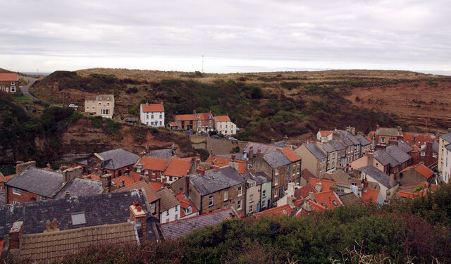
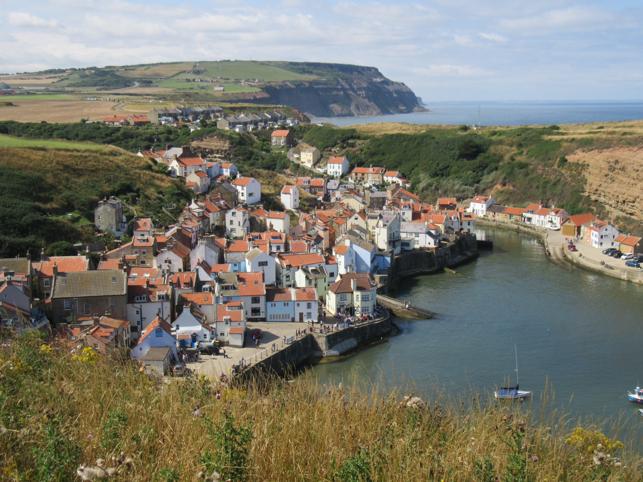
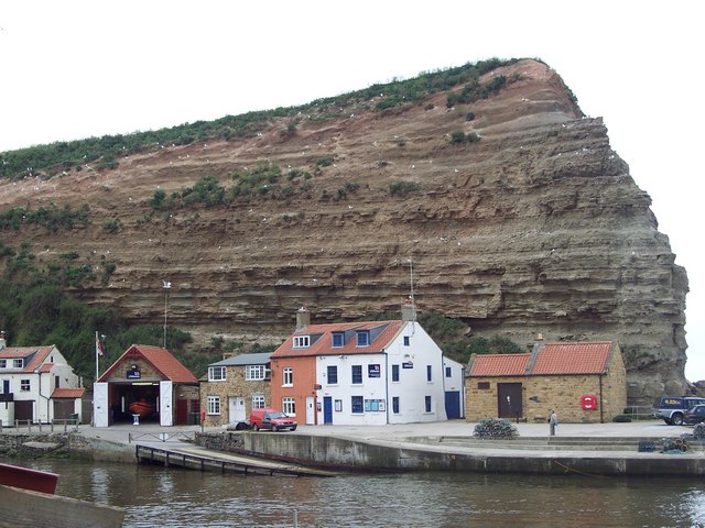
Dove Hole is a small village located in the county of Yorkshire, England. Nestled in the heart of the Peak District National Park, it is renowned for its stunning natural beauty and picturesque surroundings. The village is situated on a cliff, overlooking a breathtaking valley, and is characterized by its rugged terrain and sloping landscapes.

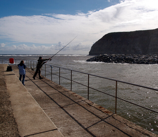
The cliff in Dove Hole offers visitors and residents alike magnificent panoramic views of the surrounding countryside. It is a popular spot for hikers and nature enthusiasts, who are attracted to the area's diverse flora and fauna. The cliff face itself is made up of layers of limestone, which have been shaped by years of erosion, creating a unique and striking geological formation.

The slope in Dove Hole is equally impressive, stretching down from the cliff towards the valley below. It is a challenging terrain for outdoor activities, such as mountain biking and rock climbing, attracting thrill-seekers from far and wide. The slope is covered in lush vegetation, including heather and various wildflowers, adding to the area's natural charm.

The village of Dove Hole itself is a quaint and peaceful community, with a close-knit population. It boasts traditional stone houses, narrow winding lanes, and a charming village green. The locals take great pride in their surroundings and often organize community events to showcase the area's natural beauty.

Overall, Dove Hole is a hidden gem in Yorkshire, offering visitors a chance to immerse themselves in the stunning landscapes and peaceful atmosphere of the Peak District. Whether exploring the cliff, conquering the slope, or simply enjoying the village's rustic charm, this Yorkshire village has something to offer for everyone.

If you have any feedback on the listing, please let us know in the comments section below.

Dove Hole Images

Images are sourced within 2km of 54.558696/-0.8017129 or Grid Reference NZ7718. Thanks to Geograph Open Source API. All images are credited.

The Cod & Lobster, Staithes
Staithes Beck and Cowbar Nab
Whitby Road (A174) at its junction with Staithes Lane, Staithes Boulby Mine is in the distance.
Whitby Road (A174) at its junction with Staithes Lane, Staithes
Boulby Mine is in the distance.
Staithes seen from Old Stubble
Barass Square, Staithes
Staithes Beck
Staithes Beck
Looking west past Cowbar Nab from the harbour, Staithes
Angler, Staithes Harbour
Staithes seen from Cowbar Bank
Barass Square, Staithes
Staithes Beck at low tide
Hinderwell Beacon The locals call this place 'The Listening Post'. A disused cold war monitoring station on Beacon Hill, Hinderwell. Part of a large network of subterranean monitoring stations dotted all round the country.
Hinderwell Beacon
The locals call this place 'The Listening Post'. A disused cold war monitoring station on Beacon Hill, Hinderwell. Part of a large network of subterranean monitoring stations dotted all round the country.
Old Nab and Brackenberry Wyke From The Cleveland Way between Hinderwell and Staithes
Old Nab and Brackenberry Wyke
From The Cleveland Way between Hinderwell and Staithes
Staithes Beach at Low Tide
Staithes Harbour at Low Tide
Old Army Barracks / Holiday Accommodation at Staithes Looks like some of the old army barracks / holiday accommodation blocks are in the process of being dismantled.
Old Army Barracks / Holiday Accommodation at Staithes
Looks like some of the old army barracks / holiday accommodation blocks are in the process of being dismantled.
Show me another place!

Dove Hole is located at Grid Ref: NZ7718 (Lat: 54.558696, Lng: -0.8017129)

Division: North Riding

Unitary Authority: Redcar and Cleveland

Police Authority: Cleveland

What 3 Words

///sobbed.grit.flattens. Near Loftus, North Yorkshire

Related Wikis

Staithes

Staithes is a village in North Yorkshire, England. Easington and Roxby Becks, which run into Staithes Beck, form the border between the unitary authorities...
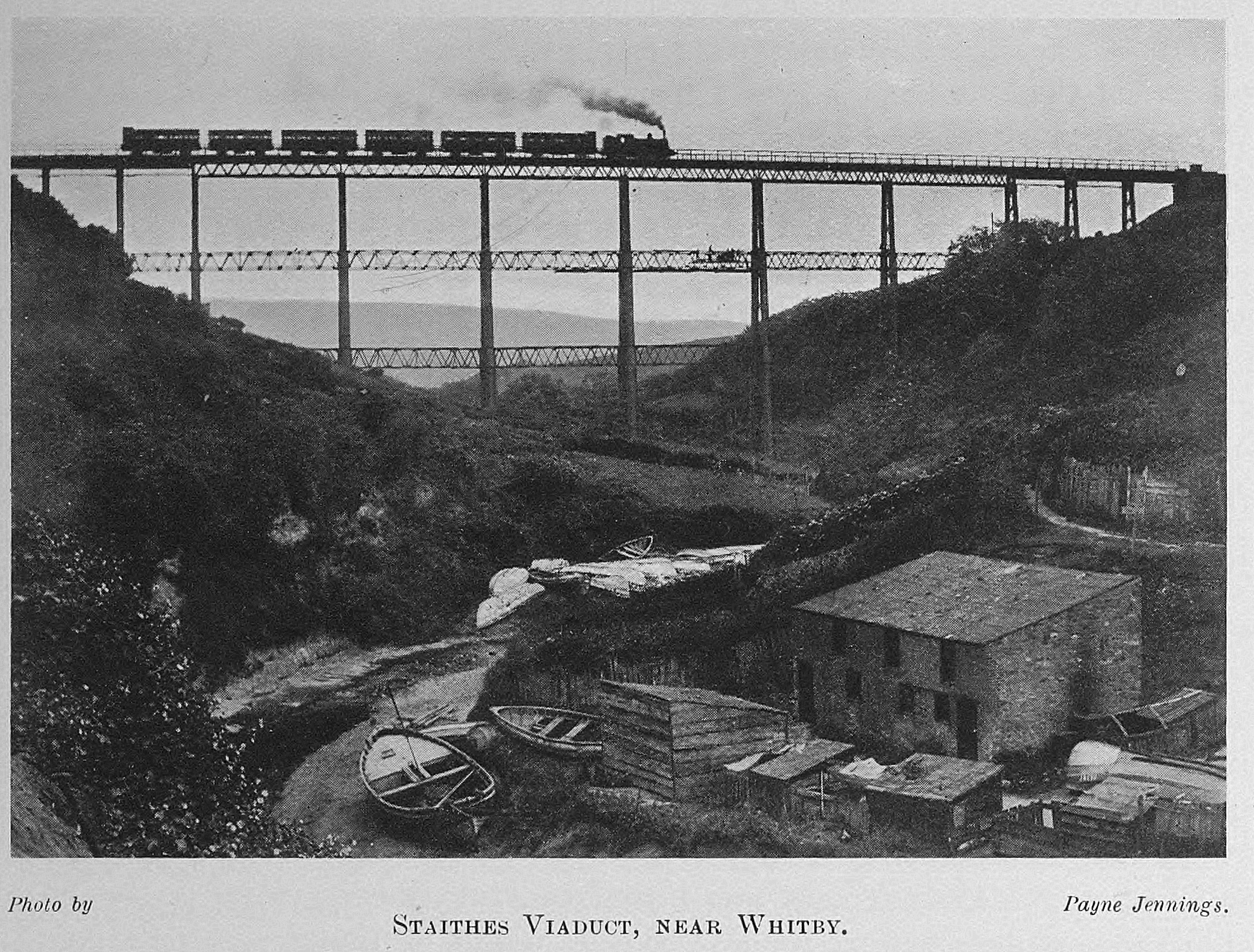
Staithes Viaduct

Staithes Viaduct was a railway bridge that straddled Staithes Beck at Staithes, Yorkshire, England. It was north of the closed Staithes railway station...

Staithes and Runswick Lifeboat Station

Staithes and Runswick Lifeboat Station is a Royal National Lifeboat Institution (RNLI) lifeboat station based in the village of Staithes, North Yorkshire...

Staithes railway station

Staithes railway station was a railway station on the Whitby Redcar and Middlesbrough Union Railway, serving the villages of Staithes and Dalehouse in...

Nearby Amenities

Located within 500m of 54.558696,-0.8017129
Source: PGS
Lat/Long: 54.559094/-0.797047
Source: PGS
Lat/Long: 54.5591997/-0.7975942
Source: PGS
Lat/Long: 54.5598405/-0.7987529
Source: PGS
Lat/Long: 54.5600365/-0.7992089
Source: PGS
Lat/Long: 54.5599369/-0.8000672
Source: PGS
Lat/Long: 54.5595886/-0.800668
Source: PGS
Lat/Long: 54.559363/-0.8011061
Source: PGS
Lat/Long: 54.5588311/-0.8016694
Source: PGS
Lat/Long: 54.5591033/-0.802213
Source: PGS
Lat/Long: 54.5590411/-0.8028138
Source: PGS
Lat/Long: 54.5588436/-0.8046091
Source: PGS
Lat/Long: 54.5590022/-0.8059233
Source: PGS
Lat/Long: 54.5586787/-0.8067334
Source: PGS
Lat/Long: 54.5585371/-0.8076632
Cowbar
Place: hamlet
Lat/Long: 54.5588854/-0.7954201
Bench
Backrest: no
Lat/Long: 54.5588264/-0.7943026
Barrier: kissing_gate
Lat/Long: 54.5582691/-0.7989947
Direction: 85
Generator Method: photovoltaic
Generator Output Electricity: yes
Generator Solar Modules: 8
Generator Source: solar
Generator Type: solar_photovoltaic_panel
Location: roof
Power: generator
Lat/Long: 54.5561991/-0.8014498
Direction: 265
Generator Method: photovoltaic
Generator Output Electricity: yes
Generator Solar Modules: 8
Generator Source: solar
Generator Type: solar_photovoltaic_panel
Location: roof
Power: generator
Lat/Long: 54.556196/-0.8014981
Fixme: needs survey
Lat/Long: 54.5585521/-0.7952118
The data included in this document is from www.openstreetmap.org. The data is made available under ODbL.

Have you been to Dove Hole?

Leave your review of Dove Hole below (or comments, questions and feedback).