Sandhole Cliff

Cliff, Slope in Devon Torridge

England

Sandhole Cliff

Hardisworthy Farm
Hardisworthy Farm Credit: Dani

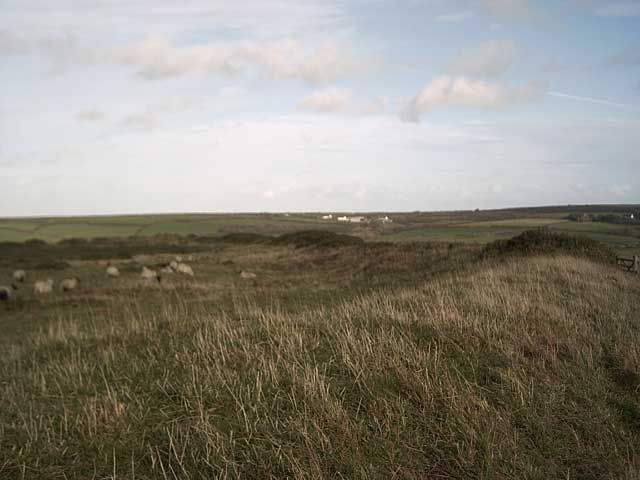
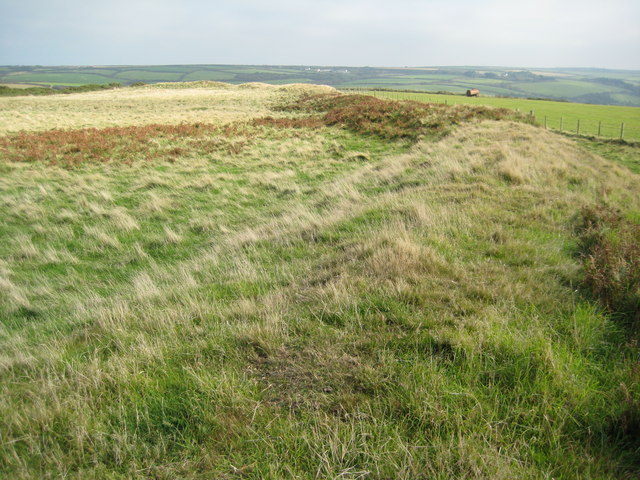
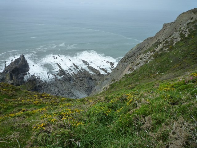
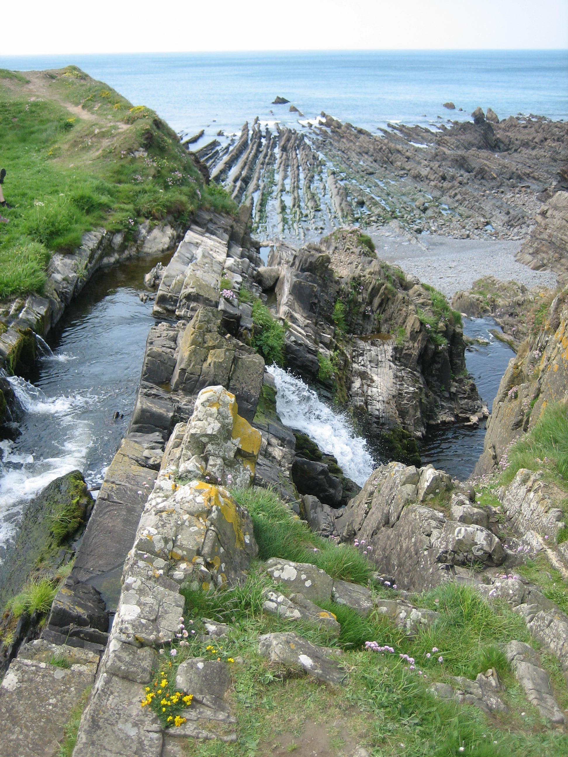
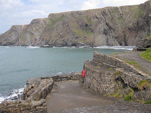
Sandhole Cliff is a notable geological feature located in Devon, England. Situated on the Jurassic Coastline, it is a prominent cliff that stretches along the coast, overlooking the English Channel. The cliff is composed of layers of sedimentary rocks, including limestone, shale, and sandstone, which have been formed over millions of years.

The cliff rises to an impressive height of approximately 80 meters, providing breathtaking views of the surrounding landscape. Its sloping face is carved by the relentless erosion caused by the crashing waves of the sea, which has shaped the cliff over time into its distinctive form. This constant erosion exposes layers of rock, offering a fascinating insight into the geological history of the area.

Sandhole Cliff is also known for its rich fossil record. The layers of sedimentary rocks contain numerous fossils dating back to the Jurassic period, including ammonites, belemnites, and other marine creatures. These fossils provide valuable evidence of the ancient marine life that once inhabited the area.

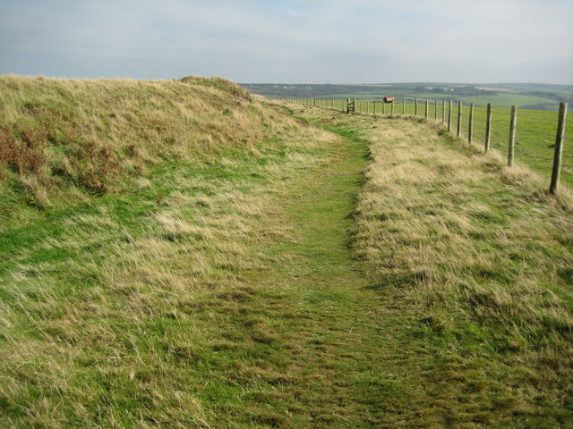
Due to its geological significance and natural beauty, Sandhole Cliff is a popular destination for geologists, nature enthusiasts, and tourists alike. The cliff offers opportunities for hiking, birdwatching, and fossil hunting, attracting visitors from far and wide.

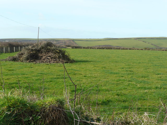
However, it is important to exercise caution when exploring Sandhole Cliff, as the cliffs can be unstable and prone to landslides. It is advisable to follow designated paths and take heed of safety warnings to ensure a safe and enjoyable experience.

If you have any feedback on the listing, please let us know in the comments section below.

Sandhole Cliff Images

Images are sourced within 2km of 50.960569/-4.536118 or Grid Reference SS2120. Thanks to Geograph Open Source API. All images are credited.

Hardisworthy Farm
Hardisworthy Farm
Embury Beacon An Iron-age promontory fort.
Embury Beacon
An Iron-age promontory fort.
West to Embury Beacon The hill in the distance ends abruptly with 500 ft. cliffs on the far side. From this point the sea is completely obscured.
West to Embury Beacon
The hill in the distance ends abruptly with 500 ft. cliffs on the far side. From this point the sea is completely obscured.
North of Putsole Farm View north over birchwood and gorse to the plantation around Golden Park.
North of Putsole Farm
View north over birchwood and gorse to the plantation around Golden Park.
Embury Beacon The defensive earthwork of Embury Beacon an Iron Age hill fort. The fort is situated above the cliffs on the coast and over time part of the hill fort has slipped into the sea as a result of coastal erosion.
Embury Beacon
The defensive earthwork of Embury Beacon an Iron Age hill fort. The fort is situated above the cliffs on the coast and over time part of the hill fort has slipped into the sea as a result of coastal erosion.
View north from Embury Beacon View north from the Iron Age hill fort on Embury Beacon. In the background the coastline stretches towards Hartland Point.
View north from Embury Beacon
View north from the Iron Age hill fort on Embury Beacon. In the background the coastline stretches towards Hartland Point.
Coast path at Embury Beacon The South West Coast Path passing the defensive earthwork protecting Embury Beacon hill fort.
Coast path at Embury Beacon
The South West Coast Path passing the defensive earthwork protecting Embury Beacon hill fort.
Footpath to Welcombe Mouth Footpath sign on the coast path.
Footpath to Welcombe Mouth
Footpath sign on the coast path.
The Cliffs at Embury Beacon Looking north towards the high point of Embury Beacon.
The Cliffs at Embury Beacon
Looking north towards the high point of Embury Beacon.
Buttercup Meadow Lush valley-bottom grassland.
Buttercup Meadow
Lush valley-bottom grassland.
Narrow Road through Woodland
Postbox at South Hole
Cliff and shore south of Embury Beacon
Minor lane near South Hole, Devon Lanes such as this are often signed as unsuitable for motors. The original surface may be crumbling or even non existent in some places.
Minor lane near South Hole, Devon
Lanes such as this are often signed as unsuitable for motors. The original surface may be crumbling or even non existent in some places.
Minor lane north of Welcombe, Devon Unclassified lanes such as this one to Elmscott can be very narrow, and are often signed as unsuitable for motors. The original surface may be crumbling or even non existent in some places.
Minor lane north of Welcombe, Devon
Unclassified lanes such as this one to Elmscott can be very narrow, and are often signed as unsuitable for motors. The original surface may be crumbling or even non existent in some places.
Minor lane to South Hole, Devon Here, narrow lanes such as this are often signed as unsuitable for motors. The original surface may be crumbling or even non existent in some places, as is the case further down this route.
Minor lane to South Hole, Devon
Here, narrow lanes such as this are often signed as unsuitable for motors. The original surface may be crumbling or even non existent in some places, as is the case further down this route.
Show me another place!

Sandhole Cliff is located at Grid Ref: SS2120 (Lat: 50.960569, Lng: -4.536118)

Administrative County: Devon

District: Torridge

Police Authority: Devon and Cornwall

What 3 Words

///stunt.smooth.adventure. Near Flexbury, Cornwall

Related Wikis

RFA Green Ranger

RFA Green Ranger was a Ranger-class fleet support tanker of the Royal Fleet Auxiliary. On 24 September 1946, Green Ranger was struck by a torpedo in Portland...

St Nectan's Church, Welcombe

St Nectan's Church is the parish church of Welcombe, on the border of Devon and Cornwall. W. G. Hoskins writes "St Nectan's Chapel was one of the many...

Welcombe

Welcombe is a village and civil parish on the coast of north Devon, England, just north of the border with Cornwall. It is part of the district of Torridge...

Hartland Quay

Hartland Quay is located on the Atlantic coast of Devon, England, south of Hartland Point and north of Bude, Cornwall. It experiences some of the roughest...

Nearby Amenities

Located within 500m of 50.960569,-4.536118
Communication Radio: yes
Man Made: mast
Tower Type: communication
Lat/Long: 50.9565981/-4.5369947
Communication Radio: yes
Man Made: mast
Tower Type: communication
Lat/Long: 50.9564466/-4.5364565
The data included in this document is from www.openstreetmap.org. The data is made available under ODbL.

Have you been to Sandhole Cliff?

Leave your review of Sandhole Cliff below (or comments, questions and feedback).