Sliding Cliff

Cliff, Slope in Cornwall

England

Sliding Cliff

Rickyard of Pentire Farm near Padstow, 1952 This triangular area was used as a rickyard until the National Trust acquired the farm, made this area a car park, made the farmhouse a holiday let, and employed contractors to do the farming. The car in the photo is a 1934 Ford V8.
Rickyard of Pentire Farm near Padstow, 1952 Credit: David Hawgood

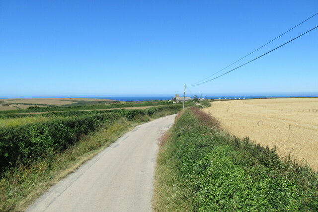
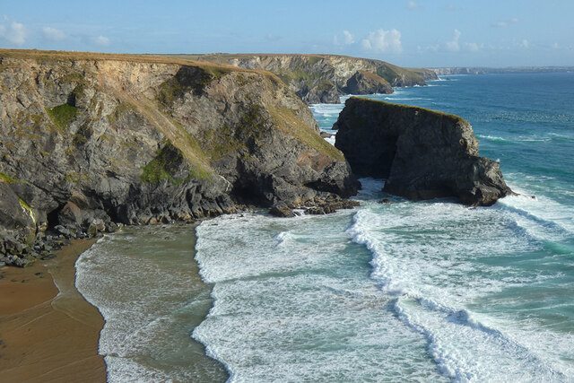
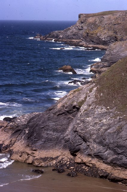
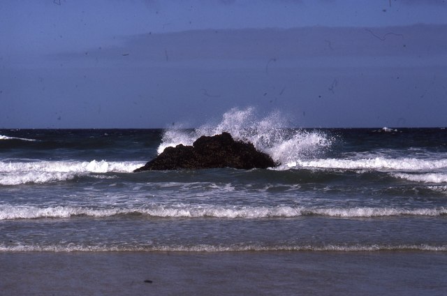
Sliding Cliff, located in Cornwall, England, is a prominent natural feature that has garnered attention due to its unique geological characteristics. It is a steep cliff or slope, known for its inclination and the tendency of its sedimentary layers to slide downwards.

The cliff is situated in an area with a long history of geological movement, which has contributed to its distinct formation. Sliding Cliff is primarily composed of sedimentary rock layers, including sandstone and shale. Over time, these layers have become unstable, leading to frequent landslides and slope movements.

The sliding phenomenon at this cliff is attributed to a combination of factors. The presence of weak, easily erodible shale layers beneath more resistant sandstone layers creates a potential for slippage. Additionally, the cliff's steep incline, coupled with the region's high levels of rainfall, adds to the instability. The combination of these factors makes Sliding Cliff prone to periodic collapses and landslides.

The area surrounding Sliding Cliff is marked by signs of ongoing erosion. Large cracks and fissures can be observed on the cliff face, evidence of previous sliding events. The fallen debris and sediment at the base of the slope are further indications of the cliff's active nature.

Due to its geological significance and potential risks, Sliding Cliff has become a site of interest for scientists, geologists, and nature enthusiasts. It serves as a reminder of the dynamic nature of our planet and the ever-changing landscape. Visitors are advised to exercise caution and maintain a safe distance from the unstable cliff face to ensure their own safety.

If you have any feedback on the listing, please let us know in the comments section below.

Sliding Cliff Images

Images are sourced within 2km of 50.489698/-5.0336861 or Grid Reference SW8469. Thanks to Geograph Open Source API. All images are credited.

Rickyard of Pentire Farm near Padstow, 1952 This triangular area was used as a rickyard until the National Trust acquired the farm, made this area a car park, made the farmhouse a holiday let, and employed contractors to do the farming. The car in the photo is a 1934 Ford V8.
Rickyard of Pentire Farm near Padstow, 1952
This triangular area was used as a rickyard until the National Trust acquired the farm, made this area a car park, made the farmhouse a holiday let, and employed contractors to do the farming. The car in the photo is a 1934 Ford V8.
Car park and campsite off the B3276 near Efflins
Turning off the B3276 for Old MacDonald's Farm
Road near Treburrick
View from the Atlantic Coaster near Old MacDonald's Farm
Entrance to Old MacDonald's Farm visitor attraction
Roads from Old MacDonald's Farm rejoining the B3276
Coastline, St Eval With Diggory's Island to the right in a view southwards at Pentire Steps.
Coastline, St Eval
With Diggory's Island to the right in a view southwards at Pentire Steps.
Surfers with wooden bellyboards, Pentire Cove 1966 In 2023 wooden surfboards are becoming popular again because they do not pollute the sea with plastic fragments. This photograph harks back to the period from 1940s to the present when we have used wooden bellyboards at this beach and nearby Porthcothan. Park Head is visible on the right.
Surfers with wooden bellyboards, Pentire Cove 1966
In 2023 wooden surfboards are becoming popular again because they do not pollute the sea with plastic fragments. This photograph harks back to the period from 1940s to the present when we have used wooden bellyboards at this beach and nearby Porthcothan. Park Head is visible on the right.
Belly board in surf, Pentire Cove 1966 Surfing on a belly board the body is part on the board, arms to the front holding the end of the board.
Belly board in surf, Pentire Cove 1966
Surfing on a belly board the body is part on the board, arms to the front holding the end of the board.
Farmland near Engollan Farmland near Engollan on a grey March morning.
Farmland near Engollan
Farmland near Engollan on a grey March morning.
Road junction on the B3276, looking south-east
On the B3276, heading towards Trevemedar
Pentire Steps with Park Head beyond Pentire Steps were a pathway cut into the cliff to the right of the photo. Parts have crumbled away but it is possible to scramble down onto the rocks. There is another cliff path into Pentire Cove, the sand in the foreground which is covered at high tide. Photo is scan from 35mm Kodachrome slide.
Pentire Steps with Park Head beyond
Pentire Steps were a pathway cut into the cliff to the right of the photo. Parts have crumbled away but it is possible to scramble down onto the rocks. There is another cliff path into Pentire Cove, the sand in the foreground which is covered at high tide. Photo is scan from 35mm Kodachrome slide.
Pentire Cove at half tide At low tide the rock in the centre is surrounded by sand; at high tide all of the sand in the cove is under water. Here the photo is taken from sand at the top of the cove.
Pentire Cove at half tide
At low tide the rock in the centre is surrounded by sand; at high tide all of the sand in the cove is under water. Here the photo is taken from sand at the top of the cove.
Notice, corn bunting and skylark nest sanctuary, Trevemedar Several fields of Trevemedar Farm are maintained with spring crops not harvested. This RSPB notice explains this, reading:
"Sanctuary area
You are entering fields that are a sanctuary for rare ground-nesting corn buntings and skylarks during spring and summer.
To help keep their nests and chicks safe please stay on the main path with your dog on a lead.
Thank you for helping these birds to breed successfully."
Notice, corn bunting and skylark nest sanctuary, Trevemedar
Several fields of Trevemedar Farm are maintained with spring crops not harvested. This RSPB notice explains this, reading: "Sanctuary area You are entering fields that are a sanctuary for rare ground-nesting corn buntings and skylarks during spring and summer. To help keep their nests and chicks safe please stay on the main path with your dog on a lead. Thank you for helping these birds to breed successfully."
Path in ground-nesting bird sanctuary, Trevemedar A number of fields on Trevemedar Farm near Porthcothan are cultivated for the benefit of ground-nesting birds, corn buntings and skylarks. See <a href="https://www.geograph.org.uk/photo/6203106">SW8571 : Notice, corn bunting and skylark nest sanctuary, Trevemedar</a> for notice about this sanctuary.
Path in ground-nesting bird sanctuary, Trevemedar
A number of fields on Trevemedar Farm near Porthcothan are cultivated for the benefit of ground-nesting birds, corn buntings and skylarks. See SW8571 : Notice, corn bunting and skylark nest sanctuary, Trevemedar for notice about this sanctuary.
Trescore Islands Offshore rocks south of Porthcothan.
Trescore Islands
Offshore rocks south of Porthcothan.
Show me another place!

Sliding Cliff is located at Grid Ref: SW8469 (Lat: 50.489698, Lng: -5.0336861)

Unitary Authority: Cornwall

Police Authority: Devon and Cornwall

What 3 Words

///blushes.fewer.jolt. Near Newquay, Cornwall

Related Wikis

Carnewas and Bedruthan Steps

Carnewas and Bedruthan Steps (Cornish: Karn Havos, meaning "rock-pile of summer dwelling" and Cornish: Bos Rudhen, meaning "Red-one's dwelling") is a stretch...

Engollan

Engollan is a hamlet 5 miles (8.0 km) south-west of Padstow in Cornwall, England. Engollan is in the civil parish of St Eval. == References == == Views... ==

Downhill, Cornwall

Downhill is a hamlet in the parish of St Eval, Cornwall, England. == References ==

Trenance

Trenance (Cornish: Trenans) is a hamlet adjoining Mawgan Porth in Cornwall, England, United Kingdom. Trenance Point is a headland nearby.There are also...

Nearby Amenities

Located within 500m of 50.489698,-5.0336861
Bedruthan Steps
Natural: stone
Tourism: attraction
Wikidata: Q813950
Lat/Long: 50.4861929/-5.0341412
Diggory Island
Place: island
Lat/Long: 50.4914044/-5.0362963
Samaritan Island
Place: island
Lat/Long: 50.4879409/-5.0348375
Queen Bess Island
Place: island
Lat/Long: 50.4890493/-5.0358605
Redcove Island
Place: island
Lat/Long: 50.4861564/-5.0348572
Barrier: kissing_gate
Material: wood
Lat/Long: 50.4938943/-5.0336972
The data included in this document is from www.openstreetmap.org. The data is made available under ODbL.

Have you been to Sliding Cliff?

Leave your review of Sliding Cliff below (or comments, questions and feedback).