Shirk Stream

Lake, Pool, Pond, Freshwater Marsh in Roxburghshire

Scotland

Shirk Stream

Winter cereals, Stodrig New seedbed.
Winter cereals, Stodrig Credit: Richard Webb

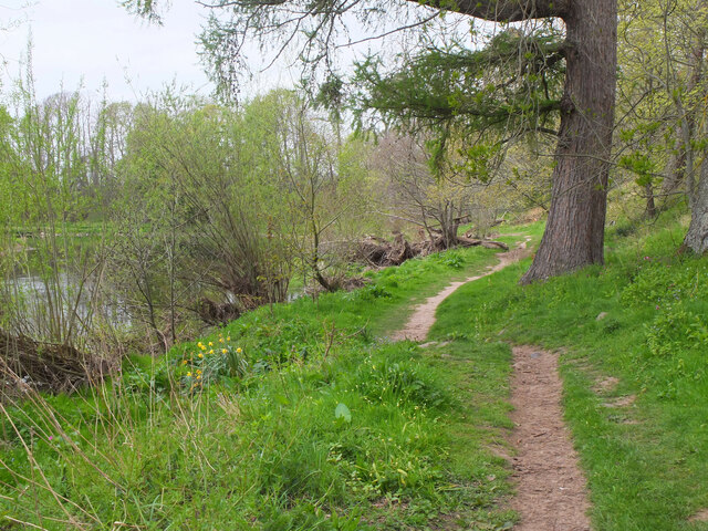
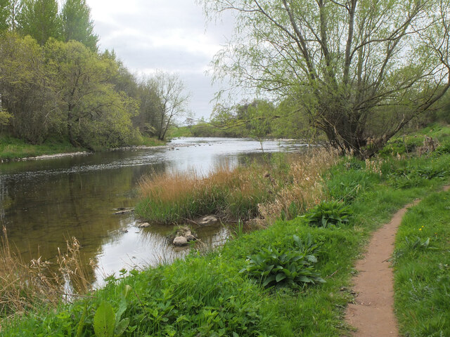
Shirk Stream is a picturesque freshwater marsh located in Roxburghshire, a historic county in the southern part of Scotland. The stream is situated within the scenic Shirk Forest, surrounded by lush greenery and rolling hills. It serves as a vital water source for the surrounding vegetation and wildlife.

Spanning over a length of approximately 2 kilometers, Shirk Stream meanders through the landscape, creating a serene and tranquil atmosphere. The stream primarily consists of clear, freshwater, which has been naturally filtered by the surrounding vegetation, resulting in excellent water quality.

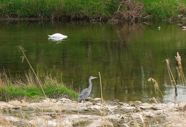
The stream is flanked by a variety of plant species, including reeds, rushes, and water lilies, which thrive in the marshy conditions. These plants not only provide a stunning visual display but also serve as crucial habitats for various aquatic creatures, such as frogs, newts, and dragonflies. The surrounding woodland is home to an array of bird species, including kingfishers, herons, and ducks, which can often be spotted gracefully gliding over the stream.

Shirk Stream offers a peaceful retreat for nature enthusiasts and provides ample opportunities for leisure activities such as fishing and birdwatching. The stream is known for its abundance of brown trout, attracting anglers from far and wide. Additionally, the area surrounding the stream offers several walking trails, allowing visitors to explore the enchanting beauty of the forest and its diverse ecosystem.

Overall, Shirk Stream in Roxburghshire is a hidden gem, offering a captivating blend of natural beauty and wildlife. Whether one seeks a peaceful escape or an opportunity to immerse themselves in nature, this freshwater marsh is an ideal destination.

If you have any feedback on the listing, please let us know in the comments section below.
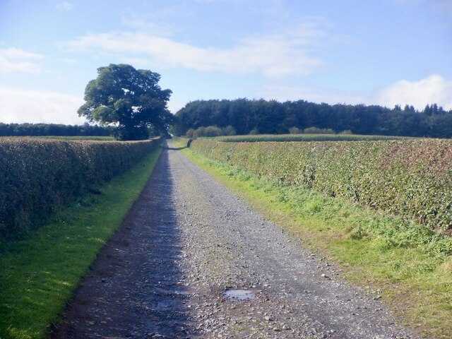
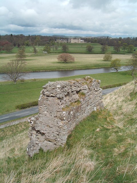
Shirk Stream Images

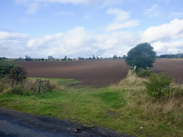
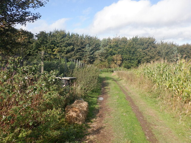
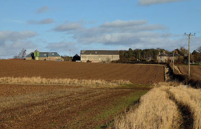
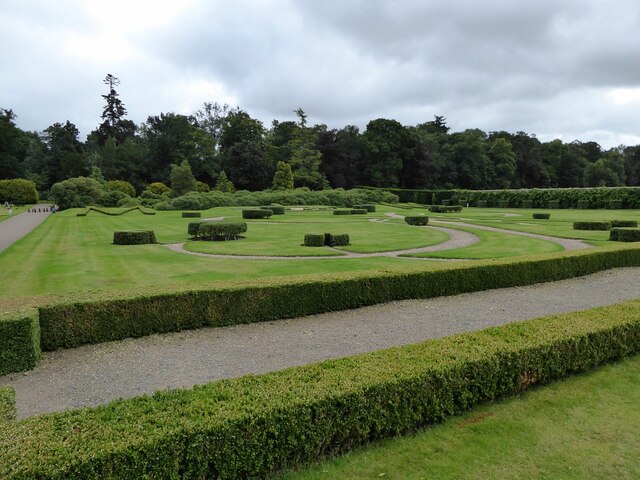
Images are sourced within 2km of 55.59218/-2.4692028 or Grid Reference NT7033. Thanks to Geograph Open Source API. All images are credited.

Winter cereals, Stodrig New seedbed.
Winter cereals, Stodrig
New seedbed.
Summit, Brox Law The maize provides cover and food for pheasants.
Summit, Brox Law
The maize provides cover and food for pheasants.
Arable fields at Galalaw Farm
Millennium Garden at Floors Castle This lovely formal garden with its French-style parterre was created to commemorate the new millennium and features the intertwining initials of the 10th Duke and Duchess of Roxburghe.
Millennium Garden at Floors Castle
This lovely formal garden with its French-style parterre was created to commemorate the new millennium and features the intertwining initials of the 10th Duke and Duchess of Roxburghe.
The approach to Floors Castle Floors Castle is set in the Roxburghe Estate. It is one of the most excellent stately homes Scotland has to offer. 
<span class="nowrap"><a title="https://www.floorscastle.com/visit-us/floors-castle/" rel="nofollow ugc noopener" href="https://www.floorscastle.com/visit-us/floors-castle/">Link</a><img style="margin-left:2px;" alt="External link" title="External link - shift click to open in new window" src="https://s1.geograph.org.uk/img/external.png" width="10" height="10"/></span>
The approach to Floors Castle
Floors Castle is set in the Roxburghe Estate. It is one of the most excellent stately homes Scotland has to offer. LinkExternal link
Home Farm Cottages At Floors Home Farm.
Home Farm Cottages
At Floors Home Farm.
Statue of Hermes in walled garden At Floors Castle.
Statue of Hermes in walled garden
At Floors Castle.
Walled garden at Floors Castle With Hermes on his pedestal.
<a title="https://www.geograph.org.uk/photo/6960162" href="https://www.geograph.org.uk/photo/6960162">Link</a>
Walled garden at Floors Castle
With Hermes on his pedestal. Link
Former Head Gardener's House, Floors Castle, Kelso This house stands within the Walled Garden of Floors Castle and has been beautifully restored. It is now available as a holiday let.
Former Head Gardener's House, Floors Castle, Kelso
This house stands within the Walled Garden of Floors Castle and has been beautifully restored. It is now available as a holiday let.
Floors Castle (Main Block), Kelso Standing on the banks of the River Tweed, Floors Castle has the common 18th-century layout of a main block with two symmetrical service wings. The Castle is a Category A Listed Building.
Floors Castle (Main Block), Kelso
Standing on the banks of the River Tweed, Floors Castle has the common 18th-century layout of a main block with two symmetrical service wings. The Castle is a Category A Listed Building.
Weather Station, Walled Garden, Floors Castle, Kelso This box is known as a Stevenson Screen and contains instruments that measure temperature, humidity and rainfall. An official weather station for the Meteorological Office since 1941, records are collected daily by the Head Gardener and are then passed on to the Meteorological Office.
Weather Station, Walled Garden, Floors Castle, Kelso
This box is known as a Stevenson Screen and contains instruments that measure temperature, humidity and rainfall. An official weather station for the Meteorological Office since 1941, records are collected daily by the Head Gardener and are then passed on to the Meteorological Office.
Road, Floors Castle Newly trimmed hedges.
Road, Floors Castle
Newly trimmed hedges.
Upstream from the last bridge on the Teviot Looking upstream from the bridge where the A699 crosses the Teviot less than a kilometre from its confluence with the Tweed at Kelso.
Upstream from the last bridge on the Teviot
Looking upstream from the bridge where the A699 crosses the Teviot less than a kilometre from its confluence with the Tweed at Kelso.
Riverside path by the Teviot The Borders Abbeys Way follows this attractive stretch of the Teviot between Kelso and Roxburgh, then on to Jedfoot and Jedburgh.
Riverside path by the Teviot
The Borders Abbeys Way follows this attractive stretch of the Teviot between Kelso and Roxburgh, then on to Jedfoot and Jedburgh.
Heron and swan, River Teviot Grey herons are common on the Borders rivers.
Heron and swan, River Teviot
Grey herons are common on the Borders rivers.
Riverside path by the Teviot The path between Kelso and Roxburgh, forming part of the Borders Abbeys Way. The river is low here after a dry spell, with stones and shingle banks above the water in places.
Riverside path by the Teviot
The path between Kelso and Roxburgh, forming part of the Borders Abbeys Way. The river is low here after a dry spell, with stones and shingle banks above the water in places.
Fishing shelter by the Teviot This stretch of river is well supplied with benches and shelters.
Fishing shelter by the Teviot
This stretch of river is well supplied with benches and shelters.
Heiton Mill, River Teviot A conversion of the old mill which is now advertised as self-catering accommodation.
Heiton Mill, River Teviot
A conversion of the old mill which is now advertised as self-catering accommodation.
Show me another place!

Shirk Stream is located at Grid Ref: NT7033 (Lat: 55.59218, Lng: -2.4692028)

Unitary Authority: The Scottish Borders

Police Authority: The Lothians and Scottish Borders

What 3 Words

///dividers.trader.coarser. Near Kelso, Scottish Borders

Related Wikis

Capture of Roxburgh (1314)

The Capture of Roxburgh was a siege that took place in 1314, which was a major conflict in the First War of Scottish Independence. This siege was a prelude...

Roxburgh Castle

Roxburgh Castle is a ruined royal castle that overlooks the junction of the rivers Tweed and Teviot, in the Borders region of Scotland. The town and castle...

Capture of Roxburgh (1460)

The capture of Roxburgh was a siege that took place during the Anglo-Scottish Wars. James II of Scotland had started a campaign to recapture Roxburgh and...

Roxburgh

Roxburgh () is a civil parish and formerly a royal burgh, in the historic county of Roxburghshire in the Scottish Borders, Scotland. It was an important...

Nearby Amenities

Located within 500m of 55.59218,-2.4692028
Roxburgh Barns
Naptan AtcoCode: 69001219
Naptan Bearing: W
Naptan BusStopType: CUS
Naptan CommonName: Roxburgh Barns
Naptan Indicator: nr Road End
Naptan Landmark: Roxburgh Road End
Naptan NaptanCode: 72726564
Naptan Street: A699
Naptan Verified: no
Source: naptan_import
Lat/Long: 55.5910484/-2.4719427
Roxburgh Barns
Naptan AtcoCode: 69001220
Naptan Bearing: E
Naptan BusStopType: CUS
Naptan CommonName: Roxburgh Barns
Naptan Indicator: opp Road End
Naptan Landmark: Roxburgh Road End
Naptan NaptanCode: 72726562
Naptan Street: A699
Naptan Verified: no
Source: naptan_import
Lat/Long: 55.591202/-2.4717224
Daniel's Den
Place: locality
Lat/Long: 55.5936562/-2.4632601
Wester Ana
Place: locality
Lat/Long: 55.593214/-2.4706532
Power: pole
Lat/Long: 55.593027/-2.4643048
Power: pole
Lat/Long: 55.5922428/-2.4658111
Power: pole
Lat/Long: 55.5917844/-2.4649434
Power: pole
Lat/Long: 55.591214/-2.4638181
Power: pole
Lat/Long: 55.5907571/-2.4650206
Power: pole
Lat/Long: 55.590306/-2.4662257
Power: pole
Lat/Long: 55.5898549/-2.4674102
Power: pole
Lat/Long: 55.5893733/-2.4664085
Power: pole
Lat/Long: 55.5888945/-2.4654068
Power: pole
Lat/Long: 55.5876853/-2.4694856
Power: pole
Lat/Long: 55.5878526/-2.4708503
The data included in this document is from www.openstreetmap.org. The data is made available under ODbL.

Have you been to Shirk Stream?

Leave your review of Shirk Stream below (or comments, questions and feedback).