Loch Niocsabhat

Lake, Pool, Pond, Freshwater Marsh in Ross-shire

Scotland

Loch Niocsabhat

Great Bernera bridges The new bridge under construction and the old white bridge.
Great Bernera bridges Credit: Catherine Morgan

Loch Niocsabhat is a picturesque freshwater loch located in Ross-shire, Scotland. Situated amidst the scenic beauty of the Scottish Highlands, it covers an area of approximately 100 acres. The loch is named after the nearby village of Niocsabhat and is a popular destination for nature enthusiasts and anglers alike.

Surrounded by rolling hills and dense forests, Loch Niocsabhat boasts crystal-clear waters that reflect the stunning landscape around it. The loch is primarily fed by small streams and natural springs, ensuring a constant flow of fresh water. It is home to a diverse range of aquatic plants and wildlife, including various species of fish, such as brown trout and perch.

The shoreline of Loch Niocsabhat is adorned with a mix of grassy banks and reed beds, creating a haven for numerous species of birds and waterfowl. Birdwatchers can spot common species like mallards, herons, and swans, as well as more elusive birds like ospreys and golden eagles.

Anglers are drawn to Loch Niocsabhat due to its abundant fish population. The loch offers excellent opportunities for fly fishing, with anglers often reeling in impressive catches of trout. Fishing permits are required to fish in the loch, and local regulations must be followed to ensure the sustainability of the fish population.

Visitors can explore Loch Niocsabhat by foot or by boat. Several walking trails provide access to the loch and its surrounding natural beauty. Additionally, there are boat rental services available for those who wish to venture out onto the tranquil waters and enjoy the serenity of the loch.

Overall, Loch Niocsabhat is a serene and picturesque freshwater loch, offering visitors a chance to immerse themselves in the untouched beauty of the Scottish Highlands and indulge in various recreational activities.

If you have any feedback on the listing, please let us know in the comments section below.

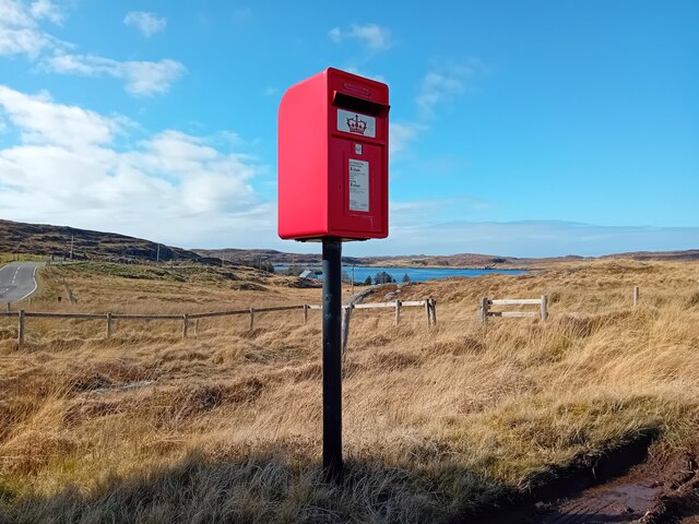
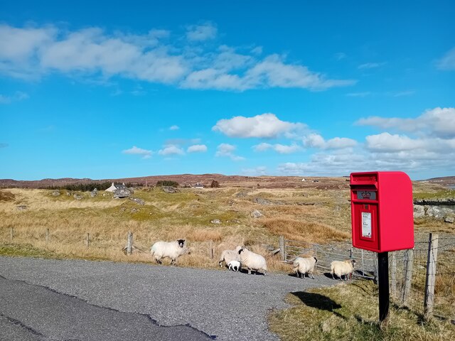
Loch Niocsabhat Images

Images are sourced within 2km of 58.213356/-6.8226094 or Grid Reference NB1635. Thanks to Geograph Open Source API. All images are credited.

Great Bernera bridges The new bridge under construction and the old white bridge.
Great Bernera bridges
The new bridge under construction and the old white bridge.
Postbox at Crulivig HS2 91. Royal Mail list this box as 'Crulivig'.
Postbox at Crulivig
HS2 91. Royal Mail list this box as 'Crulivig'.
Postbox on Great Bernera HS2 88. Royal Mail list this box as 'Shore'.
Postbox on Great Bernera
HS2 88. Royal Mail list this box as 'Shore'.
Postbox on Great Bernera HS2 93. Royal Mail list this box as 'Bernera Post Office'.
Postbox on Great Bernera
HS2 93. Royal Mail list this box as 'Bernera Post Office'.
Craft workshop in Kirkibost One of the old shellfish processing factories at Kirkibost (Circeabost) is now reborn as a craftshop.
Craft workshop in Kirkibost
One of the old shellfish processing factories at Kirkibost (Circeabost) is now reborn as a craftshop.
Cleibh ghiomaich aig cidhe Chirceabost Lobster creels at Kirkibost harbour
Cleibh ghiomaich aig cidhe Chirceabost
Lobster creels at Kirkibost harbour
"The Bridge Across the Atlantic" Bernera Bridge is one of several bridges which claim to span the Atlantic Ocean. This one connects the Lewis mainland with the island of Great Bernera / Bearnaraigh. Note the standing stones on the far side of the bridge.
<span class="nowrap"><a title="http://www.uigandbernera.com/" rel="nofollow ugc noopener" href="http://www.uigandbernera.com/">Link</a><img style="margin-left:2px;" alt="External link" title="External link - shift click to open in new window" src="https://s1.geograph.org.uk/img/external.png" width="10" height="10"/></span>
"The Bridge Across the Atlantic"
Bernera Bridge is one of several bridges which claim to span the Atlantic Ocean. This one connects the Lewis mainland with the island of Great Bernera / Bearnaraigh. Note the standing stones on the far side of the bridge. LinkExternal link
War Memorial, Breacleit The memorial stands on a mound at the crossroads in the centre of Breacleit / Breaclete, the capital of Great Bernera / Bearnaraigh. On the skyline is the Bernera Community Centre.
<span class="nowrap"><a title="http://www.uigandbernera.com/" rel="nofollow ugc noopener" href="http://www.uigandbernera.com/">Link</a><img style="margin-left:2px;" alt="External link" title="External link - shift click to open in new window" src="https://s1.geograph.org.uk/img/external.png" width="10" height="10"/></span>
War Memorial, Breacleit
The memorial stands on a mound at the crossroads in the centre of Breacleit / Breaclete, the capital of Great Bernera / Bearnaraigh. On the skyline is the Bernera Community Centre. LinkExternal link
Breacleit, Bernera Summer flowers, church and school in the village centre.
<span class="nowrap"><a title="http://www.uigandbernera.com/" rel="nofollow ugc noopener" href="http://www.uigandbernera.com/">Link</a><img style="margin-left:2px;" alt="External link" title="External link - shift click to open in new window" src="https://s1.geograph.org.uk/img/external.png" width="10" height="10"/></span>
Breacleit, Bernera
Summer flowers, church and school in the village centre. LinkExternal link
Loch Ionail Freshwater loch on the island of Great Bernera / Bearnaraigh.
<span class="nowrap"><a title="http://www.uigandbernera.com/" rel="nofollow ugc noopener" href="http://www.uigandbernera.com/">Link</a><img style="margin-left:2px;" alt="External link" title="External link - shift click to open in new window" src="https://s1.geograph.org.uk/img/external.png" width="10" height="10"/></span>
Loch Ionail
Freshwater loch on the island of Great Bernera / Bearnaraigh. LinkExternal link
Bernera Bridge Opened in 1953 and connecting Lewis with Great Bernera / Bearnaraigh.
<span class="nowrap"><a title="http://www.uigandbernera.com/" rel="nofollow ugc noopener" href="http://www.uigandbernera.com/">Link</a><img style="margin-left:2px;" alt="External link" title="External link - shift click to open in new window" src="https://s1.geograph.org.uk/img/external.png" width="10" height="10"/></span>
Bernera Bridge
Opened in 1953 and connecting Lewis with Great Bernera / Bearnaraigh. LinkExternal link
Sea Kayakers by Port a Chruidh Kayakers who have come from Miavaig / Miabhaig and are heading eastwards, having just passed below Bernera Bridge. The mainland of Lewis is on the far side of the 1953 bridge.
<span class="nowrap"><a title="http://www.uigandbernera.com/" rel="nofollow ugc noopener" href="http://www.uigandbernera.com/">Link</a><img style="margin-left:2px;" alt="External link" title="External link - shift click to open in new window" src="https://s1.geograph.org.uk/img/external.png" width="10" height="10"/></span>
Sea Kayakers by Port a Chruidh
Kayakers who have come from Miavaig / Miabhaig and are heading eastwards, having just passed below Bernera Bridge. The mainland of Lewis is on the far side of the 1953 bridge. LinkExternal link
Lewisian Gneiss Pink, folded Lewisian gneiss at the north end of Bernera Bridge. These are amongst the oldest rocks in the world.
<span class="nowrap"><a title="http://www.uigandbernera.com/" rel="nofollow ugc noopener" href="http://www.uigandbernera.com/">Link</a><img style="margin-left:2px;" alt="External link" title="External link - shift click to open in new window" src="https://s1.geograph.org.uk/img/external.png" width="10" height="10"/></span>
Lewisian Gneiss
Pink, folded Lewisian gneiss at the north end of Bernera Bridge. These are amongst the oldest rocks in the world. LinkExternal link
Stone Circle by Bernera Bridge Ancient stone circle on a mound above the north end of the bridge. the stones are part of the famous Callanish complex of standing stones.
Stone Circle by Bernera Bridge
Ancient stone circle on a mound above the north end of the bridge. the stones are part of the famous Callanish complex of standing stones.
Cleitir Stone Circle Calanais VIII - four standing stones above Bernera Bridge and the sound separating the island from Lewis.
Cleitir Stone Circle
Calanais VIII - four standing stones above Bernera Bridge and the sound separating the island from Lewis.
Breacleit church and war memorial Breacleit (or Breaclete) is the largest settlement on Great Bernera, an island off the west coast of Lewis attached to that larger island by a bridge. The little church seen here looks to date from the late C19th or early C20th. To its right can be seen the Bernera War Memorial <span class="nowrap"><a title="http://warmemscot.s4.bizhat.com/viewtopic.php?t=323" rel="nofollow ugc noopener" href="http://warmemscot.s4.bizhat.com/viewtopic.php?t=323">Link</a><img style="margin-left:2px;" alt="External link" title="External link - shift click to open in new window" src="https://s1.geograph.org.uk/img/external.png" width="10" height="10"/></span> 
Behind the church can be seen a little of Loch Breacleit.
Breacleit church and war memorial
Breacleit (or Breaclete) is the largest settlement on Great Bernera, an island off the west coast of Lewis attached to that larger island by a bridge. The little church seen here looks to date from the late C19th or early C20th. To its right can be seen the Bernera War Memorial LinkExternal link Behind the church can be seen a little of Loch Breacleit.
The road to Tacleit For anyone who enjoys driving, this is rather a wonderful sight - a well-maintained twisty lane through open countryside with wonderful views.
The lane leads to the settlement of Tacleit from the village of Breacleit on Great Bernera.
The road to Tacleit
For anyone who enjoys driving, this is rather a wonderful sight - a well-maintained twisty lane through open countryside with wonderful views. The lane leads to the settlement of Tacleit from the village of Breacleit on Great Bernera.
View to the mountains of Harris The massive bulk of the mountains of North Harris command the view southwest from Breacleit on Great Bernera.
View to the mountains of Harris
The massive bulk of the mountains of North Harris command the view southwest from Breacleit on Great Bernera.
Show me another place!

Loch Niocsabhat is located at Grid Ref: NB1635 (Lat: 58.213356, Lng: -6.8226094)

Unitary Authority: Na h-Eileanan an Iar

Police Authority: Highlands and Islands

What 3 Words

///regress.backtrack.stubble. Near Carloway, Na h-Eileanan Siar

Related Wikis

Callanish VIII

The Callanish VIII stone setting is one of many megalithic structures around the better-known (and larger) Calanais I on the west coast of the Isle of...

Dun Bharabhat, Great Bernera

Dun Bharabhat (or Dun Baravat) is an Iron Age galleried dun or "semi-broch" situated on the island of Great Bernera near Lewis in Scotland (grid reference...

Breaclete

Breacleit (or Roulanish; Scottish Gaelic: Breacleit; Old Norse: Breiðiklettr) is the central village on Great Bernera in the Outer Hebrides, Scotland....

Great Bernera

Great Bernera (; Scottish Gaelic: Beàrnaraigh Mòr), often known just as Bernera (Scottish Gaelic: Beàrnaraigh), is an island and community in the Outer...

Nearby Amenities

Located within 500m of 58.213356,-6.8226094
Passing Place
Lat/Long: 58.2105431/-6.8285376
Passing Place
Lat/Long: 58.216601/-6.8172196
Passing Place
Lat/Long: 58.2171394/-6.8193556
Passing Place
Lat/Long: 58.2116781/-6.8298007
Power: pole
Lat/Long: 58.2110822/-6.8297802
Power: pole
Lat/Long: 58.211053/-6.8290024
Power: pole
Lat/Long: 58.2110249/-6.8277131
Power: pole
Lat/Long: 58.2110135/-6.8268195
Power: pole
Lat/Long: 58.2109924/-6.8259723
Power: pole
Lat/Long: 58.2105943/-6.8273734
Power: pole
Lat/Long: 58.2103968/-6.8266988
Power: pole
Lat/Long: 58.2101635/-6.8259921
Power: pole
Lat/Long: 58.2099231/-6.8251679
Power: pole
Lat/Long: 58.2096445/-6.8242874
Power: pole
Lat/Long: 58.2093002/-6.8204658
Power: pole
Lat/Long: 58.2095244/-6.8211756
Power: pole
Lat/Long: 58.2097094/-6.8217569
Power: pole
Lat/Long: 58.2099941/-6.8226862
Power: pole
Lat/Long: 58.2103834/-6.8239317
Power: pole
Lat/Long: 58.2106855/-6.8249109
Ford: yes
Lat/Long: 58.2168638/-6.817538
The data included in this document is from www.openstreetmap.org. The data is made available under ODbL.

Have you been to Loch Niocsabhat?

Leave your review of Loch Niocsabhat below (or comments, questions and feedback).