Loch Talamh Mhic Mhàmein

Lake, Pool, Pond, Freshwater Marsh in Ross-shire

Scotland

Loch Talamh Mhic Mhàmein
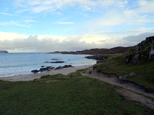
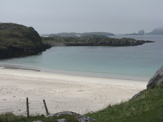
Camas Bastadh/Bostadh Spelled differently on the map and gazetteer.
Camas Bastadh/Bostadh Credit: John Lucas

Loch Talamh Mhic Mhàmein is a picturesque freshwater loch located in the county of Ross-shire, Scotland. Nestled amidst the stunning Scottish Highlands, this natural water body offers a peaceful and serene atmosphere for visitors to enjoy.

With a surface area of approximately 20 hectares, Loch Talamh Mhic Mhàmein boasts crystal-clear waters that reflect the surrounding mountainous landscape. The loch is fed by several small streams and springs, ensuring a constant flow of freshwater. Its depth varies across different sections, ranging from a shallow pool to a maximum depth of around 15 meters.

Surrounded by lush green vegetation, the loch is a haven for various species of wildlife. The marshy areas around its edges provide a perfect habitat for a diverse range of flora and fauna, including reeds, sedges, and water lilies. Birdwatchers will be delighted to spot a wide variety of waterfowl such as ducks, swans, and geese, along with the occasional heron or osprey.

Loch Talamh Mhic Mhàmein offers recreational activities for visitors to enjoy. Fishing enthusiasts can try their luck at catching trout and perch, while boating enthusiasts can explore the calm waters in canoes or small boats. The tranquil surroundings also make it an ideal spot for picnicking or simply enjoying the breathtaking views.

Access to Loch Talamh Mhic Mhàmein is relatively easy, with a nearby car park and a short walk to the loch. The area is well-maintained, with designated paths and picnic areas for visitors' convenience.

Overall, Loch Talamh Mhic Mhàmein is a hidden gem in the heart of Ross-shire, offering a serene and natural retreat for those seeking tranquility amidst Scotland's stunning Highlands.

If you have any feedback on the listing, please let us know in the comments section below.

Loch Talamh Mhic Mhàmein Images

Images are sourced within 2km of 58.247954/-6.8800233 or Grid Reference NB1339. Thanks to Geograph Open Source API. All images are credited.

Camas Bastadh/Bostadh Spelled differently on the map and gazetteer.
Camas Bastadh/Bostadh
Spelled differently on the map and gazetteer.
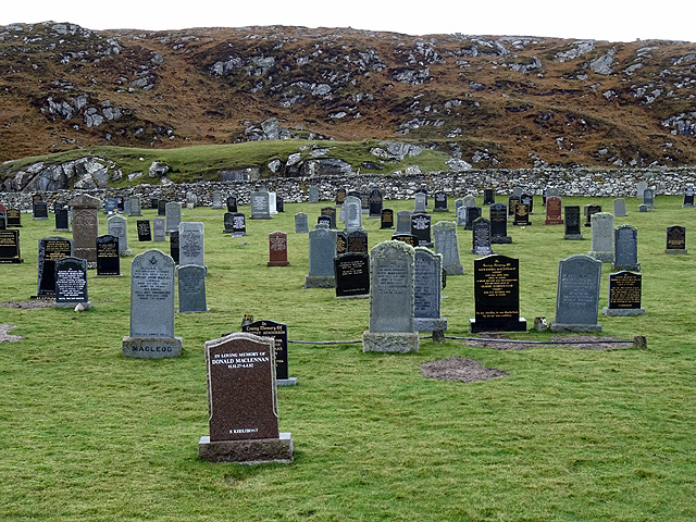
The cemetery at Bostadh Perhaps not a surprising number of burials for such a remote location, as it is a very desirable place to be laid to rest.
The cemetery at Bostadh
Perhaps not a surprising number of burials for such a remote location, as it is a very desirable place to be laid to rest.
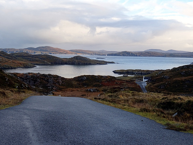
The road to Bostadh With Siaram Bostadh in mid view on the left side.
The road to Bostadh
With Siaram Bostadh in mid view on the left side.
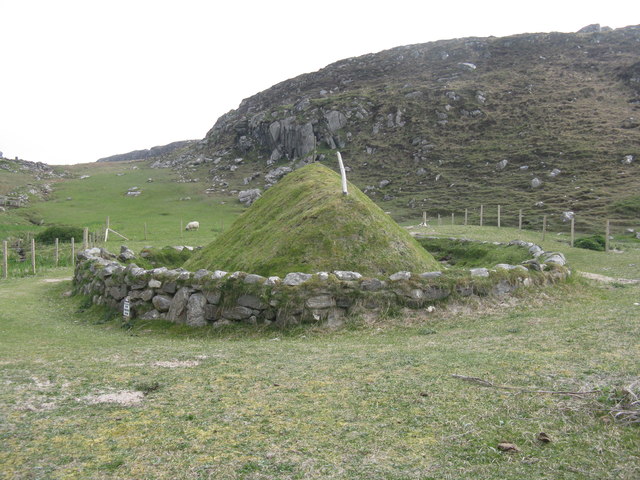
Bostadh Iron Age House The reconstructed house, viewed looking south.
Bostadh Iron Age House
The reconstructed house, viewed looking south.
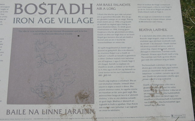
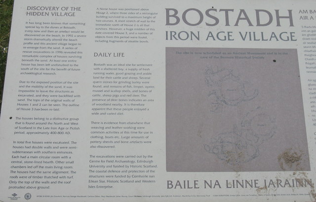
Information about Bostadh Iron Age Village The Gaelic version.
Information about Bostadh Iron Age Village
The Gaelic version.
Information about Bostadh Iron Age Village The English version.
Information about Bostadh Iron Age Village
The English version.
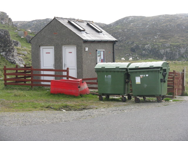
Public convenience at Bostadh Near the end of the road at the cemetery and Iron Age Village.
Public convenience at Bostadh
Near the end of the road at the cemetery and Iron Age Village.
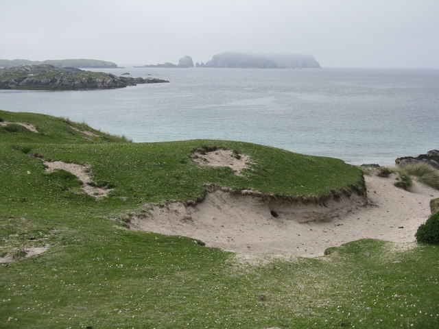
Camas Bostadh Sand dunes at Bostadh, looking to a cloud-covered Flodaigh.
Camas Bostadh
Sand dunes at Bostadh, looking to a cloud-covered Flodaigh.
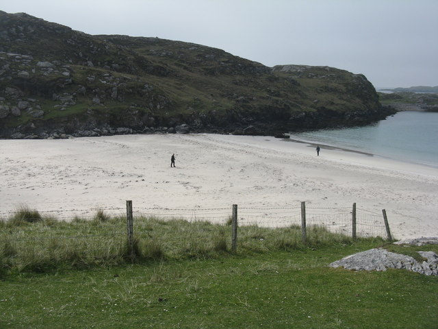
Rocky coast at Bostadh Looking across Camas Bostadh from near the cemetery wall.
Rocky coast at Bostadh
Looking across Camas Bostadh from near the cemetery wall.
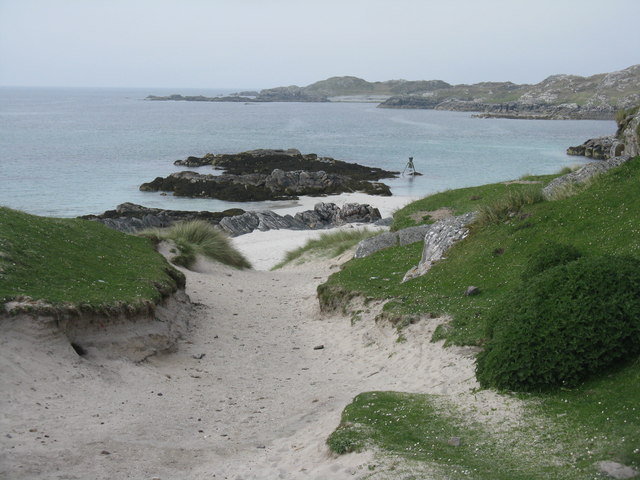
Beach at Bostadh Looking across Camas Bostadh, with part of Flodaigh on the right.
Beach at Bostadh
Looking across Camas Bostadh, with part of Flodaigh on the right.
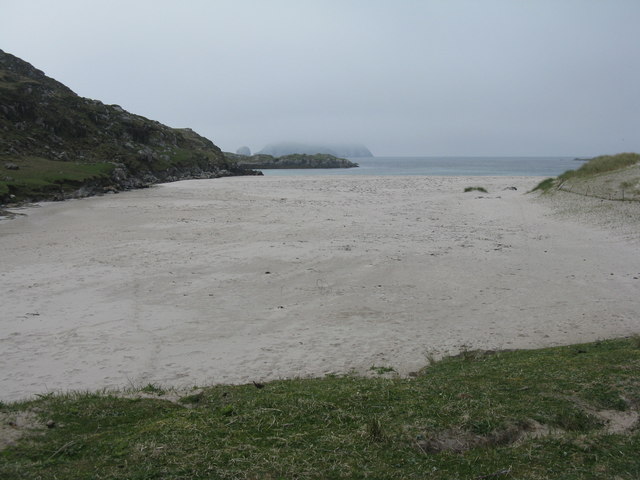
Traigh Bostadh Looking across to Cnoc Urraman.
Traigh Bostadh
Looking across to Cnoc Urraman.
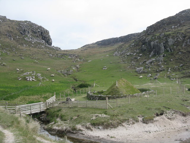
Iron Age Village at Bostadh A reconstructed house and, farther up the valley, traces of other houses.
Iron Age Village at Bostadh
A reconstructed house and, farther up the valley, traces of other houses.
View from an Iron Age house Looking over Traigh Bosdtadh to Camus Bostadh and Flodaigh, from the enclosure surrounding the reconstructed house.
View from an Iron Age house
Looking over Traigh Bosdtadh to Camus Bostadh and Flodaigh, from the enclosure surrounding the reconstructed house.
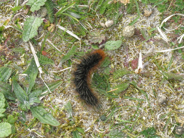
Garden Tiger Moth larva A larva of Arctia caja on the path close to the Iron Age house at Bostadh. Thin plant growth on sand, with clear signs of rabbit grazing.
Garden Tiger Moth larva
A larva of Arctia caja on the path close to the Iron Age house at Bostadh. Thin plant growth on sand, with clear signs of rabbit grazing.
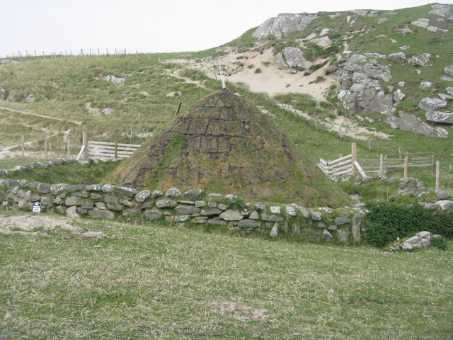
Iron Age House at Bostadh The inland end. Beyond is the path down from the car park.
Iron Age House at Bostadh
The inland end. Beyond is the path down from the car park.
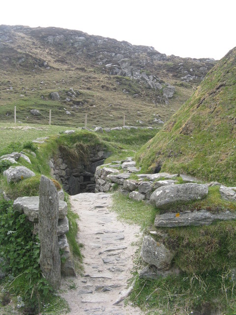
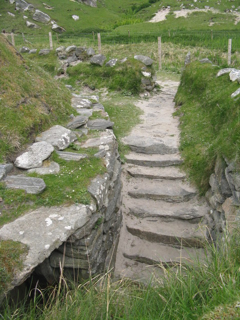
Entrance to the Iron Age House A gap in the surrounding wall leads to the top of steps leading down to an underground entrance.
Entrance to the Iron Age House
A gap in the surrounding wall leads to the top of steps leading down to an underground entrance.
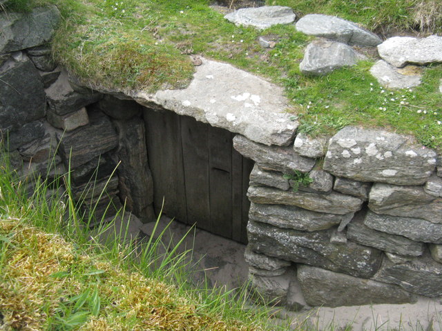
Iron Age House Underground doorway at the foot of the entrance steps. It is possible to go inside when the site is open.
Iron Age House
Underground doorway at the foot of the entrance steps. It is possible to go inside when the site is open.
Steps at the Iron Age House Leading up from the underground entrance.
Steps at the Iron Age House
Leading up from the underground entrance.
Show me another place!

Loch Talamh Mhic Mhàmein is located at Grid Ref: NB1339 (Lat: 58.247954, Lng: -6.8800233)

Unitary Authority: Na h-Eileanan an Iar

Police Authority: Highlands and Islands

What 3 Words

///clutches.narrating.obligated. Near Carloway, Na h-Eileanan Siar

Related Wikis

Bernera Riot

The Bernera Riot occurred in 1874, on the island of Great Bernera, in Scotland in response to the Highland Clearances. The use of the term 'Bernera Riot...

Little Bernera

Little Bernera (Scottish Gaelic: Beàrnaraigh Beag) is a small island situated off the west coast of the Isle of Lewis in the Outer Hebrides. Little Bernera...

Great Bernera

Great Bernera (; Scottish Gaelic: Beàrnaraigh Mòr), often known just as Bernera (Scottish Gaelic: Beàrnaraigh), is an island and community in the Outer...

Flodaigh (Outer Loch Ròg)

Flodaigh is an islet in outer Loch Ròg, Lewis, Scotland. It lies north west of Great Bernera and Little Bernera, south of Bearasaigh and Seanna Chnoc and...

Nearby Amenities

Located within 500m of 58.247954,-6.8800233
The data included in this document is from www.openstreetmap.org. The data is made available under ODbL.

Have you been to Loch Talamh Mhic Mhàmein?

Leave your review of Loch Talamh Mhic Mhàmein below (or comments, questions and feedback).