Loch na Glas-ruaidh

Lake, Pool, Pond, Freshwater Marsh in Inverness-shire

Scotland

Loch na Glas-ruaidh
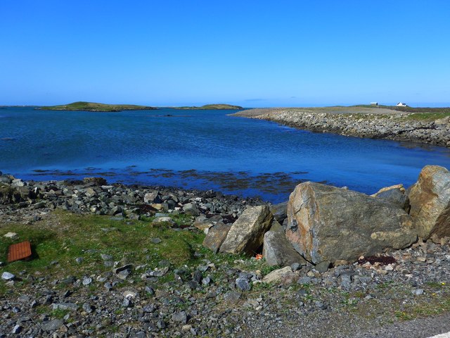
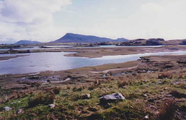
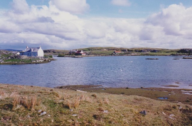
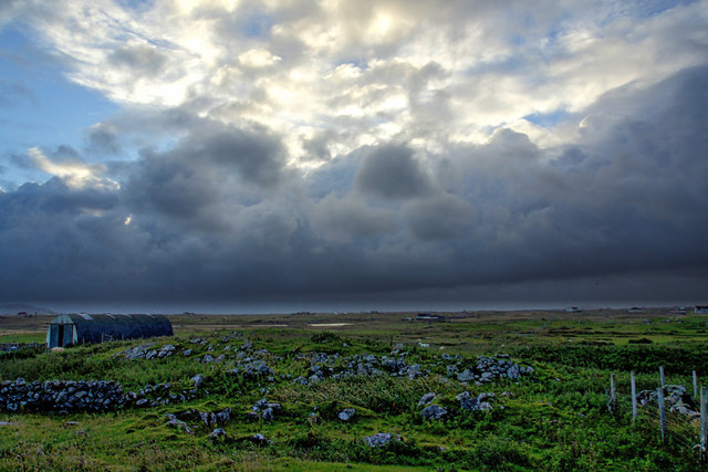
Ocean on the west side of the causeway to North Uist
Ocean on the west side of the causeway to North Uist Credit: Gordon Brown

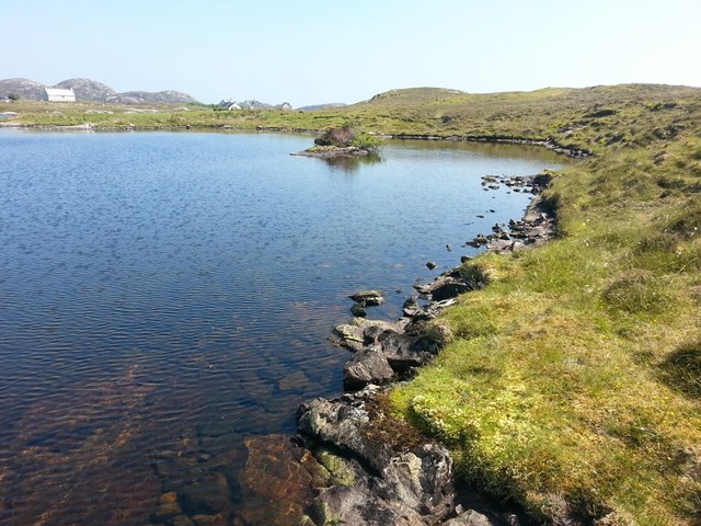
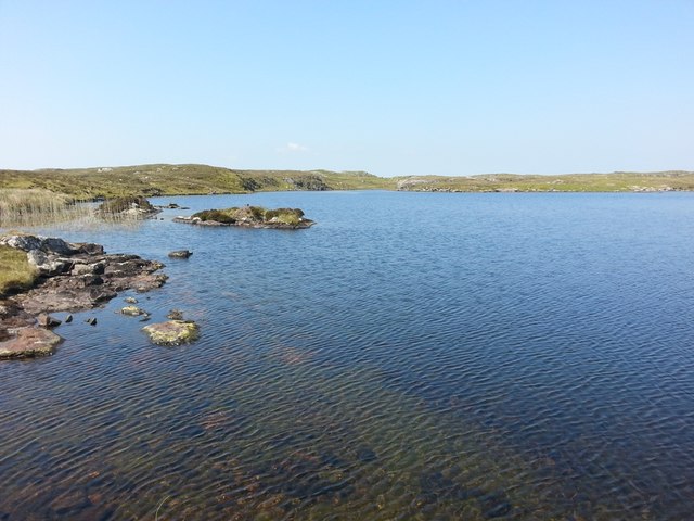
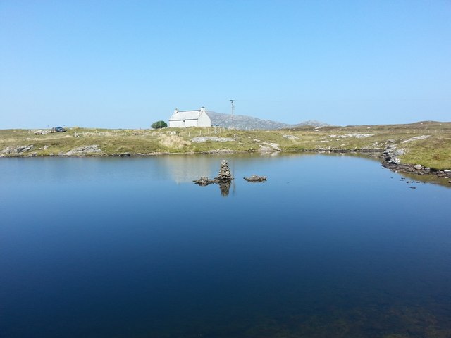
Loch na Glas-ruaidh, located in Inverness-shire, Scotland, is a picturesque freshwater lake nestled amidst the breathtaking Scottish Highlands. The name "Loch na Glas-ruaidh" translates to "lake of the red-grey stream" in Gaelic, perfectly capturing the essence of this natural wonder.

Spanning an area of approximately 50 acres, Loch na Glas-ruaidh boasts crystal-clear waters that reflect the surrounding mountains and lush greenery. The lake is fed by numerous small streams and springs, contributing to its pristine and pure quality. The depth of the loch varies, with the deepest point reaching around 30 meters.

Surrounded by a diverse landscape, this lake is a haven for wildlife enthusiasts and nature lovers. The shores of Loch na Glas-ruaidh are adorned with a rich array of flora, including reeds, rushes, and water lilies, creating a vibrant and colorful scene. This abundance of vegetation provides a habitat for a wide variety of bird species, such as ducks, swans, and herons, which can often be spotted gracefully gliding across the water's surface.

Aside from its natural beauty, Loch na Glas-ruaidh offers ample opportunities for outdoor activities. Anglers can enjoy the tranquility of the lake while fishing for brown trout, which are known to thrive in its waters. Additionally, the surrounding area boasts several walking trails, allowing visitors to explore the magnificent Highland scenery at their own pace.

Overall, Loch na Glas-ruaidh is a true gem of Inverness-shire, offering a peaceful retreat for those seeking solace in nature's embrace. Its stunning landscape and abundant wildlife make it a must-visit destination for anyone venturing into the Scottish Highlands.

If you have any feedback on the listing, please let us know in the comments section below.

Loch na Glas-ruaidh Images

Images are sourced within 2km of 57.497562/-7.2559026 or Grid Reference NF8557. Thanks to Geograph Open Source API. All images are credited.
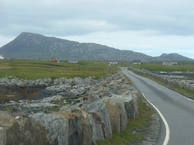
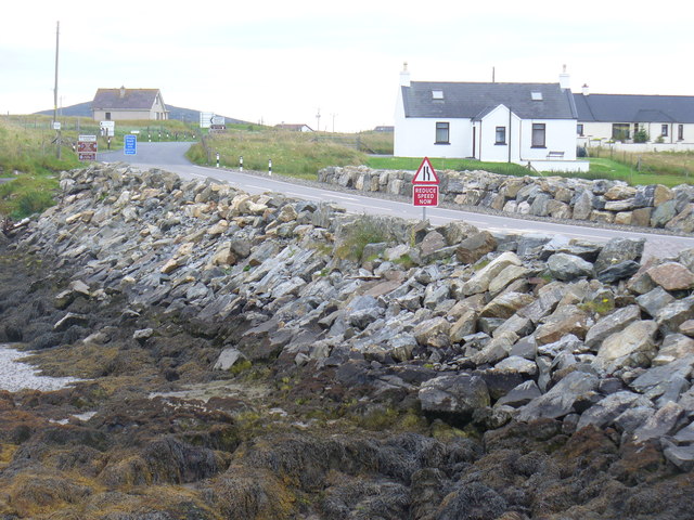
Ocean on the west side of the causeway to North Uist
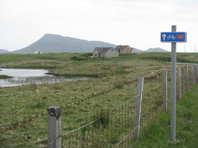
NCN780 on Grimsay Looking east, Loch an Fhaing on the left and Eaval, North Uist, in the distance.
NCN780 on Grimsay
Looking east, Loch an Fhaing on the left and Eaval, North Uist, in the distance.
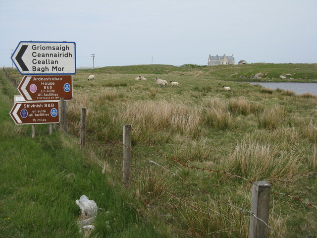
Signpost on Grimsay The house beyond the end of Loch an Fhaing is marked as a Post Office on the map, but the may not be up to date information.
Signpost on Grimsay
The house beyond the end of Loch an Fhaing is marked as a Post Office on the map, but the may not be up to date information.
Bus stop and post box on Grimsay At the road-end of a loop that leaves the main road [A865].
Bus stop and post box on Grimsay
At the road-end of a loop that leaves the main road [A865].
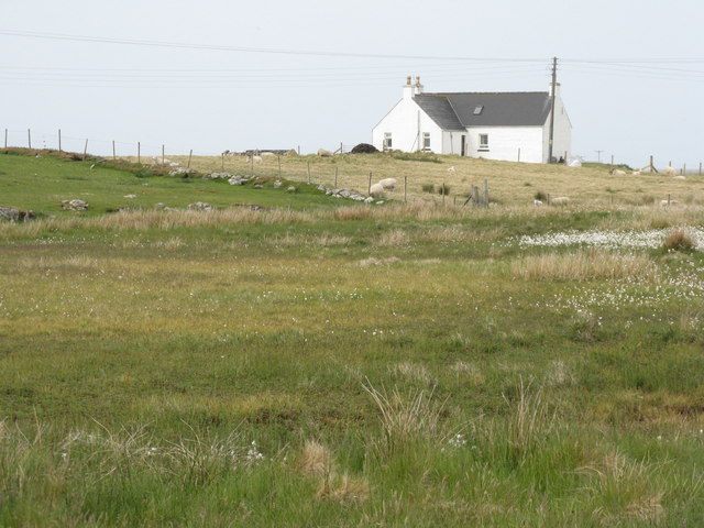
House on Grimsay Looking across Bog Cotton from the A865.
House on Grimsay
Looking across Bog Cotton from the A865.
Gearraidh Dubh Looking over the shore near Gearraidh Dubh towards Eabhal.
Gearraidh Dubh
Looking over the shore near Gearraidh Dubh towards Eabhal.
Loch na Faoileag on Grimsay One of many small islets on Loch na Faoileag on the Isle of Grimsay
Loch na Faoileag on Grimsay
One of many small islets on Loch na Faoileag on the Isle of Grimsay
Loch na Faoileag Shoreline A view along the shoreline to north west finger on Loch na Faoileag (Isle of Grimsay) .Taken on the opposite bank from the roadside.
Loch na Faoileag Shoreline
A view along the shoreline to north west finger on Loch na Faoileag (Isle of Grimsay) .Taken on the opposite bank from the roadside.
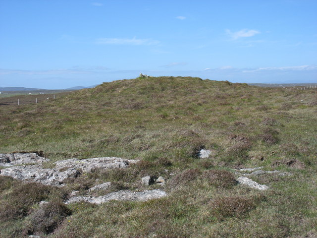
Loch na Faoileag Cairn A small cairn situated at the south-eastern end of Loch na Faoileag.
Loch na Faoileag Cairn
A small cairn situated at the south-eastern end of Loch na Faoileag.
Near Gearraidh Dubh
Near Gearraidh Dubh
Gairbh-eilean
Gairbh-eilean
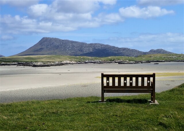
Eilean an t-Seagail Seating located at a parking spot just off the A865 near Baile Glas on Benbecula.
Eilean an t-Seagail
Seating located at a parking spot just off the A865 near Baile Glas on Benbecula.
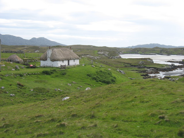
Thatch at Cladach Chairinis
The summit region of Grimsay Grimsay is a low island between North Uist and Benbecula. It is difficult to be certain of its highest point, but this eminence, 25m or so above Mean Sea Level, is a good contender.
The summit region of Grimsay
Grimsay is a low island between North Uist and Benbecula. It is difficult to be certain of its highest point, but this eminence, 25m or so above Mean Sea Level, is a good contender.
Road on Eilean na h-Airigh Leaving the causeway from Benbecula and heading for Grimsay and North Uist. Eaval / Eabhal is the North Uist mountain in the distance.
<span class="nowrap"><a title="http://www.isle-of-benbecula.co.uk/" rel="nofollow ugc noopener" href="http://www.isle-of-benbecula.co.uk/">Link</a><img style="margin-left:2px;" alt="External link" title="External link - shift click to open in new window" src="https://s1.geograph.org.uk/img/external.png" width="10" height="10"/></span>
Road on Eilean na h-Airigh
Leaving the causeway from Benbecula and heading for Grimsay and North Uist. Eaval / Eabhal is the North Uist mountain in the distance. LinkExternal link
Baile Glas, Grimsay Hamlet on the causewayed road between Benbecula and North Uist.
<span class="nowrap"><a title="http://www.isle-of-benbecula.co.uk/" rel="nofollow ugc noopener" href="http://www.isle-of-benbecula.co.uk/">Link</a><img style="margin-left:2px;" alt="External link" title="External link - shift click to open in new window" src="https://s1.geograph.org.uk/img/external.png" width="10" height="10"/></span>
Baile Glas, Grimsay
Hamlet on the causewayed road between Benbecula and North Uist. LinkExternal link
Sand Flats at Grimsay Tidal flats between Grimsay (foreground) and North Uist (background). Eaval / Eabhal is the distinctive mountain.
Sand Flats at Grimsay
Tidal flats between Grimsay (foreground) and North Uist (background). Eaval / Eabhal is the distinctive mountain.
Sandy inlet on the coast of Grimsay One of a maze of inlets and channels around Grimsay. This view is interesting as there are remains of old field walls [possibly iron age/centre picture] visible in the sand, indicating a lower sea level at some time. Cloud capped Eabhal rises in the distance.
Sandy inlet on the coast of Grimsay
One of a maze of inlets and channels around Grimsay. This view is interesting as there are remains of old field walls [possibly iron age/centre picture] visible in the sand, indicating a lower sea level at some time. Cloud capped Eabhal rises in the distance.
Show me another place!

Loch na Glas-ruaidh is located at Grid Ref: NF8557 (Lat: 57.497562, Lng: -7.2559026)

Unitary Authority: Na h-Eileanan an Iar

Police Authority: Highlands and Islands

What 3 Words

///shallower.purses.hindering. Near Balivanich, Na h-Eileanan Siar

Related Wikis

Baile Glas

Baile Glas or Ballaglasa (Scottish Gaelic: Am Baile Glas) is a settlement on Grimsay in the Outer Hebrides, Scotland. Ballaglasa is within the parish of...

Fraoch-Eilean

Fraoch-eilean is a small island with an uncertain population north of Benbecula in the Outer Hebrides of Scotland. It is about 55 hectares (140 acres...

Grimsay

Grimsay (Scottish Gaelic: Griomasaigh) is a tidal island in the Outer Hebrides of Scotland. == Geography == Grimsay is the largest of the low-lying stepping...

Flodaigh

Flodaigh is a tidal island lying to the north of Benbecula and south of Grimsay in the Outer Hebrides, Scotland. It is connected to Benbecula by a causeway...

Nearby Amenities

Located within 500m of 57.497562,-7.2559026
Created By: dmgroom_coastlines
Lat/Long: 57.50117/-7.2522598
Created By: dmgroom_coastlines
Lat/Long: 57.50142/-7.2520098
Passing Place
Lat/Long: 57.4991215/-7.252599
Passing Place
Lat/Long: 57.4992963/-7.2507076
Passing Place
Lat/Long: 57.4993164/-7.2592757
Passing Place
Lat/Long: 57.4994997/-7.2628487
Passing Place
Lat/Long: 57.4996135/-7.2561229
Barrier: cattle_grid
Lat/Long: 57.5001999/-7.2491956
Passing Place
Lat/Long: 57.4993339/-7.2539908
Passing Place
Lat/Long: 57.4994464/-7.2546501
Local Notices
Board Type: notice
Information: board
Tourism: information
Lat/Long: 57.499238/-7.2489552
Post Box
Collection Times: Mo-Fr 11:45; Sa 09:30
Drive Through: yes
Operator: Royal Mail
Post Box Mounting: pole
Post Box Type: lamp
Ref: HS6 34
Royal Cypher: scottish_crown
Lat/Long: 57.4992174/-7.2489493
Baile Glas
Place: hamlet
Wikidata: Q4848304
Wikipedia: en:Baile Glas
Lat/Long: 57.4992473/-7.2623492
Power: pole
Lat/Long: 57.4996689/-7.248859
Power: pole
Lat/Long: 57.4993065/-7.2498563
Power: pole
Lat/Long: 57.4995679/-7.2501142
Power: pole
Lat/Long: 57.5003109/-7.2493377
Power: pole
Lat/Long: 57.4987364/-7.2479967
Power: pole
Lat/Long: 57.4990073/-7.2489797
Power: pole
Lat/Long: 57.4991377/-7.2503405
Power: pole
Lat/Long: 57.4990037/-7.2515747
Power: pole
Lat/Long: 57.4988957/-7.2528622
Power: pole
Lat/Long: 57.4988481/-7.2538948
Power: pole
Lat/Long: 57.4987984/-7.2549516
Power: pole
Lat/Long: 57.4987314/-7.2563919
Power: pole
Lat/Long: 57.4986766/-7.2576445
Power: pole
Lat/Long: 57.4986117/-7.2591412
Power: pole
Lat/Long: 57.4985541/-7.2605869
Power: pole
Lat/Long: 57.4988964/-7.2507567
Power: pole
Lat/Long: 57.4988193/-7.2522748
Power: pole
Lat/Long: 57.4987458/-7.2538465
Power: pole
Lat/Long: 57.4986968/-7.2550039
Power: pole
Lat/Long: 57.4986189/-7.2564724
Power: pole
Lat/Long: 57.4985743/-7.2574809
Power: pole
Lat/Long: 57.4985066/-7.2588837
Power: pole
Lat/Long: 57.4984388/-7.2601229
Power: pole
Lat/Long: 57.4983811/-7.2617
Power: pole
Lat/Long: 57.4985053/-7.2617593
Power: pole
Lat/Long: 57.4980283/-7.2641706
Power: pole
Lat/Long: 57.4982646/-7.2630119
Power: pole
Lat/Long: 57.4981075/-7.2629904
Power: pole
Lat/Long: 57.4990243/-7.2619498
Power: pole
Lat/Long: 57.4995821/-7.2621723
Power: pole
Lat/Long: 57.5000284/-7.2623105
Power: pole
Lat/Long: 57.50009/-7.2616051
Barrier: cattle_grid
Lat/Long: 57.4994014/-7.2490235
Passing Place
Lat/Long: 57.4994876/-7.2576012
Barrier: cattle_grid
Lat/Long: 57.499406/-7.2634832
Power: pole
Lat/Long: 57.5001383/-7.2610436
Power: pole
Lat/Long: 57.4996478/-7.2547074
Power: pole
Lat/Long: 57.4992334/-7.2548402
The data included in this document is from www.openstreetmap.org. The data is made available under ODbL.

Have you been to Loch na Glas-ruaidh?

Leave your review of Loch na Glas-ruaidh below (or comments, questions and feedback).