Valla Ness

Coastal Feature, Headland, Point in Shetland

Scotland

Valla Ness

The Groot, Stavaness Looking West towards The Groot from the sea loch of Stavaness, Nesting
The Groot, Stavaness Credit: Jeremy Duncan

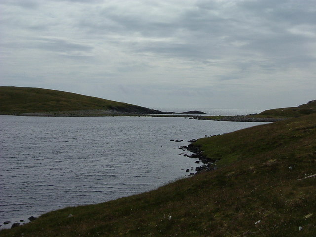
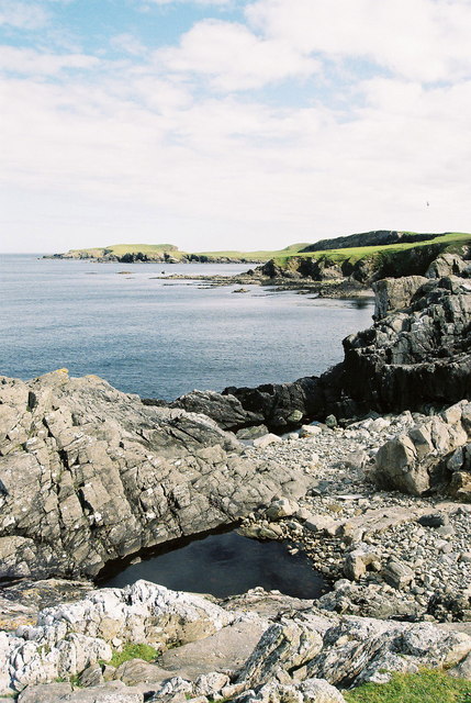
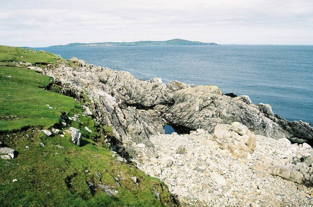
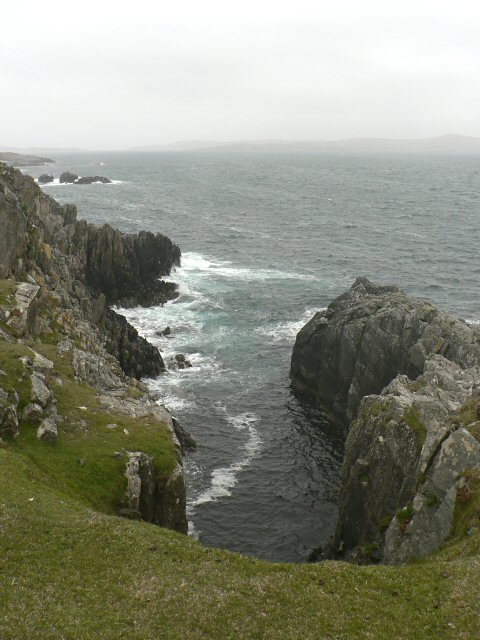
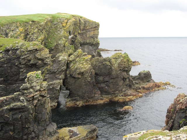
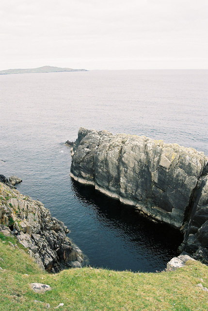
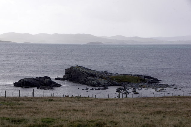
Valla Ness is a prominent coastal feature located in the Shetland Islands, an archipelago in Scotland, United Kingdom. It is a headland that juts out into the North Sea, forming a distinctive point along the rugged coastline.

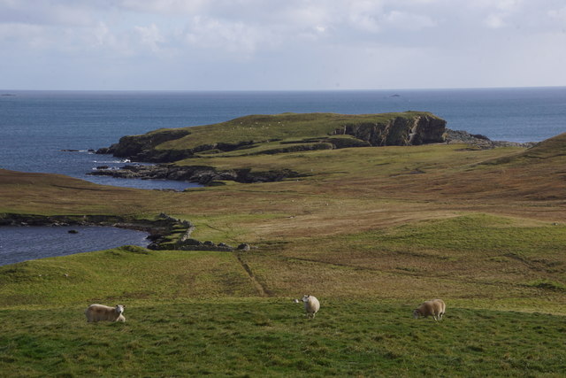
Rising to an elevation of approximately 75 meters (246 feet) above sea level, Valla Ness offers stunning panoramic views of the surrounding landscape. Its rocky cliffs create an impressive backdrop against the crashing waves of the sea. The headland is composed of sedimentary rocks, displaying layers of different colors and textures, which provide a glimpse into the geological history of the area.

The area surrounding Valla Ness is rich in biodiversity, with various seabird species making their homes on the cliffs. Puffins, fulmars, and kittiwakes are commonly spotted in the vicinity. The headland also serves as a feeding ground for seals, which can often be seen lounging on nearby rocks.

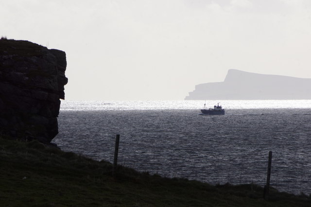
Access to Valla Ness is relatively easy, with a well-maintained footpath leading visitors to the headland. As visitors explore the area, they can enjoy the fresh sea air and the sound of seabirds echoing along the coastline. The location is popular among nature enthusiasts, hikers, and photographers who appreciate the raw beauty of the Shetland Islands.

Overall, Valla Ness is a captivating and picturesque coastal feature, offering visitors a chance to immerse themselves in the stunning natural scenery of the Shetland Islands.

If you have any feedback on the listing, please let us know in the comments section below.
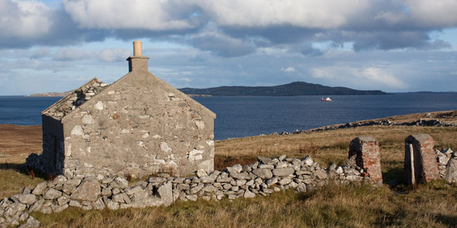
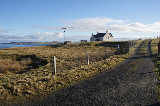
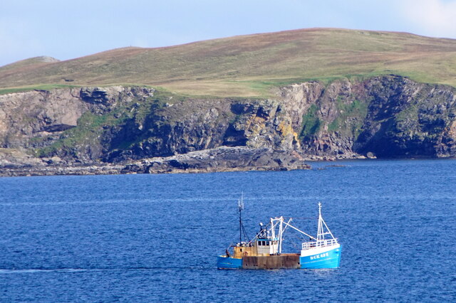
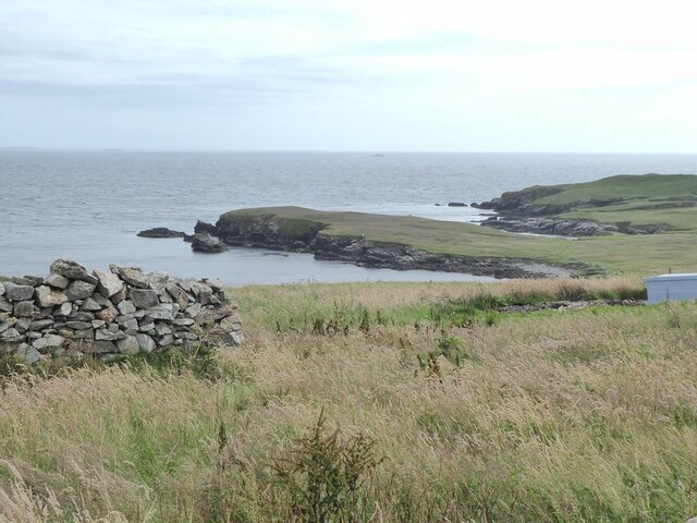
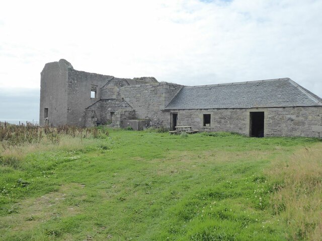
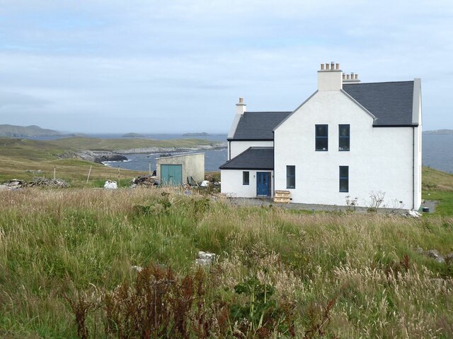
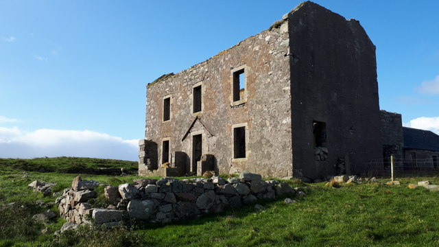
Valla Ness Images

Images are sourced within 2km of 60.309111/-1.0905097 or Grid Reference HU5058. Thanks to Geograph Open Source API. All images are credited.

The Groot, Stavaness Looking West towards The Groot from the sea loch of Stavaness, Nesting
The Groot, Stavaness
Looking West towards The Groot from the sea loch of Stavaness, Nesting
Coastline from Valla Ness, Kirkabister, Shetland This view shows the rocky coastline from Valla Ness across the Wick of Neap to Hog Island and Stany Hog.  The tide rarely, if ever, covers the pool in the foreground.
Coastline from Valla Ness, Kirkabister, Shetland
This view shows the rocky coastline from Valla Ness across the Wick of Neap to Hog Island and Stany Hog. The tide rarely, if ever, covers the pool in the foreground.
Coastline at Valla Ness, looking NE to Whalsay The foreground shows the rough pasture and coastline in this part of Mainland Shetland.
The island of Whalsay, which lies North East of Lerwick, can clearly be seen in the distance, around 5km from where the picture was taken.
Coastline at Valla Ness, looking NE to Whalsay
The foreground shows the rough pasture and coastline in this part of Mainland Shetland. The island of Whalsay, which lies North East of Lerwick, can clearly be seen in the distance, around 5km from where the picture was taken.
Seli Geo
Seli Geo
Sea arch on Hog Island
Calm sea at Seli Geo - with Whalsay on the horizon
Old Farm Machinery, Nesting, Shetland Islands Old farm machinery at Nesting near Neap, Kirkabister, Shetland Islands, with the island of Whalsay in the distance
Old Farm Machinery, Nesting, Shetland Islands
Old farm machinery at Nesting near Neap, Kirkabister, Shetland Islands, with the island of Whalsay in the distance
Ruined croft near Neap, Shetland Islands A ruined croft near Neap, Kirkabister, Shetland Islands
Ruined croft near Neap, Shetland Islands
A ruined croft near Neap, Kirkabister, Shetland Islands
Ruined crofthouse near Neap, Shetland Islands A ruined crofthouse near Neap, Nesting, Shetland Islands, with the island of Whalsay in the distance
Ruined crofthouse near Neap, Shetland Islands
A ruined crofthouse near Neap, Nesting, Shetland Islands, with the island of Whalsay in the distance
Neap, Kirkabister, Nesting
Hill of Neap, Nesting, from Brettabister The vessel is the Buckie registered BCK 625 'Kelly'
Hill of Neap, Nesting, from Brettabister
The vessel is the Buckie registered BCK 625 'Kelly'
The Wick of Neap With Hog Island to the right and further away.
The Wick of Neap
With Hog Island to the right and further away.
Ruin and barn at Neap
House at Neap The Wick of Neap and Valla Ness beyond. Further away, part obscured, is Stava Ness <a href="https://www.geograph.org.uk/gridref/HU5060">HU5060</a>.
House at Neap
The Wick of Neap and Valla Ness beyond. Further away, part obscured, is Stava Ness HU5060.
Ruin at Neap, Kirkabister, Nesting
View to Hog Island from Neap, Kirkabister, Nesting In Shetland, a hog is a young ram and not a pig.
View to Hog Island from Neap, Kirkabister, Nesting
In Shetland, a hog is a young ram and not a pig.
Ura Stack, Kirkabister, Nesting
Small boat passing the Keen, Kirkabister, Nesting Noss in the distance.
Small boat passing the Keen, Kirkabister, Nesting
Noss in the distance.
Show me another place!

Valla Ness is located at Grid Ref: HU5058 (Lat: 60.309111, Lng: -1.0905097)

Unitary Authority: Shetland Islands

Police Authority: Highlands and Islands

What 3 Words

///throat.madness.jams. Near Symbister, Shetland Islands

Related Wikis

Neap

Neap is a small village in the east coast of the Mainland of the Shetland Islands, Scotland. Neap is situated at the end of the road from Brettabister...

Brettabister

Brettabister is a settlement on the island of Mainland in Shetland, Scotland. It is in the parish of Nesting. St. Ola's parish church lies to the east...

Nesting, Shetland

Nesting is a parish in the Shetland Islands, Scotland. It includes a part of the east Shetland Mainland, measuring about twelve by four miles (19 by 6...

Billister

Billister is a settlement in the parish of Nesting, on the island of Mainland, in Shetland, Scotland. It is on Lax Firth. Billister was formerly the terminal...

Holm of Sandwick

The Holm of Sandwick is an islet, located roughly 100 metres (330 ft) off Haa Ness and the southwestern side of Whalsay, in the Shetland Islands of Scotland...

Clate

Clate (also known as Clett) is a hamlet and ward in southwestern Whalsay in the parish of Nesting in the Shetland Islands of Scotland. == Geography... ==

Sandwick, Whalsay

Sandwick is a hamlet, often considered part of the main village of Symbister along with adjacent Harlsdale, in the parish of Nesting in southwestern Whalsay...

Symbister House

Symbister House is a former country house in Symbister, Whalsay island, in the Shetland islands of Scotland. It was built in 1823 by the Bruce family who...

Nearby Amenities

Located within 500m of 60.309111,-1.0905097
Neap
Place: locality
Lat/Long: 60.3066338/-1.0916868
Power: pole
Lat/Long: 60.3063398/-1.0940627
Power: pole
Lat/Long: 60.3062644/-1.0951589
Power: pole
Lat/Long: 60.3061866/-1.0961459
The data included in this document is from www.openstreetmap.org. The data is made available under ODbL.

Have you been to Valla Ness?

Leave your review of Valla Ness below (or comments, questions and feedback).