Rubha nan Caorach

Coastal Feature, Headland, Point in Ross-shire

Scotland

Rubha nan Caorach

Chicken Head and Chicken Rock The rocks lying off Chicken Head are called Hen & Chickens and Cock Rock.  The paddle steamer HMS Lively ran aground on the rocks in 1883 and was wrecked (all aboard were rescued). The scattered wreckage of the Lively is marked by the yellow buoy at position 59°10.610’N, 06°15.467’W in depths up to 15 metres (<span class="nowrap"><a title="https://www.scottishshipwrecks.com/hms-lively/" rel="nofollow ugc noopener" href="https://www.scottishshipwrecks.com/hms-lively/">Link</a><img style="margin-left:2px;" alt="External link" title="External link - shift click to open in new window" src="https://s1.geograph.org.uk/img/external.png" width="10" height="10"/></span> Scottish Shipwrecks).
Chicken Head and Chicken Rock Credit: David Dixon

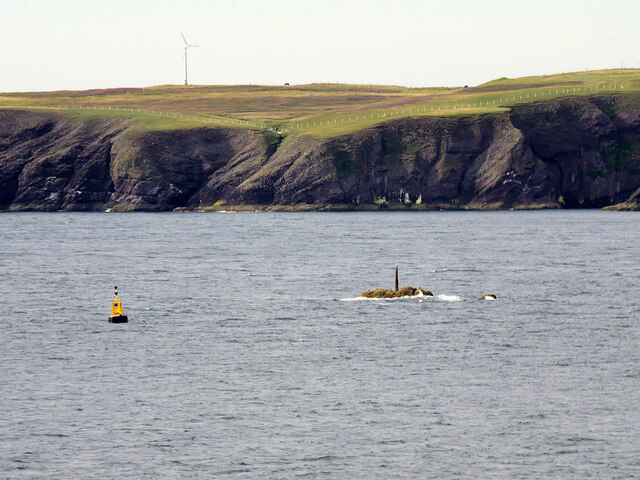
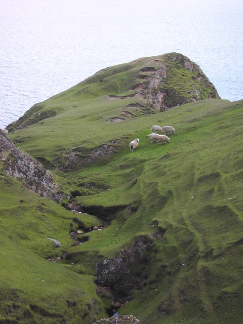
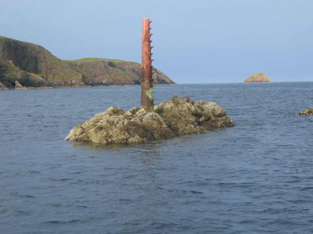
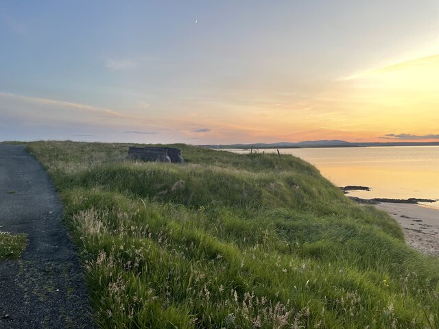
Rubha nan Caorach, located in Ross-shire, Scotland, is a stunning headland that juts out into the North Atlantic Ocean. This coastal feature is known for its rugged beauty and breathtaking views. The name "Rubha nan Caorach" translates to "Point of the Sheep" in English.

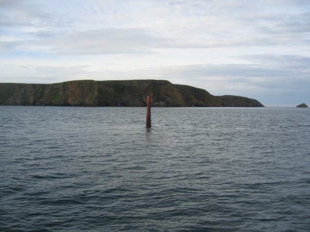
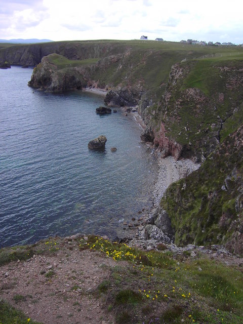
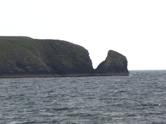
Situated on the northwest coast of Scotland, Rubha nan Caorach stands tall with its rocky cliffs and jagged edges. The headland offers a panoramic vista of the surrounding landscape, with the vast ocean stretching out as far as the eye can see. The area is characterized by its dramatic coastline, featuring sea stacks, caves, and natural arches carved by the relentless waves over centuries.

The headland is also home to a diverse range of wildlife. Seabirds such as gulls, fulmars, and puffins can be spotted nesting along the cliffs, while seals can often be seen basking on nearby rocks or swimming in the waters below. Dolphins and whales occasionally visit the area, adding to the allure of Rubha nan Caorach.

For nature lovers and outdoor enthusiasts, Rubha nan Caorach offers opportunities for exploration and adventure. Hiking trails wind their way along the headland, providing breathtaking views and a chance to discover the area's unique flora and fauna. The rugged terrain and crashing waves make it a popular spot for photographers and artists alike, capturing the untamed beauty of this coastal gem.

Overall, Rubha nan Caorach is a captivating headland, offering a blend of natural beauty, wildlife, and adventure. Its remote location and untouched landscapes make it a must-visit destination for those seeking a true Scottish coastal experience.

If you have any feedback on the listing, please let us know in the comments section below.

Rubha nan Caorach Images

Images are sourced within 2km of 58.191804/-6.2748878 or Grid Reference NB4830. Thanks to Geograph Open Source API. All images are credited.
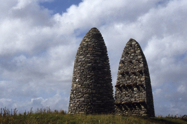
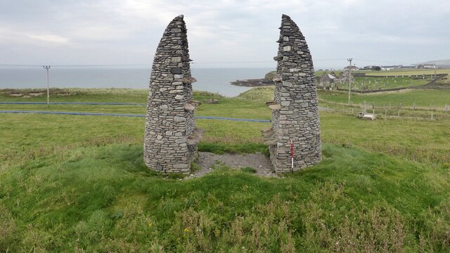
Chicken Head and Chicken Rock The rocks lying off Chicken Head are called Hen & Chickens and Cock Rock.  The paddle steamer HMS Lively ran aground on the rocks in 1883 and was wrecked (all aboard were rescued). The scattered wreckage of the Lively is marked by the yellow buoy at position 59°10.610’N, 06°15.467’W in depths up to 15 metres (<span class="nowrap"><a title="https://www.scottishshipwrecks.com/hms-lively/" rel="nofollow ugc noopener" href="https://www.scottishshipwrecks.com/hms-lively/">Link</a><img style="margin-left:2px;" alt="External link" title="External link - shift click to open in new window" src="https://s1.geograph.org.uk/img/external.png" width="10" height="10"/></span> Scottish Shipwrecks).
Chicken Head and Chicken Rock
The rocks lying off Chicken Head are called Hen & Chickens and Cock Rock. The paddle steamer HMS Lively ran aground on the rocks in 1883 and was wrecked (all aboard were rescued). The scattered wreckage of the Lively is marked by the yellow buoy at position 59°10.610’N, 06°15.467’W in depths up to 15 metres (LinkExternal link Scottish Shipwrecks).
Chicken Head The red beacon marking Chicken Rock is seen centre of frame with Chicken Head prominent behind it and Eilean Croitach to extreme right.
The name of this headland is misleading in that in Old Norse it would have been "Kirk Ness" meaning the point or headland with a Church.
The Scottish Gaelic word for "chicken" is "Cearc" which is similar in pronunciation to "Kirk" (Church). The translations were mixed up so we have finished up with "Chicken Head" on the modern maps.
Chicken Head
The red beacon marking Chicken Rock is seen centre of frame with Chicken Head prominent behind it and Eilean Croitach to extreme right. The name of this headland is misleading in that in Old Norse it would have been "Kirk Ness" meaning the point or headland with a Church. The Scottish Gaelic word for "chicken" is "Cearc" which is similar in pronunciation to "Kirk" (Church). The translations were mixed up so we have finished up with "Chicken Head" on the modern maps.
The coastline in Geodh a Chuibhrig Suardail can be seen in the background
The coastline in Geodh a Chuibhrig
Suardail can be seen in the background
A burn on the common grazings
Chicken Rock Chicken Head and Eilean Crotach in distance.
Chicken Rock
Chicken Head and Eilean Crotach in distance.
Chicken Head Viewed from the causeway across to the Eye Peninsula.
Chicken Head
Viewed from the causeway across to the Eye Peninsula.
Bayble Hill trig
Bayble Hill trig
Horses at Aiginis Geocaching is a type of global treasure hunt of people looking for caches, or hidden stashes of objects. Geocaching may also be described as a series of hide-and-seek games, where hiders provide online clues for seekers. Seekers use global positioning system (GPS) devices to find hidden caches
Horses at Aiginis
Geocaching is a type of global treasure hunt of people looking for caches, or hidden stashes of objects. Geocaching may also be described as a series of hide-and-seek games, where hiders provide online clues for seekers. Seekers use global positioning system (GPS) devices to find hidden caches
Sunsets on An Rubha Geocaching is a type of global treasure hunt of people looking for caches, or hidden stashes of objects. Geocaching may also be described as a series of hide-and-seek games, where hiders provide online clues for seekers. Seekers use global positioning system (GPS) devices to find hidden caches
Sunsets on An Rubha
Geocaching is a type of global treasure hunt of people looking for caches, or hidden stashes of objects. Geocaching may also be described as a series of hide-and-seek games, where hiders provide online clues for seekers. Seekers use global positioning system (GPS) devices to find hidden caches
Farm Raiders Monument I came across three monumental and memorial cairns in a visit to Lewis and Harris, all a tribute to the people who took action to recover their homes and livelihoods in the land struggles between landlords and crofters in the 19th and early 20th centuries.
That to the Grias & Coll Raiders [NB4639], the northernmost of the three, honours the men who suffered in the Great War [1914-18] and were promised land and homes when they returned, but the promises were not honoured. The cairn is built on the site of the confrontation between the crofters of the area and Lord Leverhulme, the owner of Lewis and Harris at the time – he planned to industrialise Lewis and opposed the Board of Agriculture’s proposals to divide farms into crofts for landless families. In March 1919 some of the biggest land raids were at Upper Coll and Cress, and land raids continued throughout Lewis until 1921, when the Coll Raiders, in spite of warnings, raided and took possession of Upper Coll, a township from which their ancestors had been evicted, and distributed the land amongst their landless families. The earthworks represent the forms of trenches and waves, symbols of promises given to ex-servicemen that they would be settled on the land after the war.
The cairn at Aignish [NB4832] commemorates and symbolises the confrontation between the Aignish Raiders and the military on 9 January 1888. The raiders, men and women of Point, were driven beyond endurance by destitution and oppression. Instead of helping, the authorities used the military to try to repel the raiders. The raiders failed to hold the farm and 13 were sentenced to prison, but the episode brought their plight to a wider audience, but it was not until 1905 that the farm was divided into crofts.
At Bailailean [NB2619] the three entrances to the cairn represent the three communities that took part in the Pairc Deer Raid - Pairc, North Lochs and Kinloch. On 22 November 1887 several hundred crofters from the Pairc townships protested at their treatment by their landlords - many townships in the area had been cleared to give more access to land for deer hunting. A large number of deer were killed and a police and marines were sent to quell what was thought to be a full scale rebellion, and the Riot Act was read by the Sheriff at Ruadh Chleit [NB2908]. Six land raiders were arrested, but acquitted at the High Court in Edinburgh in January 1888. 
The three monuments were designed by Will McLean in 1994-6 and built by local stonemason Jim Crawford.
Two interesting accounts of the land struggle generally, not just on Lewis and Harris, are ‘Mightier than a Lord’ by Iain Fraser Grigor [1979], Acair Limited, ISBN 0 86152 030 0, and ‘Go Listen to the Crofters’ by A.D. Cameron [1986], Acair Limited, ISBN 0 86152 063 7, although neither specifically cover the events marked by the cairns, which were a little later.
Neil MacGregor [ex-Director of the British Museum] covered the Raiders in his Radio 4 series [episode 5] <span class="nowrap"><a title="https://www.bbc.co.uk/programmes/m0015474," rel="nofollow ugc noopener" href="https://www.bbc.co.uk/programmes/m0015474,">Link</a><img style="margin-left:2px;" alt="External link" title="External link - shift click to open in new window" src="https://s1.geograph.org.uk/img/external.png" width="10" height="10"/></span> broadcast on 11 March 2022, when he visited Lews Castle Museum in Stornoway Museum nan Eilean (Stornoway) <span class="nowrap"><a title="https://www.cne-siar.gov.uk/leisure-sport-and-culture/museum-nan-eilean/museum-nan-eilean-stornoway/" rel="nofollow ugc noopener" href="https://www.cne-siar.gov.uk/leisure-sport-and-culture/museum-nan-eilean/museum-nan-eilean-stornoway/">Link</a><img style="margin-left:2px;" alt="External link" title="External link - shift click to open in new window" src="https://s1.geograph.org.uk/img/external.png" width="10" height="10"/></span>. A modern extension, opened in 2017, contains a feature on the Raiders memorial, but as yet [March 2022] we have no Geograph coverage.
Farm Raiders Monument
I came across three monumental and memorial cairns in a visit to Lewis and Harris, all a tribute to the people who took action to recover their homes and livelihoods in the land struggles between landlords and crofters in the 19th and early 20th centuries. That to the Grias & Coll Raiders [NB4639], the northernmost of the three, honours the men who suffered in the Great War [1914-18] and were promised land and homes when they returned, but the promises were not honoured. The cairn is built on the site of the confrontation between the crofters of the area and Lord Leverhulme, the owner of Lewis and Harris at the time – he planned to industrialise Lewis and opposed the Board of Agriculture’s proposals to divide farms into crofts for landless families. In March 1919 some of the biggest land raids were at Upper Coll and Cress, and land raids continued throughout Lewis until 1921, when the Coll Raiders, in spite of warnings, raided and took possession of Upper Coll, a township from which their ancestors had been evicted, and distributed the land amongst their landless families. The earthworks represent the forms of trenches and waves, symbols of promises given to ex-servicemen that they would be settled on the land after the war. The cairn at Aignish [NB4832] commemorates and symbolises the confrontation between the Aignish Raiders and the military on 9 January 1888. The raiders, men and women of Point, were driven beyond endurance by destitution and oppression. Instead of helping, the authorities used the military to try to repel the raiders. The raiders failed to hold the farm and 13 were sentenced to prison, but the episode brought their plight to a wider audience, but it was not until 1905 that the farm was divided into crofts. At Bailailean [NB2619] the three entrances to the cairn represent the three communities that took part in the Pairc Deer Raid - Pairc, North Lochs and Kinloch. On 22 November 1887 several hundred crofters from the Pairc townships protested at their treatment by their landlords - many townships in the area had been cleared to give more access to land for deer hunting. A large number of deer were killed and a police and marines were sent to quell what was thought to be a full scale rebellion, and the Riot Act was read by the Sheriff at Ruadh Chleit [NB2908]. Six land raiders were arrested, but acquitted at the High Court in Edinburgh in January 1888. The three monuments were designed by Will McLean in 1994-6 and built by local stonemason Jim Crawford. Two interesting accounts of the land struggle generally, not just on Lewis and Harris, are ‘Mightier than a Lord’ by Iain Fraser Grigor [1979], Acair Limited, ISBN 0 86152 030 0, and ‘Go Listen to the Crofters’ by A.D. Cameron [1986], Acair Limited, ISBN 0 86152 063 7, although neither specifically cover the events marked by the cairns, which were a little later. Neil MacGregor [ex-Director of the British Museum] covered the Raiders in his Radio 4 series [episode 5] LinkExternal link broadcast on 11 March 2022, when he visited Lews Castle Museum in Stornoway Museum nan Eilean (Stornoway) LinkExternal link. A modern extension, opened in 2017, contains a feature on the Raiders memorial, but as yet [March 2022] we have no Geograph coverage.
Road of  An Rubha
Road of An Rubha
Roads of An Rubha
Roads of An Rubha
Roads of An Rubha
Roads of An Rubha
Roads of An Rubha
Roads of An Rubha
Raiders Monument at Aiginis Farm near Stornoway From Wikipedia: Aignish is hugely important in the context of the history of Scottish land reform following the Aignish Riot of January 1888. This took place in the aftermath of land agitation following the groundbreaking legal victory of the Bernera Riot of 1874 and the Park deer raid of 1887. It was part of the Crofters' War and involved a standoff between the local landless peasantry and the heavily armed marines that were drafted in. The courage of the people is now marked by a very impressively designed memorial cairn.
Raiders Monument at Aiginis Farm near Stornoway
From Wikipedia: Aignish is hugely important in the context of the history of Scottish land reform following the Aignish Riot of January 1888. This took place in the aftermath of land agitation following the groundbreaking legal victory of the Bernera Riot of 1874 and the Park deer raid of 1887. It was part of the Crofters' War and involved a standoff between the local landless peasantry and the heavily armed marines that were drafted in. The courage of the people is now marked by a very impressively designed memorial cairn.
The beach west of Aiginis
Aignish Farm Raiders Monument Built in 1995 this is a memorial to a land raid in 1888. <span class="nowrap"><a title="https://canmore.org.uk/site/118894/lewis-aignish-farm-raiders-monument" rel="nofollow ugc noopener" href="https://canmore.org.uk/site/118894/lewis-aignish-farm-raiders-monument">Link</a><img style="margin-left:2px;" alt="External link" title="External link - shift click to open in new window" src="https://s1.geograph.org.uk/img/external.png" width="10" height="10"/></span>
Aignish Farm Raiders Monument
Built in 1995 this is a memorial to a land raid in 1888. LinkExternal link
St Columba's Church A 14th century church with later additions. <span class="nowrap"><a title="https://canmore.org.uk/site/4308/lewis-aignish-st-columbas-church" rel="nofollow ugc noopener" href="https://canmore.org.uk/site/4308/lewis-aignish-st-columbas-church">Link</a><img style="margin-left:2px;" alt="External link" title="External link - shift click to open in new window" src="https://s1.geograph.org.uk/img/external.png" width="10" height="10"/></span>
St Columba's Church
A 14th century church with later additions. LinkExternal link
Show me another place!

Rubha nan Caorach is located at Grid Ref: NB4830 (Lat: 58.191804, Lng: -6.2748878)

Unitary Authority: Na h-Eileanan an Iar

Police Authority: Highlands and Islands

What 3 Words

///funded.blurs.mothering. Near Stornoway, Na h-Eileanan Siar

Related Wikis

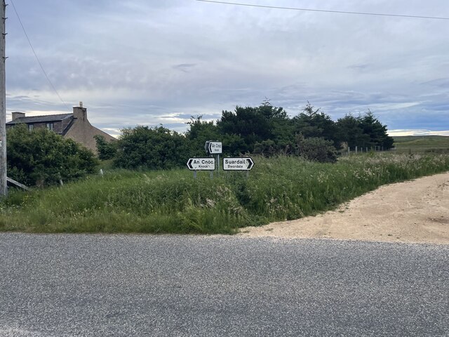
Knock, Isle of Lewis

Knock, from the Gaelic, An Cnoc (a small hill), is a village in Point peninsula on the Isle of Lewis in the Outer Hebrides of Scotland. Point (an Rubha...

Aignish

Aignish (Scottish Gaelic: Aiginis) is located northwest of Knock and east of Stornoway on the east coast of the Isle of Lewis, in the Outer Hebrides, Scotland...

Branahuie

Branahuie (Scottish Gaelic: Bràigh na h-Aoidhe) is a village on the Isle of Lewis in the Outer Hebrides, Scotland. Branahuie is within the parish of Stornoway...

Melbost

Melbost (Scottish Gaelic: Mealabost) is a traditionally Gaelic-speaking village in Point on the east coast of the Isle of Lewis, in Scotland's north-west...

Nearby Amenities

Located within 500m of 58.191804,-6.2748878
Generator Method: wind_turbine
Generator Output Electricity: yes
Generator Source: wind
Generator Type: horizontal_axis
Power: generator
Lat/Long: 58.1915761/-6.2689354
The data included in this document is from www.openstreetmap.org. The data is made available under ODbL.

Have you been to Rubha nan Caorach?

Leave your review of Rubha nan Caorach below (or comments, questions and feedback).