Àird Fhalasgair
Coastal Feature, Headland, Point in Ross-shire
Scotland
Àird Fhalasgair

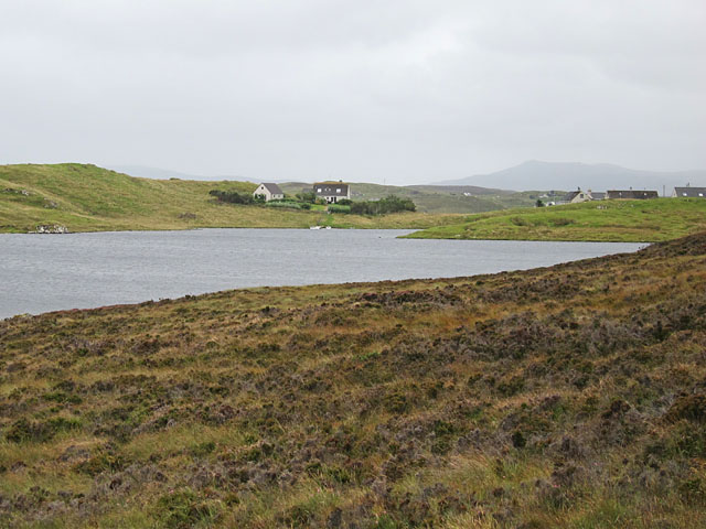
Àird Fhalasgair is a prominent coastal feature located in Ross-shire, Scotland. It is a headland that juts out into the sea, forming a distinctive point along the coastline. Situated on the western coast of the Scottish Highlands, Àird Fhalasgair offers breathtaking views of the surrounding landscape and the vast Atlantic Ocean.
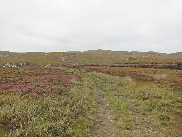
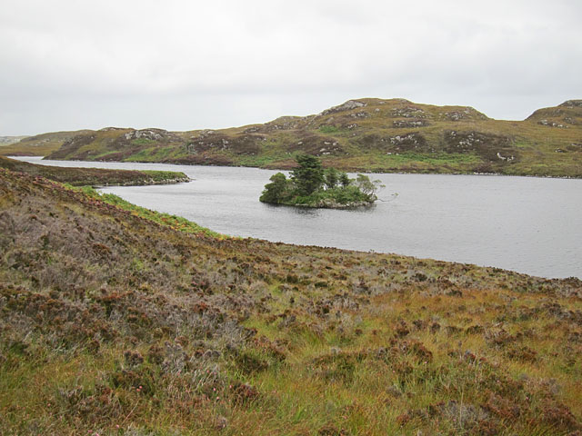
The headland is characterized by its rugged terrain, featuring steep cliffs that drop dramatically into the sea below. These cliffs are composed of ancient rocks, displaying various geological formations that provide valuable insights into the region's geological history. The exposed cliffs also serve as nesting sites for a variety of seabirds, including gulls, fulmars, and puffins, making Àird Fhalasgair a popular spot for birdwatching enthusiasts.
The headland is surrounded by pristine sandy beaches, offering visitors the opportunity to relax and enjoy the scenic beauty of the area. The crystal-clear waters are ideal for swimming and other water activities, while the sandy shores provide ample space for picnicking and sunbathing.
Àird Fhalasgair is also steeped in history, with traces of ancient settlements and archaeological sites found in the vicinity. These remnants offer a glimpse into the lives of early inhabitants and provide valuable insights into the region's past.
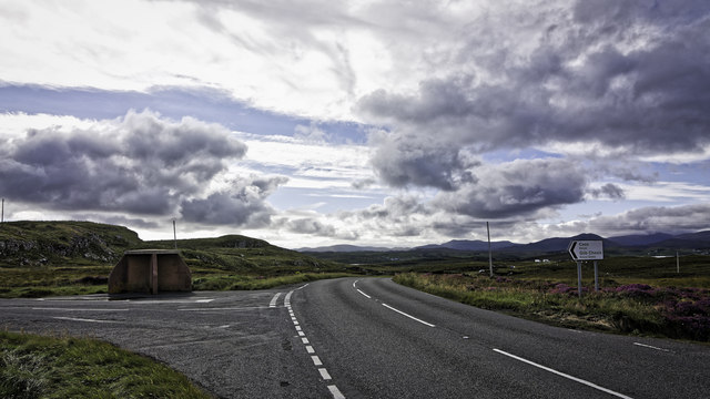
Access to Àird Fhalasgair is relatively easy, with a well-maintained road leading to the headland. Visitors can explore the area on foot, following designated trails that wind through the coastal landscape. Facilities such as parking areas and viewpoints are provided to enhance the visitor experience.
In conclusion, Àird Fhalasgair is a captivating coastal feature in Ross-shire, boasting stunning views, geological wonders, and a rich historical heritage. It is a must-visit destination for nature lovers, history enthusiasts, and anyone seeking a tranquil escape along Scotland's picturesque coastline.
If you have any feedback on the listing, please let us know in the comments section below.
Àird Fhalasgair Images
Images are sourced within 2km of 58.102888/-6.4812604 or Grid Reference NB3621. Thanks to Geograph Open Source API. All images are credited.
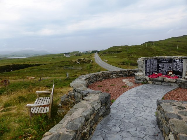
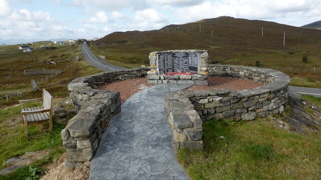
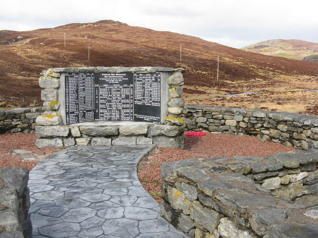
![Kinloch War Memorial 'In memory of all those from Kinloch who fought and died for Freedom'
A list of 54 men and women, aged from 15 - 46, who were lost in the Boer War [2], WW1 [41] and ww2 [11], and the crofts they came from.
The hill beyond is Nabhar.](https://s2.geograph.org.uk/geophotos/05/11/70/5117046_0f95619f.jpg)


Àird Fhalasgair is located at Grid Ref: NB3621 (Lat: 58.102888, Lng: -6.4812604)
Unitary Authority: Na h-Eileanan an Iar
Police Authority: Highlands and Islands
What 3 Words
///padding.commutes.items. Near Leurbost, Na h-Eileanan Siar
Nearby Locations
Related Wikis

Cabharstadh
Cabharstadh or Caversta (Scottish Gaelic: Cabharstaigh) is a village on the Isle of Lewis in the Outer Hebrides, Scotland. Caversta is situated in the...

Loch Erisort
Loch Erisort (Scottish Gaelic: Èireasort) is an 8-mile-long narrow sea inlet on the east coast of the Isle of Lewis in the Outer Hebrides off the west...
Eilean Chaluim Chille
Eilean Chaluim Chille (Gaelic: island of Saint Columba, Calum Cille) is an unpopulated island in the Outer Hebrides. It lies off the east coast of Lewis...

Cromore
Cromore (Scottish Gaelic: Crò Mòr) is a crofting township on the Isle of Lewis in the district of Pairc, in the Outer Hebrides, Scotland. The settlement...
Crossbost
Crossbost is a village on the Isle of Lewis in the parish of North Lochs, in the Outer Hebrides, Scotland. It is located approximately ten miles away...

Leurbost
Leurbost (Scottish Gaelic: Liùrbost) is a village on the east coast of the Isle of Lewis in the Outer Hebrides of Scotland. It is approximately 6 miles...
North Lochs
North Lochs, (Scottish Gaelic: Ceann a Tuath nan Loch), an area in eastern Lewis, Outer Hebrides, Scotland, is named for the many lochans (small lochs...

Gravir
Gravir (Scottish Gaelic: Grabhair), is a village on the shore of Loch Odhairn (a sea loch) in the Park district of the Isle of Lewis. Gravir is within...
Nearby Amenities
Located within 500m of 58.102888,-6.4812604Have you been to Àird Fhalasgair?
Leave your review of Àird Fhalasgair below (or comments, questions and feedback).