Àird Chaol

Coastal Feature, Headland, Point in Ross-shire

Scotland

Àird Chaol

Shieling at the head of Loch Strome Ruined shieling (Airigh nan Carn) with the remains of the township of Strome on the water's edge, and the hill Stromacleit behind.
Shieling at the head of Loch Strome Credit: Sarah Egan

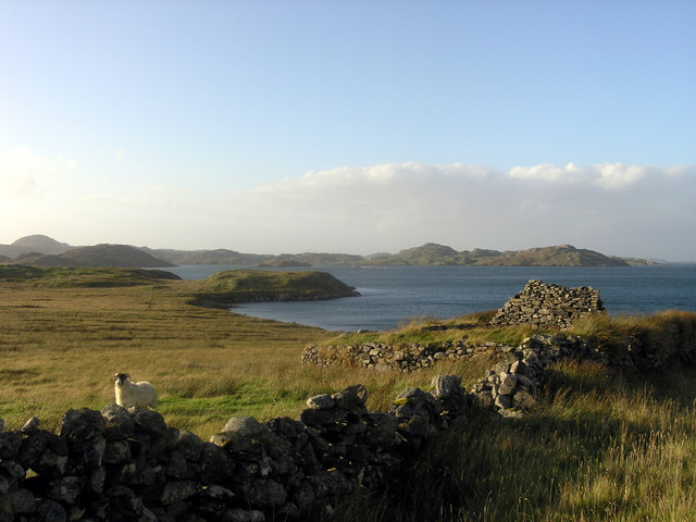
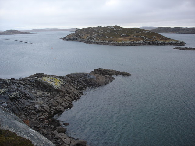
Àird Chaol is a prominent headland located in Ross-shire, on the northwestern coast of Scotland. Situated at the meeting point of the Atlantic Ocean and the Inner Sound, this coastal feature offers breathtaking views and a rich natural environment.

The headland, also known as the Point of Àird Chaol, extends outward into the sea, forming a distinctive shape that separates two nearby bays. Its elevated position provides panoramic vistas of the surrounding landscape, including the rugged cliffs, pristine beaches, and the vast expanse of water.

The geology of Àird Chaol is predominantly composed of ancient Lewisian gneiss, a type of metamorphic rock that dates back billions of years. This rock formation contributes to the headland's striking appearance and provides a habitat for various seabirds, including gulls, fulmars, and kittiwakes. Visitors to the area can often observe these birds nesting and soaring above the cliffs.

In addition to its natural beauty, Àird Chaol has historical significance as well. Nearby, there are remnants of ancient settlements, including the remains of a broch, an Iron Age roundhouse. These archaeological sites offer insight into the area's past and attract history enthusiasts.

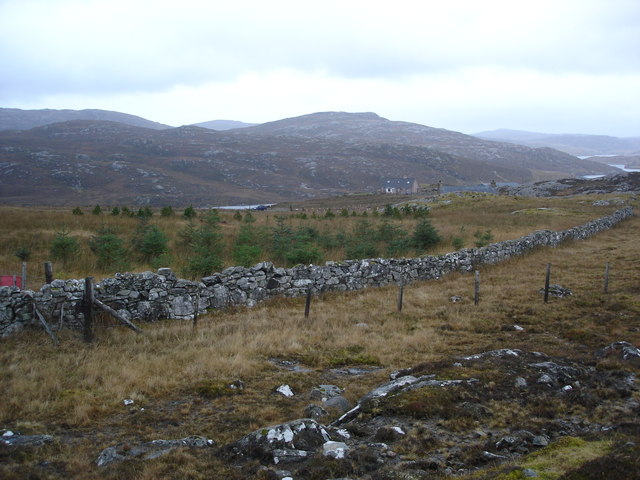
Access to Àird Chaol is possible via a well-maintained footpath that winds through the heather-covered moorland. The headland is a popular destination for hikers, wildlife enthusiasts, and photographers who seek to capture the stunning coastal scenery. Its remote location ensures a tranquil and serene experience for those who venture to this captivating coastal feature.

If you have any feedback on the listing, please let us know in the comments section below.

Àird Chaol Images

Images are sourced within 2km of 58.186911/-6.8754498 or Grid Reference NB1332. Thanks to Geograph Open Source API. All images are credited.

Shieling at the head of Loch Strome Ruined shieling (Airigh nan Carn) with the remains of the township of Strome on the water's edge, and the hill Stromacleit behind.
Shieling at the head of Loch Strome
Ruined shieling (Airigh nan Carn) with the remains of the township of Strome on the water's edge, and the hill Stromacleit behind.
Village of Strome Ruined blackhouses in the village of Strome at the head of Loch Strome.
Village of Strome
Ruined blackhouses in the village of Strome at the head of Loch Strome.
Loch Strome Ruins in the deserted village of Strome, looking down Loch Strome towards Loch Roag.
Loch Strome
Ruins in the deserted village of Strome, looking down Loch Strome towards Loch Roag.
Cliatasay On the island of Cliatasay in Loch Roag, on the site of a kelp kiln.  Vuia Mhor is visible in the distance.  The Geshader crofters used to graze their bull on this island.
Cliatasay
On the island of Cliatasay in Loch Roag, on the site of a kelp kiln. Vuia Mhor is visible in the distance. The Geshader crofters used to graze their bull on this island.
Cliatasay Natural landing stage on the island of Cliatasay in Loch Roag, used for the manufacture of potash from kelp in the early 19th century.  Vuia Mhor in the distance.
Cliatasay
Natural landing stage on the island of Cliatasay in Loch Roag, used for the manufacture of potash from kelp in the early 19th century. Vuia Mhor in the distance.
Cliatasay The rather featureless west-side of Cliatasay in Loch Roag; evidence of an old peat-cutting.
Cliatasay
The rather featureless west-side of Cliatasay in Loch Roag; evidence of an old peat-cutting.
Croft at 10 Geshader On Loch Roag, looking towards Reef
Croft at 10 Geshader
On Loch Roag, looking towards Reef
Geisiadar woods Native woods in Geisiadar on An t-Seoc's croft
Geisiadar woods
Native woods in Geisiadar on An t-Seoc's croft
Taigh "An Candy" Geisiadar A' cuimeal suil air an aimsir ann an Loch a Rog mar seana bhodach.  Tha an tigh seo iontach mar a tha e sealltain ris an taobh Tuath agaus chan eil uineagan sam bith far a bheil soluis an latha a'tighinn f'on an taobh Deas! Ach coimhead ris an clachaireachd breagha anns na ballaichean aige [Keeping an eye on the weather in Loch Ròg, like an old man. This house is unusual in the way it faces north, and there are no windows at all on the south where the daylight would come in!  But just look at the fine masonry in its walls].
Taigh "An Candy" Geisiadar
A' cuimeal suil air an aimsir ann an Loch a Rog mar seana bhodach. Tha an tigh seo iontach mar a tha e sealltain ris an taobh Tuath agaus chan eil uineagan sam bith far a bheil soluis an latha a'tighinn f'on an taobh Deas! Ach coimhead ris an clachaireachd breagha anns na ballaichean aige [Keeping an eye on the weather in Loch Ròg, like an old man. This house is unusual in the way it faces north, and there are no windows at all on the south where the daylight would come in! But just look at the fine masonry in its walls].
Mullach Sgrithir Eileanan Loch Rog bho mullach Sgrithir.  The islands of Loch Roag from the top of Sgrithir (pronounced Skreeher).  The islands are Bhuaigh Beag, Bhuaigh Mor, Great Bernera to the right and on the horizon The Old Hill and Berisay.
Mullach Sgrithir
Eileanan Loch Rog bho mullach Sgrithir. The islands of Loch Roag from the top of Sgrithir (pronounced Skreeher). The islands are Bhuaigh Beag, Bhuaigh Mor, Great Bernera to the right and on the horizon The Old Hill and Berisay.
Loch an Strom and Aird Orasaigh Loch an Strom (Norse = Straumr meaning a tidal current) and Aird Orasaigh (Norse = Orfirsey meaning a tidal island)
Loch an Strom and Aird Orasaigh
Loch an Strom (Norse = Straumr meaning a tidal current) and Aird Orasaigh (Norse = Orfirsey meaning a tidal island)
An Sruth A lonely lobster boat at the mouth of Little Loch Roag known as An Sruth.  A typical fjord being shallower and narrower at the mouth than further in as the glacier deposited its accumulated muck on its way out to the open sea.
An Sruth
A lonely lobster boat at the mouth of Little Loch Roag known as An Sruth. A typical fjord being shallower and narrower at the mouth than further in as the glacier deposited its accumulated muck on its way out to the open sea.
Ganstotal and Garbh Eilean A rock fishing mark at the cultivated area to the rear of Geisiadar known as Ganstotal.  The island of Garbh Eilean being the destination for swimming challenges for local youth.
Ganstotal and Garbh Eilean
A rock fishing mark at the cultivated area to the rear of Geisiadar known as Ganstotal. The island of Garbh Eilean being the destination for swimming challenges for local youth.
Abandoned millstone A half built mill stone at Ganstotal with the last section chiselled to a curve but not finished off.  It is possible of course that this is an early attempt by the MacFlintstone clan of Ungeshader to invent the wheel a few millennia after it was patented by the mob out of the Whacky Races.
Abandoned millstone
A half built mill stone at Ganstotal with the last section chiselled to a curve but not finished off. It is possible of course that this is an early attempt by the MacFlintstone clan of Ungeshader to invent the wheel a few millennia after it was patented by the mob out of the Whacky Races.
Great wall of Geisiadar The rear boundary to Croft Number 8 at Geisiadr.  The houses at Numbers 7 and 8 are in the pic.  The wall was of course built to protect the township of Geisidar from the maurauding hordes known as the Ungesiadar folk.
Great wall of Geisiadar
The rear boundary to Croft Number 8 at Geisiadr. The houses at Numbers 7 and 8 are in the pic. The wall was of course built to protect the township of Geisidar from the maurauding hordes known as the Ungesiadar folk.
Show me another place!

Àird Chaol is located at Grid Ref: NB1332 (Lat: 58.186911, Lng: -6.8754498)

Unitary Authority: Na h-Eileanan an Iar

Police Authority: Highlands and Islands

What 3 Words

///trapdoor.former.octagonal. Near Carloway, Na h-Eileanan Siar

Related Wikis

Fuaigh Beag

Fuaigh Beag or Vuia Be(a)g is an island in the Outer Hebrides. It is off the west coast of Lewis near Great Bernera in Loch Roag. Its name means "little...

Loch Ròg

Loch Ròg or Loch Roag is a large sea loch on the west coast of Lewis, Outer Hebrides. It is broadly divided into East Loch Roag and West Loch Roag with...

Fuaigh Mòr

Fuaigh Mòr (sometimes anglicised as Vuia Mor) is an island in the Outer Hebrides of Scotland. It is off the west coast of Lewis near Great Bernera in...

Flodaigh, Lewis

Flodaigh is a small island in Loch Roag on the west coast of Lewis in the Outer Hebrides of Scotland. It is about 33 hectares (82 acres) in extent and...

Nearby Amenities

Located within 500m of 58.186911,-6.8754498
Aird Chaol
Natural: peninsula
Lat/Long: 58.187181/-6.875921
The data included in this document is from www.openstreetmap.org. The data is made available under ODbL.

Have you been to Àird Chaol?

Leave your review of Àird Chaol below (or comments, questions and feedback).