Coneyburrow Shaw

Wood, Forest in Sussex Wealden

England

Coneyburrow Shaw

Sweeping bend on A267 In the distance is a sign for the right turn into Lake Street.
Sweeping bend on A267 Credit: Robin Webster

Coneyburrow Shaw is a picturesque woodland located in Sussex, England. Situated near the village of Coneyburrow, it covers an area of approximately 100 acres and is renowned for its natural beauty and diverse ecosystem. The woodland is predominantly composed of ancient oak and beech trees, which provide a haven for a wide variety of flora and fauna.

As one ventures into Coneyburrow Shaw, they are greeted by a tranquil atmosphere and an abundance of wildlife. The woodland floor is blanketed with a rich carpet of wildflowers, including bluebells, primroses, and wood anemones, creating a vibrant and colorful scene during the spring months. The trees tower overhead, forming a dense canopy that filters sunlight and casts dappled shadows on the forest floor.

Numerous species of birds call Coneyburrow Shaw their home, including woodpeckers, owls, and various songbirds. The woodland also provides habitat for small mammals such as squirrels, foxes, and badgers. Nature enthusiasts often visit the area to observe and photograph these creatures in their natural habitat.

Coneyburrow Shaw is a popular destination for outdoor activities such as hiking, birdwatching, and nature photography. A network of well-maintained trails allows visitors to explore the woodland, offering stunning views of the surrounding countryside and the opportunity to reconnect with nature.

The preservation and conservation of Coneyburrow Shaw are of great importance to the local community and environmental organizations. Efforts are made to protect the woodland's delicate ecosystem and ensure the continued existence of its diverse wildlife, making it a cherished natural gem in the heart of Sussex.

If you have any feedback on the listing, please let us know in the comments section below.

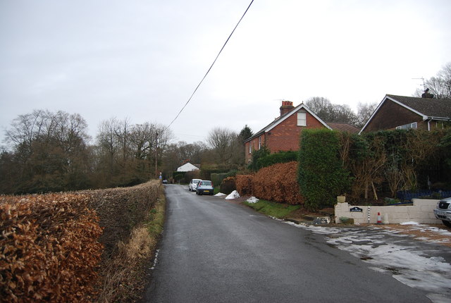
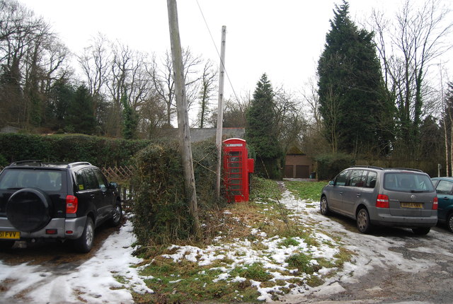
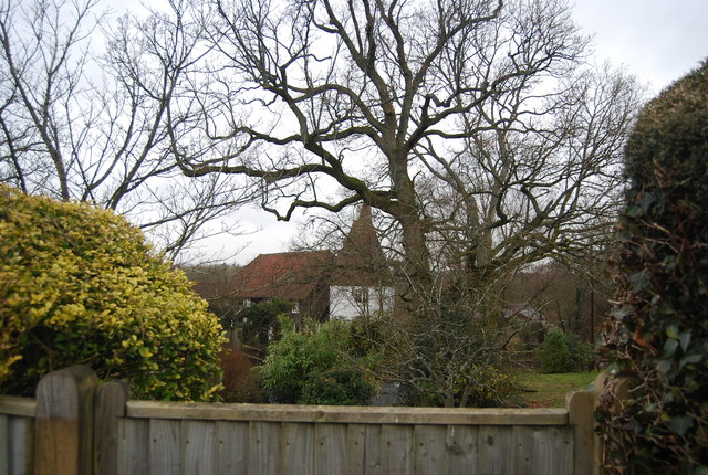
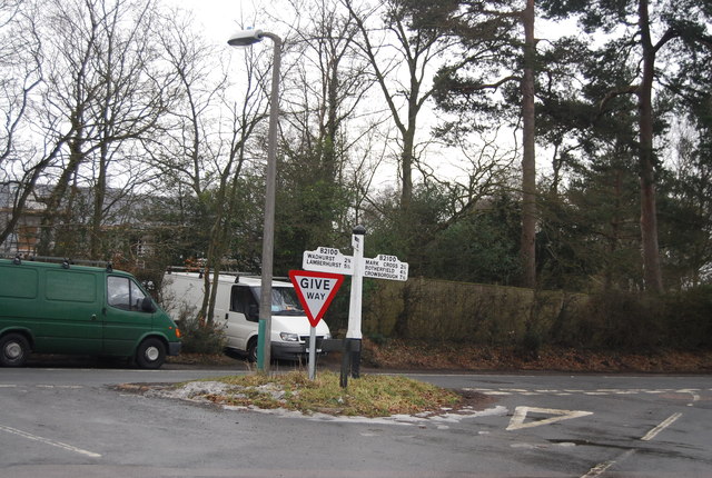
Coneyburrow Shaw Images

Images are sourced within 2km of 51.0574/0.27775202 or Grid Reference TQ5931. Thanks to Geograph Open Source API. All images are credited.

Sweeping bend on A267 In the distance is a sign for the right turn into Lake Street.
Sweeping bend on A267
In the distance is a sign for the right turn into Lake Street.
Sheep in the shade near Lakestreet Manor On the centre horizon is the former Mayfield College, a Roman Catholic boys boarding which was finally closed in 1999. A clause in the developers contract meant they could not start work until the last school occupant had died or left. Mr Walters, a lay teacher, died six years later.
Sheep in the shade near Lakestreet Manor
On the centre horizon is the former Mayfield College, a Roman Catholic boys boarding which was finally closed in 1999. A clause in the developers contract meant they could not start work until the last school occupant had died or left. Mr Walters, a lay teacher, died six years later.
A267 near Frenches Farm
Mousehall Oast, Tidebrook, Wadhurst, East Sussex The cowl vane icon depicts a mouse <a title="https://www.geograph.org.uk/photo/1218914" href="https://www.geograph.org.uk/photo/1218914">Link</a>
Mousehall Oast, Tidebrook, Wadhurst, East Sussex
The cowl vane icon depicts a mouse Link
Pond near Tidebrook Well managed pond with some visiting Canadian geese.
Pond near Tidebrook
Well managed pond with some visiting Canadian geese.
Cottage at Tidebrook At footpath junction.
Cottage at Tidebrook
At footpath junction.
Cowl of Mousehall Oast The cowl of <a href="https://www.geograph.org.uk/photo/1214262">TQ6029 : Mousehall Oast, Tidebrook, Wadhurst, East Sussex</a> with a sitting mouse icon to the vane.
Cowl of Mousehall Oast
The cowl of TQ6029 : Mousehall Oast, Tidebrook, Wadhurst, East Sussex with a sitting mouse icon to the vane.
Gas storage and transfer station
Footpath to Highfields Farm
Wealden view Stunt's Wood in the distance.
Wealden view
Stunt's Wood in the distance.
Footpath to Rocks Wood The path skirts the drive and follows the gap visible into open fields beyond.
Footpath to Rocks Wood
The path skirts the drive and follows the gap visible into open fields beyond.
The Oast, Lake Street, Tidebrook, Mayfield, East Sussex Single round kiln oast house.
The Oast, Lake Street, Tidebrook, Mayfield, East Sussex
Single round kiln oast house.
Woods near Highfields Farm Early signs of bluebells.
Woods near Highfields Farm
Early signs of bluebells.
House in Mousehall
House in Mousehall
Fairglen Rd
Fairglen Rd
Telephone kiosk, Fairglen Rd
Wild Bees Oast Single round kiln oast house. White rendered walls.
Wild Bees Oast
Single round kiln oast house. White rendered walls.
Road sign, B2100 The B2100 runs 13 miles across East Sussex from Crowborough <a href="https://www.geograph.org.uk/photo/7549622">TQ5131 : Nearing the end of the B2100</a>  to Lamberhurst, via Wadhurst.
<span class="nowrap"><a title="http://www.sabre-roads.org.uk/wiki/index.php?title=B2100" rel="nofollow ugc noopener" href="http://www.sabre-roads.org.uk/wiki/index.php?title=B2100">Link</a><img style="margin-left:2px;" alt="External link" title="External link - shift click to open in new window" src="https://s1.geograph.org.uk/img/external.png" width="10" height="10"/></span>
Road sign, B2100
The B2100 runs 13 miles across East Sussex from Crowborough TQ5131 : Nearing the end of the B2100 to Lamberhurst, via Wadhurst. LinkExternal link
Show me another place!

Coneyburrow Shaw is located at Grid Ref: TQ5931 (Lat: 51.0574, Lng: 0.27775202)

Administrative County: East Sussex

District: Wealden

Police Authority: Sussex

What 3 Words

///geek.depth.scratches. Near Town Row, East Sussex

Related Wikis

Walter's Mill, Mark Cross

Walter's Mill is a tower mill at Mark Cross, Sussex, England which has been converted to residential accommodation. == History == Walter's Mill was first...

Best Beech Hill

Best Beech Hill is a locality in the civil parish of Wadhurst in the Wealden district of East Sussex, England. Wadhurst lies approximately 1.6 miles...

Mayfield College

Mayfield College is a defunct Roman Catholic boys' boarding school founded as the Holy Trinity Orphanage For Boys in 1865–1866 by the American-born Dowager...

Jameah Islameah School

Jameah Islameah School was an independent Islamic school in East Sussex. The school was located on a 54 acre site and had residential facilities to house...

St Joseph's College, Mark Cross

St Joseph's College was a Roman Catholic minor seminary in Mark Cross, outside Rotherfield in East Sussex. It was designed by Edward Pugin and the site...

Tidebrook

Tidebrook is a hamlet within the parish of Wadhurst in East Sussex, England. It is located between the villages of Mayfield and Wadhurst. The brook for...

Wadhurst railway station

Wadhurst railway station is on the Hastings line in the south of England and serves the town of Wadhurst, East Sussex. It is 39 miles 23 chains (63.2 km...

Rotherfield and Mark Cross railway station

Rotherfield and Mark Cross (also Rotherfield) is the name of a closed station on the Eridge - Heathfield - Polegate railway (the Cuckoo Line) in East Sussex...

Nearby Amenities

Located within 500m of 51.0574,0.27775202
Barrier: stile
Lat/Long: 51.0546707/0.2767185
Barrier: stile
Lat/Long: 51.0566722/0.2718987
Houndsell Place
Addr City: Crowborough
Addr Hamlet: Mark Cross
Addr Postcode: TN6 3PF
Addr Street: Wadhurst Road
Place: isolated_dwelling
Lat/Long: 51.0593205/0.2735363
Earls Farm
Addr City: Crowborough
Addr Hamlet: Mark Cross
Addr Postcode: TN6 3PF
Addr Street: Wadhurst Road
Place: farm
Lat/Long: 51.0540036/0.2751195
Houndsell Stud
Addr City: Crowborough
Addr Hamlet: Mark Cross
Addr Postcode: TN6 3PF
Addr Street: Wadhurst Road
Place: farm
Lat/Long: 51.0584139/0.2771312
The data included in this document is from www.openstreetmap.org. The data is made available under ODbL.

Have you been to Coneyburrow Shaw?

Leave your review of Coneyburrow Shaw below (or comments, questions and feedback).