Barn Copse

Wood, Forest in Hampshire Basingstoke and Deane

England

Barn Copse

Clump of trees - Oakridge Over looking the ring road.
Clump of trees - Oakridge Credit: Mr Ignavy

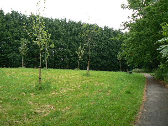
Barn Copse is a picturesque woodland located in Hampshire, England. Covering an area of approximately 100 acres, this densely wooded forest offers a tranquil escape from the hustle and bustle of everyday life. Situated in the heart of the Hampshire countryside, Barn Copse is known for its rich biodiversity and stunning natural beauty.

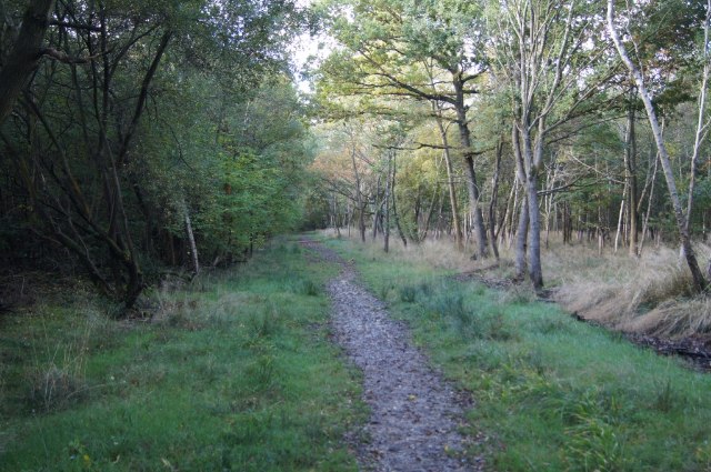
The forest is predominantly made up of a mix of broadleaf and coniferous trees, creating a diverse habitat for a wide range of flora and fauna. Ancient oak and beech trees tower above the forest floor, providing a canopy that filters sunlight and creates a serene ambiance. The forest floor itself is covered in a thick carpet of mosses, ferns, and wildflowers, adding to the magical atmosphere.

Barn Copse is home to a plethora of wildlife, making it a popular destination for nature enthusiasts and birdwatchers. Visitors may spot a variety of bird species, including woodpeckers, owls, and jays, as well as small mammals like rabbits, squirrels, and foxes. The forest is also known for its diverse insect population, with butterflies and dragonflies fluttering through the air during the warmer months.

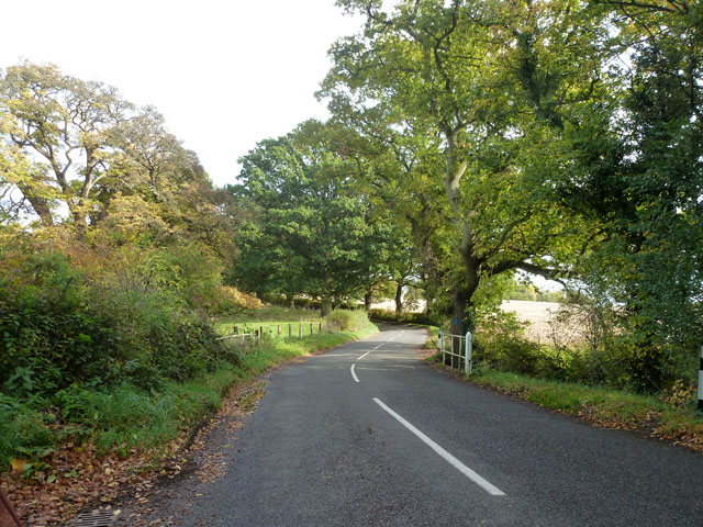
The woodland offers several walking trails, allowing visitors to explore its beauty at their own pace. These paths wind through the forest, leading to hidden clearings, babbling brooks, and secluded picnic spots. Whether you are seeking a peaceful stroll or a more strenuous hike, Barn Copse offers something for everyone.

Overall, Barn Copse is a hidden gem in Hampshire, providing a haven for nature lovers and a place to reconnect with the great outdoors. Its stunning scenery, diverse wildlife, and tranquil ambiance make it a must-visit destination for anyone looking to escape into nature.

If you have any feedback on the listing, please let us know in the comments section below.
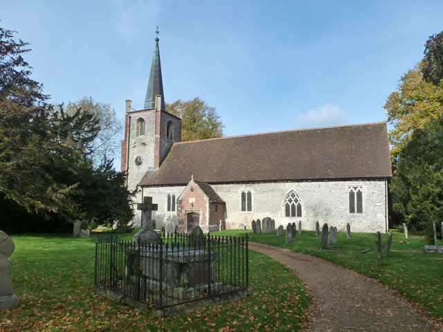
Barn Copse Images

Images are sourced within 2km of 51.291012/-1.0799454 or Grid Reference SU6455. Thanks to Geograph Open Source API. All images are credited.

Clump of trees - Oakridge Over looking the ring road.
Clump of trees - Oakridge
Over looking the ring road.
In between homes Storage facilities off the Reading Road.
In between homes
Storage facilities off the Reading Road.
Chineham car park
Chineham car park
Traffic lights and junction on A33 Taken travelling towards Basingstoke at junction with Lillymill Chine.
Traffic lights and junction on A33
Taken travelling towards Basingstoke at junction with Lillymill Chine.
Retail outlet off A33 The A33 here is designated as 'Reading Road'
Retail outlet off A33
The A33 here is designated as 'Reading Road'
Skip road onto A339 Part of the ring road network to the east of Basingstoke.
Skip road onto A339
Part of the ring road network to the east of Basingstoke.
New houses, Basingstoke Extending the northern limits of the town.
New houses, Basingstoke
Extending the northern limits of the town.
Everest Community Academy Only part of a very large site.
Everest Community Academy
Only part of a very large site.
Sherborne St. John church
Vyne Road, Sherborne St. John Named after the local big house.
Vyne Road, Sherborne St. John
Named after the local big house.
Joining the A339 The A339 runs for almost 35miles between Newbury in Berkshire and Alton in Hampshire. Along the way, it forms the eastern and northern parts of the Basingstoke Ring Road.

More details <span class="nowrap"><a title="http://www.sabre-roads.org.uk/wiki/index.php?title=A339" rel="nofollow ugc noopener" href="http://www.sabre-roads.org.uk/wiki/index.php?title=A339">Link</a><img style="margin-left:2px;" alt="External link" title="External link - shift click to open in new window" src="https://s1.geograph.org.uk/img/external.png" width="10" height="10"/></span>  SABRE Wiki
Joining the A339
The A339 runs for almost 35miles between Newbury in Berkshire and Alton in Hampshire. Along the way, it forms the eastern and northern parts of the Basingstoke Ring Road. More details LinkExternal link SABRE Wiki
Houses in Arlott Drive
Open space in Oakridge I'm amazed that houses have not been built here.
Open space in Oakridge
I'm amazed that houses have not been built here.
Open space in Oakridge
Houses in Shooters Way
Residents parking - Baynard Close
Houses in Baynard Close
Houses in Shooters Way
Show me another place!

Barn Copse is located at Grid Ref: SU6455 (Lat: 51.291012, Lng: -1.0799454)

Administrative County: Hampshire

District: Basingstoke and Deane

Police Authority: Hampshire

What 3 Words

///active.dark.wasp. Near Chineham, Hampshire

Related Wikis

Basing Wood

Basing Wood is a 120-hectare (300-acre) woodland near Basingstoke, England. == Wildlife == The wood consists of broadleaf and conifer trees, particularly...

Popley Ponds

Popley Ponds is a 1.4-hectare (3.5-acre) Local Nature Reserve in Basingstoke in Hampshire. It is owned and managed by Basingstoke and Deane Borough Council...

Everest Community Academy

Everest Community Academy is a coeducational secondary school with academy status, in Basingstoke, Hampshire. The school is part of the Bourne Education...
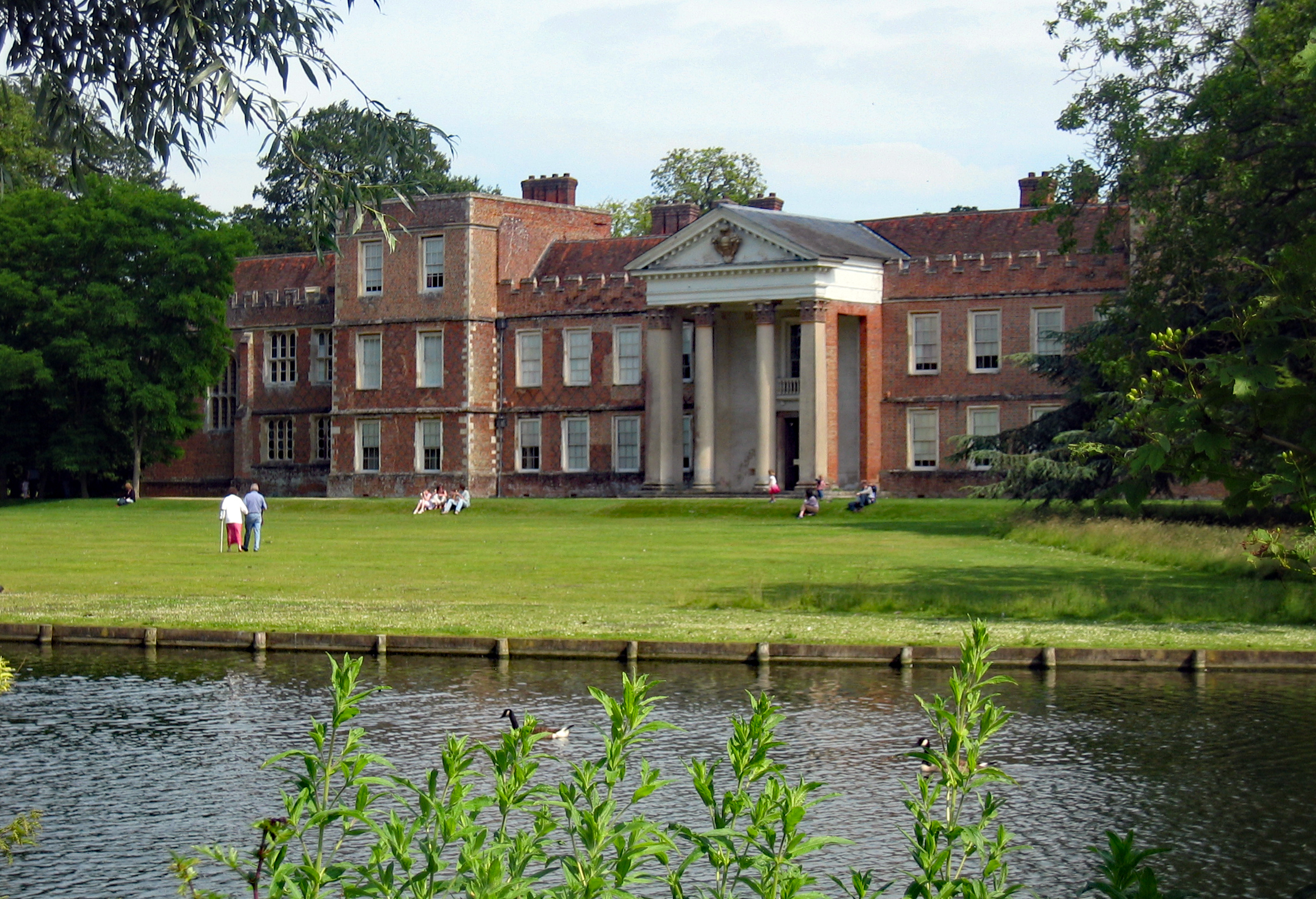
The Vyne

The Vyne is a Grade I listed 16th-century country house in the parish of Sherborne St John, near Basingstoke, in Hampshire, England. The house was first...
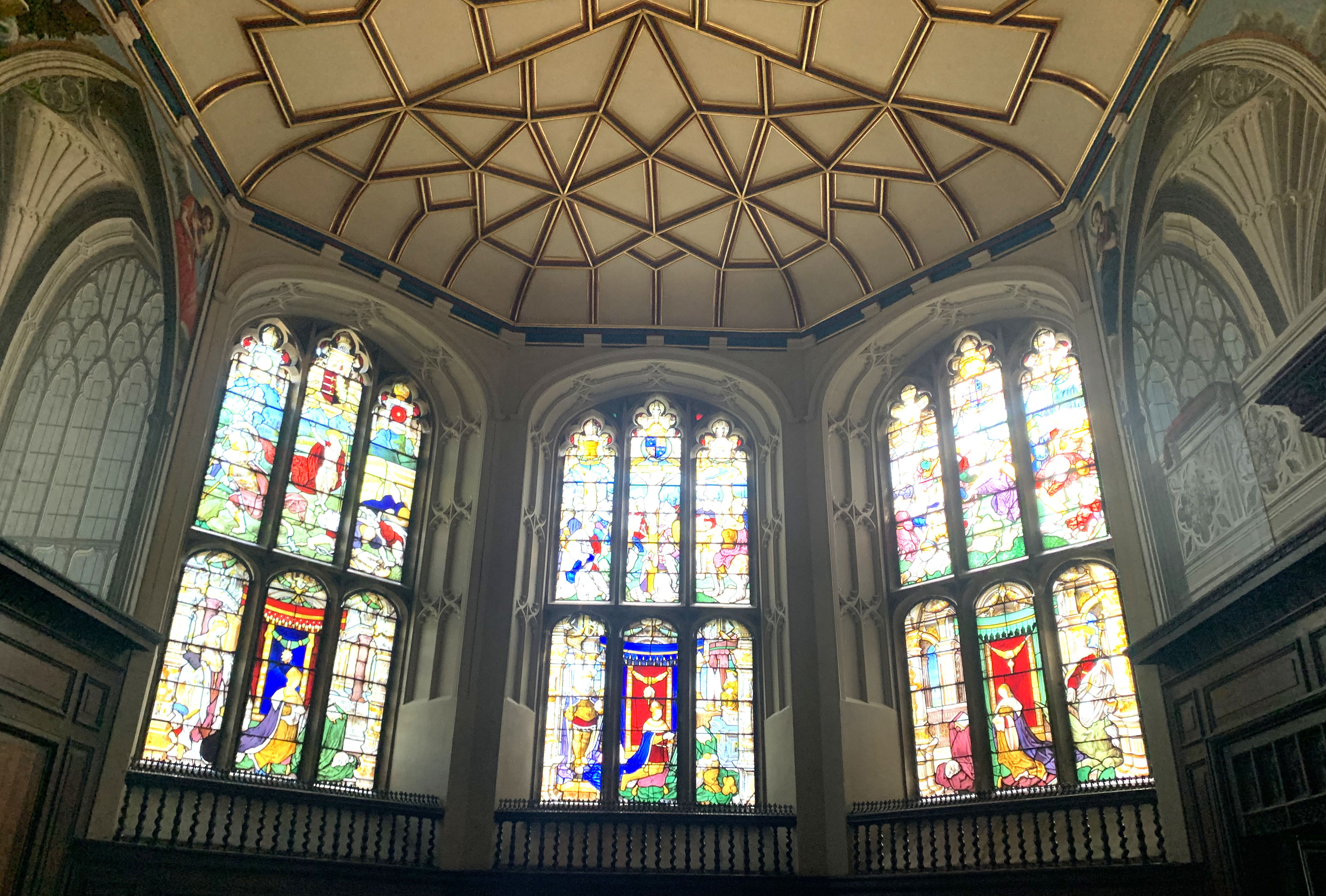
The Vyne Chapel

The Vyne Chapel is a Grade I listed Church of England chapel in The Vyne, Hampshire. The chapel's origins are early modern. The chapel is noted for its...

Daneshill Park Woods

Daneshill Park Woods is a 4.4-hectare (11-acre) Local Nature Reserve in Basingstoke in Hampshire. It is owned and managed by Basingstoke and Deane Borough...

Queen Mary's School for Boys, Basingstoke

Queen Mary's School for Boys (QMSB) was a maintained (state funded) grammar school in Basingstoke, Hampshire, England for boys aged 11–18. The school...

The Vyne Community School

The Vyne Community School is a coeducational community school in Basingstoke, England for young people aged 11–16, and still occupies the site of the former...

Nearby Amenities

Located within 500m of 51.291012,-1.0799454
Post Box
Postal Code: RG24
Ref: RG24 315
Lat/Long: 51.2885228/-1.0806263
Public Building
Building: yes
Lat/Long: 51.287755/-1.0763111
Crossing
Crossing: unmarked
Kerb: lowered
Sloped Curb: yes
Lat/Long: 51.2886521/-1.085576
Man Made: mast
Lat/Long: 51.2912505/-1.0826444
Crossing
Crossing: uncontrolled
Kerb: lowered
Sloped Curb: yes
Lat/Long: 51.2887868/-1.0832578
Bus Stop
Falklands Road
Bus: yes
Naptan AtcoCode: 1900HA011093
Naptan Bearing: E
Naptan CommonName: Falklands Road
Naptan NaptanCode: hamgdagm
Naptan PlusbusZoneRef: BSNGSTK
Naptan Street: Carpenter's Down
Naptan Verified: no
Public Transport: platform
Source: naptan_import
Lat/Long: 51.2885385/-1.0807786
Bus Stop
Falkland Road
Bus: yes
Naptan AtcoCode: 1900HA011094
Naptan Bearing: SE
Naptan CommonName: Falkland Road
Naptan Crossing: Carpenter's Down
Naptan NaptanCode: hamgdajm
Naptan PlusbusZoneRef: BSNGSTK
Naptan Street: Tasmania Close
Naptan Verified: no
Public Transport: platform
Source: naptan_import
Lat/Long: 51.288044/-1.0796412
Bus Stop
Community Centre
Bus: yes
Naptan AtcoCode: 1900HA011095
Naptan Bearing: NW
Naptan CommonName: Community Centre
Naptan Crossing: Falkland Road
Naptan NaptanCode: hamgdatj
Naptan PlusbusZoneRef: BSNGSTK
Naptan Street: Carpenter's Down
Naptan Verified: no
Public Transport: platform
Source: naptan_import
Lat/Long: 51.2874726/-1.0778744
Bus Stop
Community Centre
Bus: yes
Naptan AtcoCode: 1900HA011096
Naptan Bearing: SE
Naptan CommonName: Community Centre
Naptan Crossing: Falkland Road
Naptan NaptanCode: hamgdatw
Naptan PlusbusZoneRef: BSNGSTK
Naptan Street: Carpenter's Down
Naptan Verified: no
Public Transport: platform
Source: naptan_import
Lat/Long: 51.2876977/-1.0782308
Bus Stop
Montserrat Road
Bus: yes
Naptan AtcoCode: 1900HAA09556
Naptan Bearing: N
Naptan CommonName: Montserrat Road
Naptan Crossing: Montserrat Road
Naptan NaptanCode: hamjmapw
Naptan Street: Carpenters Down
Naptan Verified: no
Public Transport: platform
Source: naptan_import
Lat/Long: 51.288404/-1.0838452
Barrier: bollard
Lat/Long: 51.287289/-1.0804381
Crossing
Bicycle: yes
Crossing: uncontrolled
Kerb: lowered
Sloped Curb: yes
Lat/Long: 51.2879561/-1.082168
Crossing
Bicycle: yes
Crossing Island: yes
Kerb: lowered
Sloped Curb: yes
Lat/Long: 51.2881726/-1.0837833
Crossing
Bicycle: yes
Crossing Island: yes
Kerb: lowered
Sloped Curb: yes
Lat/Long: 51.2883649/-1.0804601
Crossing
Bicycle: yes
Crossing Island: yes
Kerb: lowered
Sloped Curb: yes
Lat/Long: 51.288534/-1.0837267
Crossing
Bicycle: yes
Crossing Island: yes
Kerb: lowered
Sloped Curb: yes
Lat/Long: 51.2885238/-1.0836234
Crossing
Bicycle: yes
Crossing: uncontrolled
Kerb: lowered
Sloped Curb: yes
Lat/Long: 51.2878513/-1.0838122
Barrier: bollard
Lat/Long: 51.2875471/-1.0802113
Crossing
Bicycle: yes
Crossing: unmarked
Fixme: check position
Kerb: lowered
Sloped Curb: yes
Lat/Long: 51.2869428/-1.0792868
Crossing
Crossing: unmarked
Kerb: lowered
Sloped Curb: yes
Lat/Long: 51.2903881/-1.0821687
Crossing
Crossing: unmarked
Kerb: lowered
Sloped Curb: yes
Lat/Long: 51.2901692/-1.0811893
Bench
Leisure: picnic_table
Lat/Long: 51.2894313/-1.0769564
Bench
Lat/Long: 51.2940792/-1.0767092
Information: board
Tourism: information
Lat/Long: 51.2940958/-1.0785551
Information: map
Tourism: information
Lat/Long: 51.287957/-1.0754384
Information: map
Tourism: information
Lat/Long: 51.2886246/-1.0793705
Crossing
Crossing: unmarked
Kerb: lowered
Sloped Curb: yes
Lat/Long: 51.2887585/-1.0839703
Crossing
Crossing: unmarked
Kerb: lowered
Sloped Curb: yes
Lat/Long: 51.288727/-1.0839914
Crossing
Crossing: unmarked
Kerb: lowered
Sloped Curb: yes
Lat/Long: 51.2889751/-1.0836593
Crossing
Crossing: unmarked
Kerb: lowered
Sloped Curb: yes
Lat/Long: 51.2889138/-1.0851282
Carpenter's Down Piece
Landuse: forest
Source: OS_OpenData_StreetView
Lat/Long: 51.2922807/-1.0734892
Basingstoke Scouting Supplies
Opening Hours: Th 18:00-20:00, Sa 10:00-12:00
Operator: Basingstoke Scouting Supplies
Shop: yes
Lat/Long: 51.2876888/-1.0761016
Barrier: bollard
Lat/Long: 51.2877364/-1.0800539
Barrier: bollard
Lat/Long: 51.2880288/-1.0798381
Barrier: kerb
Lat/Long: 51.2875688/-1.0759124
Barrier: bollard
Lat/Long: 51.2881313/-1.0794875
Bus Stop
Carpenters Down
Bus: yes
Naptan AtcoCode: 1900HAA91340
Naptan NaptanCode: hamjpwpd
Public Transport: platform
Lat/Long: 51.288756/-1.0841693
Bus Stop
Carpenters Down
Bus: yes
Public Transport: platform
Lat/Long: 51.2888391/-1.0841392
The data included in this document is from www.openstreetmap.org. The data is made available under ODbL.

Have you been to Barn Copse?

Leave your review of Barn Copse below (or comments, questions and feedback).