Batsons Copse

Wood, Forest in Hampshire Basingstoke and Deane

England

Batsons Copse

Country house This picture was taken from approx 545582 and looks due north to a house just across the main A339
Country house Credit: Nygel Gardner

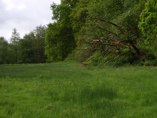
Batsons Copse is a well-preserved woodland located in Hampshire, England. Covering an area of approximately 50 acres, it is a popular destination for nature enthusiasts and outdoor lovers. The copse is situated on the eastern outskirts of the village of Chalton, nestled between the South Downs National Park and Queen Elizabeth Country Park.

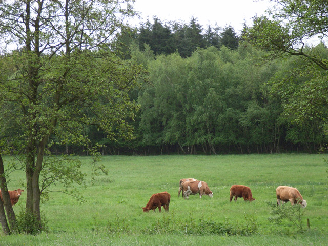
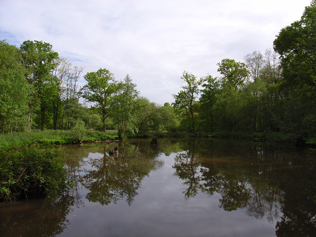
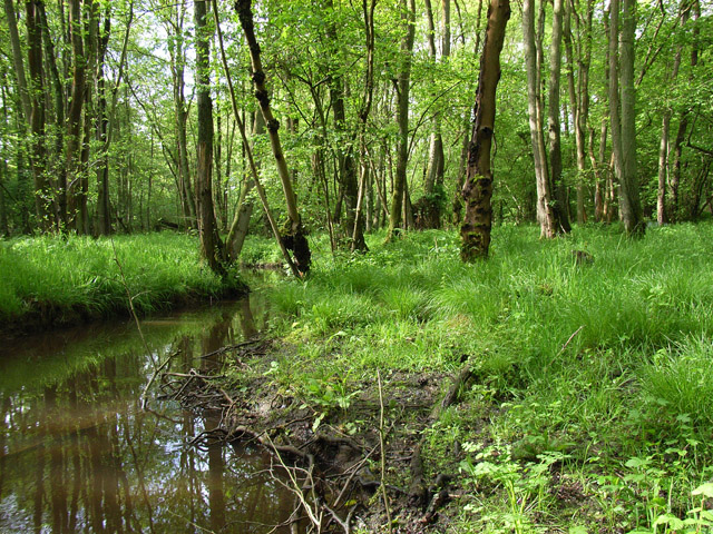
The woodland boasts a diverse range of tree species, including oak, beech, holly, and birch. The dense canopy provides a sheltered habitat for a variety of wildlife, making it an ideal spot for birdwatching and wildlife observation. Visitors may catch a glimpse of woodpeckers, tawny owls, and various songbirds that call Batsons Copse their home.

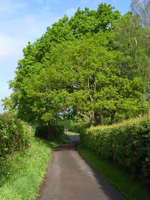
The copse is crisscrossed by a network of well-maintained footpaths, allowing visitors to explore its tranquil surroundings. The pathways wind through the ancient trees, leading to secluded clearings and picturesque viewpoints. The forest floor is carpeted with ferns, bluebells, and wildflowers, creating a vibrant tapestry of colors during the spring and summer months.

Batsons Copse also holds historical significance, with evidence of human presence dating back to the Iron Age. Archaeological surveys have uncovered remnants of ancient settlements and tools, adding to the area's cultural value.

With its natural beauty, abundant wildlife, and historical importance, Batsons Copse offers a serene and educational experience for those seeking a peaceful retreat in the heart of Hampshire's countryside.

If you have any feedback on the listing, please let us know in the comments section below.

Batsons Copse Images

Images are sourced within 2km of 51.33789/-1.2043178 or Grid Reference SU5560. Thanks to Geograph Open Source API. All images are credited.

Country house This picture was taken from approx 545582 and looks due north to a house just across the main A339
Country house
This picture was taken from approx 545582 and looks due north to a house just across the main A339
The Wolverton Road The section of the road opposite Wolverton Wood in the south eastern section of the grid square. It runs diagonally across this section of the square and the field on the western side of the road is just visible. The picture was taken looking north east along the road.
The Wolverton Road
The section of the road opposite Wolverton Wood in the south eastern section of the grid square. It runs diagonally across this section of the square and the field on the western side of the road is just visible. The picture was taken looking north east along the road.
The George & Dragon Inn, Towns End
Towns End
Towns End
St. Catherine's Church, Crabbs Hill, Wolverton
Wolverton Common
Wolverton Common
Frith Common Looking across to Sandford Wood.
Frith Common
Looking across to Sandford Wood.
Pond near Frith Common One of two ponds in the vicinity that are not shown by the Ordnance Survey.
Pond near Frith Common
One of two ponds in the vicinity that are not shown by the Ordnance Survey.
Woodland stream, Frith Common The stream emanates from Sandford Springs, which give their name to the nearby golf club.
Woodland stream, Frith Common
The stream emanates from Sandford Springs, which give their name to the nearby golf club.
Lane at Frith Common Farm A public footpath on a private road.
Lane at Frith Common Farm
A public footpath on a private road.
Clinker's Copse The fringe of the wood where it meets a rather boggy meadow.
Clinker's Copse
The fringe of the wood where it meets a rather boggy meadow.
St Catherine's Church, Wolverton An early Georgian Church (1717) in a lovely rural setting. Locked unfortunately but the brick exterior provides a casing for the original medieval interior.
St Catherine's Church, Wolverton
An early Georgian Church (1717) in a lovely rural setting. Locked unfortunately but the brick exterior provides a casing for the original medieval interior.
St Catherine's Church The unusual east end of the church.
St Catherine's Church
The unusual east end of the church.
St Catherine's Churchyard, Wolverton A well kept churchyard with levelled graves and a lovely view.
St Catherine's Churchyard, Wolverton
A well kept churchyard with levelled graves and a lovely view.
The tower, St Catherine's Church, Wolverton Looking almost straight up at the tower at the early Georgian St Catherine's Church, Wolverton.
The tower, St Catherine's Church, Wolverton
Looking almost straight up at the tower at the early Georgian St Catherine's Church, Wolverton.
St Catherine's Church, Wolverton Built in 1717 of light red brick. Nikolaus Pevsner called it "the best Early Georgian church in Hampshire", though some complain that the tower dwarfs the rest of the church.

In fact the church is a "re-casing" and inside the roof is medieval. Perhaps both sides of the argument have a point: the tower is fine - and it is large. 

The door was firmly locked on my visit...
St Catherine's Church, Wolverton
Built in 1717 of light red brick. Nikolaus Pevsner called it "the best Early Georgian church in Hampshire", though some complain that the tower dwarfs the rest of the church. In fact the church is a "re-casing" and inside the roof is medieval. Perhaps both sides of the argument have a point: the tower is fine - and it is large. The door was firmly locked on my visit...
Wolverton House A handsome late Georgian manor house. Strangely, the house attracts no attention from most Hampshire guides. Perhaps its proximity to St Catherine's Church means that it is overlooked by visitors.

Wolverton formed part of the estate of the Duke of Wellington until the mid-20th century.
Wolverton House
A handsome late Georgian manor house. Strangely, the house attracts no attention from most Hampshire guides. Perhaps its proximity to St Catherine's Church means that it is overlooked by visitors. Wolverton formed part of the estate of the Duke of Wellington until the mid-20th century.
St Catherine's Church tower The fine red-brick tower of St Catherine's Church, Wolverton, seen from the west. There was an erroneous tradition that the church (1717) was designed by Sir Christopher Wren. It might have been the work of one of his pupils.
St Catherine's Church tower
The fine red-brick tower of St Catherine's Church, Wolverton, seen from the west. There was an erroneous tradition that the church (1717) was designed by Sir Christopher Wren. It might have been the work of one of his pupils.
Show me another place!

Batsons Copse is located at Grid Ref: SU5560 (Lat: 51.33789, Lng: -1.2043178)

Administrative County: Hampshire

District: Basingstoke and Deane

Police Authority: Hampshire

What 3 Words

///defend.reinvest.awards. Near Kingsclere, Hampshire

Related Wikis

Axmansford

Axmansford is a village in Hampshire, England. It is in the civil parish of Baughurst. == External links == Media related to Axmansford at Wikimedia Commons

Wolverton, Hampshire

Wolverton is a village in north Hampshire, England. It is within the civil parish of Baughurst, and located approximately 7 miles (11 km) from both Newbury...

Ashford Hill

Ashford Hill is a village in Basingstoke and Deane, Hampshire, England. == Governance == The village of Ashford Hill is part of the civil parish of Ashford...

Ashford Hill Woods and Meadows

Ashford Hill Woods and Meadows is a 141.5-hectare (350-acre) biological Site of Special Scientific Interest near Ashford Hill in Hampshire. An area of...

Wolverton Common

Wolverton Common is a hamlet in north Hampshire, England. Its nearest town is Tadley, which lies approximately 2.5 miles (4 km) east from the hamlet....

Ashford Hill NNR

Ashford Hill is a British national nature reserve next to the village of Ashford Hill in Hampshire. Part of the reserve is a designated a Site of Special...

Inhurst

Inhurst is a hamlet in Hampshire, England. It is in the civil parish of Baughurst. == History == Inhurst House was established as a school in the 1960s...

Brimpton Common

Brimpton Common is a hamlet in Berkshire, England. It is part of Brimpton Parish, and part of the Benefice of Aldermaston and Woolhampton in the Diocese...

Nearby Amenities

Located within 500m of 51.33789,-1.2043178
Wheathold Farm
Landuse: farm
Note Retag: CS #48756035
Lat/Long: 51.3412365/-1.2025923
Barrier: stile
Lat/Long: 51.3397064/-1.2093892
Springfield Farm
Landuse: farm
Note Retag: CS #48756035
Lat/Long: 51.335411/-1.198475
Barrier: kissing_gate
Lat/Long: 51.3352329/-1.2005667
The data included in this document is from www.openstreetmap.org. The data is made available under ODbL.

Have you been to Batsons Copse?

Leave your review of Batsons Copse below (or comments, questions and feedback).