Bedlams Copse

Wood, Forest in Hampshire Winchester

England

Bedlams Copse

Newly built houses in Brunel Way, Whiteley The houses are complete and occupied, but the road surface is still in need of some attention.
Newly built houses in Brunel Way, Whiteley Credit: David Martin

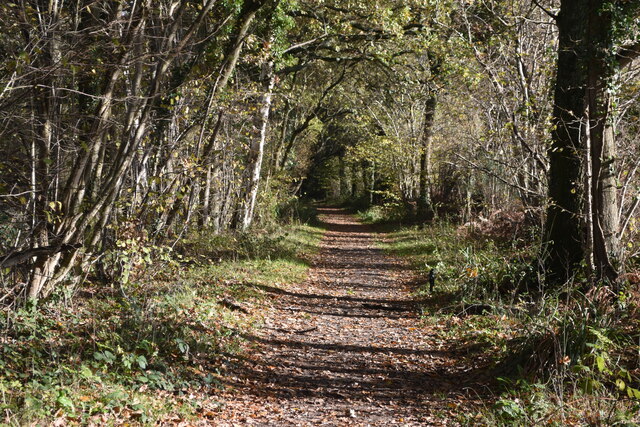
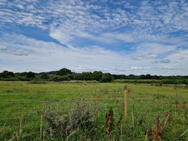
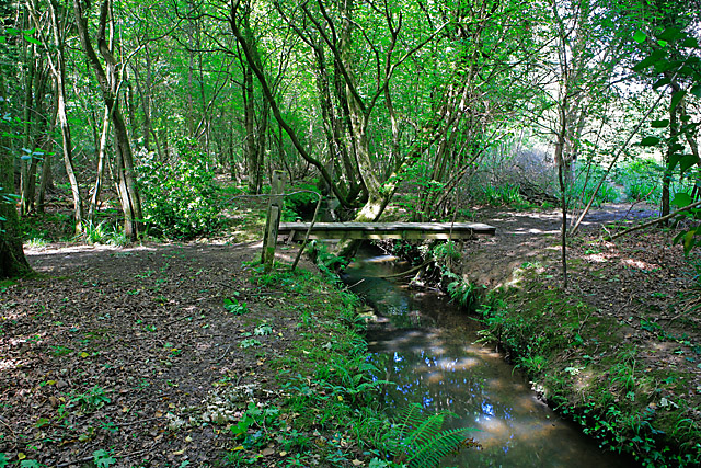
Bedlams Copse is a serene and picturesque woodland located in the county of Hampshire, England. Spread over an area of approximately 50 acres, this enchanting copse is nestled within the rolling countryside, offering a peaceful retreat for nature enthusiasts and tranquility seekers.

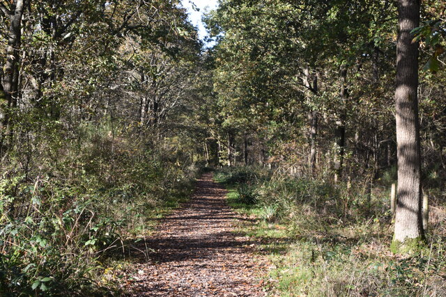
The copse is primarily composed of a diverse range of deciduous trees, including oak, beech, ash, and birch, which create a dense canopy overhead, providing shade and shelter for the thriving flora and fauna. The forest floor is adorned with a vibrant carpet of wildflowers during the spring and summer months, adding a burst of color to the surroundings.

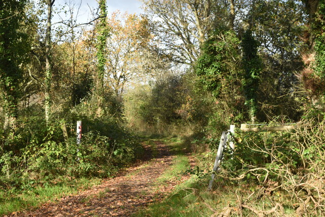
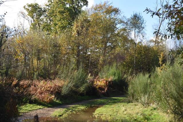
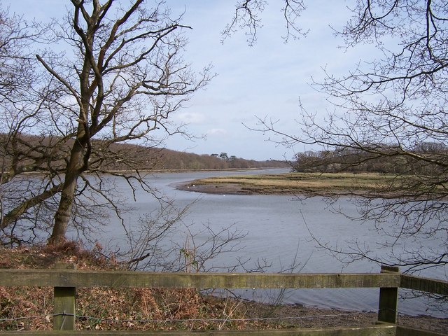
Tranquil footpaths wind through the copse, inviting visitors to explore its hidden treasures. These pathways lead to several natural clearings and small glades, providing idyllic spots for picnics or simply soaking in the beauty of the surroundings. The copse is also intersected by a charming stream, meandering through the trees, adding a touch of serenity to the atmosphere.

Bedlams Copse is home to a rich variety of wildlife, with numerous species of birds, such as woodpeckers, owls, and finches, calling it their sanctuary. Squirrels can be seen scampering between the branches, while deer occasionally graze on the outskirts of the woodland.

With its captivating natural beauty, Bedlams Copse offers a welcome escape from the hustle and bustle of everyday life. Whether it's a leisurely stroll, birdwatching, or simply immersing oneself in the wonders of nature, this woodland gem provides a tranquil haven for all who visit.

If you have any feedback on the listing, please let us know in the comments section below.

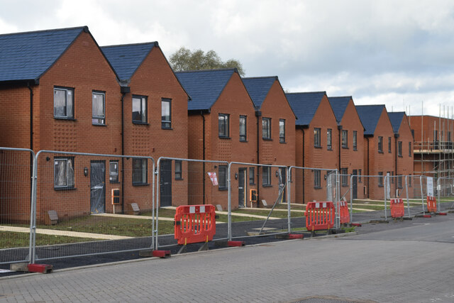
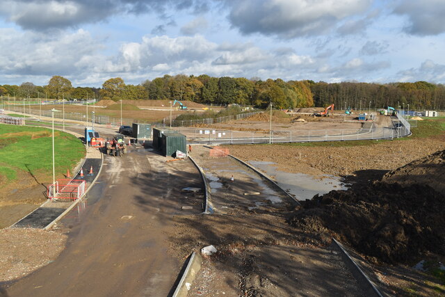
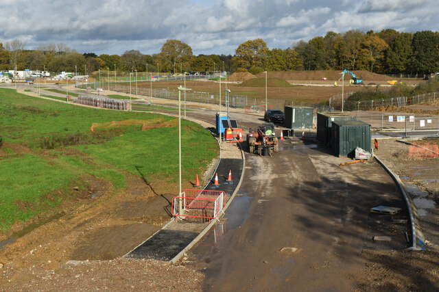
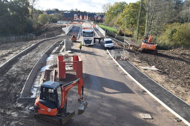
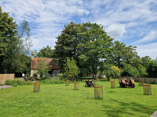
Bedlams Copse Images

Images are sourced within 2km of 50.89766/-1.253875 or Grid Reference SU5211. Thanks to Geograph Open Source API. All images are credited.

Newly built houses in Brunel Way, Whiteley The houses are complete and occupied, but the road surface is still in need of some attention.
Newly built houses in Brunel Way, Whiteley
The houses are complete and occupied, but the road surface is still in need of some attention.
New housing construction on Glassfield Road, Whiteley These houses are on a section of Glassfield Road that is still in full possession of the developers.
New housing construction on Glassfield Road, Whiteley
These houses are on a section of Glassfield Road that is still in full possession of the developers.
Footpath towards Glassfield Road Pre-existing right of way, increasingly surrounded by new housing development.
Footpath towards Glassfield Road
Pre-existing right of way, increasingly surrounded by new housing development.
New housing nearing completion on Bluebell Way, Whiteley
Tree-lined footpath, Whiteley
New road under construction, Whiteley Taken from a temporary footbridge enabling the footpath to pass over the area controlled by the developers.
New road under construction, Whiteley
Taken from a temporary footbridge enabling the footpath to pass over the area controlled by the developers.
New road under construction, Whiteley Taken from a temporary footbridge enabling the footpath to pass over the area controlled by the developers.
New road under construction, Whiteley
Taken from a temporary footbridge enabling the footpath to pass over the area controlled by the developers.
Drainage work on Whiteley Way The contractors are working on a balancing pond and drainage beside this newly-constructed section of Whiteley Way. The present extent of new housing is visible in the distance. Photo taken from a temporary footbridge enabling the footpath to pass over the area controlled by the developers.
Drainage work on Whiteley Way
The contractors are working on a balancing pond and drainage beside this newly-constructed section of Whiteley Way. The present extent of new housing is visible in the distance. Photo taken from a temporary footbridge enabling the footpath to pass over the area controlled by the developers.
Track branching away from footpath, Whiteley
Path in Ridge Copse The path here crosses a linear clearing beneath high voltage electricity lines.
Path in Ridge Copse
The path here crosses a linear clearing beneath high voltage electricity lines.
Footpath adjacent to Whiteley Way
Whiteley Farm roundabout on Whiteley Way Whiteley Way, straight on, is not yet a through route, eventually coming to a public end at a building site.
Whiteley Farm roundabout on Whiteley Way
Whiteley Way, straight on, is not yet a through route, eventually coming to a public end at a building site.
New houses on a new road, Whiteley Way A greenfield housing development.
New houses on a new road, Whiteley Way
A greenfield housing development.
Manor Farm: field
Manor Farm: field
Manor Farm : meadow
Manor Farm : meadow
Manor Farm: parlour
Manor Farm: parlour
Manor Farm: farmyard
Manor Farm: graves by the church
Show me another place!

Bedlams Copse is located at Grid Ref: SU5211 (Lat: 50.89766, Lng: -1.253875)

Administrative County: Hampshire

District: Winchester

Police Authority: Hampshire

What 3 Words

///hires.cemented.waltz. Near Botley, Hampshire
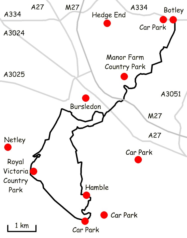
Related Wikis

Curbridge, Hampshire

Curbridge is a village and former civil parish, now in the parish of Curdridge, in the Winchester district, in the county of Hampshire, England. In 1951...

Burridge

Burridge is a small village in the Borough of Fareham, south of Hampshire, England. It lies approximately 14 miles south of Winchester on the A3051 between...

Upper Hamble Estuary and Woods

Upper Hamble Estuary and Woods is a 151.2-hectare (374-acre) biological Site of Special Scientific Interest east of Southampton in Hampshire. It is part...

Botley Wood and Everett's and Mushes Copses

Botley Wood and Everett's and Mushes Copses is a 352.7-hectare (872-acre) biological Site of Special Scientific Interest north of Fareham in Hampshire...

College of Air Traffic Control

The College of Air Traffic Control or CATC is the main British non-military training establishment for air traffic control (ATC). It also trains people...

Whiteley

Whiteley is a community of (planned) 6,500 homes in the county of Hampshire, England, near Fareham. The development straddles the boundary between two...

Swanwick, Hampshire

Swanwick () is a village in Hampshire, England, east of the River Hamble and north of the M27 motorway. The village is located within the borough of...

Strawberry Trail

The Strawberry Trail is a 15-mile footpath through Hampshire, England The trail is part linear and part circular. The linear section connects Botley to...

Nearby Amenities

Located within 500m of 50.89766,-1.253875
Curbridge
Place: village
Source: npe
Wikidata: Q5194654
Wikipedia: en:Curbridge, Hampshire
Lat/Long: 50.9018105/-1.2513828
Bus Stop
Horse & Jockey
Bench: no
Bin: no
Lit: no
Naptan AtcoCode: 1900HA110579
Naptan Bearing: S
Naptan CommonName: Horse & Jockey
Naptan NaptanCode: hamdmpap
Naptan PlusbusZoneRef: FAREHAM
Naptan ShortCommonName: Curbridge
Naptan Street: A3051 Botley Road
Naptan Verified: no
Shelter: no
Source: naptan_import
Tactile Paving: no
Lat/Long: 50.9016203/-1.2515668
Bus Stop
Horse & Jockey
Bench: no
Bin: no
Lit: no
Naptan AtcoCode: 1900HA110580
Naptan Bearing: N
Naptan CommonName: Horse & Jockey
Naptan NaptanCode: hamdmpaj
Naptan PlusbusZoneRef: FAREHAM
Naptan ShortCommonName: Curbridge
Naptan Street: A3051 Botley Road
Naptan Verified: no
Shelter: no
Source: naptan_import
Tactile Paving: no
Lat/Long: 50.9016572/-1.2517084
Bus Stop
Curbridge
Naptan AtcoCode: 1900HA110581
Naptan Bearing: SW
Naptan CommonName: Curbridge
Naptan Crossing: Ridge Lane
Naptan NaptanCode: hamdmjwj
Naptan PlusbusZoneRef: FAREHAM
Naptan Street: A3051 Botley Road
Naptan Verified: no
Source: naptan_import
Lat/Long: 50.900297/-1.2527542
Bus Stop
Curbridge
Naptan AtcoCode: 1900HA110582
Naptan Bearing: NE
Naptan CommonName: Curbridge
Naptan Crossing: Ridge Lane
Naptan NaptanCode: hamdmjwg
Naptan PlusbusZoneRef: FAREHAM
Naptan Street: A3051 Botley Road
Naptan Verified: no
Source: naptan_import
Lat/Long: 50.9003513/-1.2528102
Bus Stop
Bluebell Way
Bus: yes
Naptan AtcoCode: 1900HA110583
Naptan Bearing: NE
Naptan CommonName: Bluebell Way
Naptan Indicator: NE-bound
Naptan NaptanCode: hamdmjmj
Naptan PlusbusZoneRef: FAREHAM
Naptan Street: A3051 Botley Road
Naptan Verified: no
Public Transport: platform
Source: naptan_import
Lat/Long: 50.8984886/-1.2577695
Bus Stop
Bluebell Way
Bus: yes
Naptan AtcoCode: 1900HA110584
Naptan Bearing: SW
Naptan CommonName: Bluebell Way
Naptan Indicator: SW-bound
Naptan NaptanCode: hamdmjma
Naptan PlusbusZoneRef: FAREHAM
Naptan Street: A3051 Botley Road
Naptan Verified: no
Public Transport: platform
Source: naptan_import
Lat/Long: 50.8981395/-1.2587819
Barrier: stile
Lat/Long: 50.8951605/-1.2509665
Barrier: kissing_gate
Lat/Long: 50.8941452/-1.2511277
Crossing
Lat/Long: 50.8937737/-1.2519726
Crossing
Lat/Long: 50.8961291/-1.2565256
Traffic Signals
Traffic Signals: signal
Lat/Long: 50.8982541/-1.2581541
Traffic Signals
Traffic Signals: signal
Lat/Long: 50.8983299/-1.2583725
Traffic Signals
Traffic Signals: signal
Lat/Long: 50.8984057/-1.2579989
Bus Stop
Bluebell Way One
Bus: yes
Naptan AtcoCode: 1900HAA92121
Naptan Bearing: SE
Naptan CommonName: Bluebell Way One
Naptan Indicator: SE-bound
Naptan NaptanCode: hampagmj
Naptan PlusbusZoneRef: FAREHAM
Naptan Street: Bluebell Way
Naptan Verified: no
Public Transport: platform
Lat/Long: 50.8964441/-1.2563262
Bus Stop
Bluebell Way One
Bus: yes
Naptan AtcoCode: 1900HAA92120
Naptan Bearing: NW
Naptan CommonName: Bluebell Way One
Naptan Indicator: NW-bound
Naptan NaptanCode: hampagmg
Naptan PlusbusZoneRef: FAREHAM
Naptan Street: Bluebell Way
Naptan Verified: no
Public Transport: platform
Lat/Long: 50.8964166/-1.2565635
The data included in this document is from www.openstreetmap.org. The data is made available under ODbL.

Have you been to Bedlams Copse?

Leave your review of Bedlams Copse below (or comments, questions and feedback).