Cathole Wood

Wood, Forest in Derbyshire Derbyshire Dales

England

Cathole Wood

Stile and footpath across a snowy field Footprints in the snow pick out the line of the path to Stainsbro' Lane.
Stile and footpath across a snowy field Credit: Ian Calderwood

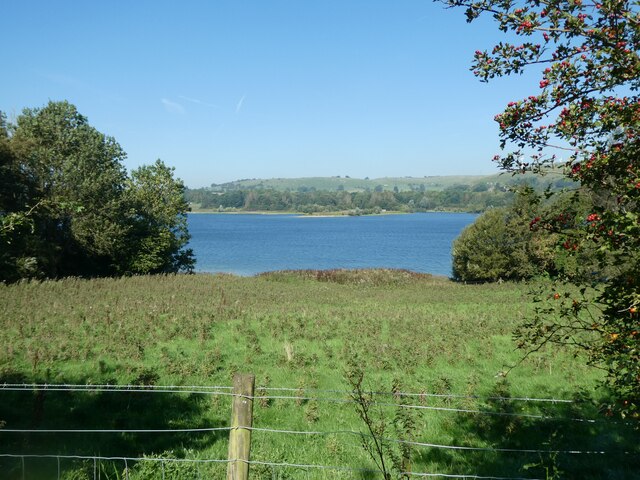
Cathole Wood is a picturesque forest located in Derbyshire, England. Covering an area of approximately 100 acres, it is known for its stunning natural beauty and diverse wildlife. The wood is situated on the outskirts of the small village of Cathole, nestled between rolling hills and meandering streams.

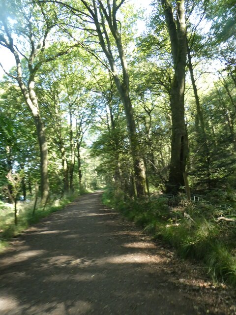
The woodland itself is predominantly made up of ancient oak trees, some of which are believed to be over 500 years old. These majestic trees provide a lush canopy, creating a serene and tranquil environment for visitors to enjoy. The forest floor is carpeted with a variety of wildflowers, ferns, and mosses, adding to the wood's enchanting charm.

Cathole Wood is a haven for wildlife enthusiasts, as it is home to a wide range of animal species. Birdwatchers will delight in spotting various woodland birds, including owls, woodpeckers, and warblers. Mammals such as badgers, foxes, and deer can also be found roaming the forest, offering a glimpse into the region's natural biodiversity.

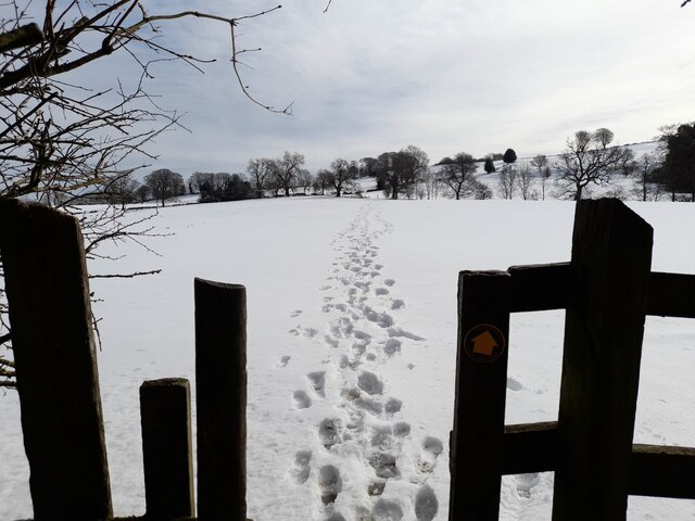
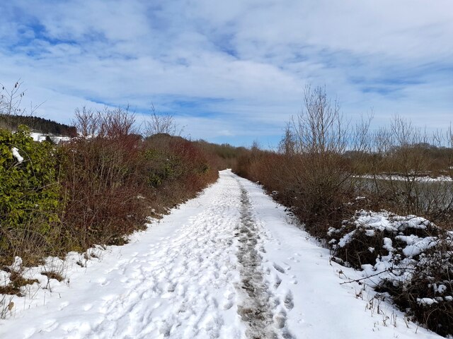
The wood features several well-maintained footpaths and trails, making it popular among hikers and nature lovers. These paths meander through the forest, offering visitors the opportunity to explore its hidden nooks and crannies. Along the way, there are designated picnic spots, allowing visitors to relax and enjoy a meal amidst the tranquil surroundings.

Cathole Wood truly encapsulates the beauty of Derbyshire's countryside, offering a peaceful retreat from the hustle and bustle of everyday life. Its rich flora and fauna, coupled with its scenic trails, make it a must-visit destination for those seeking solace in nature.

If you have any feedback on the listing, please let us know in the comments section below.

Cathole Wood Images

Images are sourced within 2km of 53.066816/-1.5939662 or Grid Reference SK2752. Thanks to Geograph Open Source API. All images are credited.

Stile and footpath across a snowy field Footprints in the snow pick out the line of the path to Stainsbro' Lane.
Stile and footpath across a snowy field
Footprints in the snow pick out the line of the path to Stainsbro' Lane.
Snowy perimeter path at Carsington Water The permissive path around Carsington Water coated with snow.
Snowy perimeter path at Carsington Water
The permissive path around Carsington Water coated with snow.
Snowy island in Carsington Water Some late-season snow coating a small island at the head of Carsington Water.
Snowy island in Carsington Water
Some late-season snow coating a small island at the head of Carsington Water.
Snowy gate at an entrance to Hall Wood A permissive path heading into Hall Wood.
Snowy gate at an entrance to Hall Wood
A permissive path heading into Hall Wood.
Snow-covered bench by a permissive path in Hall Wood
Snow-covered track The perimeter track at Carsington Water covered by late-season snow.
Snow-covered track
The perimeter track at Carsington Water covered by late-season snow.
The Chair in a snowy field Despite the snow, people have still been making their way across the field to sit on the carved wooden chair.
The Chair in a snowy field
Despite the snow, people have still been making their way across the field to sit on the carved wooden chair.
Hopton Hall
Hopton Hall
Cycle route in Lendow Wood
The Wooden Chair, sculpture overlooking Carsington Water Seen at a different time of year in <a href="https://www.geograph.org.uk/photo/7430056">SK2651 : The Chair in a snowy field</a>
The Wooden Chair, sculpture overlooking Carsington Water
Seen at a different time of year in SK2651 : The Chair in a snowy field
Cycle route on edge of Carsington Water The woodland ahead does not appear to have a name, but the reservoir flooded a valley and Lendow Wood on the left of the cycle route
Cycle route on edge of Carsington Water
The woodland ahead does not appear to have a name, but the reservoir flooded a valley and Lendow Wood on the left of the cycle route
Cycle route in woodland by Carsington Water The woodland which the reservoir flooded, of which this is roughly an extension, was Lendow Wood
Cycle route in woodland by Carsington Water
The woodland which the reservoir flooded, of which this is roughly an extension, was Lendow Wood
Cycle route approaching Big Covert
Cycle route in Big Covert
Field by Carsington Water
Cycle route in Hall Wood
The edge of Hall Wood; cycle route emerging to fields
Carsington Water from cycle route near Hopton
Show me another place!

Cathole Wood is located at Grid Ref: SK2752 (Lat: 53.066816, Lng: -1.5939662)

Administrative County: Derbyshire

District: Derbyshire Dales

Police Authority: Derbyshire

What 3 Words

///ranks.coasting.solar. Near Wirksworth, Derbyshire

Related Wikis

Dream Cave

Dream Cave (sometimes called Dream Hole or Dream Mine) is a natural limestone cavern located near Wirksworth in Derbyshire, England. It was discovered...

Callow, Derbyshire

Callow is a village and a civil parish in the Derbyshire Dales District, in the English county of Derbyshire. At the 2011 Census the population of the...

Haarlem Mill

Haarlem Mill, on the River Ecclesbourne in Wirksworth, Derbyshire, was an early cotton mill. Built by Richard Arkwright, it was the first cotton mill in...

Derby Road Ground

Derby Road Ground is a cricket ground in Wirksworth, Derbyshire. The first recorded match on the ground was in 1866, when Wirksworth played an All-England...

Nearby Amenities

Located within 500m of 53.066816,-1.5939662
Rough Pitty Wood
Natural: wood
Lat/Long: 53.0700265/-1.593135
Generator Method: wind_turbine
Generator Source: wind
Generator Type: horizontal_axis
Height: 10
Power: generator
Lat/Long: 53.0691222/-1.5890962
Material: wood
Power: pole
Lat/Long: 53.0682704/-1.5874383
Material: wood
Power: pole
Lat/Long: 53.0672478/-1.5893431
Material: wood
Power: pole
Lat/Long: 53.0654736/-1.5912754
Material: wood
Power: pole
Lat/Long: 53.0644236/-1.5907536
Material: wood
Power: pole
Lat/Long: 53.0634108/-1.5902537
Material: wood
Power: pole
Lat/Long: 53.0699051/-1.5888273
Power: pole
Lat/Long: 53.0677862/-1.5883183
Power: pole
Lat/Long: 53.0664952/-1.5901449
The data included in this document is from www.openstreetmap.org. The data is made available under ODbL.

Have you been to Cathole Wood?

Leave your review of Cathole Wood below (or comments, questions and feedback).