Lodge Wood

Wood, Forest in Cheshire

England

Lodge Wood

Macclesfield Canal near Scholar Green in Cheshire Looking south-south-west near Ramsdell Hall.
The bridge half a mile to the north is called Rowndes No 2 Bridge, No 86 on current Macclesfield Canal numbering. Is the narrowing ahead here the site of a former Rowndes No 1 Bridge? The position is not included as No 87, which is allocated to Kent Green Bridge, to the south-west. Late Victorian OS maps show a track leading directly to this spot, but already no bridge.
Macclesfield Canal near Scholar Green in Cheshire Credit: Roger Kidd

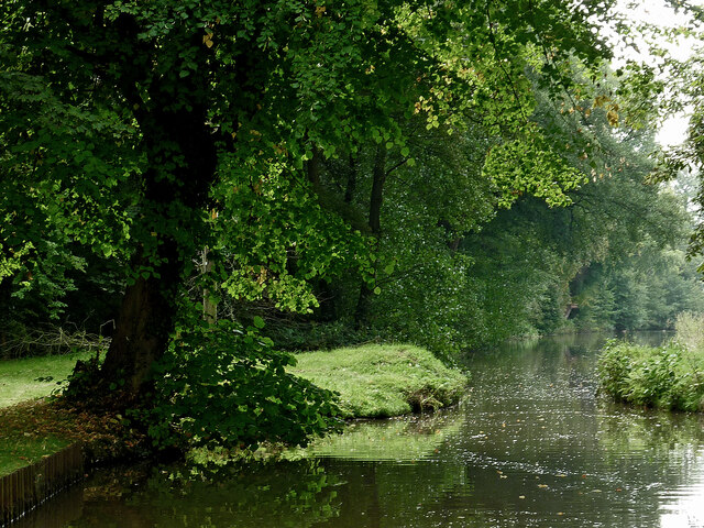
Lodge Wood is an enchanting forest located in the picturesque county of Cheshire, England. Nestled amidst the rolling countryside, this woodland exudes a tranquil and serene ambiance, making it a popular destination for nature lovers and outdoor enthusiasts alike.

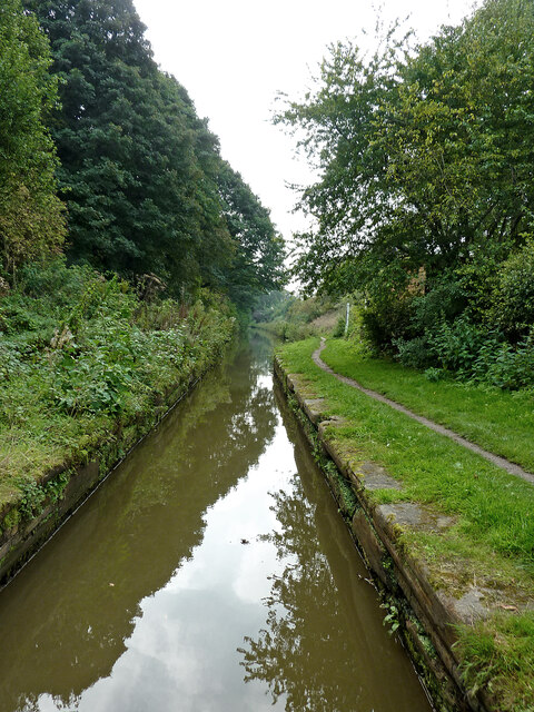
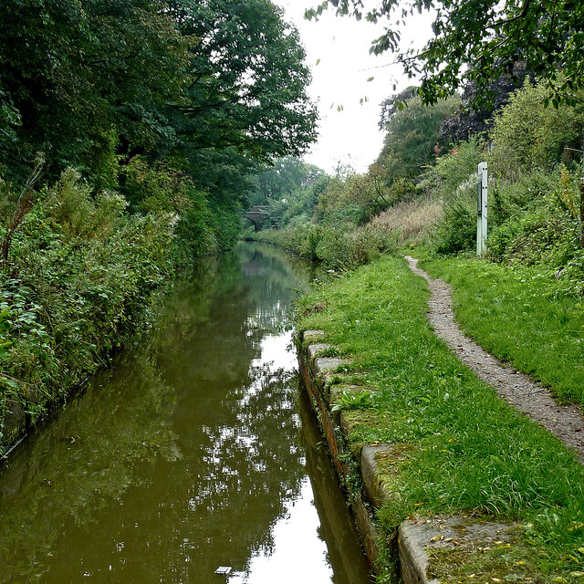
Covering an area of approximately 50 hectares, Lodge Wood boasts a diverse range of flora and fauna, creating a haven for wildlife. The forest is predominantly composed of broadleaf trees, including oak, beech, and birch, which provide a rich canopy of shade during the summer months. The forest floor is adorned with a vibrant carpet of wildflowers, creating a burst of color and fragrance.

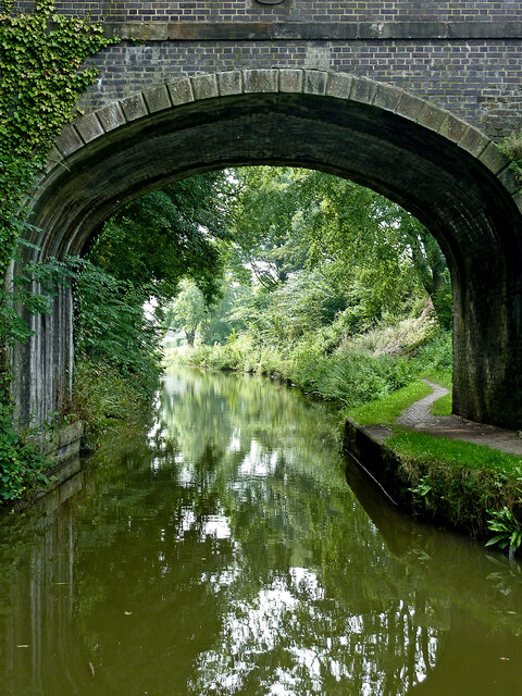
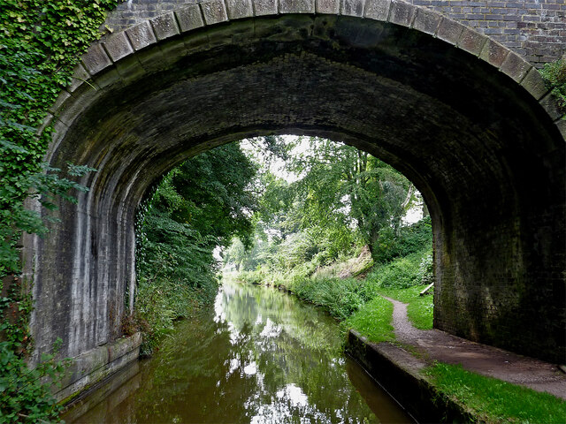
The wood is crisscrossed with a network of well-maintained trails, allowing visitors to explore its beauty at their own pace. These pathways wind through the woodland, offering stunning views of the surrounding countryside and glimpses of wildlife. It is not uncommon to spot deer, squirrels, and a variety of bird species while meandering through the forest.

Lodge Wood is also home to a diverse range of plant and animal species. Rare orchids, such as the bee orchid and lady's slipper, can be found nestled amongst the undergrowth. The forest is a haven for birdwatchers, with species such as woodpeckers, owls, and nightingales making it their home.

Visitors to Lodge Wood have the opportunity to partake in a range of activities, including hiking, birdwatching, and photography. The forest is a perfect place for quiet contemplation and relaxation, with secluded picnic spots scattered throughout.

In conclusion, Lodge Wood in Cheshire offers a beautiful and tranquil escape from the bustle of everyday life. Its diverse ecosystem and range of activities make it a must-visit destination for nature enthusiasts and those seeking a peaceful retreat.

If you have any feedback on the listing, please let us know in the comments section below.
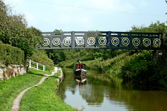
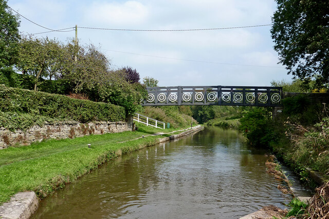
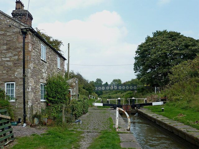
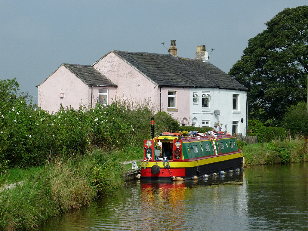
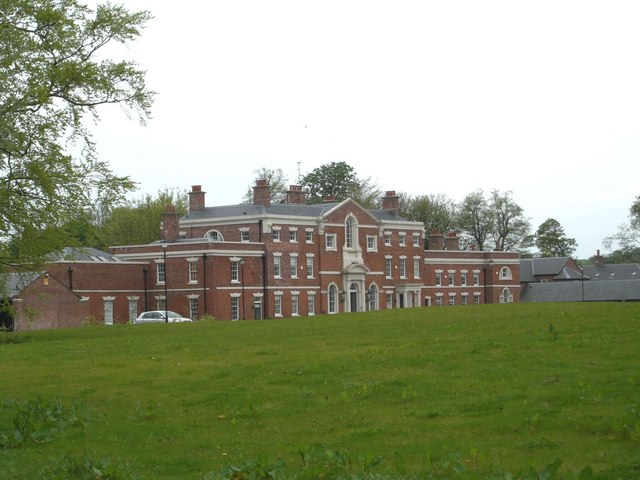
Lodge Wood Images

Images are sourced within 2km of 53.112895/-2.2646109 or Grid Reference SJ8257. Thanks to Geograph Open Source API. All images are credited.

Macclesfield Canal near Scholar Green in Cheshire Looking south-south-west near Ramsdell Hall.
The bridge half a mile to the north is called Rowndes No 2 Bridge, No 86 on current Macclesfield Canal numbering. Is the narrowing ahead here the site of a former Rowndes No 1 Bridge? The position is not included as No 87, which is allocated to Kent Green Bridge, to the south-west. Late Victorian OS maps show a track leading directly to this spot, but already no bridge.
Macclesfield Canal near Scholar Green in Cheshire
Looking south-south-west near Ramsdell Hall. The bridge half a mile to the north is called Rowndes No 2 Bridge, No 86 on current Macclesfield Canal numbering. Is the narrowing ahead here the site of a former Rowndes No 1 Bridge? The position is not included as No 87, which is allocated to Kent Green Bridge, to the south-west. Late Victorian OS maps show a track leading directly to this spot, but already no bridge.
Macclesfield Canal at Kent Green in Cheshire Looking north-north-east at the site where the Foundry Lane Swing Bridge, No 88 has been removed. Ahead is Kent Green Bridge, No 87. The house on the left is the former Bird-in-Hand public house, closed in the 1990s. <a title="https://www.geograph.org.uk/photo/603995" href="https://www.geograph.org.uk/photo/603995">Link</a>
Macclesfield Canal at Kent Green in Cheshire
Looking north-north-east at the site where the Foundry Lane Swing Bridge, No 88 has been removed. Ahead is Kent Green Bridge, No 87. The house on the left is the former Bird-in-Hand public house, closed in the 1990s. Link
Macclesfield Canal at Kent Green in Cheshire A telephoto image, looking north-north-east at the site where the Foundry Lane Swing Bridge, No 88 has been removed.  A house off to the left is the former Bird-in-Hand public house, closed in the 1990s. <a title="https://www.geograph.org.uk/photo/603995Ahead" href="https://www.geograph.org.uk/photo/603995Ahead">Link</a> is Kent Green Bridge, No 87.
Macclesfield Canal at Kent Green in Cheshire
A telephoto image, looking north-north-east at the site where the Foundry Lane Swing Bridge, No 88 has been removed. A house off to the left is the former Bird-in-Hand public house, closed in the 1990s. Link is Kent Green Bridge, No 87.
Hall Green Footbridge near Scholar Green in Cheshire This is the Macclesfield Canal, looking north-east from Hall Green Stop Lock. Narrowboat 'Oz' approaches at a steady rate while I open the lock gate! The footbridge carries a public footpath.
Hall Green Footbridge near Scholar Green in Cheshire
This is the Macclesfield Canal, looking north-east from Hall Green Stop Lock. Narrowboat 'Oz' approaches at a steady rate while I open the lock gate! The footbridge carries a public footpath.
Hall Green Footbridge near Scholar Green in Cheshire This is the Macclesfield Canal, looking north-east from Hall Green Stop Lock. The footbridge carries a public footpath.
Hall Green Footbridge near Scholar Green in Cheshire
This is the Macclesfield Canal, looking north-east from Hall Green Stop Lock. The footbridge carries a public footpath.
Hall Green Stop Lock near Scholar Green, Cheshire Looking north-north-east towards Congleton.
The stop lock here separated the Macclesfield Canal (ahead) from the Trent and Mersey Canal (behind), with a rise of just twelve inches (30·5 cm). This was to ensure that the later Macclesfield Canal did not "steal" water from the Trent and Mersey Canal!
The water between here and Hardings Wood Junction is now generally considered to be part of the Macclesfield Canal.
Hall Green Stop Lock near Scholar Green, Cheshire
Looking north-north-east towards Congleton. The stop lock here separated the Macclesfield Canal (ahead) from the Trent and Mersey Canal (behind), with a rise of just twelve inches (30·5 cm). This was to ensure that the later Macclesfield Canal did not "steal" water from the Trent and Mersey Canal! The water between here and Hardings Wood Junction is now generally considered to be part of the Macclesfield Canal.
Hall Green Narrows near Scholar Green in Cheshire This thirty metre narrow channel is south of Hall Green Stop Lock, which separates the Macclesfield Canal (behind) from the Trent and Mersey Canal (ahead).
The whole section between here and Hardings Wood Junction is now generally considered to be part of the Macclesfield Canal, or even "Trent and Mersey Canal (Hall Green Branch)".
Hall Green Narrows near Scholar Green in Cheshire
This thirty metre narrow channel is south of Hall Green Stop Lock, which separates the Macclesfield Canal (behind) from the Trent and Mersey Canal (ahead). The whole section between here and Hardings Wood Junction is now generally considered to be part of the Macclesfield Canal, or even "Trent and Mersey Canal (Hall Green Branch)".
Trent and Mersey Canal (Hall Green Branch) Looking south-west towards Hardings Wood.
There is a thirty metre narrow channel south of Hall Green Stop Lock, which separates the Macclesfield Canal (behind) from the Trent and Mersey Canal (ahead).
The whole section between here and Hardings Wood Junction is now generally considered to be part of the Macclesfield Canal, or even "Trent and Mersey Canal (Hall Green Branch)".
Trent and Mersey Canal (Hall Green Branch)
Looking south-west towards Hardings Wood. There is a thirty metre narrow channel south of Hall Green Stop Lock, which separates the Macclesfield Canal (behind) from the Trent and Mersey Canal (ahead). The whole section between here and Hardings Wood Junction is now generally considered to be part of the Macclesfield Canal, or even "Trent and Mersey Canal (Hall Green Branch)".
Moss Lane Bridge near Scholar Green in Cheshire Moss Lane Bridge is No 94 across the Trent and Mersey Canal (Hall Green Branch). This canal is often considered now as part of the Macclesfield Canal, and uses its bridge numbering sequence.
Moss Lane Bridge near Scholar Green in Cheshire
Moss Lane Bridge is No 94 across the Trent and Mersey Canal (Hall Green Branch). This canal is often considered now as part of the Macclesfield Canal, and uses its bridge numbering sequence.
Railway bridge over Spring Bank, Scholar Green The Mow Cop tramway ran across the field to the left, but as the railway opened in 1848, the tramway must have ceased operation before that date.
Railway bridge over Spring Bank, Scholar Green
The Mow Cop tramway ran across the field to the left, but as the railway opened in 1848, the tramway must have ceased operation before that date.
Junction of Spring Bank and Station Road There is a bus shelter, and a mobile phone mast.
Junction of Spring Bank and Station Road
There is a bus shelter, and a mobile phone mast.
New houses at Littler's Wharf The centre section of this terrace of houses was one of the buildings at Littler's Wharf at the terminus of the Mow Cop Tramway. It has been converted and extended at both ends; this can be seen more clearly in a side view <a href="https://www.geograph.org.uk/photo/5695966">SJ8457 : Scholar Green</a>.
New houses at Littler's Wharf
The centre section of this terrace of houses was one of the buildings at Littler's Wharf at the terminus of the Mow Cop Tramway. It has been converted and extended at both ends; this can be seen more clearly in a side view SJ8457 : Scholar Green.
The Rising Sun at Scholar Green See also <a href="https://www.geograph.org.uk/photo/3535504">SJ8357 : Rising Sun at Congleton</a>.
The Rising Sun at Scholar Green
Pipe bridge over the Macclesfield Canal Probably a water pipe, as it's lagged.
Pipe bridge over the Macclesfield Canal
Probably a water pipe, as it's lagged.
Station Road bridge over the Macclesfield Canal The bridge dates from 1827, by William Crosley, and is grade II listed (list entry 1138709).
Station Road bridge over the Macclesfield Canal
The bridge dates from 1827, by William Crosley, and is grade II listed (list entry 1138709).
Approaching Sherborne Wharf A marina on the Macclesfield Canal. This is a relatively modern development for the era of pleasure boating, although there had originally been Littler's Wharf nearby where coal from the Mow Cop collieries was loaded onto barges.
Approaching Sherborne Wharf
A marina on the Macclesfield Canal. This is a relatively modern development for the era of pleasure boating, although there had originally been Littler's Wharf nearby where coal from the Mow Cop collieries was loaded onto barges.
Sherborne Wharf at Scholar Green A marina on the Macclesfield Canal. This is a relatively modern development for the era of pleasure boating, although there had originally been Littler's Wharf nearby where coal from the Mow Cop collieries was loaded onto barges.
Sherborne Wharf at Scholar Green
A marina on the Macclesfield Canal. This is a relatively modern development for the era of pleasure boating, although there had originally been Littler's Wharf nearby where coal from the Mow Cop collieries was loaded onto barges.
Show me another place!

Lodge Wood is located at Grid Ref: SJ8257 (Lat: 53.112895, Lng: -2.2646109)

Unitary Authority: Cheshire East

Police Authority: Cheshire

What 3 Words

///headboard.apricot.downhill. Near Rode Heath, Cheshire

Related Wikis

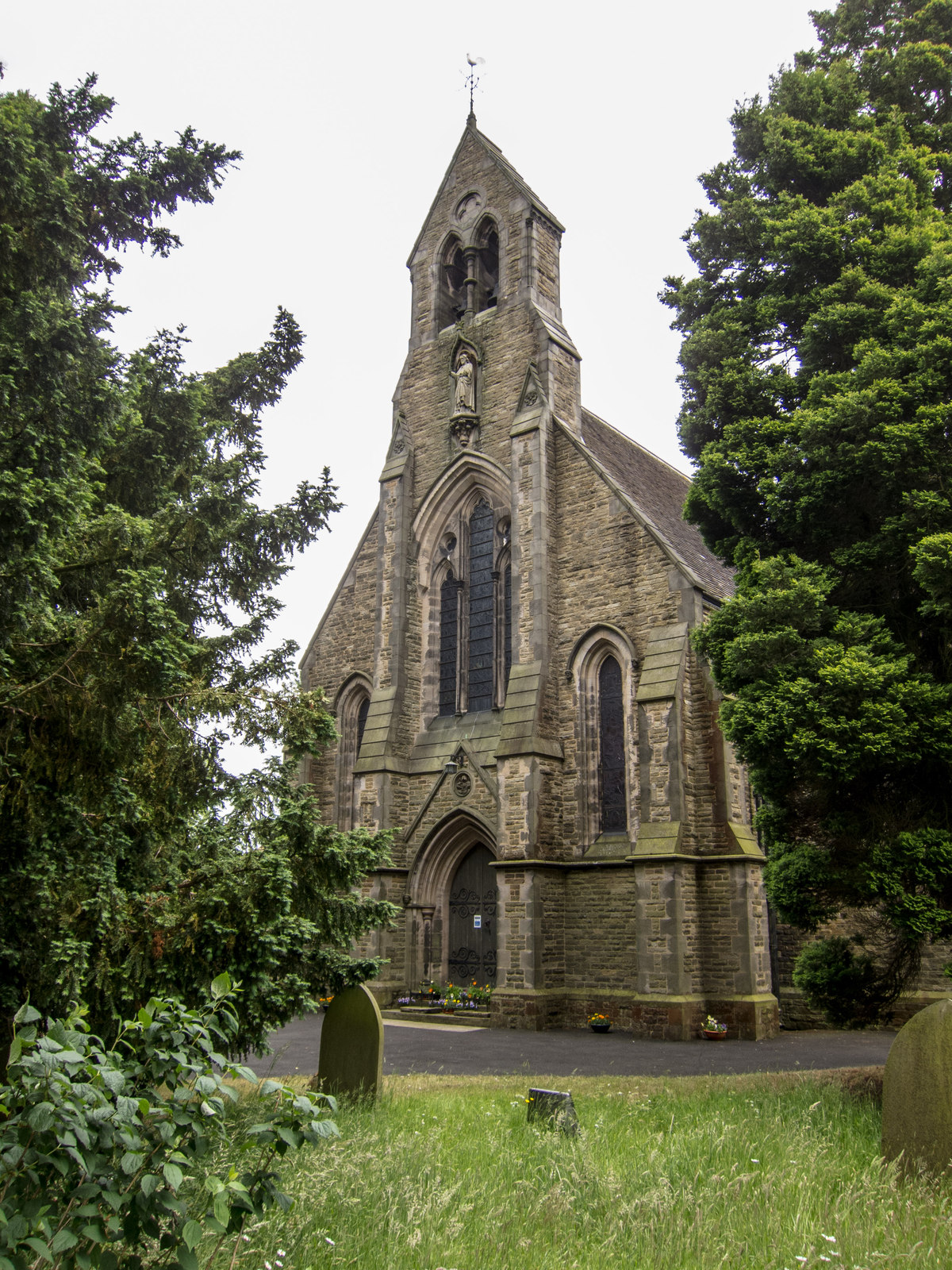
All Saints Church, Scholar Green

All Saints Church is in the village of Scholar Green in the parish of Odd Rode, Cheshire, England. It is an Anglican parish church in the deanery of Congleton...

Rode Hall

Rode Hall, a Georgian country house, is the seat of the Wilbraham family, members of the landed gentry in the parish of Odd Rode, Cheshire, England. The...

Odd Rode

Odd Rode is a civil parish in the unitary authority of Cheshire East and the ceremonial county of Cheshire, England. It borders the Staffordshire parish...

Scholar Green

Scholar Green () is a village in the civil parish of Odd Rode, in Cheshire, England. Encompassing the smaller settlements of Kent Green and The Bank, it...

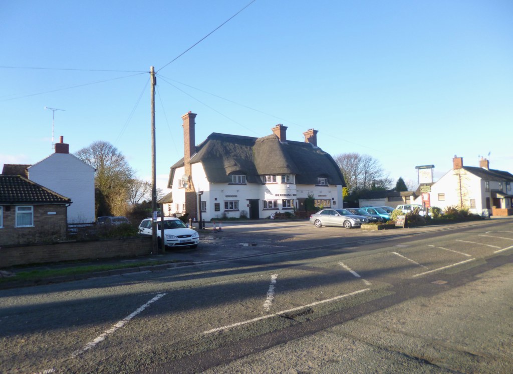
The Bleeding Wolf, Scholar Green

The Bleeding Wolf is a Grade II listed public house at 121 Congleton Road North, Scholar Green, Cheshire ST7 3BQ. The unusual name is said to arise from...

Church Lawton

Church Lawton is a village and located in the unitary authority of Cheshire East and the ceremonial county of Cheshire in England. Its location is such...

All Saints Church, Church Lawton

All Saints’ Church stands on a mound close to Lawton Hall in the small village of Church Lawton, Cheshire, England. It is recorded in the National Heritage...

Lawton Hall

Lawton Hall is a former country house to the east of the village of Church Lawton, Cheshire, England. The building has since been used as a hotel, then...

Nearby Amenities

Located within 500m of 53.112895,-2.2646109
Post Box
Ref: ST7 86
Lat/Long: 53.1138348/-2.2643409
Rode Hall and Gardens
Tourism: attraction
Website: http://www.rodehall.co.uk/
Lat/Long: 53.1122303/-2.2710719
Bus Stop
Scholar Green, Church Lane / All Saints Church
Bus: yes
Naptan AtcoCode: 0600CO17334
Naptan Bearing: NW
Naptan BusStopType: CUS
Naptan CommonName: All Saints Church
Naptan Crossing: Holehouse Lane
Naptan Indicator: opp
Naptan Landmark: All Saints Church
Naptan LocalityName: Scholar Green
Naptan NaptanCode: chetgdg
Naptan ShortCommonName: All Saints Church
Naptan Street: Church Lane
Naptan Verified: no
Network: Cheshire East Council
Operator: Ansa Transport
Public Transport: platform
Source: naptan_import
Lat/Long: 53.1139845/-2.2649345
Bus Stop
Scholar Green, Church Lane / All Saints Church
Bus: yes
Naptan AtcoCode: 0600CO17336
Naptan Bearing: SE
Naptan BusStopType: CUS
Naptan CommonName: All Saints Church
Naptan Crossing: Holehouse Lane
Naptan Indicator: o/s
Naptan Landmark: All Saints Church
Naptan LocalityName: Scholar Green
Naptan NaptanCode: chetdwg
Naptan ShortCommonName: All Saints Church
Naptan Street: Church Lane
Naptan Verified: no
Network: Cheshire East Council
Operator: Ansa Transport
Public Transport: platform
Source: naptan_import
Lat/Long: 53.1139761/-2.2646506
Barrier: stile
Lat/Long: 53.1122889/-2.2578062
Barrier: stile
Lat/Long: 53.1150391/-2.2606581
Barrier: cattle_grid
Lat/Long: 53.1112349/-2.2701893
Bus Stop
Scholar Green, Church Lane / Lunts Moss
Bus: yes
Naptan AtcoCode: 0600CO19094
Naptan Bearing: NW
Naptan BusStopType: CUS
Naptan CommonName: Lunts Moss
Naptan Crossing: Lunts Moss
Naptan Indicator: cnr
Naptan Landmark: Odd Rode Rectory
Naptan LocalityName: Scholar Green
Naptan NaptanCode: cheadjgj
Naptan ShortCommonName: Lunts Moss
Naptan Street: Church Lane
Network: Cheshire East Council
Operator: Ansa Transport
Public Transport: platform
Source: naptan_import
Lat/Long: 53.110801/-2.261252
Bus Stop
Scholar Green, Church Lane / Lunts Moss
Bus: yes
Naptan AtcoCode: 0600CO19093
Naptan Bearing: SE
Naptan BusStopType: CUS
Naptan CommonName: Lunts Moss
Naptan Crossing: Lunts Moss
Naptan Indicator: opp
Naptan Landmark: Odd Rode Rectory
Naptan LocalityName: Scholar Green
Naptan NaptanCode: cheadjgp
Naptan ShortCommonName: Lunts Moss
Naptan Street: Church Lane
Network: Cheshire East Council
Operator: Ansa Transport
Public Transport: platform
Source: naptan_import
Lat/Long: 53.1109039/-2.2609851
Barrier: cattle_grid
Lat/Long: 53.1137781/-2.2647884
Access: private
Playground: trampoline
Lat/Long: 53.1130644/-2.2716324
Cafe
Rode Hall Courtyard Kitchen
Lat/Long: 53.1125201/-2.2715593
Entrance: yes
Lat/Long: 53.1125396/-2.2716018
Toilets
Access: customers
Male: yes
Lat/Long: 53.1124918/-2.2719497
Toilets
Access: customers
Female: yes
Wheelchair: yes
Lat/Long: 53.1125115/-2.271921
Leisure: outdoor_seating
Lat/Long: 53.1125513/-2.271747
The data included in this document is from www.openstreetmap.org. The data is made available under ODbL.

Have you been to Lodge Wood?

Leave your review of Lodge Wood below (or comments, questions and feedback).