Aptor Pool

Lake, Pool, Pond, Freshwater Marsh in Devon South Hams

England

Aptor Pool

Berry Pomeroy Castle The castle seen above Pomeroy's Leap from the lane to Castle Mill, with a beech tree and the walls catching the lowering sun.
Berry Pomeroy Castle Credit: Derek Harper

Aptor Pool is a picturesque freshwater body located in Devon, England. Nestled amidst the tranquil countryside, it serves as a haven for both wildlife and visitors seeking a serene natural retreat. Spanning an area of approximately 5 acres, the pool is a combination of a lake, pool, pond, and freshwater marsh, creating a diverse and dynamic ecosystem.

Surrounded by lush greenery and dotted with water lilies and reeds, Aptor Pool is a visual delight. The calm, still waters reflect the surrounding landscape, providing a peaceful ambiance for visitors. The pool's depth varies, with some areas being shallow and others reaching a maximum depth of around 10 feet.

The diverse range of flora and fauna in and around Aptor Pool makes it a haven for wildlife enthusiasts. The marshy areas are home to a variety of waterfowl, including mallards, coots, and herons, which can often be spotted gracefully gliding across the water. Visitors may also catch a glimpse of dragonflies, butterflies, and other insects that thrive in this wetland habitat.

Aptor Pool is also a popular spot for recreational activities such as fishing and boating. Anglers can enjoy casting their lines in search of carp, tench, and perch, among other fish species that inhabit the pool. Non-motorized boats, such as canoes or kayaks, provide a peaceful means of exploring the pool's nooks and crannies.

Visitors to Aptor Pool can take advantage of the tranquil surroundings by embarking on leisurely walks along the pool's edge or simply relaxing on one of the benches strategically placed to offer panoramic views. The pool's idyllic setting, coupled with its rich biodiversity, makes Aptor Pool a must-visit destination for nature lovers and those seeking a serene escape from the hustle and bustle of everyday life.

If you have any feedback on the listing, please let us know in the comments section below.
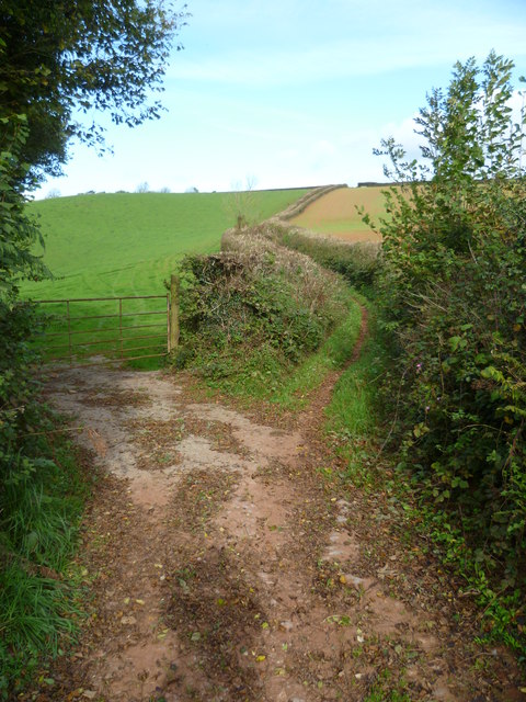
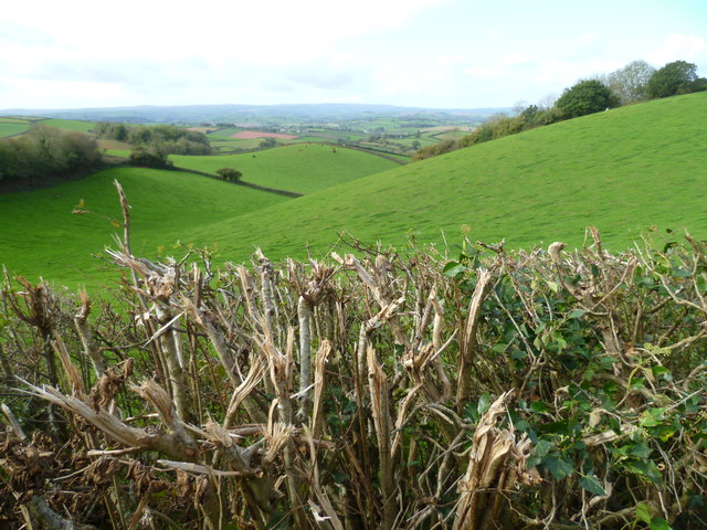
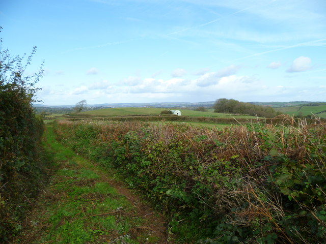
Aptor Pool Images

Images are sourced within 2km of 50.459904/-3.614553 or Grid Reference SX8563. Thanks to Geograph Open Source API. All images are credited.

Berry Pomeroy Castle The castle seen above Pomeroy's Leap from the lane to Castle Mill, with a beech tree and the walls catching the lowering sun.
Berry Pomeroy Castle
The castle seen above Pomeroy's Leap from the lane to Castle Mill, with a beech tree and the walls catching the lowering sun.
Marldon Bowls Club
Marldon Bowls Club
Garden at Compton Castle The thatched roof of a large barn is in the background.
Garden at Compton Castle
The thatched roof of a large barn is in the background.
A quiet seat at Compton Castle This is close to the Knot Garden.
A quiet seat at Compton Castle
This is close to the Knot Garden.
Orange Way in Devon and Torbay (64) This is the way past Berry Pomeroy Castle.
Orange Way in Devon and Torbay (64)
This is the way past Berry Pomeroy Castle.
Orange Way in Devon and Torbay (65) The way to go is down the hill.
Orange Way in Devon and Torbay (65)
The way to go is down the hill.
Orange Way in Devon and Torbay (66) Here I looked back to the "back entrance" to Berry Castle.  The signpost is waymarked for John Musgrave Heritage Trail and Torbay Totnes Trail.  The Orange Way is not waymarked.
Orange Way in Devon and Torbay (66)
Here I looked back to the "back entrance" to Berry Castle. The signpost is waymarked for John Musgrave Heritage Trail and Torbay Totnes Trail. The Orange Way is not waymarked.
Orange Way in Devon and Torbay (67) At the junction at Afton Bridge the Orange Way turns right on a bridleway.
Orange Way in Devon and Torbay (67)
At the junction at Afton Bridge the Orange Way turns right on a bridleway.
Orange Way in Devon and Torbay (68) A footpath leaves the bridleway used on this walk near Loventor Manor. A different view of this junction is at <a title="https://www.geograph.org.uk/photo/804578" href="https://www.geograph.org.uk/photo/804578">Link</a>.
Orange Way in Devon and Torbay (68)
A footpath leaves the bridleway used on this walk near Loventor Manor. A different view of this junction is at Link.
Orange Way in Devon and Torbay (69) Here the bridleway bends through 90°.
Orange Way in Devon and Torbay (69)
Here the bridleway bends through 90°.
Orange Way in Devon and Torbay (70) This is the view from the bridleway at Butterball Copse.  The masts are on Beacon Hill and were seen earlier at <a href="https://www.geograph.org.uk/photo/2667966">SX8757 : Orange Way in Devon and Torbay (24)</a>.  This time they are less than a mile away.
Orange Way in Devon and Torbay (70)
This is the view from the bridleway at Butterball Copse. The masts are on Beacon Hill and were seen earlier at SX8757 : Orange Way in Devon and Torbay (24). This time they are less than a mile away.
Orange Way in Devon and Torbay (71) Aptor Lane stretches ahead with a field entrance on the left.
Orange Way in Devon and Torbay (71)
Aptor Lane stretches ahead with a field entrance on the left.
Orange Way in Devon and Torbay (72) The hedge along Aptor Lane has been brutally cut.  I hope it survives.
Orange Way in Devon and Torbay (72)
The hedge along Aptor Lane has been brutally cut. I hope it survives.
Orange Way in Devon and Torbay (73) Taken on Aptor Lane the camera is looking towards the building on Ipplepen Road.  Aptor Lane was difficult to walk along as all the (large) hedge cuttings has been left underfoot.
Orange Way in Devon and Torbay (73)
Taken on Aptor Lane the camera is looking towards the building on Ipplepen Road. Aptor Lane was difficult to walk along as all the (large) hedge cuttings has been left underfoot.
Orange Way in Devon and Torbay (74) Here Aptor Lane ends at Ipplepen Road.  About a mile away on the right of the picture the windmill at North Whinborough can be seen.  I believe it to be a private residence now.
Orange Way in Devon and Torbay (74)
Here Aptor Lane ends at Ipplepen Road. About a mile away on the right of the picture the windmill at North Whinborough can be seen. I believe it to be a private residence now.
Orange Way in Devon and Torbay (75) Wrigwell Lane leaves Ipplepen Road ahead.
Orange Way in Devon and Torbay (75)
Wrigwell Lane leaves Ipplepen Road ahead.
Orange Way in Devon and Torbay (76) This is looking along Wrigwell Lane from Ipplepen Road.  An earlier view is at <a title="https://www.geograph.org.uk/photo/1125132" href="https://www.geograph.org.uk/photo/1125132">Link</a> and it seems the bridleway sign has been moved between times.
Orange Way in Devon and Torbay (76)
This is looking along Wrigwell Lane from Ipplepen Road. An earlier view is at Link and it seems the bridleway sign has been moved between times.
Orange Way in Devon and Torbay (77) The Orange Way is on the bridleway called Wrigwell Lane which crosses Tanyard Lane here.
Orange Way in Devon and Torbay (77)
The Orange Way is on the bridleway called Wrigwell Lane which crosses Tanyard Lane here.
Show me another place!

Aptor Pool is located at Grid Ref: SX8563 (Lat: 50.459904, Lng: -3.614553)

Administrative County: Devon

District: South Hams

Police Authority: Devon and Cornwall

What 3 Words

///whisk.trickster.formed. Near Marldon, Devon

Related Wikis

Marldon

Marldon is a village in the South Hams in Devon, United Kingdom, to the north-west of Paignton. It is the most northeasterly Civil Parish in the South...

Combe Fishacre

Combe Fishacre is a village in the English county of Devon. == References == The geographic coordinates are from the Ordnance Survey. == External links... ==

Beacon Hill transmitting station

The Beacon Hill transmitting station is an English telecommunications facility located at Beacon Hill, Marldon, Devon. It includes a guyed mast (Beacon...
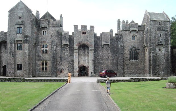
Compton Castle

Compton Castle in the parish of Marldon in Devon, is a fortified manor house in the village of Compton (formerly "Compton Pole"), about 5 miles (8 km)...

Nearby Amenities

Located within 500m of 50.459904,-3.614553
Barrier: kissing_gate
Lat/Long: 50.4570841/-3.6146642
Barrier: kissing_gate
Lat/Long: 50.4575299/-3.6179906
Aptor
Place: hamlet
Source: OS_OpenData_StreetView
Lat/Long: 50.4607248/-3.6147594
Marldon Airstrip
Aeroway: airstrip
Lat/Long: 50.4608826/-3.6078246
The data included in this document is from www.openstreetmap.org. The data is made available under ODbL.

Have you been to Aptor Pool?

Leave your review of Aptor Pool below (or comments, questions and feedback).