Kilnmoor Copse
Wood, Forest in Devon Mid Devon
England
Kilnmoor Copse

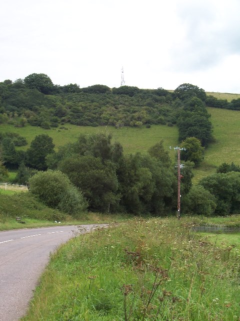
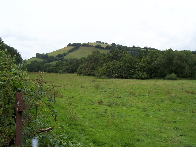
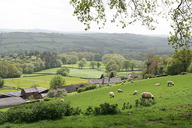
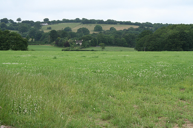
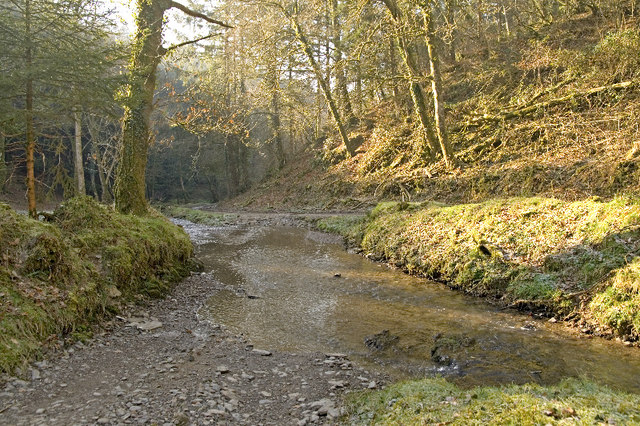
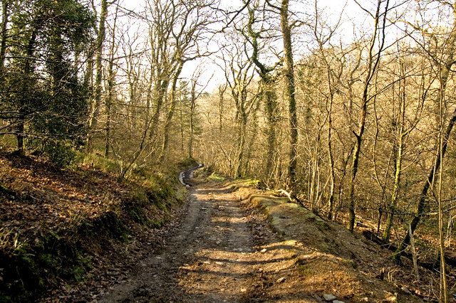
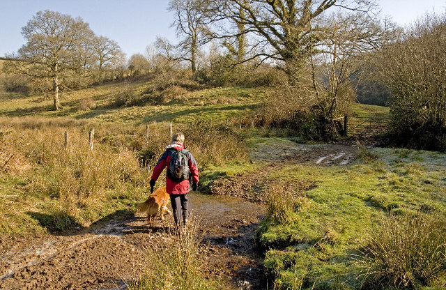
Kilnmoor Copse is a picturesque woodland located in Devon, England. Stretching over 100 acres, it is a haven for nature lovers and outdoor enthusiasts. The copse is characterized by its dense forest cover, consisting primarily of oak, beech, and birch trees, which provide a rich habitat for a variety of wildlife.
The woodland is crisscrossed with well-maintained footpaths, making it easily accessible for visitors of all ages. These paths meander through the copse, offering stunning views of the surrounding countryside and inviting visitors to explore its hidden corners. The forest floor is carpeted with wildflowers during the spring and summer months, creating a vibrant and colorful display.
Kilnmoor Copse is home to a diverse range of wildlife, including deer, foxes, badgers, and a plethora of bird species. It is a popular spot for birdwatchers, who come to observe species such as woodpeckers, owls, and various songbirds. The copse also boasts a small pond, which attracts frogs, newts, and dragonflies.
The woodland is managed by a local conservation group, who ensure the preservation of its natural beauty and protect its inhabitants. They conduct regular maintenance work, such as tree planting and clearing invasive species, to maintain the copse's biodiversity.
Kilnmoor Copse offers a tranquil escape from the hustle and bustle of everyday life, providing a serene environment for walking, picnicking, and enjoying the wonders of nature. With its stunning scenery and abundant wildlife, it is a must-visit destination for anyone seeking a peaceful retreat in the heart of Devon.
If you have any feedback on the listing, please let us know in the comments section below.
Kilnmoor Copse Images
Images are sourced within 2km of 51.016169/-3.46165 or Grid Reference SS9725. Thanks to Geograph Open Source API. All images are credited.


Kilnmoor Copse is located at Grid Ref: SS9725 (Lat: 51.016169, Lng: -3.46165)
Administrative County: Devon
District: Mid Devon
Police Authority: Devon and Cornwall
What 3 Words
///nudge.charted.nightfall. Near Dulverton, Somerset
Nearby Locations
Related Wikis

Shillingford, Devon
Shillingford is a village two miles (3 km) northeast of Bampton on the River Batherm in Mid Devon, England, close to the border with West Somerset. It...

Morebath
Morebath is an upland village in the county of Devon, England. It is mostly given over to sheep-farming, and situated on the southern edge of Exmoor. An...

St George's Church, Morebath
St George's Church, Morebath is a Grade II* listed parish church in the Church of England Diocese of Exeter in Morebath, Devon. It is part of the Hukeley...

Church of St John, Skilgate
The Anglican Church of St John in Skilgate, Somerset, England was built in the 14th century. It is a Grade II* listed building. == History == The church...

Morebath Junction railway station
Morebath Junction Halt was a railway halt near the junction of the Devon and Somerset Railway and Exe Valley Railway in Devon, South West England. �...
Skilgate
Skilgate is a village and civil parish 5 miles (8 km) east of Dulverton and 8 miles (13 km) west of Wiveliscombe in the Somerset West and Taunton district...

Petton, Devon
Petton, also known as Petton Cross, is an English village in the civil parish of Bampton, the district of Mid Devon, and the county of Devon. It lies on...

Bampton Castle, Devon
Bampton Castle in the parish of Bampton, Devon was the seat of the feudal barony of Bampton. It is located on a spur that overlooks the River Batherm....
Related Videos


Working Model of Bampton Railway
This working model of the railway station in Bampton, Devon, was constructed by Liverpool modellers during the pandemic ...

197 - Four Ponds Fishery, Devon.
https://www.facebook.com/fourpondsfishery For this session ive headed on down to devon and four ponds fishery is the ...
Nearby Amenities
Located within 500m of 51.016169,-3.46165Have you been to Kilnmoor Copse?
Leave your review of Kilnmoor Copse below (or comments, questions and feedback).