Fife Ness Muir

Wood, Forest in Fife

Scotland

Fife Ness Muir

Observation post north of Fife Ness This small structure is at the top of the beach. It has a stone base covered by an iron partial cylinder with a domed top.

It is a wartime two-man observation post, possibly associated with Crail airfield.

It may be the one recorded as Canmore ID 80388, Site Number NO61SW 16, to the north-east and noted as "Not seen (knocked down?)".
Observation post north of Fife Ness Credit: Rob Burke

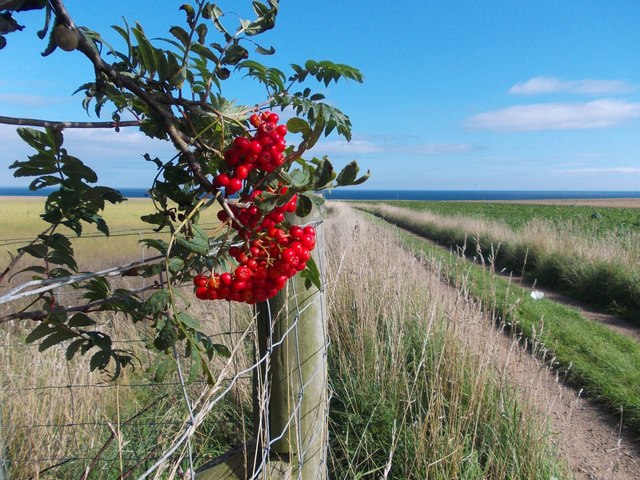
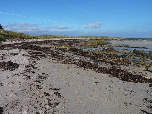
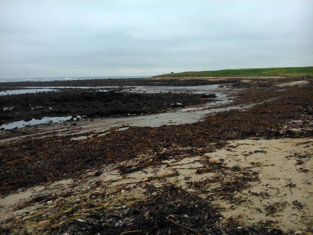
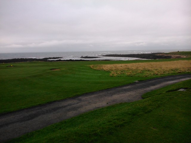
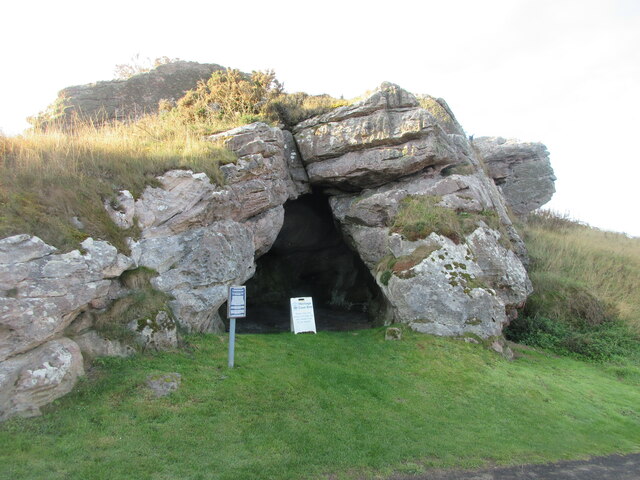
Fife Ness Muir, located in the county of Fife, Scotland, is a picturesque wood and forest area that offers visitors a tranquil and natural setting. Covering an area of approximately 400 acres, this nature reserve is a haven for wildlife and a popular destination for outdoor enthusiasts.

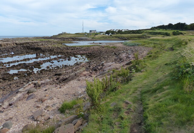
The site is characterized by its diverse range of habitats, including woodland, wetland, and grassland areas. Fife Ness Muir is home to a variety of plant and animal species, making it an important ecological site. Visitors can spot a wide range of birds, such as kestrels, buzzards, and woodpeckers, as well as rare butterflies and dragonflies.

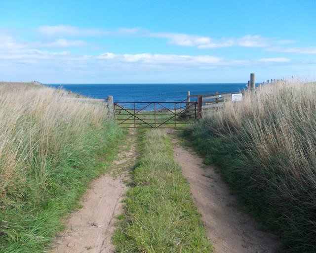
The woodlands in Fife Ness Muir are predominantly made up of native species like oak, birch, and hazel, providing a rich and diverse habitat for flora and fauna. There are well-maintained trails throughout the wood, allowing visitors to explore the area on foot and enjoy the peaceful surroundings.

Not only is Fife Ness Muir a haven for wildlife, but it also offers visitors several recreational activities. The reserve has picnic areas and benches where visitors can relax and enjoy a meal amidst nature. Additionally, there are designated spaces for outdoor education and wildlife watching hides, providing opportunities for learning and observing the local wildlife.

Overall, Fife Ness Muir is a charming and diverse woodland area, offering visitors a chance to connect with nature and immerse themselves in the beauty of the Scottish countryside.

If you have any feedback on the listing, please let us know in the comments section below.

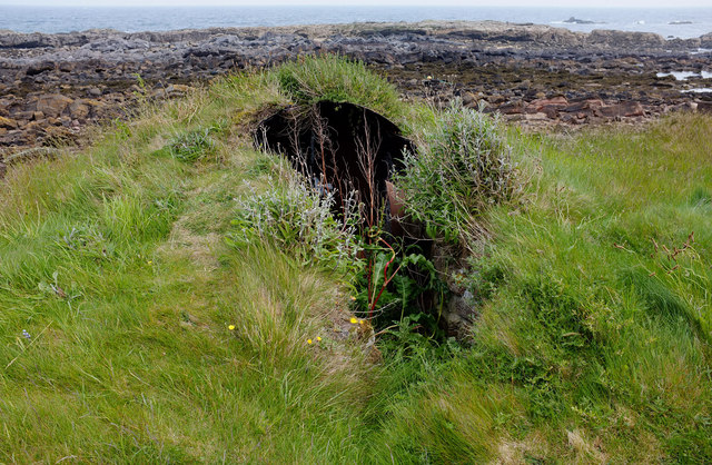
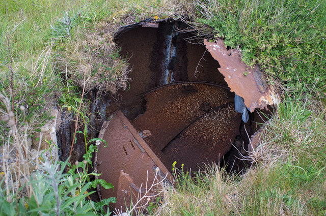
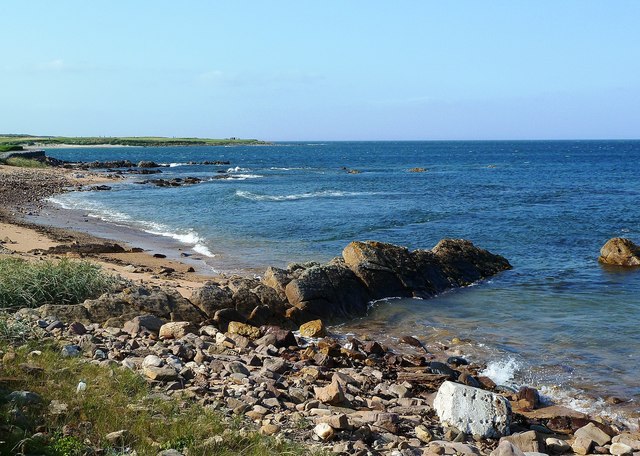
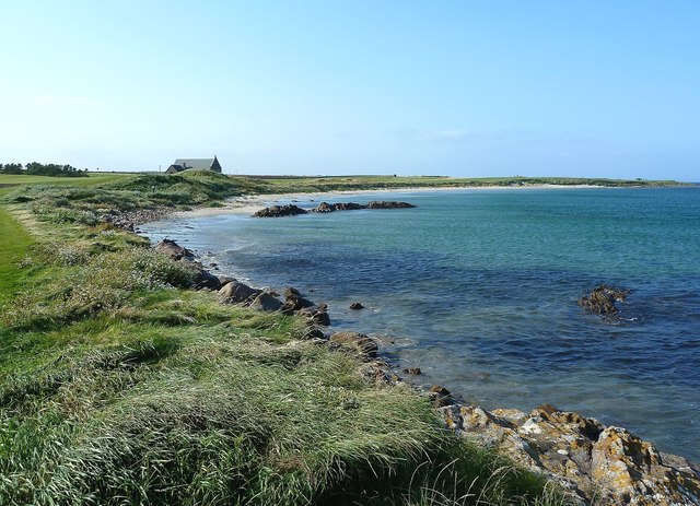
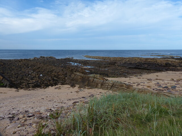
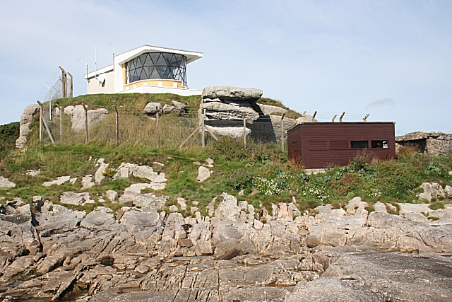
Fife Ness Muir Images

Images are sourced within 2km of 56.278538/-2.590385 or Grid Reference NO6309. Thanks to Geograph Open Source API. All images are credited.

Observation post north of Fife Ness This small structure is at the top of the beach. It has a stone base covered by an iron partial cylinder with a domed top.

It is a wartime two-man observation post, possibly associated with Crail airfield.

It may be the one recorded as Canmore ID 80388, Site Number NO61SW 16, to the north-east and noted as "Not seen (knocked down?)".
Observation post north of Fife Ness
This small structure is at the top of the beach. It has a stone base covered by an iron partial cylinder with a domed top. It is a wartime two-man observation post, possibly associated with Crail airfield. It may be the one recorded as Canmore ID 80388, Site Number NO61SW 16, to the north-east and noted as "Not seen (knocked down?)".
Observation post roof This is the corroded iron roof of <a href="https://www.geograph.org.uk/photo/2456612">NO6310 : Observation post north of Fife Ness</a>.
Observation post roof
This is the corroded iron roof of NO6310 : Observation post north of Fife Ness.
Fife Ness View Looking along the northern edge of the Ness on a very windy September afternoon.  The in-shore water was remarkably sheltered.
Fife Ness View
Looking along the northern edge of the Ness on a very windy September afternoon. The in-shore water was remarkably sheltered.
Fife Ness View Looking along the northern coastline of Fife Ness, at Balcomie Links, on a very windy afternoon which presented the golfers with a real challenge.
Fife Ness View
Looking along the northern coastline of Fife Ness, at Balcomie Links, on a very windy afternoon which presented the golfers with a real challenge.
Rowan berries by a track to the sea North of Wormiston Farm on the coast of Fife.
Rowan berries by a track to the sea
North of Wormiston Farm on the coast of Fife.
Track to the sea from Wormiston
Crail lifeboat station above Balcomie Sands Now a feature on the Balcomie Golf Links and used by the greenkeepers for storage. Crail station opened in 1884 but closed in 1923.
Crail lifeboat station above Balcomie Sands
Now a feature on the Balcomie Golf Links and used by the greenkeepers for storage. Crail station opened in 1884 but closed in 1923.
Balcomie Golf Course There can be but few golf courses with such scenic surroundings as Crail Golfing Society's Balcomie Links course, designed by golfing legend Old Tom Morris and laid out in 1895.
Balcomie Golf Course
There can be but few golf courses with such scenic surroundings as Crail Golfing Society's Balcomie Links course, designed by golfing legend Old Tom Morris and laid out in 1895.
Balcomie beach The Fife Coastal Path involves a 400 metre sand and rock section along this beach to avoid the risk of being struck by a golf ball on the golf course of Balcomie Links.
Balcomie beach
The Fife Coastal Path involves a 400 metre sand and rock section along this beach to avoid the risk of being struck by a golf ball on the golf course of Balcomie Links.
Balcomie Links from the Fife Coastal Path The view from the Fife Coastal Path from the wooden shelter on the golf course <a href="https://www.geograph.org.uk/photo/1461722">NO6210 : Two greens</a>.  The path goes behind the green coloured shelter and the sign post on the right directs walkers on the correct path.
Balcomie Links from the Fife Coastal Path
The view from the Fife Coastal Path from the wooden shelter on the golf course NO6210 : Two greens. The path goes behind the green coloured shelter and the sign post on the right directs walkers on the correct path.
Former life boat station The view of the former life boat station at the 2nd tee of the 493 yard 2nd hole on the Balcomie links. One of the tees is in front of the building.
Former life boat station
The view of the former life boat station at the 2nd tee of the 493 yard 2nd hole on the Balcomie links. One of the tees is in front of the building.
Putting it out Golfers on a green at Balcomie golf course.
Putting it out
Golfers on a green at Balcomie golf course.
Fluke dub - low tide covered in weed
Fluke dub - low tide
covered in weed
Fluke Dub
Fluke Dub
Constantine's Cave Constantine's Cave on the Fife Coastal Path at Crail Golf Course.
Constantine's Cave
Constantine's Cave on the Fife Coastal Path at Crail Golf Course.
Rocky shoreline at Balcomie Looking westwards along the rocky shoreline north of Crail Golf Course.
Rocky shoreline at Balcomie
Looking westwards along the rocky shoreline north of Crail Golf Course.
Fife Coastal Path towards Fife Ness The Fife Coastal Path runs from Kincardine to Newburgh along the coastline of Fife. It was established in 2002 and is 187 km (116 mi) in length.
Fife Coastal Path towards Fife Ness
The Fife Coastal Path runs from Kincardine to Newburgh along the coastline of Fife. It was established in 2002 and is 187 km (116 mi) in length.
Beach at Balcomie Golf Links
Show me another place!

Fife Ness Muir is located at Grid Ref: NO6309 (Lat: 56.278538, Lng: -2.590385)

Unitary Authority: Fife

Police Authority: Fife

What 3 Words

///midfield.keyboard.overlaps. Near Crail, Fife

Related Wikis

Fife Ness

Fife Ness (Scottish Gaelic: Rubha Fiobha) is a headland forming the most eastern point in Fife, Scotland. Anciently the area was called Muck Ross, which...

RNAS Crail (HMS Jackdaw)

Royal Naval Air Station Crail (RNAS Crail, also known as HMS Jackdaw) is a former Royal Naval Air Station of the Fleet Air Arm located 4.9 miles (7.9 km...

North Carr

The Carr (also known as Carr Briggs and Carr Rock) is a sandstone reef on the headland between the Firth of Forth and St Andrews Bay. There have been many...

Crail Parish Church

Crail Parish Church is an ancient church building in Crail, Fife, Scotland. It is Category A listed, its oldest part dating to the 12th century. The walls...

Nearby Amenities

Located within 500m of 56.278538,-2.590385
Fife Ness
Height: 12
Man Made: lighthouse
Operator: Northern Lighthouse Board
Operator Wikidata: Q918253
Seamark Light 1 Character: Iso
Seamark Light 1 Colour: white
Seamark Light 1 Height: 12
Seamark Light 1 Period: 10
Seamark Light 1 Range: 21
Seamark Light 1 Sector End: 197
Seamark Light 1 Sector Start: 143
Seamark Light 2 Character: Iso
Seamark Light 2 Colour: red
Seamark Light 2 Height: 12
Seamark Light 2 Period: 10
Seamark Light 2 Range: 20
Seamark Light 2 Sector End: 217
Seamark Light 2 Sector Start: 197
Seamark Light 3 Character: Iso
Seamark Light 3 Colour: white
Seamark Light 3 Height: 12
Seamark Light 3 Period: 10
Seamark Light 3 Range: 21
Seamark Light 3 Sector End: 23
Seamark Light 3 Sector Start: 217
Seamark Light Reference: A 3102
Seamark Name: Fife Ness
Seamark Radio Station Category: ais
Seamark Radio Station Mmsi: 002320798
Seamark Type: light_major
Website: https://www.nlb.org.uk/lighthouses/fife-ness/
Wikidata: Q26094938
Wikipedia: en:Fife Ness Lighthouse
Lat/Long: 56.278833/-2.5858673
Constantine's Cave
Natural: cave_entrance
Tourism: attraction
Lat/Long: 56.2819208/-2.5948207
Passing Place
Lat/Long: 56.2798525/-2.5970967
Passing Place
Lat/Long: 56.2795067/-2.5976246
Power: pole
Lat/Long: 56.2805016/-2.5938909
Bunker Type: pillbox
Military: bunker
Lat/Long: 56.2789342/-2.5856186
Bench
Lat/Long: 56.2805006/-2.5935097
Tide Mill
Historic: ruins
Lat/Long: 56.2802125/-2.5886388
Passing Place
Lat/Long: 56.2792587/-2.5981384
Power: pole
Lat/Long: 56.2806108/-2.5972054
Power: pole
Lat/Long: 56.2801531/-2.5964592
Power: pole
Lat/Long: 56.2797835/-2.5958631
Power: pole
Lat/Long: 56.2795494/-2.5954868
Power: pole
Lat/Long: 56.2801437/-2.5949975
Power: pole
Lat/Long: 56.2782327/-2.5881338
Power: pole
Lat/Long: 56.2786505/-2.5885883
Power: pole
Lat/Long: 56.2792431/-2.5882987
Power: pole
Lat/Long: 56.2787889/-2.590922
The data included in this document is from www.openstreetmap.org. The data is made available under ODbL.

Have you been to Fife Ness Muir?

Leave your review of Fife Ness Muir below (or comments, questions and feedback).