Saltire Wood

Wood, Forest in Kincardineshire

Scotland

Saltire Wood

Arnhall Quarry Extensive area of shallow quarrying near Gannochy. Extracting sands and gravels from glacial deposits at the end of Glen Esk.
Arnhall Quarry Credit: Gordon Hatton

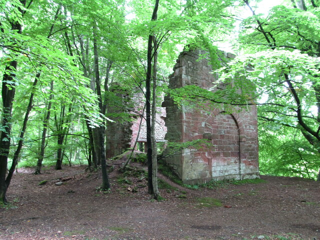
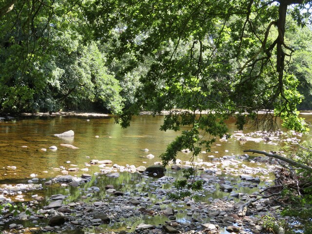
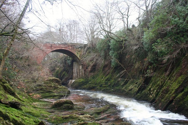
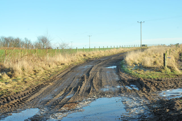
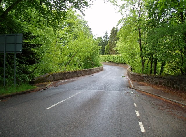
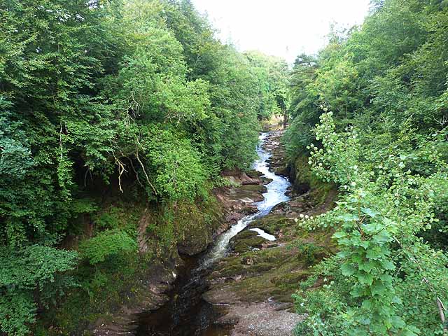
Saltire Wood is a picturesque forest located in Kincardineshire, Scotland. Covering an area of approximately 100 acres, this woodland is a haven for nature enthusiasts and outdoor adventurers alike. It is situated near the village of Auchenblae, offering easy access to visitors from nearby towns and cities.

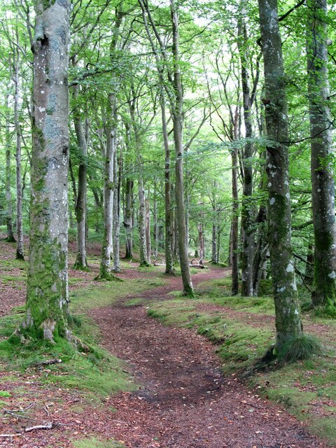
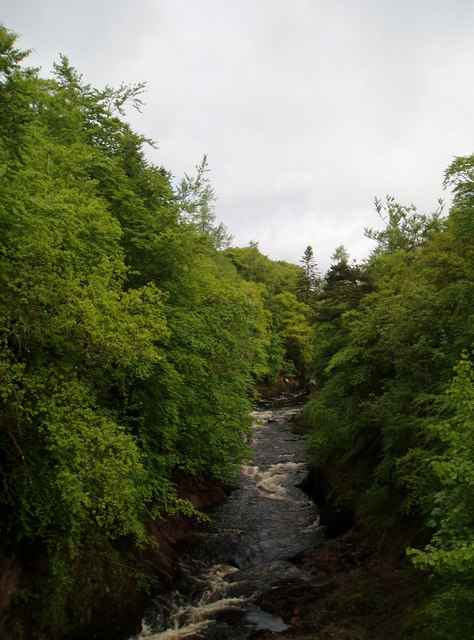
The woodland is predominantly composed of an enchanting mix of native broadleaf trees, including oak, birch, and rowan. The lush green canopy provides a rich habitat for a diverse range of wildlife, making it a popular spot for birdwatching and nature photography. Visitors may spot species such as red squirrels, roe deer, and a variety of woodland birds while exploring the forest.

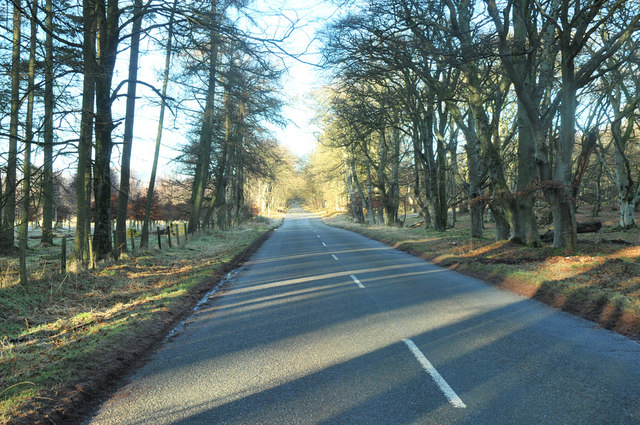
A network of well-maintained trails winds its way through the wood, offering opportunities for leisurely walks, hikes, and even mountain biking. The paths are clearly marked, making it easy for visitors to navigate and explore the different sections of the woodland. Along the way, there are picnic areas, perfect for a relaxing break surrounded by the sights and sounds of nature.

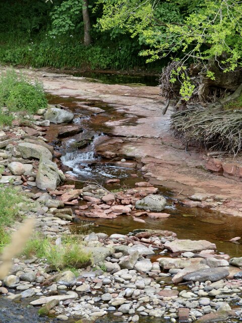
Saltire Wood boasts breathtaking views of the surrounding countryside, with rolling hills and meandering streams adding to its natural beauty. The forest is particularly stunning during the autumn months when the leaves change color, creating a vibrant and picturesque landscape.

Managed by a local conservation organization, Saltire Wood is also involved in various educational and conservation programs, aiming to promote awareness and understanding of the local ecosystem. Overall, Saltire Wood offers a tranquil escape from the hustle and bustle of everyday life, inviting visitors to immerse themselves in the beauty of nature.

If you have any feedback on the listing, please let us know in the comments section below.
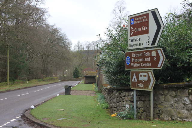
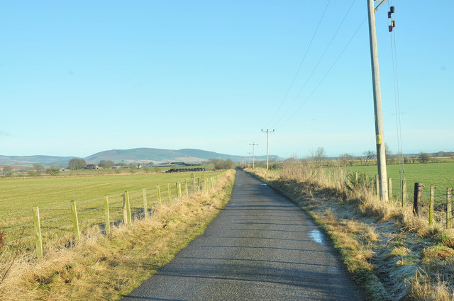
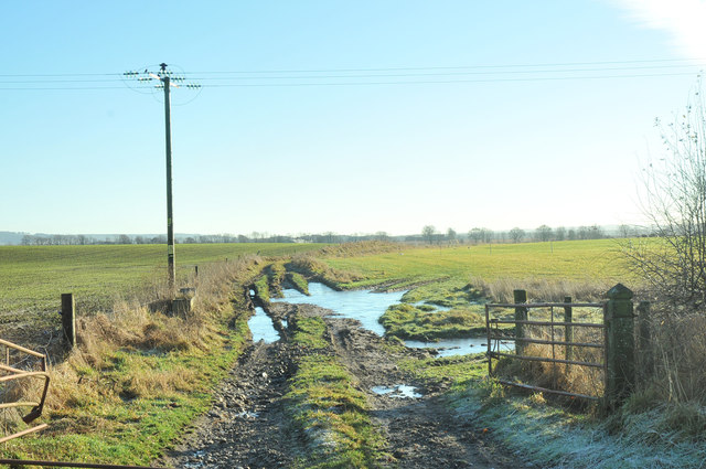
Saltire Wood Images

Images are sourced within 2km of 56.826396/-2.6359282 or Grid Reference NO6170. Thanks to Geograph Open Source API. All images are credited.

Arnhall Quarry Extensive area of shallow quarrying near Gannochy. Extracting sands and gravels from glacial deposits at the end of Glen Esk.
Arnhall Quarry
Extensive area of shallow quarrying near Gannochy. Extracting sands and gravels from glacial deposits at the end of Glen Esk.
Gannochy Tower An 18th century folly in woodland above the River North Esk. Grade 'C' listed. Not sure if it was built as a romantic ruin, or whether it fell apart.
Gannochy Tower
An 18th century folly in woodland above the River North Esk. Grade 'C' listed. Not sure if it was built as a romantic ruin, or whether it fell apart.
Woodland path near Gannochy Bridge This path follows the left bank of the River North Esk and begins as a very pleasant woodland route. Further on towards Edzell the path is narrow and close by a fence before dropping suddenly and very steeply down a 15m bank to the waterside. Don't say I didn't warn you. The path on the right bank of the river is excellent all the way.
Woodland path near Gannochy Bridge
This path follows the left bank of the River North Esk and begins as a very pleasant woodland route. Further on towards Edzell the path is narrow and close by a fence before dropping suddenly and very steeply down a 15m bank to the waterside. Don't say I didn't warn you. The path on the right bank of the river is excellent all the way.
River Esk Beautiful river walk, such a devastation of fallen trees with some magnificent tree specimens felled by ferocious winds.
River Esk
Beautiful river walk, such a devastation of fallen trees with some magnificent tree specimens felled by ferocious winds.
River Esk Reminiscing of lazy days of picnics, happy times with children splashing in the cool shaded pools while parents relax in the sunshine.
River Esk
Reminiscing of lazy days of picnics, happy times with children splashing in the cool shaded pools while parents relax in the sunshine.
Old ruins by the road Difficult to see but there are a few old buildings at this layby
Old ruins by the road
Difficult to see but there are a few old buildings at this layby
Gannochy Tower Remains of a folly tower, built in the later 18th century. It is now a shell, has tall storeys with a high keyblocked arch at the east and a blind arch at the west, and is constructed from courses with slate cherry cocking.
<span class="nowrap"><a title="https://online.aberdeenshire.gov.uk/smrpub/master/detail.aspx?Authority=ASH&refno=NO67SW0116" rel="nofollow ugc noopener" href="https://online.aberdeenshire.gov.uk/smrpub/master/detail.aspx?Authority=ASH&refno=NO67SW0116">Link</a><img style="margin-left:2px;" alt="External link" title="External link - shift click to open in new window" src="https://s1.geograph.org.uk/img/external.png" width="10" height="10"/></span>
Gannochy Tower
Remains of a folly tower, built in the later 18th century. It is now a shell, has tall storeys with a high keyblocked arch at the east and a blind arch at the west, and is constructed from courses with slate cherry cocking. LinkExternal link
Entrance to The Burn estate
Gannochy Bridge Ganochy Bridge from the bed of the North Esk.
Gannochy Bridge
Ganochy Bridge from the bed of the North Esk.
Glen Esk road junction near Edzell
Minor road near Arnhall
Waterlogged field near Arnhall
Farm track near Arnhall
Road past Saltire Wood
The North Esk at Gannochy
Gannochy Bridge On the border of Aberdeenshire (at this point previously Kincardineshire) and Angus.
Gannochy Bridge
On the border of Aberdeenshire (at this point previously Kincardineshire) and Angus.
River North Esk Looking downstream from Gannochy Bridge.
River North Esk
Looking downstream from Gannochy Bridge.
The "Blue Door" The notice on the Blue Door reads "The Burn House - North Esk "Blue Door" River Walk
- The Burn is an educational charitable trust - a study centre left in memory of James Russell, killed in action in 1944
- You are most welcome to walk along the river path" 
etc etc
The "Blue Door"
The notice on the Blue Door reads "The Burn House - North Esk "Blue Door" River Walk - The Burn is an educational charitable trust - a study centre left in memory of James Russell, killed in action in 1944 - You are most welcome to walk along the river path" etc etc
Show me another place!

Saltire Wood is located at Grid Ref: NO6170 (Lat: 56.826396, Lng: -2.6359282)

Unitary Authority: Aberdeenshire

Police Authority: North East

What 3 Words

///price.table.comedians. Near Laurencekirk, Aberdeenshire

Nearby Locations

Saltire Wood

Related Wikis

Edzell Woods

Edzell Woods is a village in the Kincardine and Mearns area of Aberdeenshire, Scotland. It is 4 miles (6.4 km) from Edzell by road, but only one mile...

Inglis Memorial Hall

The Inglis Memorial Hall is a municipal structure in the High Street in Edzell, Angus, Scotland, which for much of the 20th century served as Edzell Parish...

Edzell

Edzell (; Scots: Aigle; Scottish Gaelic: Eigill) is a village in Angus, Scotland. It is 5 miles (8 km) north of Brechin, by the River North Esk. Edzell...

Edzell railway station

Edzell railway station served the village of Edzell, Angus, Scotland from 1896 to 1964 on the Brechin and Edzell District Railway. == History == The station...

RAF Edzell

Royal Air Force Edzell or more simply RAF Edzell is a former Royal Air Force satellite station located in Aberdeenshire, one mile east of Edzell in Angus...

Edzell Castle

Edzell Castle is a ruined 16th-century castle, with an early-17th-century walled garden. It is located close to Edzell, and is around 5 miles (8 km) north...

Fettercairn distillery

Fettercairn distillery is a whisky distillery in Fettercairn. Situated under the Grampian foothills in the Howe of Mearns, Fettercairn town’s name is...

Fettercairn

Fettercairn (, Scottish Gaelic: Fothair Chàrdain) is a small village in Aberdeenshire, Scotland, northwest of Laurencekirk in Aberdeenshire on the B966...

Nearby Amenities

Located within 500m of 56.826396,-2.6359282
Power: pole
Lat/Long: 56.8308394/-2.6360045
Power: pole
Lat/Long: 56.830624/-2.637344
Power: pole
Lat/Long: 56.830435/-2.6385129
Power: pole
Lat/Long: 56.8302322/-2.6397513
Power: pole
Lat/Long: 56.8220557/-2.6339184
The data included in this document is from www.openstreetmap.org. The data is made available under ODbL.

Have you been to Saltire Wood?

Leave your review of Saltire Wood below (or comments, questions and feedback).