Birkie Wood

Wood, Forest in Berwickshire

Scotland

Birkie Wood

Grazing, Blythe Grassland won from the moor through great effort, the piles of cleared stones are visible all over the picture. Blythe is a big cattle farm.
Grazing, Blythe Credit: Richard Webb

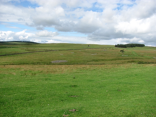
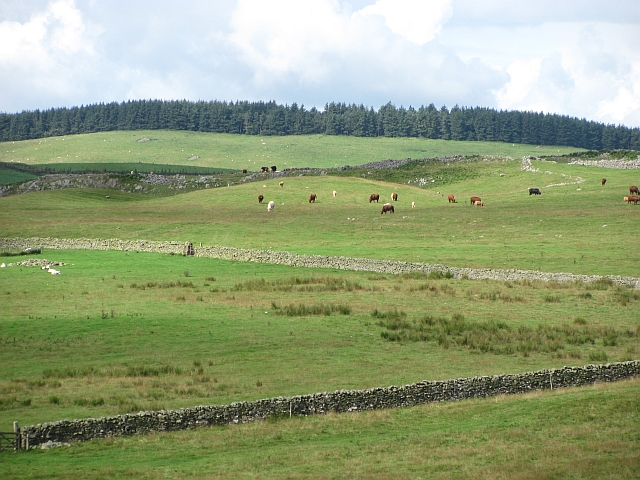
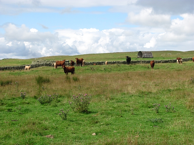
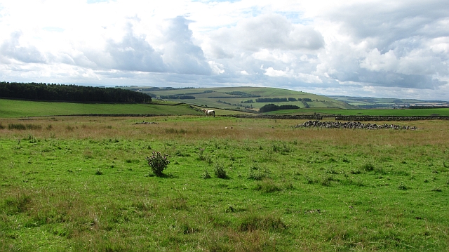
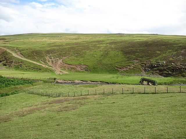
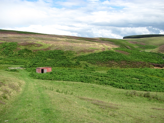
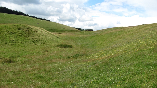
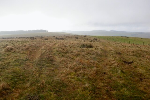
Birkie Wood is a picturesque forest located in the region of Berwickshire, Scotland. Covering an area of approximately 300 acres, this woodland is a haven of natural beauty and tranquility. The wood is situated near the small village of Birkie, just a few miles south of the town of Duns.

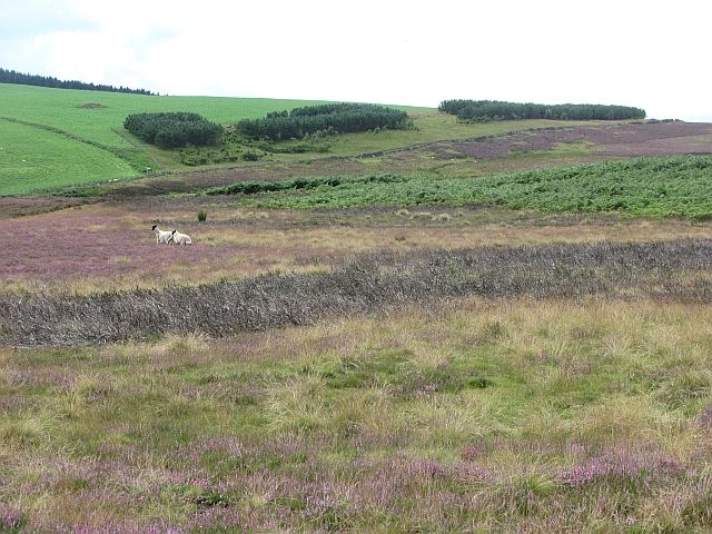
Birkie Wood is dominated by a diverse range of broadleaf trees, including oak, beech, and ash, which create a lush and vibrant canopy. The forest floor is carpeted with a colorful array of wildflowers, adding to the enchanting atmosphere. The wood is also home to a variety of wildlife, such as red squirrels, roe deer, and numerous species of birds.

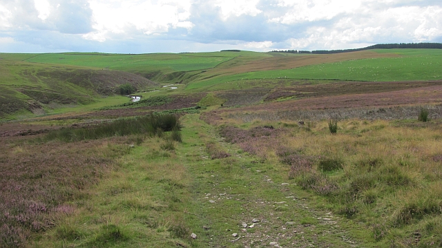
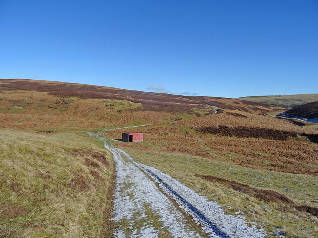
Visitors to Birkie Wood can enjoy a network of well-maintained trails that wind their way through the forest, providing opportunities for peaceful walks, picnics, and birdwatching. The paths are easily accessible and suitable for people of all ages and abilities.

The wood is managed by a local conservation organization, which ensures the preservation of its natural habitat and promotes sustainable practices such as responsible forestry. The organization also runs educational programs and events to raise awareness about the importance of woodland conservation.

Birkie Wood offers a tranquil escape from the hustle and bustle of everyday life, providing visitors with the chance to connect with nature and appreciate the beauty of Scotland's woodlands. Whether for a leisurely stroll or a family outing, this charming forest is a must-visit for nature enthusiasts and those seeking a peaceful retreat.

If you have any feedback on the listing, please let us know in the comments section below.
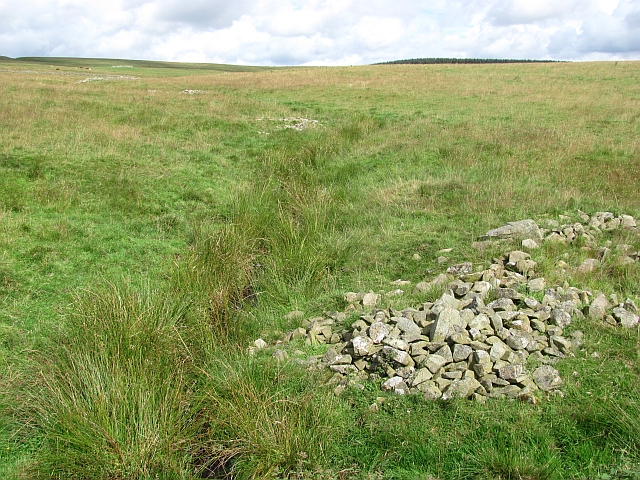
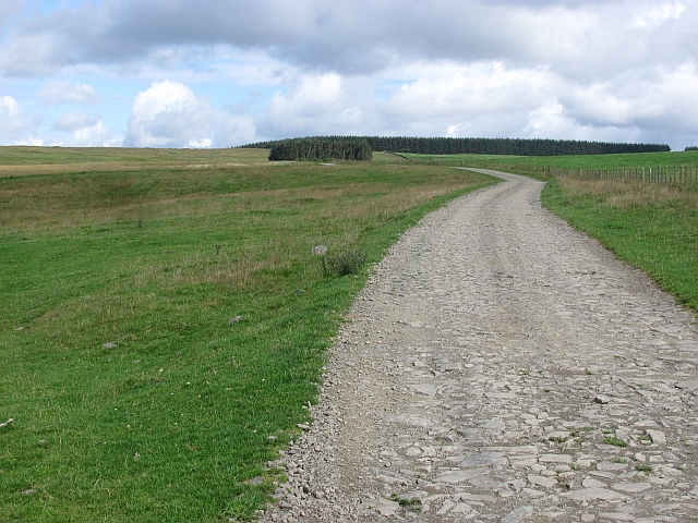
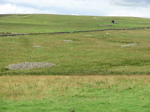
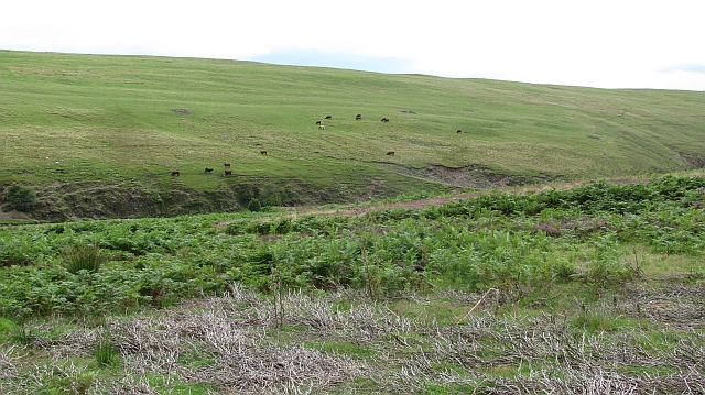
Birkie Wood Images

Images are sourced within 2km of 55.738182/-2.6771506 or Grid Reference NT5749. Thanks to Geograph Open Source API. All images are credited.

Grazing, Blythe Grassland won from the moor through great effort, the piles of cleared stones are visible all over the picture. Blythe is a big cattle farm.
Grazing, Blythe
Grassland won from the moor through great effort, the piles of cleared stones are visible all over the picture. Blythe is a big cattle farm.
Hill fort and rocky ground This area is unusually rocky for the Lammermuir Hills. The stones have been put to use in building dykes, now backed up with electric fences. There are the remains of a hill fort on the spur in the middle of the picture.
Hill fort and rocky ground
This area is unusually rocky for the Lammermuir Hills. The stones have been put to use in building dykes, now backed up with electric fences. There are the remains of a hill fort on the spur in the middle of the picture.
Cattle, Blythe This part of the Lammermuir Hills is covered with grass rather than heather. The grazing supports a large herd of cattle.
Cattle, Blythe
This part of the Lammermuir Hills is covered with grass rather than heather. The grazing supports a large herd of cattle.
Roaring bull The Charolais bull was away from the cows and bellowing - he seemed to be interested in what was happening in the next field.
Roaring bull
The Charolais bull was away from the cows and bellowing - he seemed to be interested in what was happening in the next field.
Spot the burn The Spotts Burn is flowing through vegetation. Some of the stones cleared to make this field have been used to make a road embankment over the burn and surrounding wet ground.
Spot the burn
The Spotts Burn is flowing through vegetation. Some of the stones cleared to make this field have been used to make a road embankment over the burn and surrounding wet ground.
Road, Blythe A well surfaced road running through farmland. It serves the distant moorland and some remote dwellings in the Lammermuir interior.
Road, Blythe
A well surfaced road running through farmland. It serves the distant moorland and some remote dwellings in the Lammermuir interior.
Farmland, Spott Burn Clearance cairns in fields won from a rocky bit of the Lammermuir Hills. The piles of stones were all hand picked from the moors, turning them to farmland.
Farmland, Spott Burn
Clearance cairns in fields won from a rocky bit of the Lammermuir Hills. The piles of stones were all hand picked from the moors, turning them to farmland.
Cattle, Blythe Cattle grazing on grass won from the moor. Clearance cairns can be seen, where the stones were gathered from the land when it was being reclaimed.
Cattle, Blythe
Cattle grazing on grass won from the moor. Clearance cairns can be seen, where the stones were gathered from the land when it was being reclaimed.
Moorland between the Wheel Burn and Blythe Water Blooming heather, some sheep and a lot of grouse.
Moorland between the Wheel Burn and Blythe Water
Blooming heather, some sheep and a lot of grouse.
Track along the Blythe Water A very good path/track runs up the western side of the Blythe Water. It gives a moorland alternative to dodging the cattle on the Southern Upland Way between the Blythe Water footbridge and Braidshawrig.
Track along the Blythe Water
A very good path/track runs up the western side of the Blythe Water. It gives a moorland alternative to dodging the cattle on the Southern Upland Way between the Blythe Water footbridge and Braidshawrig.
Footbridge over the Blythe Water A footbridge carries the Southern Upland Way route over the Blythe Water.
Footbridge over the Blythe Water
A footbridge carries the Southern Upland Way route over the Blythe Water.
Shed by the Wheel Burn A tin shed near where the Wheel Burn meets the Blythe Water (right).
Shed by the Wheel Burn
A tin shed near where the Wheel Burn meets the Blythe Water (right).
Reentrant, Snawdon Burn A change from the usual uncomplecated, smooth contours found in the Lammermuir Hills. The hollow was probably a former watercourse.  The grassland is rich in wildflowers.
Reentrant, Snawdon Burn
A change from the usual uncomplecated, smooth contours found in the Lammermuir Hills. The hollow was probably a former watercourse. The grassland is rich in wildflowers.
Red Sheep Shelter Looking north above the valley of the Blythe Water on a track leading to Braidshawrig is this red open doored shelter, presumably for the many sheep in these parts. These little buildings are in abundance in the southern Lammermuirs.
Red Sheep Shelter
Looking north above the valley of the Blythe Water on a track leading to Braidshawrig is this red open doored shelter, presumably for the many sheep in these parts. These little buildings are in abundance in the southern Lammermuirs.
Bridge over the Blythe Water Footbridge over the Blythe Water on the Southern Upland Way on an early spring day.
Bridge over the Blythe Water
Footbridge over the Blythe Water on the Southern Upland Way on an early spring day.
George’s Cairn on Peat Law This impressive memorial cairn is marked on the Ordnance Survey Explorer map as George’s Cairn. The cairn is approximately 2m wide at the base and 3.5m high and is topped with an upright stone. There is a 2.5m loose stone surround which I presume is to prevent cattle from damaging the cairn. It is dedicated to Captain George Nisbet McDougal, M.C. who was killed during the D-Day Landings in 1944. The inscription on the cairn is as follows:

IN MEMORY OF
CAPT. GEORGE NISBET McDOUGAL, M.C.
629TH FLD. SQN. ROYAL ENGINEERS
SERVED WITH 8TH ARMY
FROM ALAMEIN TO TUNIS
KILLED IN ACTION AT
LA BRÊCHE NORMANDY
ON D. DAY 8TH JUNE 1944, AGE 23
BURIED AT HERMANVILLE
1921 – 44

SON OF CAPT. ARTHUR R. McDOUGAL,
BLYTHE & HIS WIFE H MAUD LOGAN
OF BIRKHILL & GRANDSON OF GEORGE
McDOUGAL WHO CAME TO BLYTHE IN
1852 & G.G. GRANDSON OF GEORGE
NISBET WHO CAME TO FLASS IN 1801.
GOODBYE

ALSO OF HIS COMRADES
2 OFFICERS & 24 MEN
WHO FELL THEN & LIE IN
HERMANVILLE
George’s Cairn on Peat Law
This impressive memorial cairn is marked on the Ordnance Survey Explorer map as George’s Cairn. The cairn is approximately 2m wide at the base and 3.5m high and is topped with an upright stone. There is a 2.5m loose stone surround which I presume is to prevent cattle from damaging the cairn. It is dedicated to Captain George Nisbet McDougal, M.C. who was killed during the D-Day Landings in 1944. The inscription on the cairn is as follows: IN MEMORY OF CAPT. GEORGE NISBET McDOUGAL, M.C. 629TH FLD. SQN. ROYAL ENGINEERS SERVED WITH 8TH ARMY FROM ALAMEIN TO TUNIS KILLED IN ACTION AT LA BRÊCHE NORMANDY ON D. DAY 8TH JUNE 1944, AGE 23 BURIED AT HERMANVILLE 1921 – 44 SON OF CAPT. ARTHUR R. McDOUGAL, BLYTHE & HIS WIFE H MAUD LOGAN OF BIRKHILL & GRANDSON OF GEORGE McDOUGAL WHO CAME TO BLYTHE IN 1852 & G.G. GRANDSON OF GEORGE NISBET WHO CAME TO FLASS IN 1801. GOODBYE ALSO OF HIS COMRADES 2 OFFICERS & 24 MEN WHO FELL THEN & LIE IN HERMANVILLE
The inscription panel at George’s Cairn, Peat Law For a view of the cairn dedicated to Captain George Nisbet McDougal, M.C. who was killed at the D-Day Landings, see <a href="https://www.geograph.org.uk/photo/6006257">NT5850 : George’s Cairn on Peat Law</a>.
The inscription reads:

IN MEMORY OF
CAPT. GEORGE NISBET McDOUGAL, M.C.
629TH FLD. SQN. ROYAL ENGINEERS
SERVED WITH 8TH ARMY
FROM ALAMEIN TO TUNIS
KILLED IN ACTION AT
LA BRÊCHE NORMANDY
ON D. DAY 8TH JUNE 1944, AGE 23
BURIED AT HERMANVILLE
1921 – 44

SON OF CAPT. ARTHUR R. McDOUGAL,
BLYTHE & HIS WIFE H MAUD LOGAN
OF BIRKHILL & GRANDSON OF GEORGE
McDOUGAL WHO CAME TO BLYTHE IN
1852 & G.G. GRANDSON OF GEORGE
NISBET WHO CAME TO FLASS IN 1801.
GOODBYE

ALSO OF HIS COMRADES
2 OFFICERS & 24 MEN
WHO FELL THEN & LIE IN
HERMANVILLE
The inscription panel at George’s Cairn, Peat Law
For a view of the cairn dedicated to Captain George Nisbet McDougal, M.C. who was killed at the D-Day Landings, see NT5850 : George’s Cairn on Peat Law. The inscription reads: IN MEMORY OF CAPT. GEORGE NISBET McDOUGAL, M.C. 629TH FLD. SQN. ROYAL ENGINEERS SERVED WITH 8TH ARMY FROM ALAMEIN TO TUNIS KILLED IN ACTION AT LA BRÊCHE NORMANDY ON D. DAY 8TH JUNE 1944, AGE 23 BURIED AT HERMANVILLE 1921 – 44 SON OF CAPT. ARTHUR R. McDOUGAL, BLYTHE & HIS WIFE H MAUD LOGAN OF BIRKHILL & GRANDSON OF GEORGE McDOUGAL WHO CAME TO BLYTHE IN 1852 & G.G. GRANDSON OF GEORGE NISBET WHO CAME TO FLASS IN 1801. GOODBYE ALSO OF HIS COMRADES 2 OFFICERS & 24 MEN WHO FELL THEN & LIE IN HERMANVILLE
Quadbike tracks, Scoured Rig
Show me another place!

Birkie Wood is located at Grid Ref: NT5749 (Lat: 55.738182, Lng: -2.6771506)

Unitary Authority: The Scottish Borders

Police Authority: The Lothians and Scottish Borders

What 3 Words

///chef.swing.enlighten. Near Lauder, Scottish Borders

Nearby Locations

Birkie Wood

Related Wikis

Boon Farm

Boon is a farm and former barony located near Lauder, Scotland. == History == === Name origins === Boon (aka "Boune" or "Bounn"), derives from the Breton...

Thirlestane Castle

Thirlestane Castle is a castle set in extensive parklands near Lauder in the Borders of Scotland. The site is aptly named Castle Hill, as it stands upon...

Lauderdale

Lauderdale is the valley of the Leader Water (a tributary of the Tweed) in the Scottish Borders. It contains the town of Lauder, as well as Earlston. The...

Lauder Town Hall

Lauder Town Hall is a municipal structure in the Market Place in Lauder, Scottish Borders, Scotland. The structure, which is used as the local registrar...

Lauder

The former Royal Burgh of Lauder (, Scottish Gaelic: Labhdar) is a town in the Scottish Borders in the historic county of Berwickshire. On the Southern...

Whitslaid Tower

Whitslaid Tower was an ancient Berwickshire seat of the Lauder family for over 300 years. It is today a ruin high above the eastern bank of the Leader...

Lauder railway station

Lauder railway station served the town of Lauder, Berwickshire, Scotland, from 1901 to 1958. It was situated on the Lauder Light Railway. == History... ==

Addinston

Addinston is a farming village, off the A697, close to the Carfraemill roundabout, with two hill forts and settlements, in Lauderdale in the Scottish...

Nearby Amenities

Located within 500m of 55.738182,-2.6771506
Barrier: cattle_grid
Lat/Long: 55.7363132/-2.6820791
The data included in this document is from www.openstreetmap.org. The data is made available under ODbL.

Have you been to Birkie Wood?

Leave your review of Birkie Wood below (or comments, questions and feedback).