Cummerton Wood

Wood, Forest in Banffshire

Scotland

Cummerton Wood

River Dee
River Dee Credit: thejackrustles

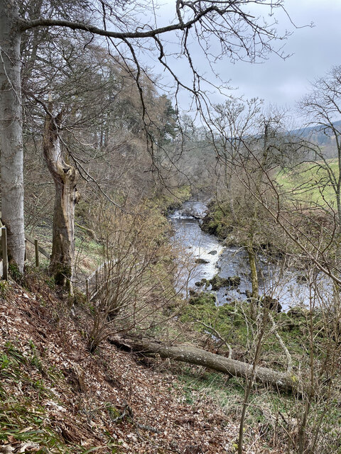
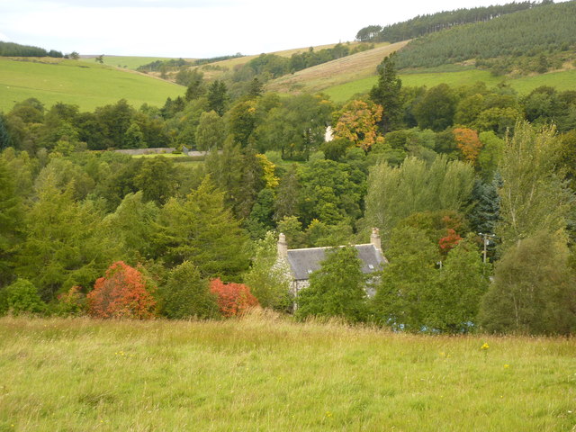
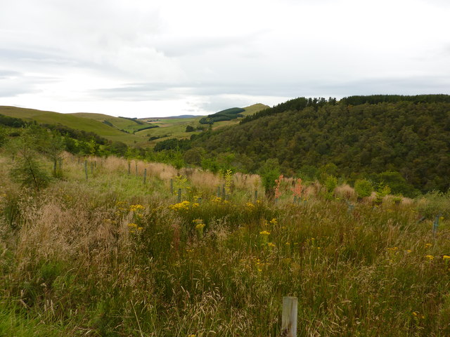
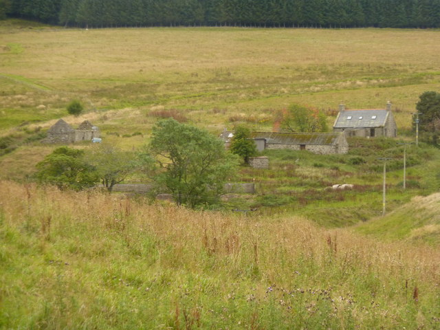
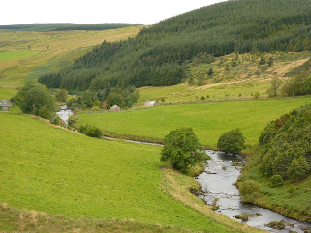
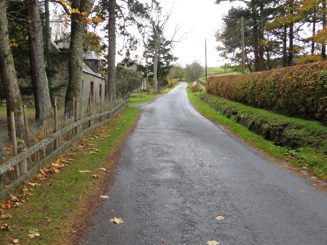
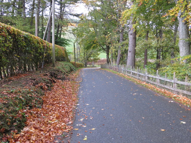
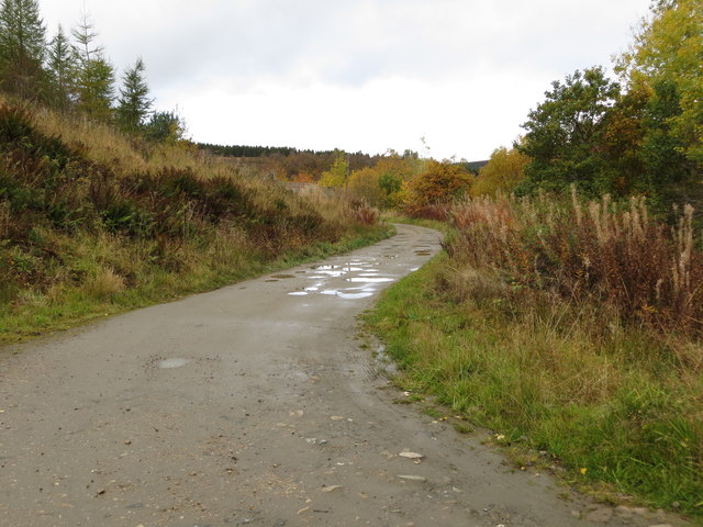
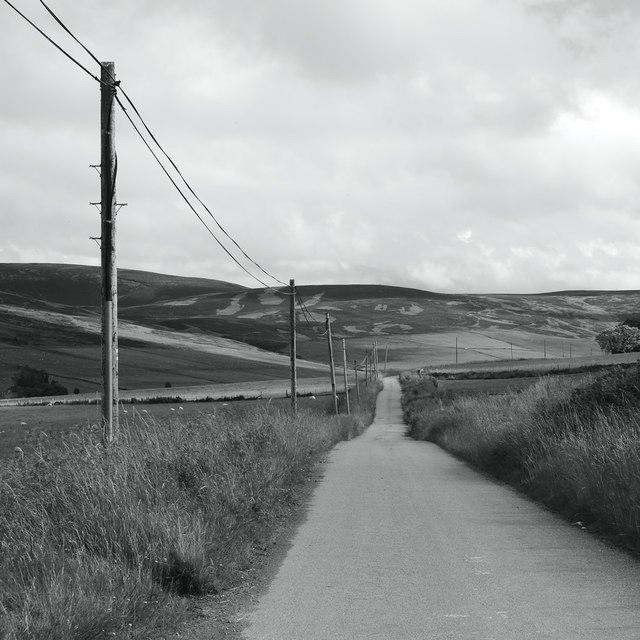
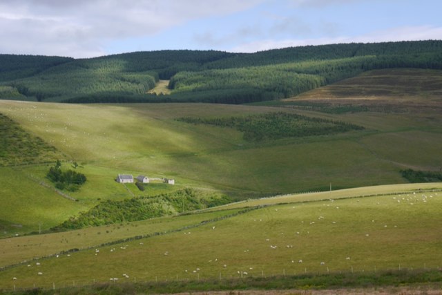
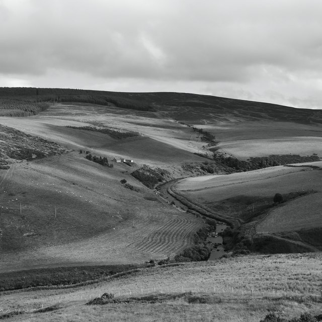
Cummerton Wood is a picturesque forest located in the region of Banffshire, Scotland. Covering an area of approximately 500 acres, this enchanting woodland is nestled in the heart of the Scottish countryside, providing a tranquil retreat for nature lovers and outdoor enthusiasts alike.

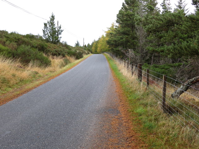
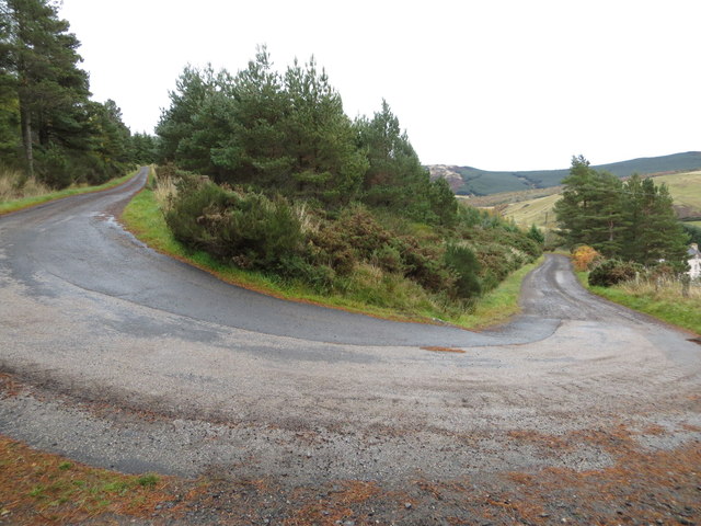
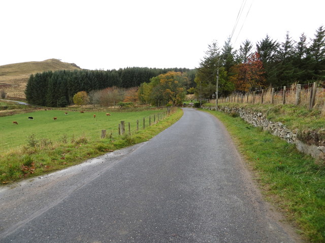
The wood is characterized by its diverse range of tree species, including ancient oaks, towering pines, and vibrant birches. The lush undergrowth is adorned with a carpet of wildflowers, creating a vibrant tapestry of colors throughout the seasons. Cummerton Wood is also home to a variety of wildlife, such as red squirrels, deer, and a wide array of bird species, making it a haven for nature enthusiasts and birdwatchers.

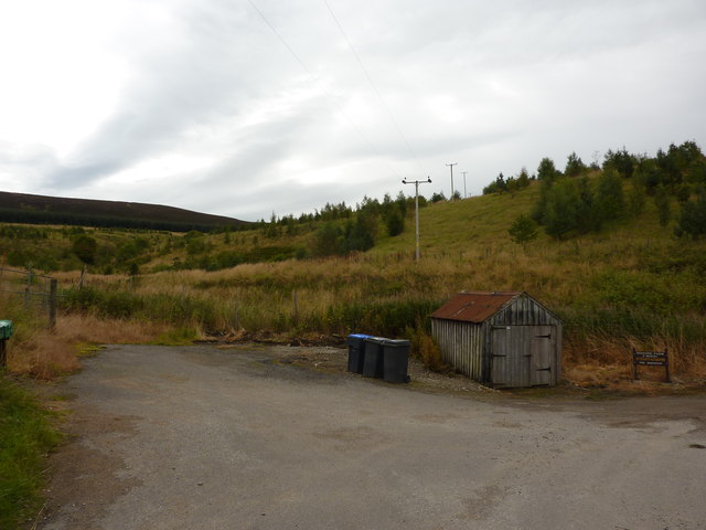
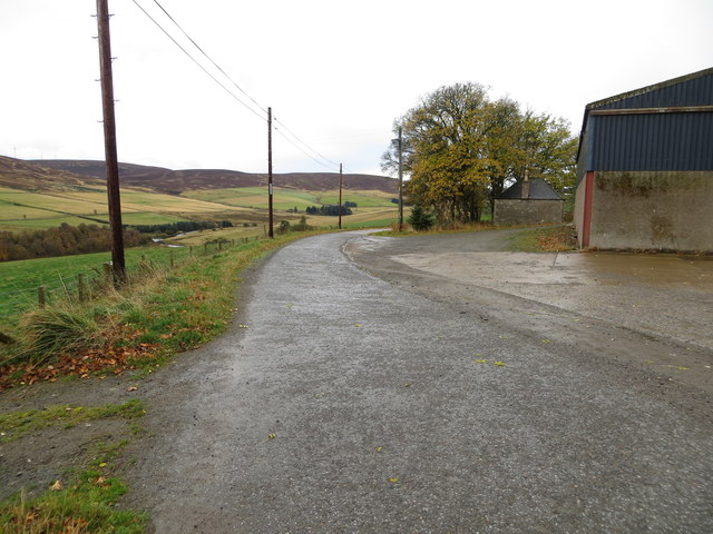
Traversing through Cummerton Wood, visitors can explore a network of well-maintained trails, offering opportunities for leisurely strolls and more challenging hikes. The paths wind their way through the forest, leading to secluded picnic spots and breathtaking viewpoints, where visitors can soak in the beauty of the surrounding landscapes.

Cummerton Wood also holds historical significance, as it was once part of a larger estate that dates back several centuries. The remnants of old stone walls and forgotten ruins can still be found within the wood, adding an air of mystery and intrigue to the area.

Whether it's a peaceful walk among the trees, an adventurous hike, or a glimpse into the past, Cummerton Wood offers visitors a truly immersive and magical experience within the natural wonders of Banffshire.

If you have any feedback on the listing, please let us know in the comments section below.

Cummerton Wood Images

Images are sourced within 2km of 57.406516/-2.977108 or Grid Reference NJ4135. Thanks to Geograph Open Source API. All images are credited.

River Dee
River Dee
Rooftop of Auchinhandoch A house by the River Deveron, Strathbogie, opposite Beldorney Castle, the tennis courts and grounds of which can be glimpsed through the trees.
Rooftop of Auchinhandoch
A house by the River Deveron, Strathbogie, opposite Beldorney Castle, the tennis courts and grounds of which can be glimpsed through the trees.
Young plantation near Howiemill Looking south west, up the valley of the River Deveron. The hill in the centre distance is Craig Dorney.
Young plantation near Howiemill
Looking south west, up the valley of the River Deveron. The hill in the centre distance is Craig Dorney.
Shed and waste bins for Succoth Farm
Wrightstone, farm buildings in Deveron valley
River Deveron at Waterside A footbridge crosses the river between the building with the green roof and the small red-doored building, at Mill of Lynebain. Conifer plantation covers the slopes of Craig Dorney.
River Deveron at Waterside
A footbridge crosses the river between the building with the green roof and the small red-doored building, at Mill of Lynebain. Conifer plantation covers the slopes of Craig Dorney.
Mains of Beldorney The Mains is beside the road from Glass to the Cabrach. Further up, on the top of the brae, is Tighnaird, which seems to be undergoing renovation.
Mains of Beldorney
The Mains is beside the road from Glass to the Cabrach. Further up, on the top of the brae, is Tighnaird, which seems to be undergoing renovation.
Gallows Hill One of many Gallows Hills , this one belonging to the parish of Glass.
Gallows Hill
One of many Gallows Hills , this one belonging to the parish of Glass.
Road passing Bellcherrie Looking south-westward.
Road passing Bellcherrie
Looking south-westward.
Road at Millbrae Wood Looking north-eastward.
Road at Millbrae Wood
Looking north-eastward.
Minor road to or from Lynebain Looking north-eastward.
Minor road to or from Lynebain
Looking north-eastward.
Minor road approaching Backside Looking south-westward.
Minor road approaching Backside
Looking south-westward.
Minor road near Dumeath Looking south-westward.
Minor road near Dumeath
Looking south-westward.
Road approaching Dumeath Looking northward.
Road approaching Dumeath
Looking northward.
The metalled minor road ends here but this track continues on to Succoth Farm Looking north-westward.
The metalled minor road ends here but this track continues on to Succoth Farm
Looking north-westward.
Road near Bellcherrie
Backhill Gouls
Backhill Gouls
Crooked Pot, River Deveron
Show me another place!

Cummerton Wood is located at Grid Ref: NJ4135 (Lat: 57.406516, Lng: -2.977108)

Unitary Authority: Aberdeenshire

Police Authority: North East

What 3 Words

///signified.scrambles.business. Near Dufftown, Moray

Nearby Locations

Bridge Pot Cummerton Wood

Related Wikis

Beldorney Castle

Beldorney Castle is a Z-plan castle dating from the mid-16th century, about two miles south of Glass, in hilly country in the valley of the Deveron, in...

Glass, Aberdeenshire

Glass is a parish about 8 miles west of Huntly, Aberdeenshire, Scotland. It is now wholly located in Aberdeenshire but before the reorganisation of Scottish...

Blairmore School

Blairmore School was an independent boarding preparatory school in Glass near Huntly, Aberdeenshire until its closure in 1993. The site is now owned and...

Wormy Hillock Henge

Wormy Hillock Henge, also known as The Dragon's Grave, is a small henge in Aberdeenshire, Scotland. It is a Scheduled Ancient Monument located in the Clashindarroch...

Nearby Amenities

Located within 500m of 57.406516,-2.977108
Ford: yes
Lat/Long: 57.4023611/-2.9797106
Power: pole
Lat/Long: 57.4038031/-2.9824236
Power: pole
Lat/Long: 57.4042543/-2.981942
Power: pole
Lat/Long: 57.4046409/-2.9815306
Power: pole
Lat/Long: 57.4051189/-2.9810251
Power: pole
Lat/Long: 57.4056923/-2.980444
Power: pole
Lat/Long: 57.4060869/-2.9811229
Power: pole
Lat/Long: 57.4065559/-2.9819439
Power: pole
Lat/Long: 57.4070737/-2.9828479
Power: pole
Lat/Long: 57.4075865/-2.9837076
Power: pole
Lat/Long: 57.4077972/-2.9840839
Power: pole
Lat/Long: 57.4080376/-2.9845341
Power: pole
Lat/Long: 57.4087293/-2.9843275
Power: pole
Lat/Long: 57.4044351/-2.9805284
Power: pole
Lat/Long: 57.4038586/-2.9794424
Power: pole
Lat/Long: 57.4031479/-2.9780495
Power: pole
Lat/Long: 57.4025016/-2.977344
Power: pole
Lat/Long: 57.4024136/-2.9760188
Power: pole
Lat/Long: 57.402317/-2.9745562
Mill of Lynebain
Place: isolated_dwelling
Lat/Long: 57.4028413/-2.9806641
Lynebain
Place: isolated_dwelling
Lat/Long: 57.404425/-2.9785183
The data included in this document is from www.openstreetmap.org. The data is made available under ODbL.

Have you been to Cummerton Wood?

Leave your review of Cummerton Wood below (or comments, questions and feedback).