Huntly Moss

Wood, Forest in Selkirkshire

Scotland

Huntly Moss

Track over Howford Hill A waymarked route. This section has seen little recent use by agricultural vehicles.
Track over Howford Hill Credit: Richard Webb

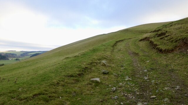
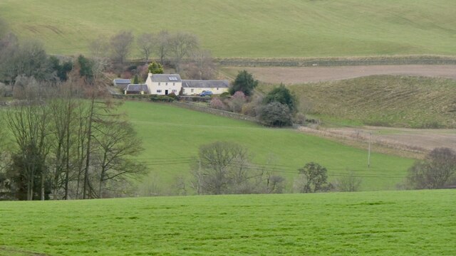
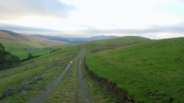
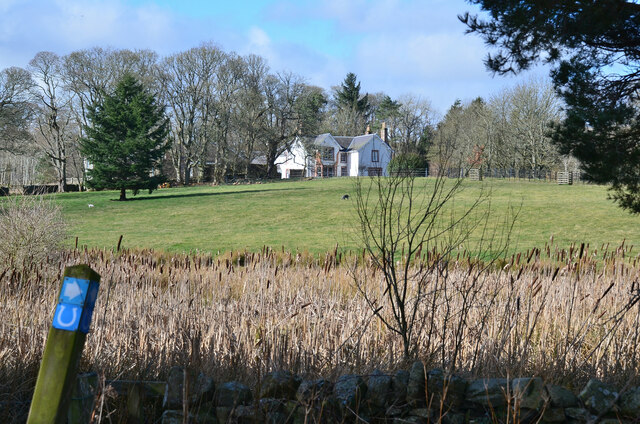
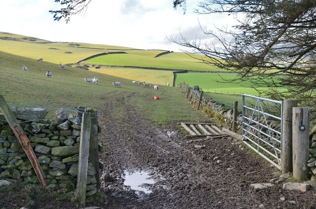
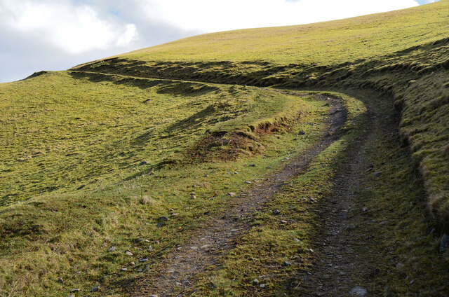
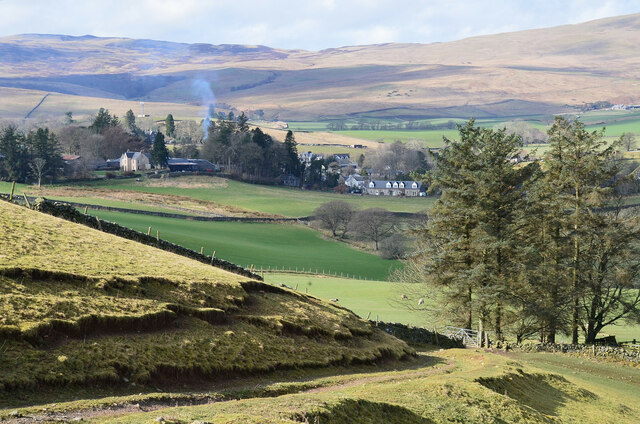
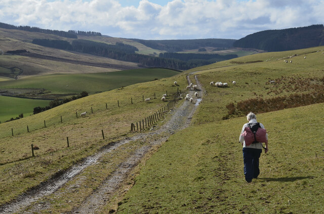
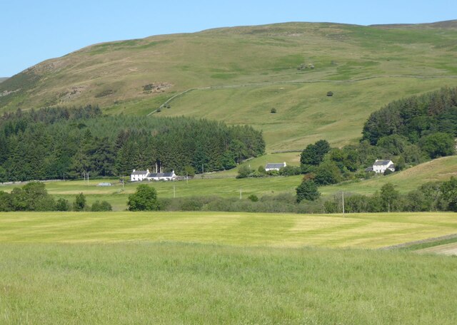
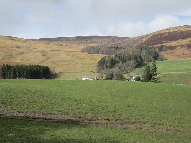
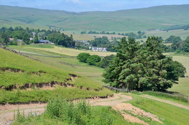
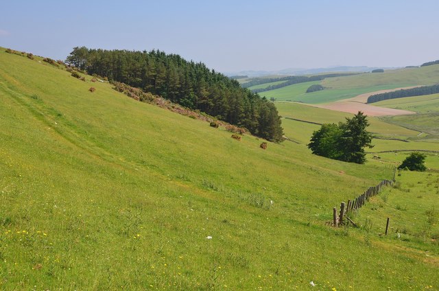
Huntly Moss, located in Selkirkshire, Scotland, is a picturesque wood and forest area that covers an extensive area of approximately 250 acres. It is a designated Site of Special Scientific Interest (SSSI) due to its unique and diverse ecological features.

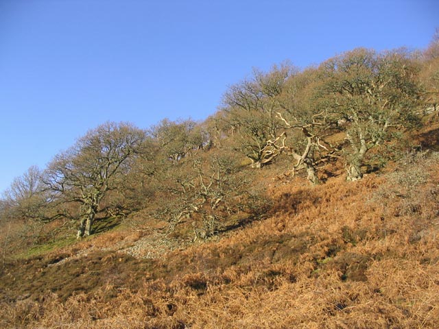
The moss is primarily composed of wetland habitats, including bog and fen areas, making it a haven for various plant and animal species. The dominant vegetation consists of sphagnum moss, cotton grass, and heather, creating a vibrant tapestry of colors throughout the year. Additionally, the woodlands surrounding the moss are predominantly made up of native species such as birch, oak, and pine.

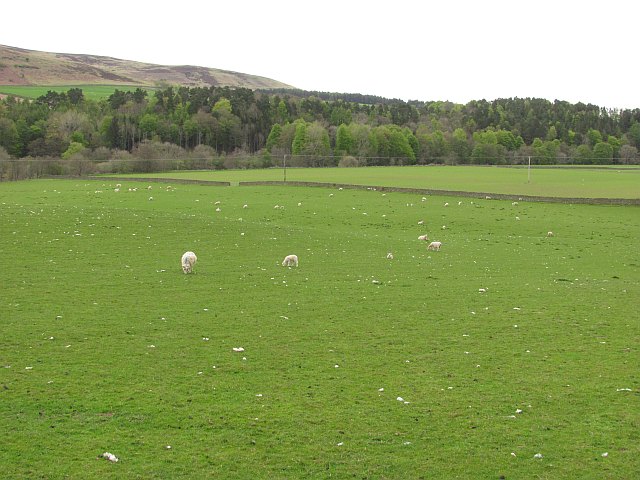
This nature reserve serves as an important breeding ground for several bird species, including the rare black grouse and snipe. It is also home to a diverse range of mammals, such as red deer, otters, and badgers. Visitors to Huntly Moss can often spot these animals, especially in the early morning or evening hours.

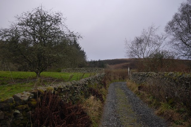
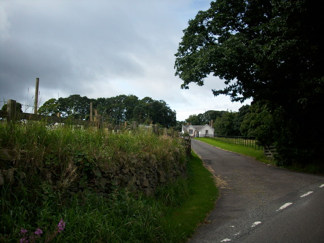
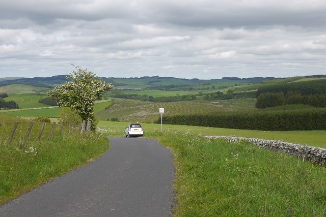
The moss is a popular destination for nature enthusiasts and photographers, providing ample opportunities for exploration and capturing stunning natural landscapes. Several walking trails have been established within the area, allowing visitors to experience the beauty of the moss up close.

In addition to its ecological significance, Huntly Moss also plays a crucial role in water management and carbon storage. The wetland habitats act as natural sponges, retaining rainwater and reducing flooding downstream. The moss also acts as a carbon sink, absorbing and storing significant amounts of carbon dioxide from the atmosphere.

Overall, Huntly Moss is a remarkable wood and forest area that offers a rich and diverse ecosystem, making it a cherished natural gem in Selkirkshire.

If you have any feedback on the listing, please let us know in the comments section below.

Huntly Moss Images

Images are sourced within 2km of 55.51272/-2.9303441 or Grid Reference NT4124. Thanks to Geograph Open Source API. All images are credited.

Track over Howford Hill A waymarked route. This section has seen little recent use by agricultural vehicles.
Track over Howford Hill
A waymarked route. This section has seen little recent use by agricultural vehicles.
Brockhill View across the hidden from sight Ettrick Water.
Brockhill
View across the hidden from sight Ettrick Water.
Road, Mid Hill Serving some buildings to the south and a quarry on Howford Hill.
Road, Mid Hill
Serving some buildings to the south and a quarry on Howford Hill.
Bulrushes at Howford Bulrushes in a marshy corner below the house. The waymark indicates the Buccleuch Country Ride, a 59 mile (95 km) route between the Ettrick and Yarrow valleys.
Bulrushes at Howford
Bulrushes in a marshy corner below the house. The waymark indicates the Buccleuch Country Ride, a 59 mile (95 km) route between the Ettrick and Yarrow valleys.
Sheep pasture, Ettrickbridge Sheep on the north side of Howford Hill.
Sheep pasture, Ettrickbridge
Sheep on the north side of Howford Hill.
Track on Howford Hill A well-graded route to the hill above Ettrickbridge.
Track on Howford Hill
A well-graded route to the hill above Ettrickbridge.
Ettrickbridge from Howford Hill
Track on Midhill The track is part of a circular walk from Ettrickbridge and also on the Buccleuch Country Ride.
Track on Midhill
The track is part of a circular walk from Ettrickbridge and also on the Buccleuch Country Ride.
Brockhill Under Fauldshope West Hill.
Brockhill
Under Fauldshope West Hill.
Road, Brockhill
Road, Brockhill
A field, Fauldshope Rather wet underfoot.  Last improved field before the moors start.
A field, Fauldshope
Rather wet underfoot. Last improved field before the moors start.
View towards Brockhill The hills beyond the Ettrick Water were seeing quite a bit of activity. There were  lot of police about at the road junction in Yarrowford on the other side of the hill and they had the helicopter up.
View towards Brockhill
The hills beyond the Ettrick Water were seeing quite a bit of activity. There were lot of police about at the road junction in Yarrowford on the other side of the hill and they had the helicopter up.
Track to Howford Hill The field track crosses the grassy ridge of Howford Hill and continues SE towards Caver's Hill and the Ale Water, with a branch track circling back round the hill back to Ettrickbridge. Helmburn farm is on the left and the village of Ettrickbridge is below.
Track to Howford Hill
The field track crosses the grassy ridge of Howford Hill and continues SE towards Caver's Hill and the Ale Water, with a branch track circling back round the hill back to Ettrickbridge. Helmburn farm is on the left and the village of Ettrickbridge is below.
Hill pasture and shelter belt Grass with wild flowers on the SE slope of Howford Hill.
Hill pasture and shelter belt
Grass with wild flowers on the SE slope of Howford Hill.
Wooded hillside A mixture of trees but mostly old oaks to the Southeast of Fauldshope West Hill. This area is named on the Explorer Map as Light Oaks.
Wooded hillside
A mixture of trees but mostly old oaks to the Southeast of Fauldshope West Hill. This area is named on the Explorer Map as Light Oaks.
Farm Road to Howford Farm Near the Howford Hill
Farm Road to Howford Farm
Near the Howford Hill
Sheep grazing, Brockhill A lot of shed wool here.
Sheep grazing, Brockhill
A lot of shed wool here.
Minor road, Hartwoodmyres
Show me another place!

Huntly Moss is located at Grid Ref: NT4124 (Lat: 55.51272, Lng: -2.9303441)

Unitary Authority: The Scottish Borders

Police Authority: The Lothians and Scottish Borders

What 3 Words

///stripped.complain.simulations. Near Selkirk, Scottish Borders

Nearby Locations

Huntly Moss

Related Wikis

Oakwood Roman Fort and Camp

Oakwood Roman Fort and Camp is a British archaeological site, a Roman fort and nearby Roman camp, about 3.5 miles (5.6 km) south-west of Selkirk in the...

Aikwood Tower

Aikwood Tower (formerly known as Oakwood Tower) is a 16th-century tower house in the Scottish Borders area of Scotland, 4 miles (6 kilometres) southwest...

Ettrickbridge

Ettrickbridge (Scottish Gaelic: Drochaid Eadaraig) is a village situated in the Scottish Borders region of Scotland, 7 miles (11 km) from the nearby town...

Bowhill, Scottish Borders

Bowhill is a village off the A708, in the Scottish Borders area of Scotland, near Selkirk, by the Yarrow Water Other places nearby include Bowhill House...

Carterhaugh

Carterhaugh is a wood and farm near the confluence of the Yarrow Water and the Ettrick Water near Selkirk in the Scottish Borders. This real location...

Bowhill House

Bowhill House is a historic house near Bowhill at Selkirk in the Scottish Borders area of Scotland. It is a member of the Historic Houses Association,...

Kirkhope Tower

Kirkhope Tower is a Scottish Pele, located in the Ettrick Valley, in the historic county of Selkirkshire, now a division of the Scottish Borders. The tower...

Battle of Philiphaugh

The Battle of Philiphaugh was fought on 13 September 1645 during the Wars of the Three Kingdoms near Selkirk in the Scottish Borders. The Royalist army...

Nearby Amenities

Located within 500m of 55.51272,-2.9303441
Power: pole
Lat/Long: 55.5113473/-2.9373759
Power: pole
Lat/Long: 55.5116342/-2.9363079
Power: pole
Lat/Long: 55.5119532/-2.9351159
Power: pole
Lat/Long: 55.5123056/-2.9338523
Power: pole
Lat/Long: 55.5126532/-2.9325405
Power: pole
Lat/Long: 55.5130294/-2.931155
Power: pole
Lat/Long: 55.5133496/-2.9299524
Power: pole
Lat/Long: 55.5137912/-2.9289643
Power: pole
Lat/Long: 55.5142602/-2.92789
Power: pole
Lat/Long: 55.5147935/-2.9266769
Power: pole
Lat/Long: 55.5153149/-2.9254954
The data included in this document is from www.openstreetmap.org. The data is made available under ODbL.

Have you been to Huntly Moss?

Leave your review of Huntly Moss below (or comments, questions and feedback).