Young Bush Wood

Wood, Forest in Peeblesshire

Scotland

Young Bush Wood

Sheep, Glen Greening up pasture in front of Birks and Birks Hill.
Sheep, Glen Credit: Richard Webb

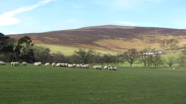
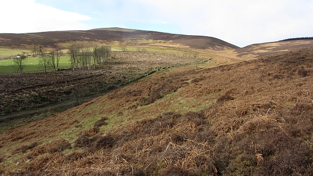
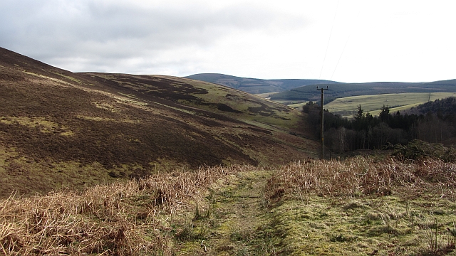
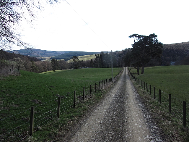
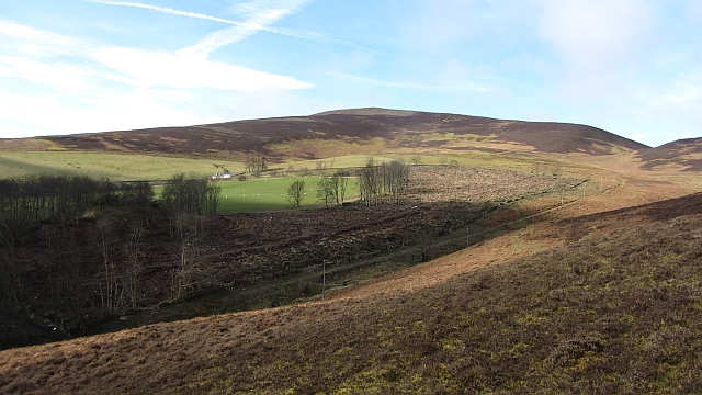
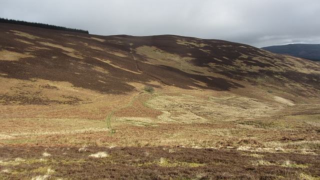
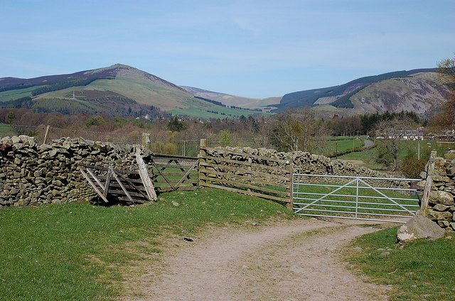
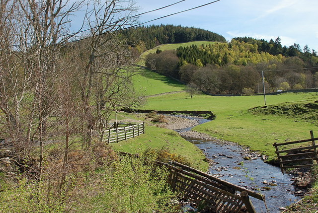
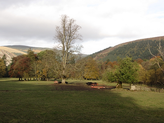
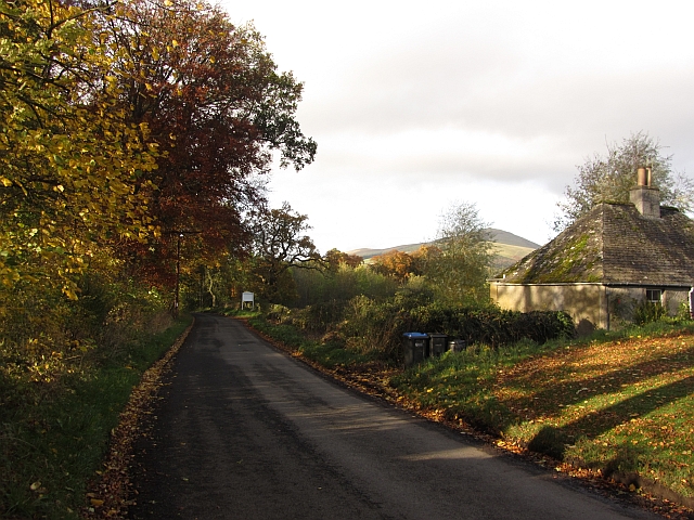
Young Bush Wood is a picturesque forest located in Peeblesshire, Scotland. Covering an area of approximately 100 acres, it is a popular destination for nature enthusiasts, hikers, and wildlife lovers. The wood is situated near the charming town of Peebles, surrounded by rolling hills and stunning landscapes.

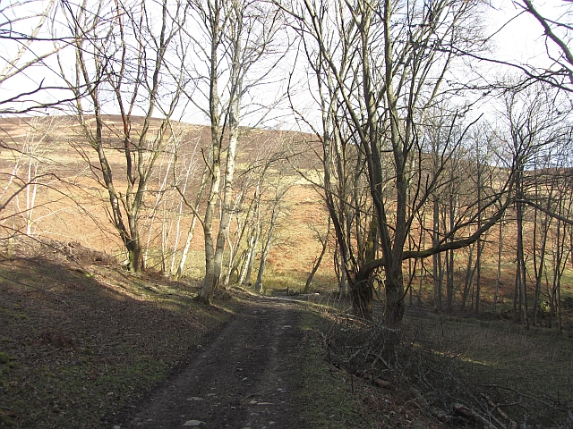
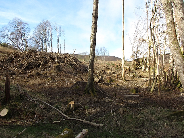
This ancient woodland boasts a diverse range of tree species, including oak, beech, birch, and ash, creating a lush and vibrant environment. The dense canopy provides a sheltered habitat for numerous wildlife species, such as red squirrels, roe deer, and a variety of bird species, making it a haven for nature lovers and birdwatchers.

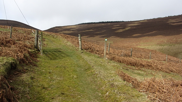
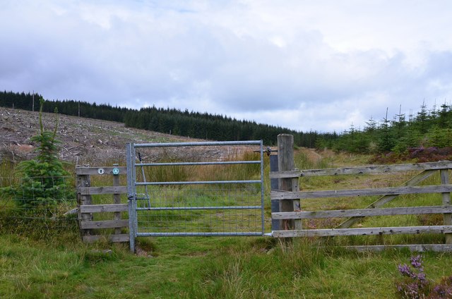
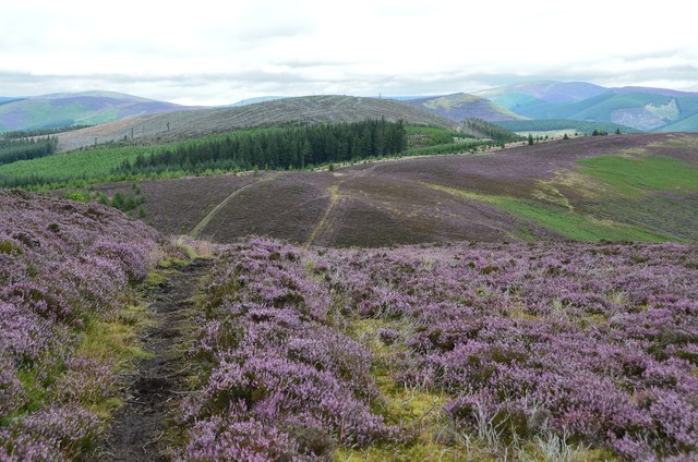
The wood features a well-maintained network of walking trails, allowing visitors to explore its beauty and tranquility. Along the trails, there are informative signs providing details about the flora and fauna found within the wood, enhancing the educational aspect of the visit. The wood also offers picnic areas and benches, providing the perfect opportunity for a peaceful break amidst nature.

During spring, the forest floor is adorned with a vibrant carpet of wildflowers, creating a picturesque scene. The changing seasons bring their own unique charm to Young Bush Wood, with autumn showcasing a stunning display of colorful foliage, while winter brings a serene, snow-covered landscape.

Overall, Young Bush Wood is a hidden gem in Peeblesshire, offering visitors a chance to immerse themselves in nature's beauty and tranquility. With its diverse wildlife, well-maintained trails, and breathtaking scenery, it is a must-visit destination for anyone seeking a peaceful escape in the heart of Scotland's natural wonders.

If you have any feedback on the listing, please let us know in the comments section below.

Young Bush Wood Images

Images are sourced within 2km of 55.600162/-3.08936 or Grid Reference NT3134. Thanks to Geograph Open Source API. All images are credited.

Sheep, Glen Greening up pasture in front of Birks and Birks Hill.
Sheep, Glen
Greening up pasture in front of Birks and Birks Hill.
Glass Burn The Glass Burn descends moorland slopes towards Glen. A plantation containing western hemlock has recently been felled. Paths meet before a pass through the ridgeline nick. From there you can descend through Cardrona Forest, or contour beneath Birks Hill to pick up the drove road to Peebles.
Glass Burn
The Glass Burn descends moorland slopes towards Glen. A plantation containing western hemlock has recently been felled. Paths meet before a pass through the ridgeline nick. From there you can descend through Cardrona Forest, or contour beneath Birks Hill to pick up the drove road to Peebles.
Woodland track An estate road at The Glen. Ongoing paths run over the hill to Tweeddale.
Woodland track
An estate road at The Glen. Ongoing paths run over the hill to Tweeddale.
Hill track, Glass Burn A path, not marked by the Ordnance Survey, but waymarked on the ground leads away from The Glen towards Cardrona Forest and Peebles.
Hill track, Glass Burn
A path, not marked by the Ordnance Survey, but waymarked on the ground leads away from The Glen towards Cardrona Forest and Peebles.
Road to Birks This private road continues as paths over the hill to Peebles.
Road to Birks
This private road continues as paths over the hill to Peebles.
Felled woodland, Birks A recently (2012) felled block of conifers on the Glen Estate.
Felled woodland, Birks
A recently (2012) felled block of conifers on the Glen Estate.
Felled area, Birks A recently (2012) felled conifer wood.
Felled area, Birks
A recently (2012) felled conifer wood.
A path to Peebles A hill path crosses a pass into Cardrona Forest and onwards towards Peebles.
A path to Peebles
A hill path crosses a pass into Cardrona Forest and onwards towards Peebles.
Glass Burn and Orchard Rig Moorland on the Glen Estate.
Glass Burn and Orchard Rig
Moorland on the Glen Estate.
Forestry gate on Beards Hill The gate into Cardrona Forest on the path up from The Glen. The area to the left has been clear-felled in the last year or two.
Forestry gate on Beards Hill
The gate into Cardrona Forest on the path up from The Glen. The area to the left has been clear-felled in the last year or two.
Path in the heather near Cardrona Forest On Orchard Rig looking to the clear-felled summit of Wallace's Hill with Lee Pen just to the right.
Path in the heather near Cardrona Forest
On Orchard Rig looking to the clear-felled summit of Wallace's Hill with Lee Pen just to the right.
Track approaching Damhead farm The track from Damhead Rig passes through the farmyard. The buildings at Traquair village are in the middle distance.
Track approaching Damhead farm
The track from Damhead Rig passes through the farmyard. The buildings at Traquair village are in the middle distance.
Fingland Burn Seen from the road bridge, with Shaw Hill in the background.
Fingland Burn
Seen from the road bridge, with Shaw Hill in the background.
Traquair Kirk Looking to the west.
Traquair Kirk
Looking to the west.
Wallace's Hill At an altitude of 460 metres Wallace's Hill is in Cardrona Forest.  The name presumably refers to the exploits of the great Scottish patriot Sir William Wallace,(1270 - 1305) who was active in the area. There are many interesting walks in the forest which is  owned by the Forestry Commission
Wallace's Hill
At an altitude of 460 metres Wallace's Hill is in Cardrona Forest. The name presumably refers to the exploits of the great Scottish patriot Sir William Wallace,(1270 - 1305) who was active in the area. There are many interesting walks in the forest which is owned by the Forestry Commission
War memorial at Traquair The solid looking memorial stands at a road junction; Lee Pen is the prominent hill beyond.
War memorial at Traquair
The solid looking memorial stands at a road junction; Lee Pen is the prominent hill beyond.
Gardener's Acre Parkland, grazed by cattle, Traquair.
Gardener's Acre
Parkland, grazed by cattle, Traquair.
B7062, Traquair Outside the famous shut gate - The Steekit Yetts  <a href="https://www.geograph.org.uk/photo/4678">NT3235 : The Steekit Yetts</a>. This road is a quiet and narrow alternative to the A72 on the other side of the Tweed.
B7062, Traquair
Outside the famous shut gate - The Steekit Yetts NT3235 : The Steekit Yetts. This road is a quiet and narrow alternative to the A72 on the other side of the Tweed.
Show me another place!

Young Bush Wood is located at Grid Ref: NT3134 (Lat: 55.600162, Lng: -3.08936)

Unitary Authority: The Scottish Borders

Police Authority: The Lothians and Scottish Borders

What 3 Words

///without.greyhound.sensible. Near Innerleithen, Scottish Borders

Related Wikis

Traquair

Traquair (Scottish Gaelic: Cille Bhrìghde) is a small village and civil parish in the Scottish Borders; until 1975 it was in the county of Peeblesshire...

Sir Walter Scott Way

The Sir Walter Scott Way is a 92-mile (148 km) long-distance footpath in the Scottish Borders. The route broadly follows the waymarked Southern Upland...

Quair Water

The Quair Water is a tributary of the River Tweed in the Scottish Borders area of Scotland. Its name is related to Traquair. == Etymology == The name Quair...

Traquair House

Traquair House, approximately 7 miles southeast of Peebles, is claimed to be the oldest continually inhabited house in Scotland. Whilst not strictly a...

Have you been to Young Bush Wood?

Leave your review of Young Bush Wood below (or comments, questions and feedback).