Coille na Dubh Chlaise

Wood, Forest in Ross-shire

Scotland

Coille na Dubh Chlaise

Paved path on Beinn Eighe National Nature Reserve There are two constructed and waymarked paths on the Beinn Eighe National Nature Reserve, the Woodland Trail and the Mountain Trail. Here, close to the A832, on the south side of the road the path has been re-routed and the two routes coincide now returning to the car park entirely on that side of the road. The massive stone slabs carry the way over an area of bog.
Paved path on Beinn Eighe National Nature Reserve Credit: Trevor Littlewood

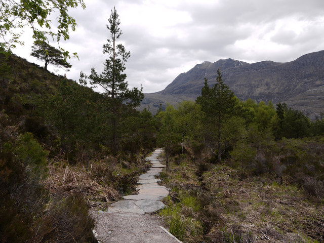
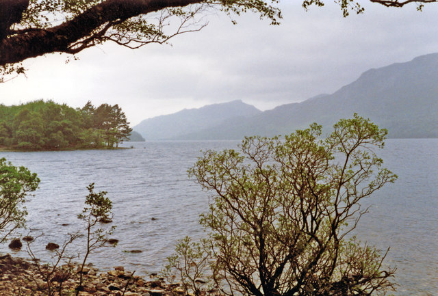
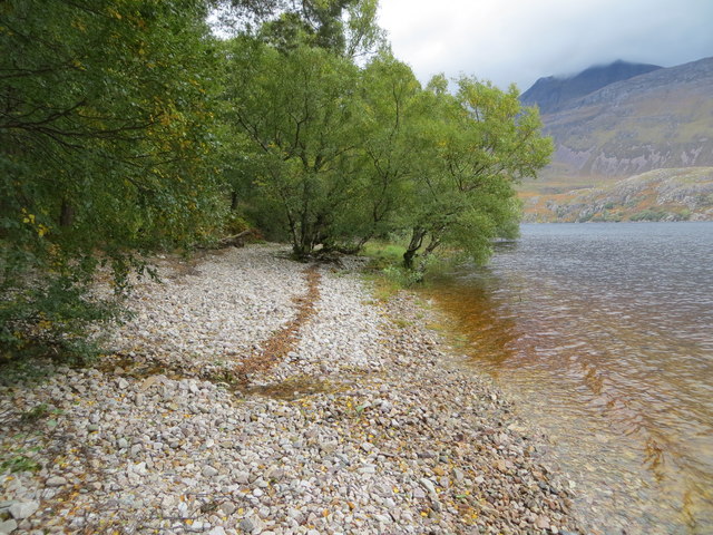
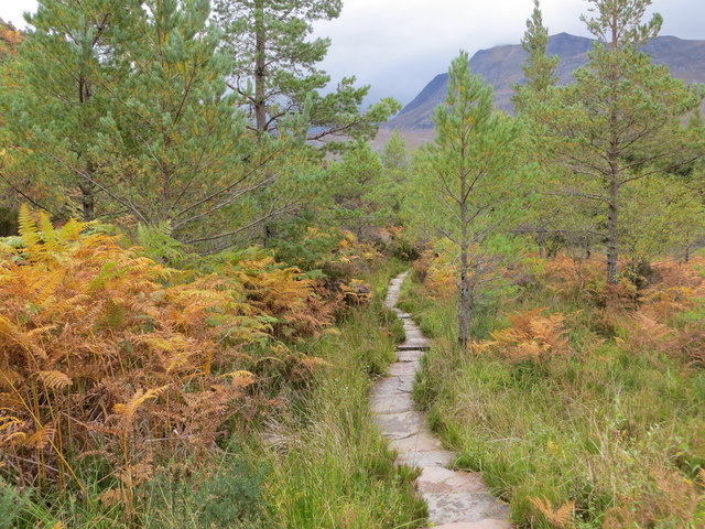
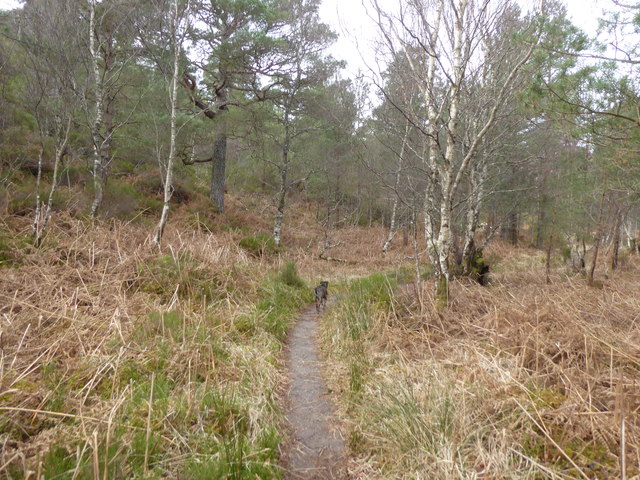
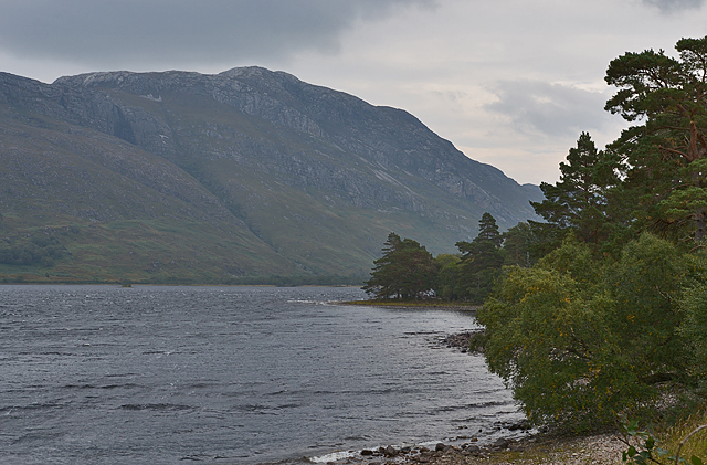
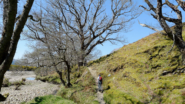
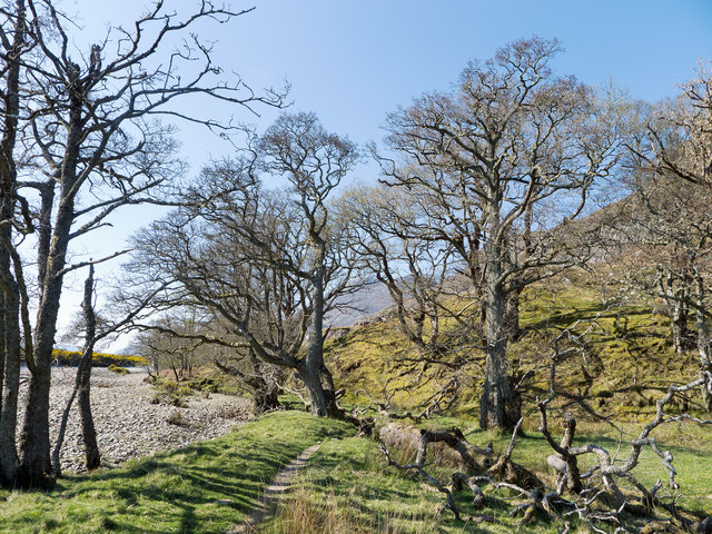
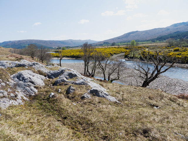
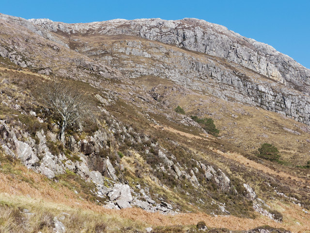
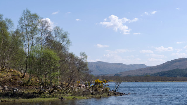
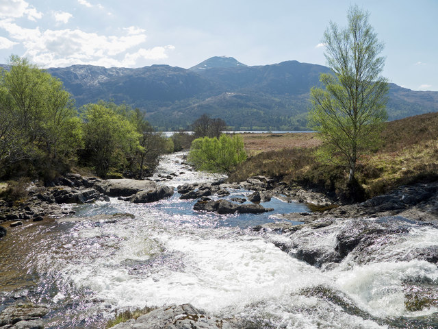
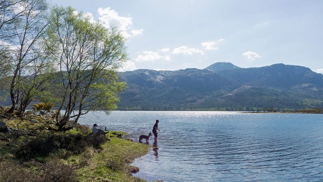
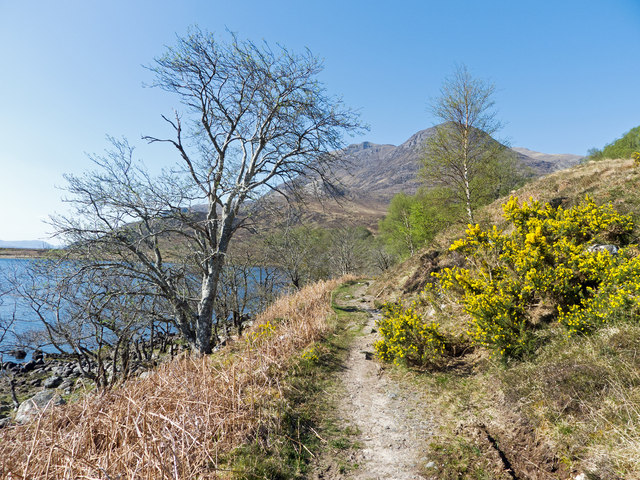
Coille na Dubh Chlaise, located in Ross-shire, Scotland, is a stunning wood or forest that offers visitors a serene and picturesque experience. Spanning over a vast area, this natural haven is renowned for its rich biodiversity and breathtaking landscapes.

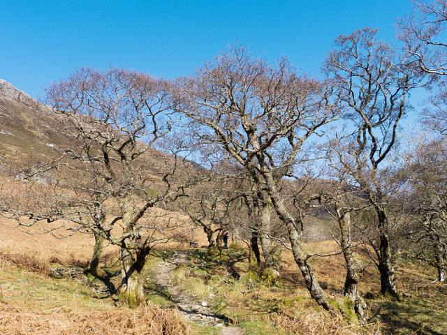
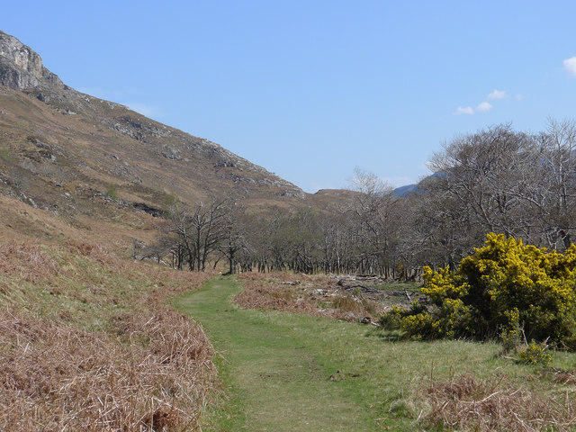
The forest is characterized by its diverse range of tree species, including ancient oaks, towering Scots pines, and striking birches. These trees create a dense canopy, casting dappled sunlight onto the forest floor and providing a magical ambiance. In spring, the forest comes alive with a vibrant carpet of bluebells and wildflowers, creating a colorful display that attracts nature enthusiasts and photographers alike.

Coille na Dubh Chlaise is also home to a wide variety of wildlife. Visitors may spot red squirrels darting through the trees, while lucky observers might catch a glimpse of elusive deer or even pine martens. Birdwatchers will be delighted by the abundance of species, such as woodpeckers, owls, and the occasional golden eagle soaring above.

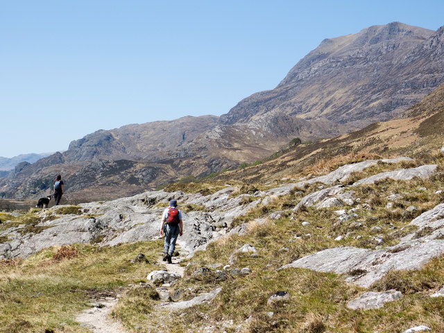
The forest offers several walking trails, allowing visitors to explore its hidden treasures. These paths wind through ancient woodlands, across babbling streams, and up gentle slopes, offering stunning panoramic views of the surrounding countryside. Nature lovers can also enjoy a picnic, surrounded by the peaceful sounds of nature.

Coille na Dubh Chlaise is not only a haven for wildlife and natural beauty but also serves as an important ecological site. The forest plays a vital role in carbon sequestration, helping to combat climate change and maintain the delicate balance of the local ecosystem.

Overall, Coille na Dubh Chlaise is a breathtaking wood that captures the essence of Scotland's natural beauty. It offers a tranquil escape and a chance to connect with nature in a truly awe-inspiring setting.

If you have any feedback on the listing, please let us know in the comments section below.

Coille na Dubh Chlaise Images

Images are sourced within 2km of 57.63483/-5.3235077 or Grid Reference NH0165. Thanks to Geograph Open Source API. All images are credited.

Paved path on Beinn Eighe National Nature Reserve There are two constructed and waymarked paths on the Beinn Eighe National Nature Reserve, the Woodland Trail and the Mountain Trail. Here, close to the A832, on the south side of the road the path has been re-routed and the two routes coincide now returning to the car park entirely on that side of the road. The massive stone slabs carry the way over an area of bog.
Paved path on Beinn Eighe National Nature Reserve
There are two constructed and waymarked paths on the Beinn Eighe National Nature Reserve, the Woodland Trail and the Mountain Trail. Here, close to the A832, on the south side of the road the path has been re-routed and the two routes coincide now returning to the car park entirely on that side of the road. The massive stone slabs carry the way over an area of bog.
NW on Loch Maree from Taagan Nature Trail parking place near Kinlochewe, 1994 View NW on A832 Achnasheen - Poolewe road, with slopes of Ben Venue (2,231 ft.) on the right and further back Slioch (3,217 ft.). (Cf. <a href="https://www.geograph.org.uk/photo/2268894">NH0065 : Gairloch : Glas Leitire</a>).
NW on Loch Maree from Taagan Nature Trail parking place near Kinlochewe, 1994
View NW on A832 Achnasheen - Poolewe road, with slopes of Ben Venue (2,231 ft.) on the right and further back Slioch (3,217 ft.). (Cf. NH0065 : Gairloch : Glas Leitire).
On the Woodland Trail, Beinn Eighe Reserve For information on the trail read the booklet.  <span class="nowrap"><a title="http://www.snh.org.uk/pdfs/publications/designatedareas/Beinneighewoodtrail.pdf" rel="nofollow ugc noopener" href="http://www.snh.org.uk/pdfs/publications/designatedareas/Beinneighewoodtrail.pdf">Link</a><img style="margin-left:2px;" alt="External link" title="External link - shift click to open in new window" src="https://s1.geograph.org.uk/img/external.png" width="10" height="10"/></span>
On the Woodland Trail, Beinn Eighe Reserve
For information on the trail read the booklet. LinkExternal link
Shoreline path beside Loch Maree Looking north-westward.
Shoreline path beside Loch Maree
Looking north-westward.
Paved path through an area of Scots Pines Looking south-eastward.
Paved path through an area of Scots Pines
Looking south-eastward.
Path at Beinn Eighe National Nature Reserve
Loch Maree shoreline With the loch in a sombre mood. Meallan Ghobhar, a small summit on the edge of the vast plateau of which Beinn a' Mhùinidh is the highest point, rises in the background.
Loch Maree shoreline
With the loch in a sombre mood. Meallan Ghobhar, a small summit on the edge of the vast plateau of which Beinn a' Mhùinidh is the highest point, rises in the background.
Path beside the Kinlochewe River Walking towards Slioch on a fine Spring day.
Path beside the Kinlochewe River
Walking towards Slioch on a fine Spring day.
Path beside the Kinlochewe River The established trees are a real bonus on the walk towards Loch Maree. Evident are large tree branches having fallen victim to age and wind and now lying on the ground.
Path beside the Kinlochewe River
The established trees are a real bonus on the walk towards Loch Maree. Evident are large tree branches having fallen victim to age and wind and now lying on the ground.
Path beside the Kinlochewe River The path gives good views to the mountains on all sides of Kinlochewe.
Path beside the Kinlochewe River
The path gives good views to the mountains on all sides of Kinlochewe.
Admiring Slioch from the access path from Kinlochewe On the footpath that leads along the east side of Loch Maree.
Admiring Slioch from the access path from Kinlochewe
On the footpath that leads along the east side of Loch Maree.
The Kinlochewe River Seen from a small rise in the path to Slioch.
The Kinlochewe River
Seen from a small rise in the path to Slioch.
Loch Maree footpath by the Allt na Still A grassy track through the bracken.
Loch Maree footpath by the Allt na Still
A grassy track through the bracken.
The flank of Beinn a Mhuinidh A mountain lower than Slioch to the north of Kinlochewe, viewed from the path that follows the shore of Loch Maree.
The flank of Beinn a Mhuinidh
A mountain lower than Slioch to the north of Kinlochewe, viewed from the path that follows the shore of Loch Maree.
Camas an Trusdair, Loch Maree The innermost reach of this delightful bay
Camas an Trusdair, Loch Maree
The innermost reach of this delightful bay
Abhainn Fhasaigh draining to Loch Maree A fine river crossed by a bridge to take walkers along the shore of Loch Maree or up Slioch.
Abhainn Fhasaigh draining to Loch Maree
A fine river crossed by a bridge to take walkers along the shore of Loch Maree or up Slioch.
Beside Loch Maree on a hot Spring Day A great place to relax and paddle on a calm Spring day - for all the family - dog included.
Beside Loch Maree on a hot Spring Day
A great place to relax and paddle on a calm Spring day - for all the family - dog included.
Path on the east side of Loch Maree A place where Nigel Brown has stopped in the past.  <a href="https://www.geograph.org.uk/photo/2400511">NH0165 : The Loch Maree path</a>   and   <a href="https://www.geograph.org.uk/photo/1731605">NH0165 : Path on the east side of Loch Maree</a>.  A view ahead towards Slioch.
Path on the east side of Loch Maree
A place where Nigel Brown has stopped in the past. NH0165 : The Loch Maree path and NH0165 : Path on the east side of Loch Maree. A view ahead towards Slioch.
Show me another place!

Coille na Dubh Chlaise is located at Grid Ref: NH0165 (Lat: 57.63483, Lng: -5.3235077)

Unitary Authority: Highland

Police Authority: Highlands and Islands

What 3 Words

///nervy.ended.swarm. Near Kinlochewe, Highland

Related Wikis

Taagan

Taagan (Scottish Gaelic: Na Tathagan) is a hamlet in Ross and Cromarty, in the Highland council area of Scotland. It is situated about 2 km north west...

Anancaun

Anancaun (Scottish Gaelic: Àth nan Ceann) is a small hamlet located in Ross-shire, Scotland, within the Scottish council area of Highland. == References ==

Cape Wrath Trail

Cape Wrath Trail is a hiking route that runs through the Scottish Highlands and along the west coast of Scotland. It is approximately 200 miles (321 km...

Kinlochewe

Kinlochewe (Scottish Gaelic: Ceann Loch Iù or Iùbh) is a village in Wester Ross in the Northwest Highlands of Scotland. It is in the parish of Gairloch...

Nearby Amenities

Located within 500m of 57.63483,-5.3235077
Ford: yes
Lat/Long: 57.6311505/-5.3252698
The data included in this document is from www.openstreetmap.org. The data is made available under ODbL.

Have you been to Coille na Dubh Chlaise?

Leave your review of Coille na Dubh Chlaise below (or comments, questions and feedback).