Fron Wood

Wood, Forest in Denbighshire

Wales

Fron Wood

The River Dee from the Newbridge viaduct
The River Dee from the Newbridge viaduct Credit: Roy Hughes

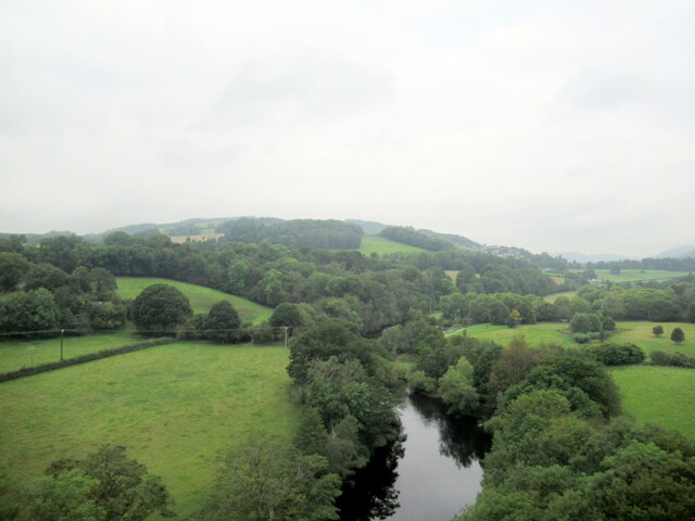
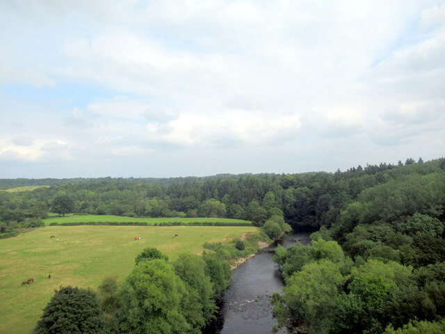
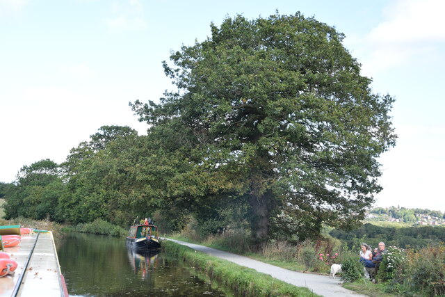
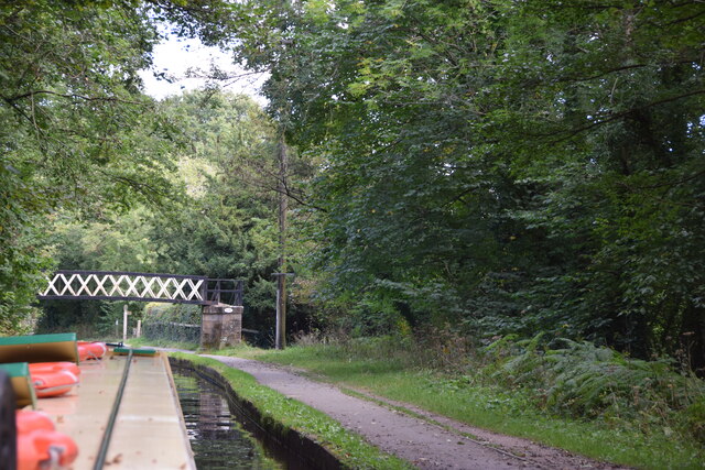
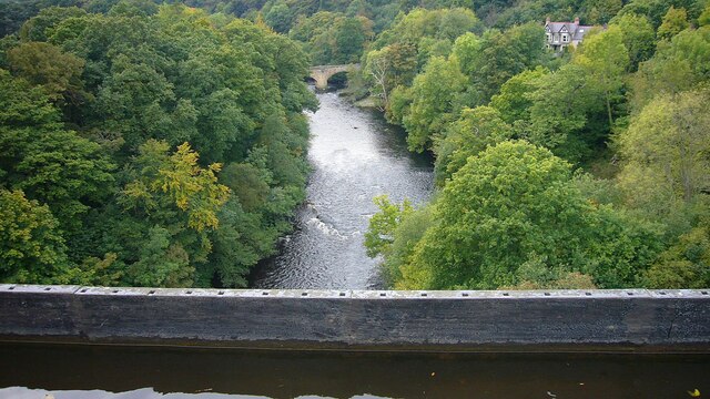
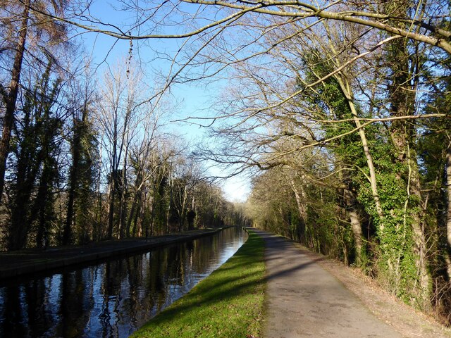
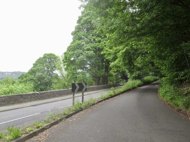
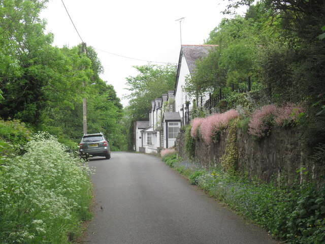
Fron Wood is a picturesque forest located in Denbighshire, Wales. Covering an area of approximately 500 acres, it offers a tranquil escape from the hustle and bustle of everyday life. The woodland is primarily made up of native broadleaf trees such as oak, beech, and birch, creating a diverse and vibrant ecosystem.

The forest is a haven for wildlife, with a wide range of species calling it home. Visitors may catch a glimpse of red squirrels, badgers, and various bird species including woodpeckers and owls. The woodland floor is adorned with a carpet of bluebells in the spring, creating a breathtaking display of color.

A network of well-maintained footpaths winds its way through Fron Wood, allowing visitors to explore and appreciate the natural beauty at their own pace. The paths are suitable for both leisurely strolls and more adventurous hikes, with varying levels of difficulty.

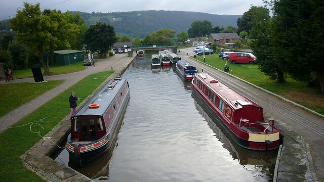
Fron Wood is a popular destination for outdoor enthusiasts and nature lovers. It provides ample opportunities for activities such as birdwatching, photography, and picnicking. The peaceful atmosphere and stunning scenery make it an ideal spot for relaxation and rejuvenation.

Managed by the local forestry commission, Fron Wood is well-preserved and cared for. The commission ensures the conservation of the woodland and its inhabitants, while also providing educational programs and guided tours for visitors of all ages.

In summary, Fron Wood in Denbighshire is a breathtaking forest offering a tranquil retreat into nature. With its diverse wildlife, beautiful flora, and well-maintained footpaths, it is a must-visit destination for those seeking solace and natural beauty.

If you have any feedback on the listing, please let us know in the comments section below.
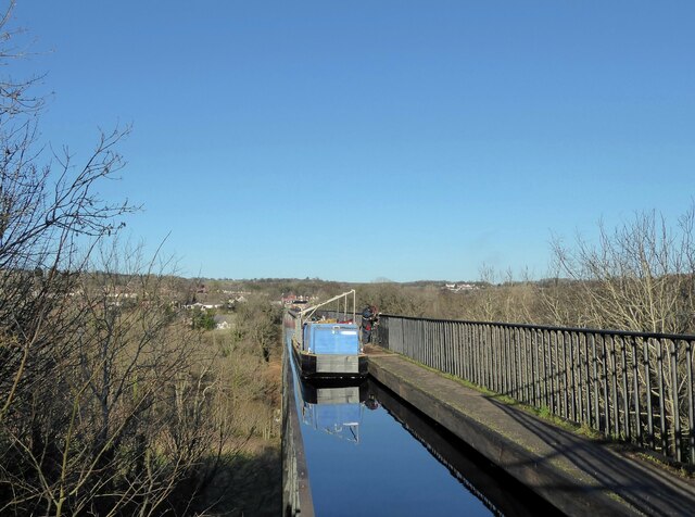
Fron Wood Images

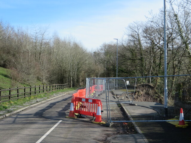
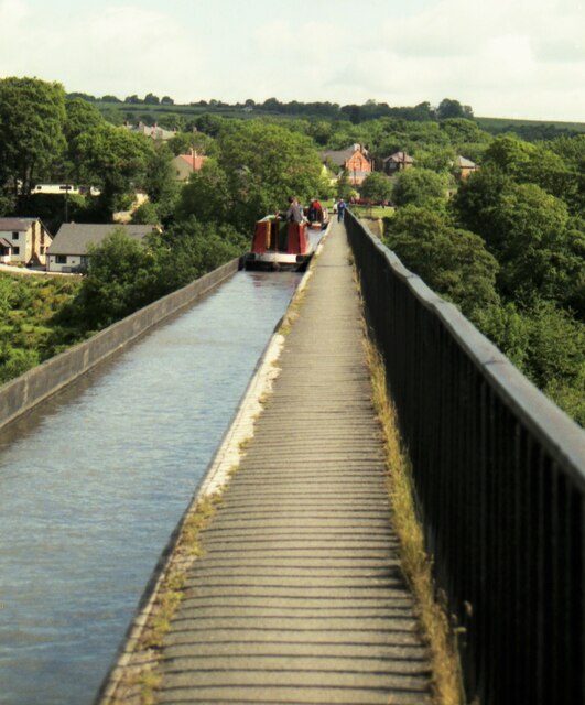
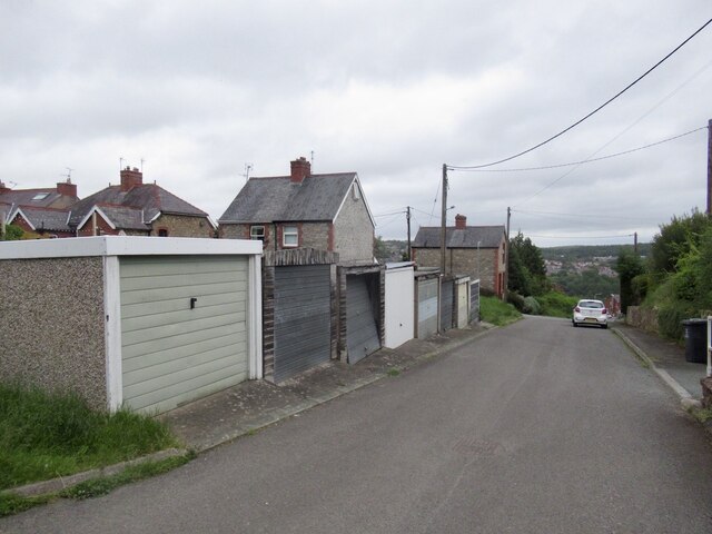
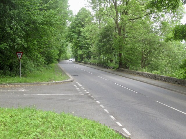
Images are sourced within 2km of 52.959578/-3.0795739 or Grid Reference SJ2740. Thanks to Geograph Open Source API. All images are credited.

The River Dee from the Newbridge viaduct
Trevor Basin Trevor Basin is at the northern end of the central section of what was planned as the Ellesmere Canal linking the Mersey and Severn rivers. The canal was never completed in full and Trevor Basin - just north of Pontcysyllte Aqueduct - became the northern terminus. The canal here is today named the Llangollen Canal, though the stretch from Trevor Basin to Llangollen was in fact only originally intended as a water feed to the Ellesmere canal.
Trevor Basin
Trevor Basin is at the northern end of the central section of what was planned as the Ellesmere Canal linking the Mersey and Severn rivers. The canal was never completed in full and Trevor Basin - just north of Pontcysyllte Aqueduct - became the northern terminus. The canal here is today named the Llangollen Canal, though the stretch from Trevor Basin to Llangollen was in fact only originally intended as a water feed to the Ellesmere canal.
Narrowboat on Pontcysyllte Aqueduct The highest canal aqueduct in the world, Grade I listed and a UNESCO World Heritage Site. Completed in 1805 to a design by Thomas Telford and William Jessop.
Narrowboat on Pontcysyllte Aqueduct
The highest canal aqueduct in the world, Grade I listed and a UNESCO World Heritage Site. Completed in 1805 to a design by Thomas Telford and William Jessop.
Llangollen Canal near Plas-yn-pentre Taken just east of Bridge 34W.
Llangollen Canal near Plas-yn-pentre
Taken just east of Bridge 34W.
Bridge 33W, Llangollen Canal This bridge just south of the village of Trevor is a footbridge.
Bridge 33W, Llangollen Canal
This bridge just south of the village of Trevor is a footbridge.
Trevor Arm, Llangollen Canal The Llangollen canal is an arm of the Shropshire Union canal that runs from Hurleston Junction to Llangollen with a wide variety of scenery along its course. Its total length is 46 miles, but the last 1½ miles from Llangollen to Llantisilio is unnavigable by any boats over about 10' length.
The canal's vital statistics for craft are:
Length 72 '
Beam 6'10"
Headroom 7'
Draught 2'3" (Hurleston to Pontcysyllte) 2' (P. to Llangollen)
These are the maximum dimensions for any craft, based on the minimum dimensions of locks & bridges.
There are a total of 21 locks on the canal, but only two between Llangollen and Whitchurch (a distance of about 31 miles). One of the most notable things about the canal is the strong flow especially in the "narrows" near Llangollen and in the tunnels near Chirk. About 12 million gallons of water passes down this canal from the River Dee to the Shropshire Union every day.
The most famous feature of this canal is the superb feat of engineering that is the 200-year-old Pontcysyllte Aqueduct rising 126' above the River Dee and running for over 335 yds - for more information on this see the numerous photos for squares SJ2742 and SJ2741
Trevor Arm, Llangollen Canal
The Llangollen canal is an arm of the Shropshire Union canal that runs from Hurleston Junction to Llangollen with a wide variety of scenery along its course. Its total length is 46 miles, but the last 1½ miles from Llangollen to Llantisilio is unnavigable by any boats over about 10' length. The canal's vital statistics for craft are: Length 72 ' Beam 6'10" Headroom 7' Draught 2'3" (Hurleston to Pontcysyllte) 2' (P. to Llangollen) These are the maximum dimensions for any craft, based on the minimum dimensions of locks & bridges. There are a total of 21 locks on the canal, but only two between Llangollen and Whitchurch (a distance of about 31 miles). One of the most notable things about the canal is the strong flow especially in the "narrows" near Llangollen and in the tunnels near Chirk. About 12 million gallons of water passes down this canal from the River Dee to the Shropshire Union every day. The most famous feature of this canal is the superb feat of engineering that is the 200-year-old Pontcysyllte Aqueduct rising 126' above the River Dee and running for over 335 yds - for more information on this see the numerous photos for squares SJ2742 and SJ2741
Cysylltau Bridge View from Pont Cysyllte Aqueduct.
Cysylltau Bridge
View from Pont Cysyllte Aqueduct.
The Llangollen Canal, Froncysyllte The Llangollen Canal runs on a high tree-covered embankment on the southern approach to Pont-Cysyllte.
The Llangollen Canal, Froncysyllte
The Llangollen Canal runs on a high tree-covered embankment on the southern approach to Pont-Cysyllte.
Repairing the railings Repairs are underway to the cast iron railings of the Pont-Cysyllte aqueduct.  The equipment has been taken to the site by boat and the canal is closed while the work is in progress.
Repairing the railings
Repairs are underway to the cast iron railings of the Pont-Cysyllte aqueduct. The equipment has been taken to the site by boat and the canal is closed while the work is in progress.
Closed road, Newbridge In early 2021, the B5605 - formerly the main A483 - suffered a landslide just behind where I'm standing here. The road has been closed since, and there is still no agreement on funding to restore it.
Closed road, Newbridge
In early 2021, the B5605 - formerly the main A483 - suffered a landslide just behind where I'm standing here. The road has been closed since, and there is still no agreement on funding to restore it.
Landslip, B5605 The road - the old A483 - runs along a cliff above a bend in the River Dee. It suffered a landslide in January 2021, and has been closed ever since.
Landslip, B5605
The road - the old A483 - runs along a cliff above a bend in the River Dee. It suffered a landslide in January 2021, and has been closed ever since.
Landslip, B5605 Taken from the opposite side to <a href="https://www.geograph.org.uk/photo/7108963">SJ2841 : Landslip, B5605</a>, this shows the extent of the landslide that took out the old A483 (the Manchester - Swansea trunk road of its day) in the torrential rains of Storm Christoph in January 2021. It also shows the extent of the work needed to repair the damage, for it is a sheer drop there down to the River Dee, 100 feet below.
Landslip, B5605
Taken from the opposite side to SJ2841 : Landslip, B5605, this shows the extent of the landslide that took out the old A483 (the Manchester - Swansea trunk road of its day) in the torrential rains of Storm Christoph in January 2021. It also shows the extent of the work needed to repair the damage, for it is a sheer drop there down to the River Dee, 100 feet below.
Cruising North on the Pontcysyllte Aqueduct in 1995 A convoy system was in use
Cruising North on the Pontcysyllte Aqueduct in 1995
A convoy system was in use
Woodlands Grove, Froncysyllte
A5 West of Froncysyllte.
A5
West of Froncysyllte.
Cwmalis Road, Froncysyllte Leaving the A5 (left).
Cwmalis Road, Froncysyllte
Leaving the A5 (left).
Carmel Terrace Cwmalis Road, Froncysyllte.
Carmel Terrace
Cwmalis Road, Froncysyllte.
Show me another place!

Fron Wood is located at Grid Ref: SJ2740 (Lat: 52.959578, Lng: -3.0795739)

Unitary Authority: Wrexham

Police Authority: North Wales

What 3 Words

///rollover.calculating.pans. Near Chirk, Wrexham

Related Wikis

Froncysyllte

Froncysyllte (; Welsh pronunciation: [vrɔŋkəˈsəɬte]), colloquially known as Fron, is a village in Wrexham County Borough, Wales and stands on the banks...

Tŷ Mawr Country Park

Tŷ Mawr Country Park (Welsh: Parc Gwledig Tŷ Mawr) is a country park and farm park near Cefn Mawr in Wrexham County Borough, Wales. The country park lies...

Cefn Viaduct, Wrexham

The Cefn (Newbridge) Viaduct is Grade II* listed railway viaduct across the River Dee between Cefn and Chirk communities in Wrexham County Borough, Wales...

Cefn railway station

Cefn railway station was a minor railway station on the Great Western Railway's London to Birkenhead main line serving the mining village of Cefn Mawr...

Nearby Amenities

Located within 500m of 52.959578,-3.0795739
Grit Bin
Lat/Long: 52.961092/-3.084955
Fast Food
Samirah Tandoori Take-Away
Cuisine: indian
Lat/Long: 52.9630626/-3.0835667
Parking
Parking: lane
Lat/Long: 52.9627832/-3.0812795
Fast Food
Lat/Long: 52.96283/-3.0814579
Barrier: kissing_gate
Lat/Long: 52.9569762/-3.0778322
Bench
Backrest: yes
Material: wood
Lat/Long: 52.9613292/-3.072748
Building: yes
Lat/Long: 52.9573644/-3.0853918
Barrier: kissing_gate
Lat/Long: 52.9570649/-3.0772409
Barrier: kissing_gate
Lat/Long: 52.9569353/-3.0766917
Direction: 215
Generator Method: photovoltaic
Generator Output Electricity: yes
Generator Solar Modules: 7
Generator Source: solar
Generator Type: solar_photovoltaic_panel
Location: roof
Power: generator
Lat/Long: 52.9623347/-3.0847036
Direction: SSW
Generator Method: photovoltaic
Generator Output Electricity: yes
Generator Solar Modules: 11
Generator Source: solar
Generator Type: solar_photovoltaic_panel
Location: roof
Power: generator
Lat/Long: 52.9621852/-3.0842831
Direction: SSW
Generator Method: photovoltaic
Generator Output Electricity: yes
Generator Solar Modules: 7
Generator Source: solar
Generator Type: solar_photovoltaic_panel
Location: roof
Power: generator
Lat/Long: 52.9621941/-3.085234
Direction: SSW
Generator Method: photovoltaic
Generator Output Electricity: yes
Generator Solar Modules: 7
Generator Source: solar
Generator Type: solar_photovoltaic_panel
Location: roof
Power: generator
Lat/Long: 52.962033/-3.0847015
Direction: SSW
Generator Method: photovoltaic
Generator Output Electricity: yes
Generator Solar Modules: 7
Generator Source: solar
Generator Type: solar_photovoltaic_panel
Location: roof
Power: generator
Lat/Long: 52.9619122/-3.0854653
Stop
Direction: backward
Lat/Long: 52.9600909/-3.0755011
Crossing
Crossing: marked
Crossing Island: no
Crossing Ref: toucan
Kerb: flush
Tactile Paving: yes
Lat/Long: 52.9630104/-3.0837526
Give Way
Direction: backward
Lat/Long: 52.9630142/-3.0839271
Fron Isaf
Name Cy: Fron Isaf
Name En: Fron Isaf
Place: locality
Wikidata: Q107032548
Lat/Long: 52.9579767/-3.077769
Direction: 165
Generator Method: photovoltaic
Generator Output Electricity: yes
Generator Solar Modules: 16
Generator Source: solar
Generator Type: solar_photovoltaic_panel
Location: roof
Power: generator
Lat/Long: 52.9612215/-3.0746403
Barrier: stile
Lat/Long: 52.9598909/-3.0816112
The data included in this document is from www.openstreetmap.org. The data is made available under ODbL.

Have you been to Fron Wood?

Leave your review of Fron Wood below (or comments, questions and feedback).