Coed Pen-y-cefn

Wood, Forest in Merionethshire

Wales

Coed Pen-y-cefn

A470 near Coed y Brenin
A470 near Coed y Brenin Credit: Steven Brown

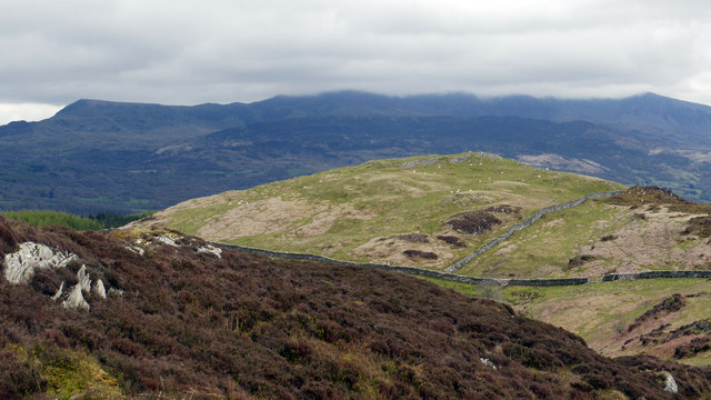
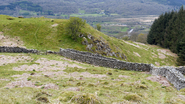
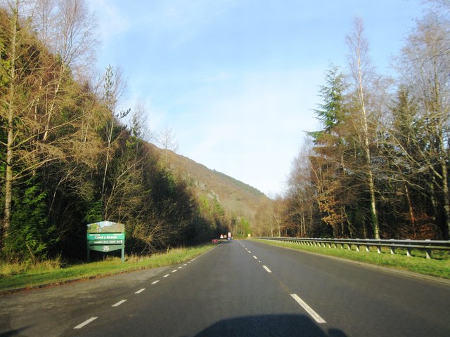
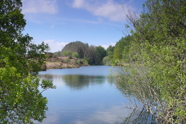
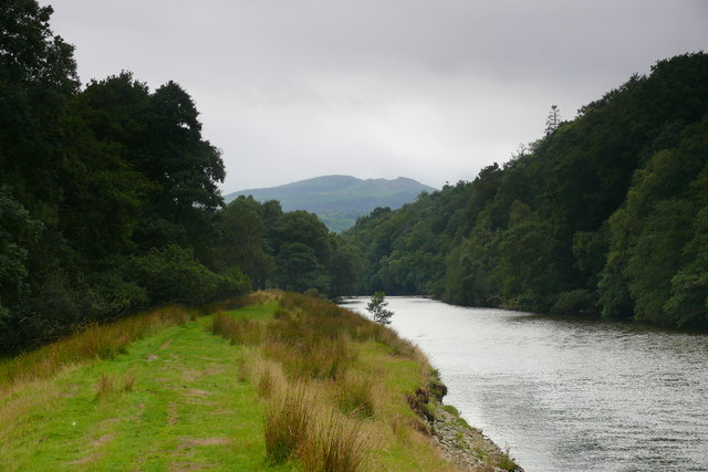
Coed Pen-y-cefn, located in Merionethshire, Wales, is a picturesque woodland area known for its natural beauty and rich biodiversity. The name "Coed Pen-y-cefn" translates to "Wood, Forest" in English, aptly describing the area's lush, dense cover of trees and vegetation.

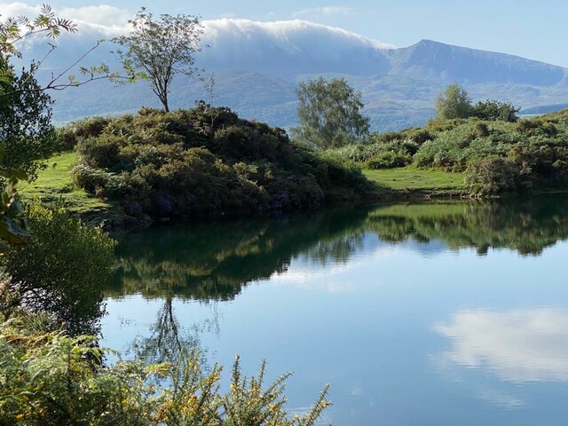
Covering an expansive area, the woodland is primarily made up of native species such as oak, birch, and ash, creating a diverse and vibrant ecosystem. The canopy provides shelter for a wide range of wildlife, including various bird species, small mammals, and insects. Nature enthusiasts and birdwatchers often flock to Coed Pen-y-cefn to observe species like woodpeckers, owls, and warblers in their natural habitat.

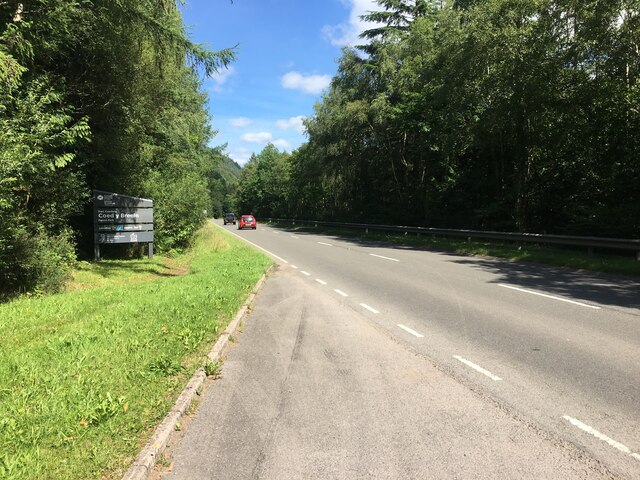
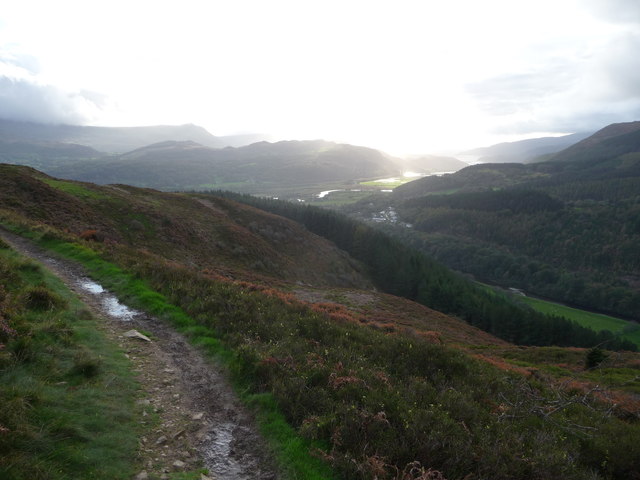
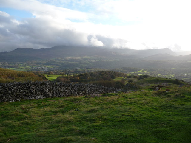
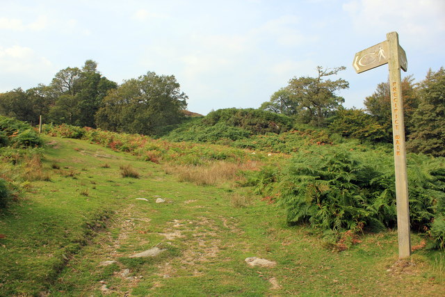
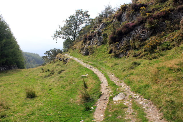
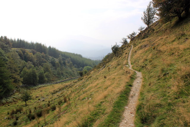
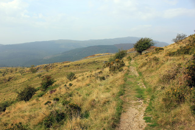
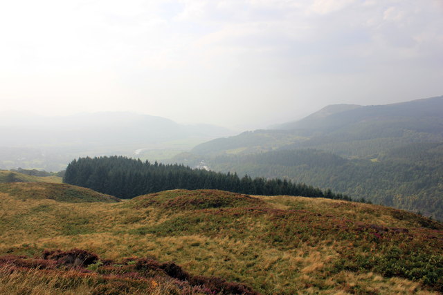
The woodland is crisscrossed with well-maintained trails, making it a popular destination for hikers and walkers. These trails offer breathtaking views of the surrounding countryside and provide opportunities to witness the changing seasons firsthand. In spring, the woodland floor comes alive with a carpet of bluebells and other wildflowers, creating a stunning display of colors.

Coed Pen-y-cefn is not only a haven for wildlife but also serves as a recreational space for visitors. Picnic areas and benches are scattered throughout the woodland, offering a tranquil setting to relax and enjoy the natural surroundings. The peaceful atmosphere and scenic beauty make it an ideal spot for nature lovers seeking solitude and a connection with the great outdoors.

Overall, Coed Pen-y-cefn in Merionethshire is a cherished woodland area, cherished for its diverse ecosystem, stunning landscapes, and its ability to provide a much-needed escape from the fast pace of modern life.

If you have any feedback on the listing, please let us know in the comments section below.

Coed Pen-y-cefn Images

Images are sourced within 2km of 52.750763/-3.8889737 or Grid Reference SH7218. Thanks to Geograph Open Source API. All images are credited.

A470 near Coed y Brenin
Llyn Tan-y-Graig A spectacular September morning shows the lake off at its very best.
Llyn Tan-y-Graig
A spectacular September morning shows the lake off at its very best.
Cadair Idris a Llyn Tan-y-Graig The morning mist and cloud is fast burning off the summits of Cadair Idris, as the sun takes hold on a beautifully warm early September morning.
Cadair Idris a Llyn Tan-y-Graig
The morning mist and cloud is fast burning off the summits of Cadair Idris, as the sun takes hold on a beautifully warm early September morning.
The south-west slopes of Foel Faner Looking to the Afon Mawddach estuary.
The south-west slopes of Foel Faner
Looking to the Afon Mawddach estuary.
Part of the Precipice Walk above Dolgellau The walk offers great views westards in late afternoon or evening, depending on the season, and the weather.
Part of the Precipice Walk above Dolgellau
The walk offers great views westards in late afternoon or evening, depending on the season, and the weather.
Cadair Idris from the Precipice Walk Majestic, beautiful, inspiring - this view has it all. Though it's not quite as good as the view from that ridgeline...
Cadair Idris from the Precipice Walk
Majestic, beautiful, inspiring - this view has it all. Though it's not quite as good as the view from that ridgeline...
Foel Faner Foel Faner is a lesser top of the hill, Foel Cynwch and is seen from the ridge south of the summit of that hill. The cloud-shadowed and misted mountain range in the distance is Cadair Idris.
Foel Faner
Foel Faner is a lesser top of the hill, Foel Cynwch and is seen from the ridge south of the summit of that hill. The cloud-shadowed and misted mountain range in the distance is Cadair Idris.
Walls beside Coed Dol-fawr The declining south-west ridge of Foel Cynwch has a tapering finger of moorland that eventually gives way to farmland and woods. The walls seen here are adjacent to one of those woods.
Walls beside Coed Dol-fawr
The declining south-west ridge of Foel Cynwch has a tapering finger of moorland that eventually gives way to farmland and woods. The walls seen here are adjacent to one of those woods.
A470 north from Llanelltyd
A470 northbound
A470 northbound
A470 northbound
A470 northbound
Llyn Tan y Graig Cronfa Ddwr uwchben Llanelltyd / Reservoir above Llanelltyd.
Llyn Tan y Graig
Cronfa Ddwr uwchben Llanelltyd / Reservoir above Llanelltyd.
Afon Mawddach ger Dolfawr / Afon Mawddach near Dolfawr Llwybr caniataol ar lannau'r Afon Mawddach / Permissive path on the banks of the Afon Mawddach.
Afon Mawddach ger Dolfawr / Afon Mawddach near Dolfawr
Llwybr caniataol ar lannau'r Afon Mawddach / Permissive path on the banks of the Afon Mawddach.
The Precipice Walk The Precipice Walk as it heads south from Llyn Cynwch. The Precipice Walk is not a public footpath but a private walk over part of the Nannau estate, which dates back to the twelfth century. The public have been allowed to use the walk by the estate since 1890 on the understanding that they observe the country code, follow the route indicated and use the proper access.
The Precipice Walk
The Precipice Walk as it heads south from Llyn Cynwch. The Precipice Walk is not a public footpath but a private walk over part of the Nannau estate, which dates back to the twelfth century. The public have been allowed to use the walk by the estate since 1890 on the understanding that they observe the country code, follow the route indicated and use the proper access.
The Precipice Walk The Precipice Walk as it heads clockwise from Llyn Cynwch. The recommended route for the walk is anti-clockwise as it offers better views south west along the valley. The Precipice Walk is not a public footpath but a private walk over part of the Nannau estate, which dates back to the twelfth century. The public have been allowed to use the walk by the estate since 1890 on the understanding that they observe the country code, follow the route indicated and use the proper access.
The Precipice Walk
The Precipice Walk as it heads clockwise from Llyn Cynwch. The recommended route for the walk is anti-clockwise as it offers better views south west along the valley. The Precipice Walk is not a public footpath but a private walk over part of the Nannau estate, which dates back to the twelfth century. The public have been allowed to use the walk by the estate since 1890 on the understanding that they observe the country code, follow the route indicated and use the proper access.
The Precipice Walk The Precipice Walk as it heads clockwise from the south. The recommended route for the walk is anti-clockwise as it offers better views south west along the valley. The Precipice Walk is not a public footpath but a private walk over part of the Nannau estate, which dates back to the twelfth century. The public have been allowed to use the walk by the estate since 1890 on the understanding that they observe the country code, follow the route indicated and use the proper access.
The Precipice Walk
The Precipice Walk as it heads clockwise from the south. The recommended route for the walk is anti-clockwise as it offers better views south west along the valley. The Precipice Walk is not a public footpath but a private walk over part of the Nannau estate, which dates back to the twelfth century. The public have been allowed to use the walk by the estate since 1890 on the understanding that they observe the country code, follow the route indicated and use the proper access.
View south west from the Precipice Walk A very hazy view south west towards western scarp of Cadair Idris from a viewpoint on the Precipice Walk.
View south west from the Precipice Walk
A very hazy view south west towards western scarp of Cadair Idris from a viewpoint on the Precipice Walk.
Show me another place!

Coed Pen-y-cefn is located at Grid Ref: SH7218 (Lat: 52.750763, Lng: -3.8889737)

Unitary Authority: Gwynedd

Police Authority: North Wales

What 3 Words

///chains.rejoins.sourcing. Near Dolgellau, Gwynedd

Nearby Locations

Coed Pen-y-cefn Coed Crwn

Related Wikis

Dolgellau transmitting station

The Dolgellau transmitting station is a broadcasting and telecommunications facility located on a hill about 1 km north of the town of Dolgellau, in Gwynedd...

Dolgellau railway station

Dolgellau railway station (Welsh pronunciation: [dɔlˈɡɛɬaɨ]) in Gwynedd, North Wales, was a station on the Ruabon to Barmouth line, originally the terminus...

Hengwrt

Hengwrt (English: Old Court) was a mansion near Dolgellau in Meirionnydd, Gwynedd. It lay in the parish of Llanelltyd near the confluence of the River...

County Hall, Dolgellau

County Hall (Welsh: Neuadd y Sir Dolgellau) is a municipal building in Smithfield Street, Dolgellau, Gwynedd, Wales. The structure, which was the headquarters...

Dolgellau Athletic A.F.C.

Dolgellau Athletic A.F.C. are a Welsh football club based in Dolgellau, Wales. They have a reserve team playing in the Aberystwyth League Division One...

Dr Williams' School

Dr Williams' School was a school founded in Dolgellau in 1875. It opened its doors in 1878 and continued until it was closed in 1975.Samuel Holland was...

Coleg Meirion-Dwyfor

Coleg Meirion-Dwyfor (meaning in English "Meirion-Dwyfor College"), also known as CMD, is a college in Gwynedd, Wales with its main campus in Dolgellau...

Dolgellau

Dolgellau (Welsh: [dɔlˈɡɛɬaɨ] ) is a town and community in Gwynedd, north-west Wales, lying on the River Wnion, a tributary of the River Mawddach. It was...

Nearby Amenities

Located within 500m of 52.750763,-3.8889737
Radio Station
Man Made: mast
Lat/Long: 52.7494983/-3.8868128
Power: pole
Lat/Long: 52.7510293/-3.8943144
Power: pole
Lat/Long: 52.7506721/-3.894529
Power: pole
Lat/Long: 52.7504545/-3.8944378
Power: pole
Lat/Long: 52.7498928/-3.8937243
Power: pole
Lat/Long: 52.7495421/-3.8931986
Power: pole
Lat/Long: 52.7491232/-3.8925817
Barrier: kissing_gate
Source: GPS survey
Lat/Long: 52.7521435/-3.8948988
Power: pole
Lat/Long: 52.7549255/-3.8888847
Power: pole
Lat/Long: 52.7545505/-3.8877904
Power: pole
Lat/Long: 52.7542502/-3.886924
Power: pole
Lat/Long: 52.7539807/-3.8861542
Power: pole
Lat/Long: 52.7536836/-3.8855159
Power: pole
Lat/Long: 52.7529792/-3.8836993
Power: pole
Lat/Long: 52.7525619/-3.8824394
Power: pole
Lat/Long: 52.7526361/-3.8823931
Power: pole
Lat/Long: 52.7546476/-3.8871359
Power: pole
Lat/Long: 52.7535132/-3.8849841
Power: pole
Lat/Long: 52.7530523/-3.8836594
Power: pole
Lat/Long: 52.7505842/-3.8861073
Power: pole
Lat/Long: 52.7502205/-3.8842566
Power: pole
Lat/Long: 52.750117/-3.8877803
Power: pole
Lat/Long: 52.7494806/-3.8890141
Power: pole
Lat/Long: 52.7479025/-3.8897115
Power: pole
Lat/Long: 52.7471767/-3.8891617
Power: pole
Lat/Long: 52.7487662/-3.8897088
Bench
Colour: blue
Material: wood
Source: GPS survey
Lat/Long: 52.7493879/-3.8922527
Grit Bin
Source: GPS survey
Lat/Long: 52.7506251/-3.8941276
Power: pole
Lat/Long: 52.7534146/-3.8850027
Direction: 165
Generator Method: photovoltaic
Generator Output Electricity: yes
Generator Solar Modules: 16
Generator Source: solar
Generator Type: solar_photovoltaic_panel
Location: roof
Power: generator
Lat/Long: 52.7468268/-3.8854734
Direction: 255
Generator Method: photovoltaic
Generator Output Electricity: yes
Generator Solar Modules: 12
Generator Source: solar
Generator Type: solar_photovoltaic_panel
Location: roof
Power: generator
Lat/Long: 52.7487056/-3.8921186
Direction: SSE
Generator Method: photovoltaic
Generator Output Electricity: yes
Generator Solar Modules: 16
Generator Source: solar
Generator Type: solar_photovoltaic_panel
Location: roof
Power: generator
Lat/Long: 52.7487186/-3.8926792
Direction: SSE
Generator Method: photovoltaic
Generator Output Electricity: yes
Generator Solar Modules: 16
Generator Source: solar
Generator Type: solar_photovoltaic_panel
Location: roof
Power: generator
Lat/Long: 52.7484264/-3.893398
Direction: 190
Generator Method: photovoltaic
Generator Output Electricity: yes
Generator Solar Modules: 18
Generator Source: solar
Generator Type: solar_photovoltaic_panel
Location: roof
Power: generator
Lat/Long: 52.7464833/-3.8874093
Direction: 175
Generator Method: photovoltaic
Generator Output Electricity: yes
Generator Source: solar
Generator Type: solar_photovoltaic_panel
Location: roof
Power: generator
Lat/Long: 52.7474044/-3.8851943
The data included in this document is from www.openstreetmap.org. The data is made available under ODbL.

Have you been to Coed Pen-y-cefn?

Leave your review of Coed Pen-y-cefn below (or comments, questions and feedback).