Allt Pen-y-lan

Wood, Forest in Carmarthenshire

Wales

Allt Pen-y-lan

Llandysul Food Festival Carreg-las Dancers with keen youngsters performing "Dilwyn"
Llandysul Food Festival Credit: chris whitehouse

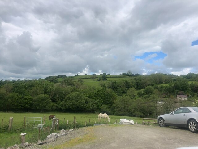
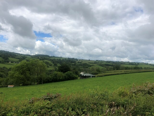
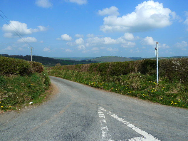
Allt Pen-y-lan, located in Carmarthenshire, Wales, is a picturesque wood or forest that spans over a vast area. The woodland is nestled within the enchanting countryside, offering visitors a serene and tranquil environment to explore and unwind.

This ancient woodland is home to a diverse range of flora and fauna, making it a haven for nature enthusiasts and wildlife lovers. The forest is characterized by its dense canopy, which provides a cool and shaded atmosphere during hot summer months. Tall, majestic trees, including oak, beech, and birch, dominate the landscape, creating a stunning display of colors during the autumn season.

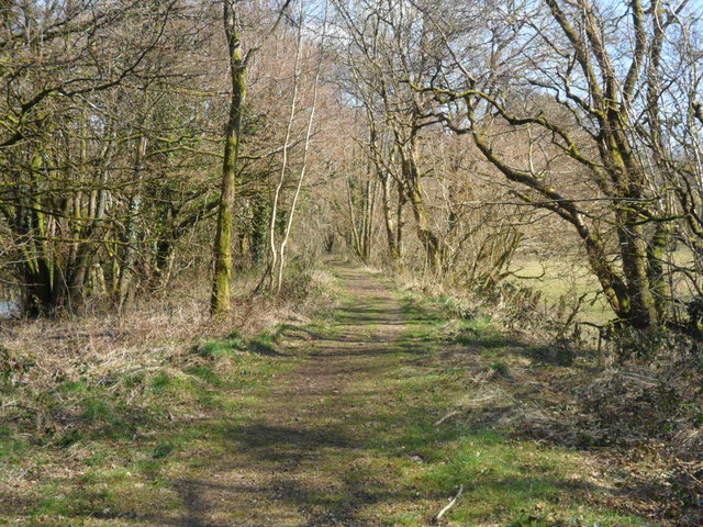
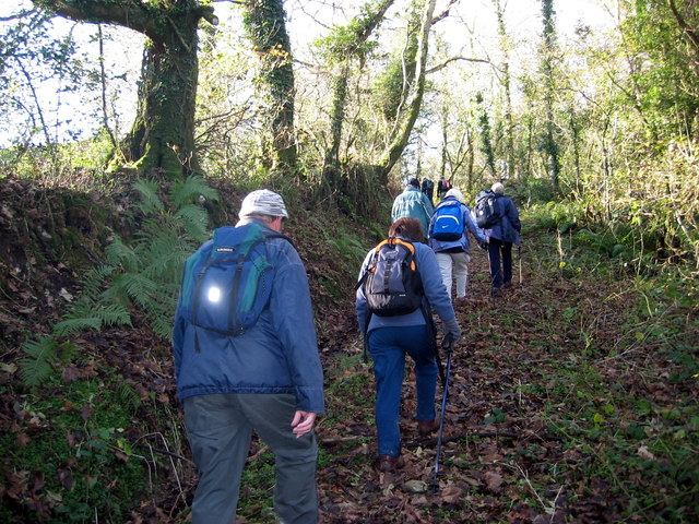
Allt Pen-y-lan is crisscrossed by a network of footpaths and trails, allowing visitors to wander through its enchanting beauty at their own pace. The paths wind through the woodland, leading visitors to hidden streams, cascading waterfalls, and small, secluded glades. These natural features add a touch of magic to the forest, inviting explorers to discover the hidden gems within.

The woodland is also home to a variety of wildlife, including birds, mammals, and insects. Birdwatchers can spot species such as woodpeckers, owls, and warblers, while lucky visitors may even catch a glimpse of deer or foxes. The forest floor is carpeted with a rich tapestry of wildflowers and ferns, creating a vibrant and ever-changing landscape throughout the year.

Allt Pen-y-lan is a true gem in the heart of Carmarthenshire, offering visitors a chance to reconnect with nature and enjoy the peace and tranquility of the Welsh countryside. Whether it's a leisurely stroll or a more adventurous hike, this woodland is sure to leave a lasting impression on all who visit.

If you have any feedback on the listing, please let us know in the comments section below.

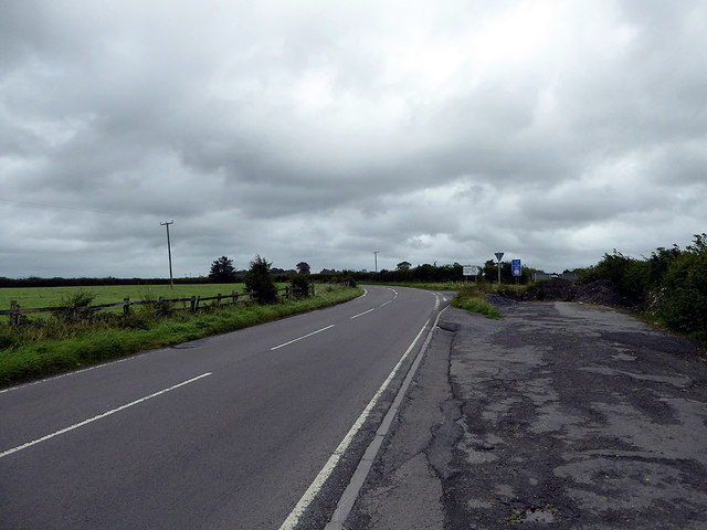
Allt Pen-y-lan Images

Images are sourced within 2km of 52.025441/-4.2921535 or Grid Reference SN4238. Thanks to Geograph Open Source API. All images are credited.
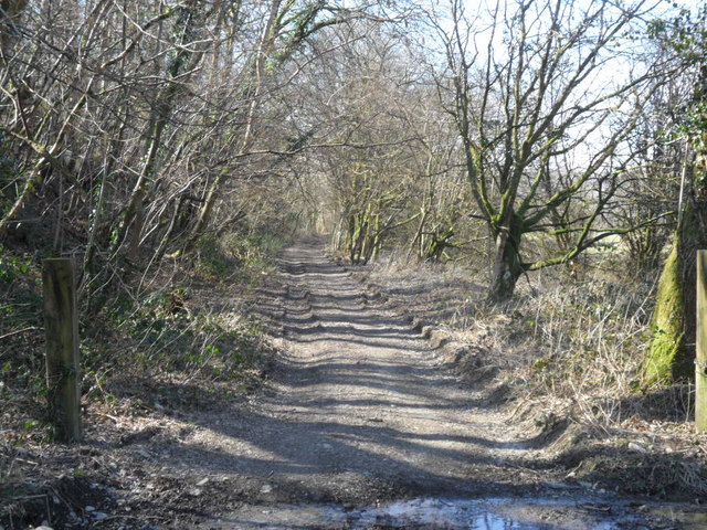
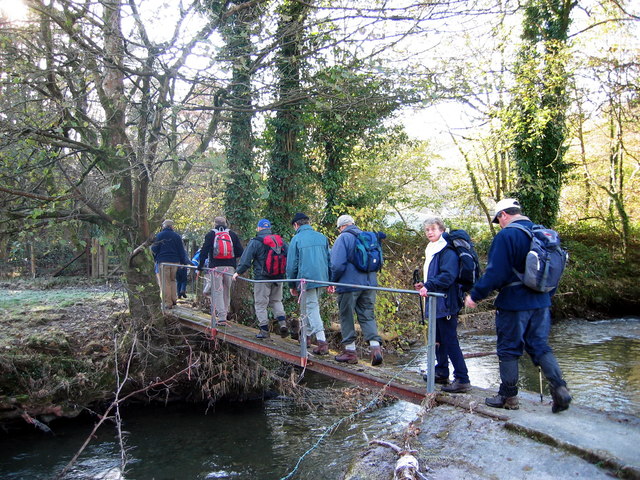
Llandysul Food Festival Carreg-las Dancers with keen youngsters performing "Dilwyn"
Llandysul Food Festival
Carreg-las Dancers with keen youngsters performing "Dilwyn"
Llandysul Food Festival Not the best of weather, Carreg-las dancing took place on the sheltered stage as the grass was very wet and slippery, one could be forgiven if this photo was mistaken for a "Punch and Judy Show"! 2010 photo is <a href="https://www.geograph.org.uk/photo/2763690">SN4140 : Llandysul Food Festival</a> perfect weather!
Llandysul Food Festival
Not the best of weather, Carreg-las dancing took place on the sheltered stage as the grass was very wet and slippery, one could be forgiven if this photo was mistaken for a "Punch and Judy Show"! 2010 photo is SN4140 : Llandysul Food Festival perfect weather!
Wind Turbine at Blaen Pant
Overgrown Stile The sign may be putting off some walkers.
Overgrown Stile
The sign may be putting off some walkers.
Field with horses grazing near Llanfihangel-ar-arth
Ty Newydd farm In the hills near Llanfihangel-ar-Arth
Ty Newydd farm
In the hills near Llanfihangel-ar-Arth
Lane junction with B4336 near Llandysul
Disused trackbed of the Newcastle Emlyn branch Looking towards Llandysul, this is the trackbed of the Carmarthen and Cardigan Railway's line to Llandysul, later extended to Newcastle Emlyn by the GWR.  This part of the line is now a footpath.
Disused trackbed of the Newcastle Emlyn branch
Looking towards Llandysul, this is the trackbed of the Carmarthen and Cardigan Railway's line to Llandysul, later extended to Newcastle Emlyn by the GWR. This part of the line is now a footpath.
Disused trackbed of the Newcastle Emlyn branch Facing towards Pencader, this is the Carmarthen and Cardigan Railway's line to Llandysul, eventually extended to Newcastle Emlyn by the GWR.  This part of the trackbed is now in private ownership.
Disused trackbed of the Newcastle Emlyn branch
Facing towards Pencader, this is the Carmarthen and Cardigan Railway's line to Llandysul, eventually extended to Newcastle Emlyn by the GWR. This part of the trackbed is now in private ownership.
Pompren Afon Tyweli / Tyweli River footbridge Cerddwyr yn croesi Afon Tyweli. 

Walkers crossing the Tyweli River.
Pompren Afon Tyweli / Tyweli River footbridge
Cerddwyr yn croesi Afon Tyweli. Walkers crossing the Tyweli River.
Ger Felin Gwyddil / Near Felin Gwyddil Cerddwyr yn dilyn trac o Felin Gwyddil.

Walkers following a track from Felin Gwyddil (trans. Gwyddil [stream] mill).
Ger Felin Gwyddil / Near Felin Gwyddil
Cerddwyr yn dilyn trac o Felin Gwyddil. Walkers following a track from Felin Gwyddil (trans. Gwyddil [stream] mill).
Tuag at Ben Pistyll / Towards Pen Pistyll Cerddwyr yn dilyn llwybr lan at Ben Pistyll.

Walkers ascending along a path towards Pen Pistyll (trans. top of the spring).
Tuag at Ben Pistyll / Towards Pen Pistyll
Cerddwyr yn dilyn llwybr lan at Ben Pistyll. Walkers ascending along a path towards Pen Pistyll (trans. top of the spring).
A lane near Llandysul Looking down to Blaen-y-waun.
A lane near Llandysul
Looking down to Blaen-y-waun.
Ordnance Survey Rivet This OS cut mark can be found on the Churn Stand of Llwynffynnon. It marks a point 193.646m above mean sea level.
Ordnance Survey Rivet
This OS cut mark can be found on the Churn Stand of Llwynffynnon. It marks a point 193.646m above mean sea level.
Ordnance Survey Cut Mark This OS cut mark can be found on the gatepost NE side of the road. It marks a point 159.965m above mean sea level.
Ordnance Survey Cut Mark
This OS cut mark can be found on the gatepost NE side of the road. It marks a point 159.965m above mean sea level.
Ordnance Survey Cut Mark This OS cut mark can be found on the Churn Stand of Cwmcathan Farm. It marks a point 196.095m above mean sea level.
Ordnance Survey Cut Mark
This OS cut mark can be found on the Churn Stand of Cwmcathan Farm. It marks a point 196.095m above mean sea level.
Road junction on the B4336 road South of Llandysul.
Road junction on the B4336 road
South of Llandysul.
Cymru Rydd (Free Wales) and a Bwcabus (Book a bus) On the B4336 road near Llandysul.
Cymru Rydd (Free Wales) and a Bwcabus (Book a bus)
On the B4336 road near Llandysul.
Show me another place!

Allt Pen-y-lan is located at Grid Ref: SN4238 (Lat: 52.025441, Lng: -4.2921535)

Unitary Authority: Carmarthenshire

Police Authority: Dyfed Powys

What 3 Words

///showcases.striving.limits. Near Llandysul, Ceredigion

Related Wikis

Craig Gwrtheyrn

Craig Gwrtheyrn, or Caer Gwrtheyrn, is an Iron Age hillfort on the south side of the River Teifi, about 1.2 miles (1.9 km) west of the village of Llanfihangel...

Llandyssul railway station

Llandyssul (previously Llandyssil) was a railway station near the village of Llandysul, West Wales, on the originally broad gauge Teifi Valley line of...

Llandysul

Llandysul, also spelt Llandyssul, is a small town and community in the county of Ceredigion, Wales. As a community it consists of the townships of Capel...

Ysgol Dyffryn Teifi

Ysgol Dyffryn Teifi was a bilingual (Welsh and English) comprehensive school in Llandysul, Ceredigion. It stood on the site of the previous Llandysul Grammar...

Pencader Junction railway station

Pencader Junction railway station served the village of Pencader, Carmarthenshire, Wales, from 1866 to 1880 on the Manchester and Milford Railway. ��2...

Llanfihangel-ar-Arth

Llanfihangel-ar-Arth is a village and community in the county of Carmarthenshire, Wales. The area includes six villages: Alltwalis, Dolgran, Gwyddgrug...

Pencader railway station

Pencader railway station served the village of Pencader, Carmarthenshire, Wales, from 1864 to 1965 on the Carmarthen and Cardigan Railway. == History... ==

Pencader, Carmarthenshire

Pencader () is a small village in Carmarthenshire, Wales , in the community of Llanfihangel-ar-Arth. It is located around 3 miles (5 km) south-east of...

Nearby Amenities

Located within 500m of 52.025441,-4.2921535
Building: yes
Lat/Long: 52.0215729/-4.2893299
Direction: S
Generator Method: photovoltaic
Generator Output Electricity: yes
Generator Solar Modules: 4
Generator Source: solar
Generator Type: solar_photovoltaic_panel
Location: roof
Power: generator
Lat/Long: 52.0238882/-4.2951547
The data included in this document is from www.openstreetmap.org. The data is made available under ODbL.

Have you been to Allt Pen-y-lan?

Leave your review of Allt Pen-y-lan below (or comments, questions and feedback).